
Overview
This page is a summary catalogue of the Menapia wxUAS contributions to the WesCon–WOEST field campaign, funded by NERC (NE/X018539/1). There were around ~130 flight hours and ~700 flights flown during the summer of 2023.
If you disagree with any of the plot interpretations on this page, contact the Menapia Chief Meteorological Officer Ben Pickering and the descriptions can be reviewed.
Also if you spot any suspected issues with any of the netCDF files, or the data accessed through our database API, let Ben know and this page will be updated to benefit all WesCon–WOEST researchers.
Note that most recent data are shown first. New data are added to the catalogue as camapigns progress.
Tags are being used here to quickly find days of interest in the sidebar, which can be accessed with the (☰) button in the top left corner of the page. The tags are:
Week 10
2023-08-25
Synoptic Overview
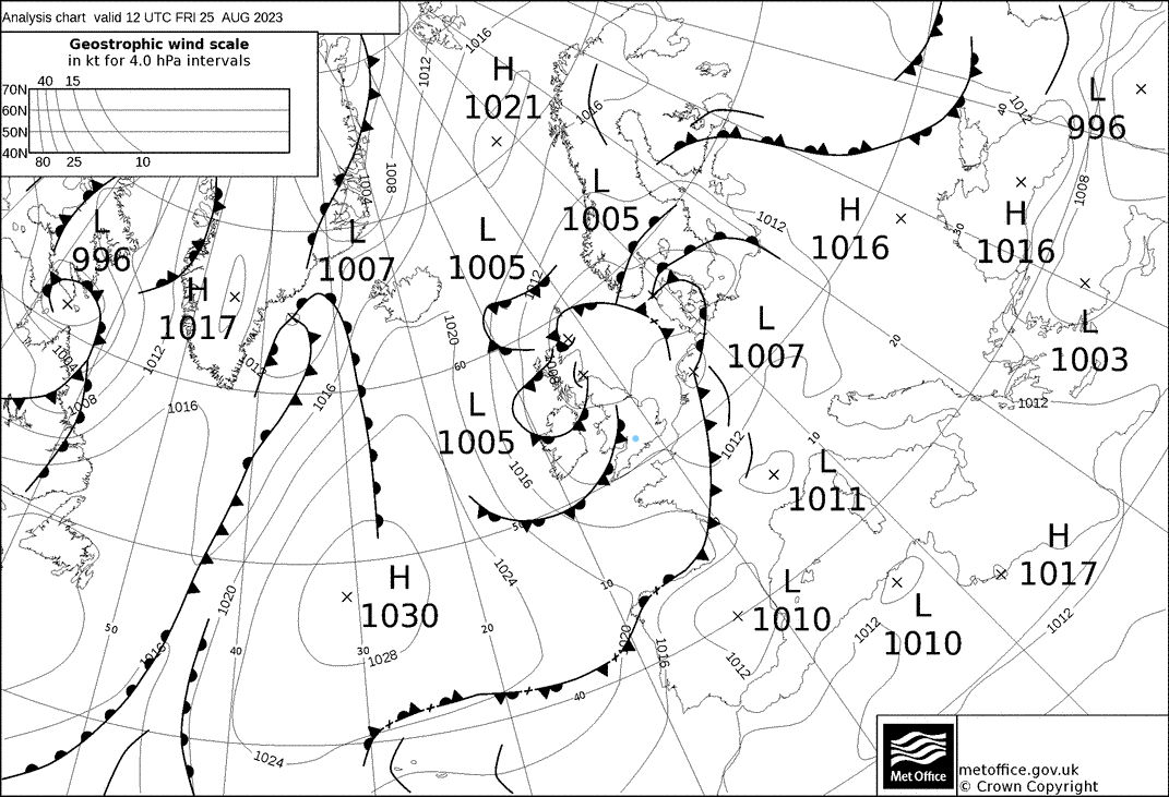
Cold front moved off to the SE overnight, cold sector airmass, approaching occluded fronts and shortwave trough associated with a weak pressure minima.
Flight Patterns
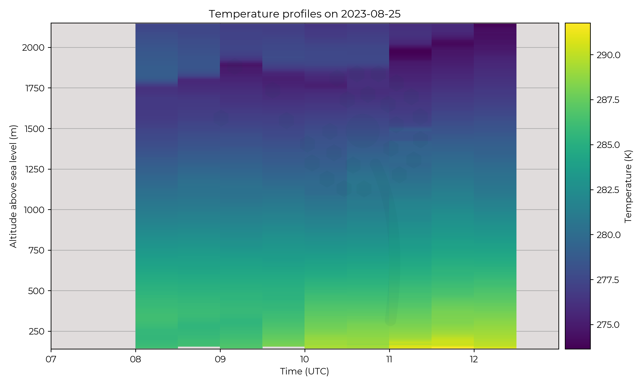
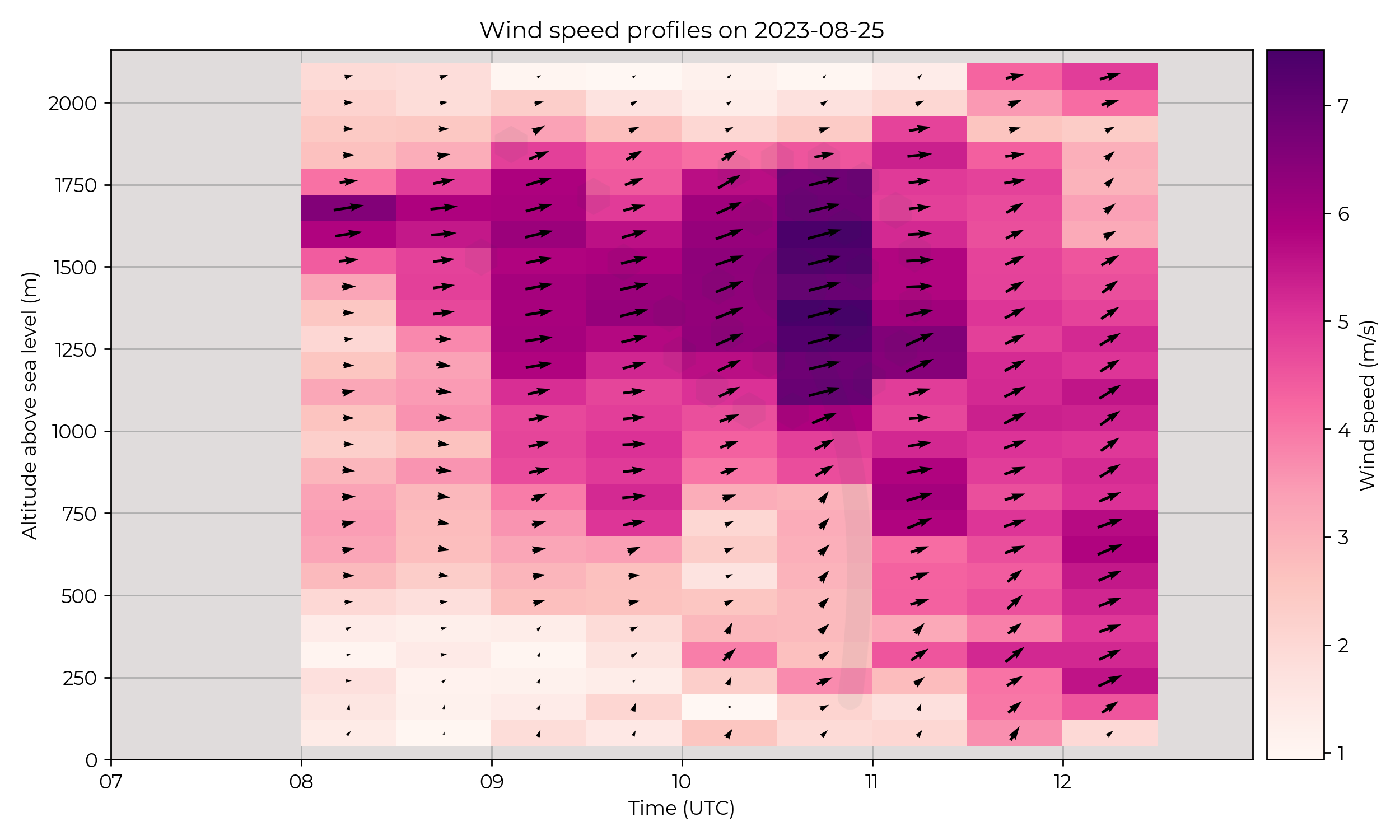
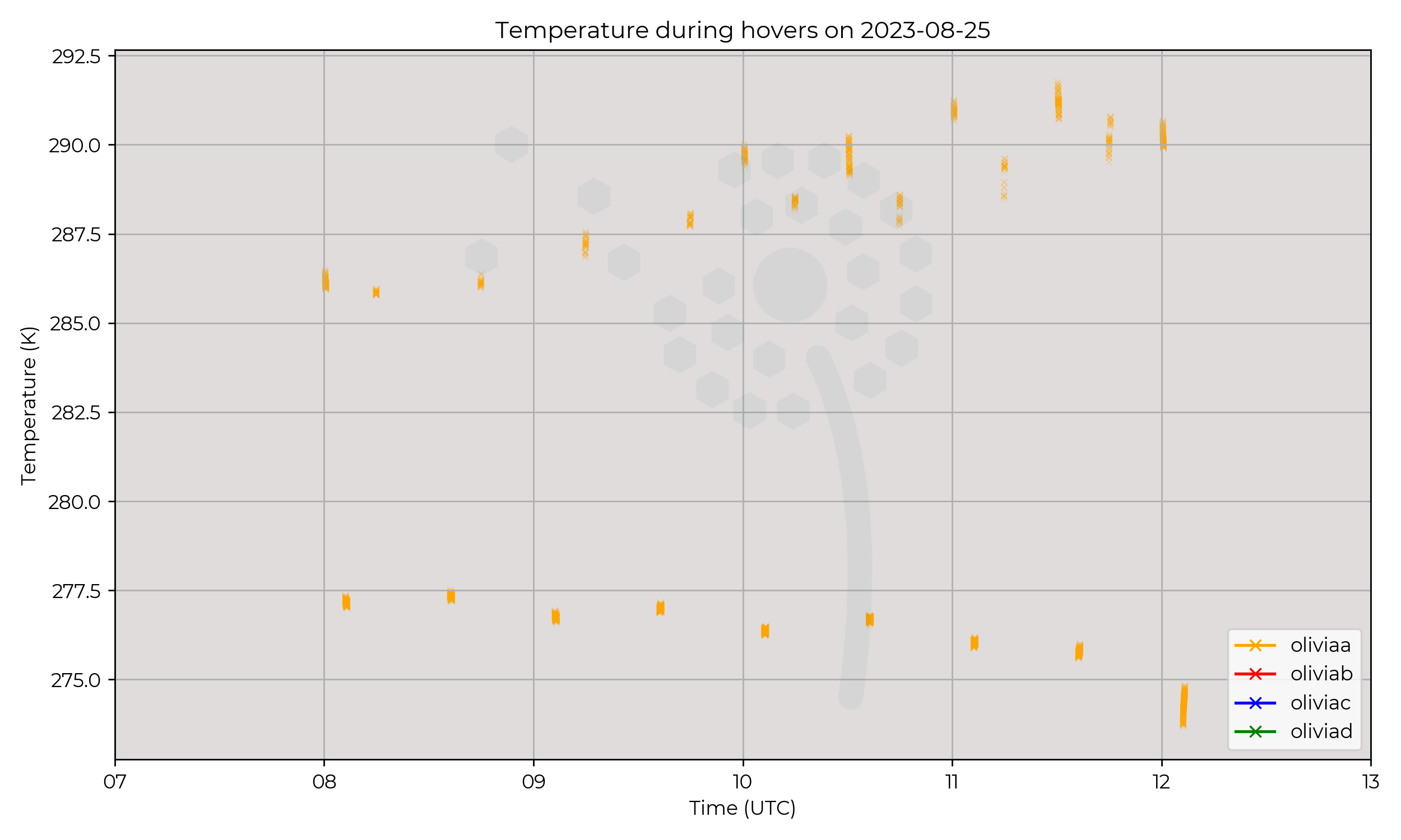
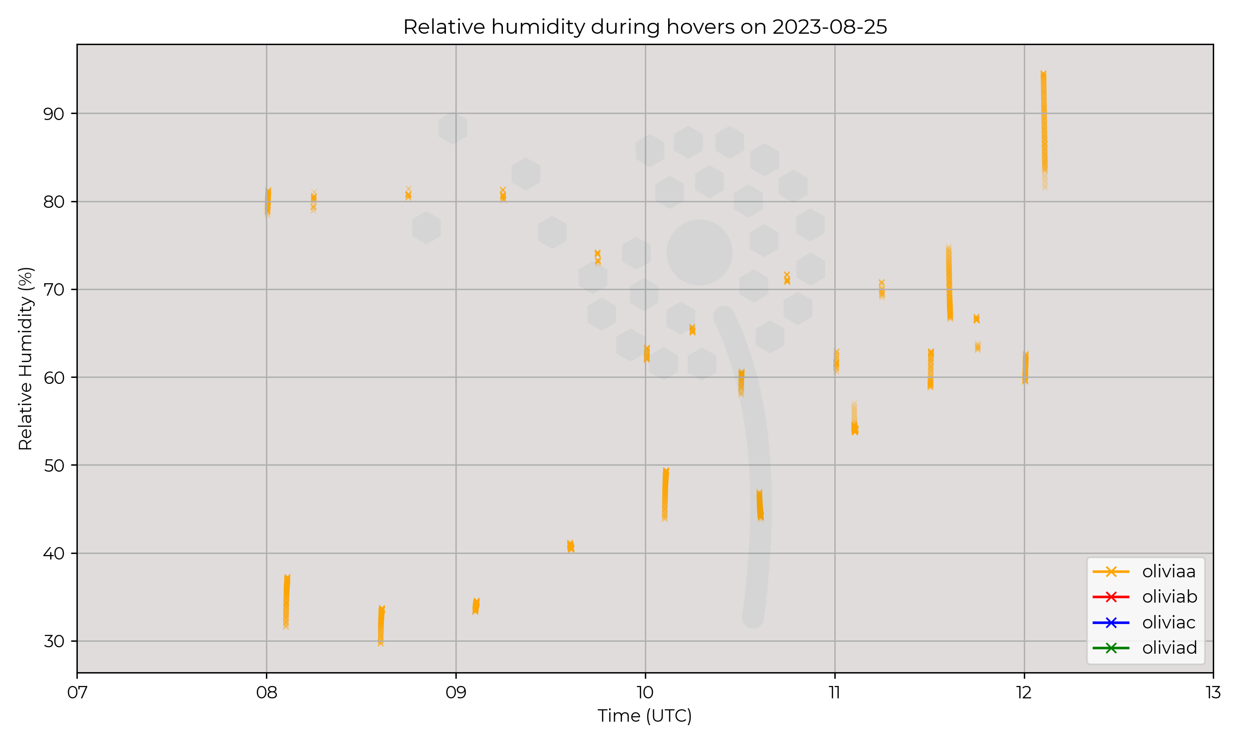
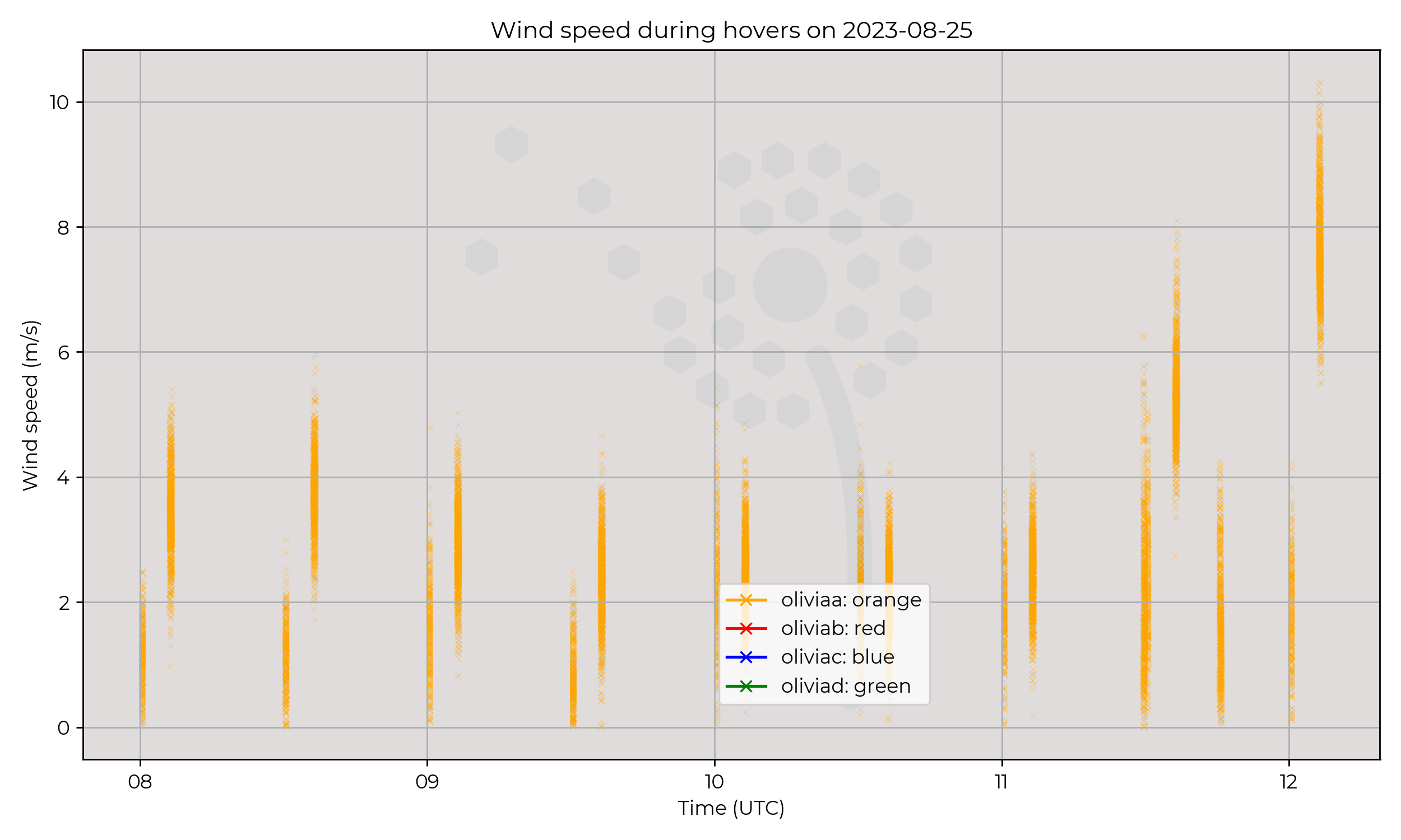
MetSprite flew 2 km profiles from 08 UTC every 30 minutes until the 12 UTC flight which ended with a parachute landing.
Observations
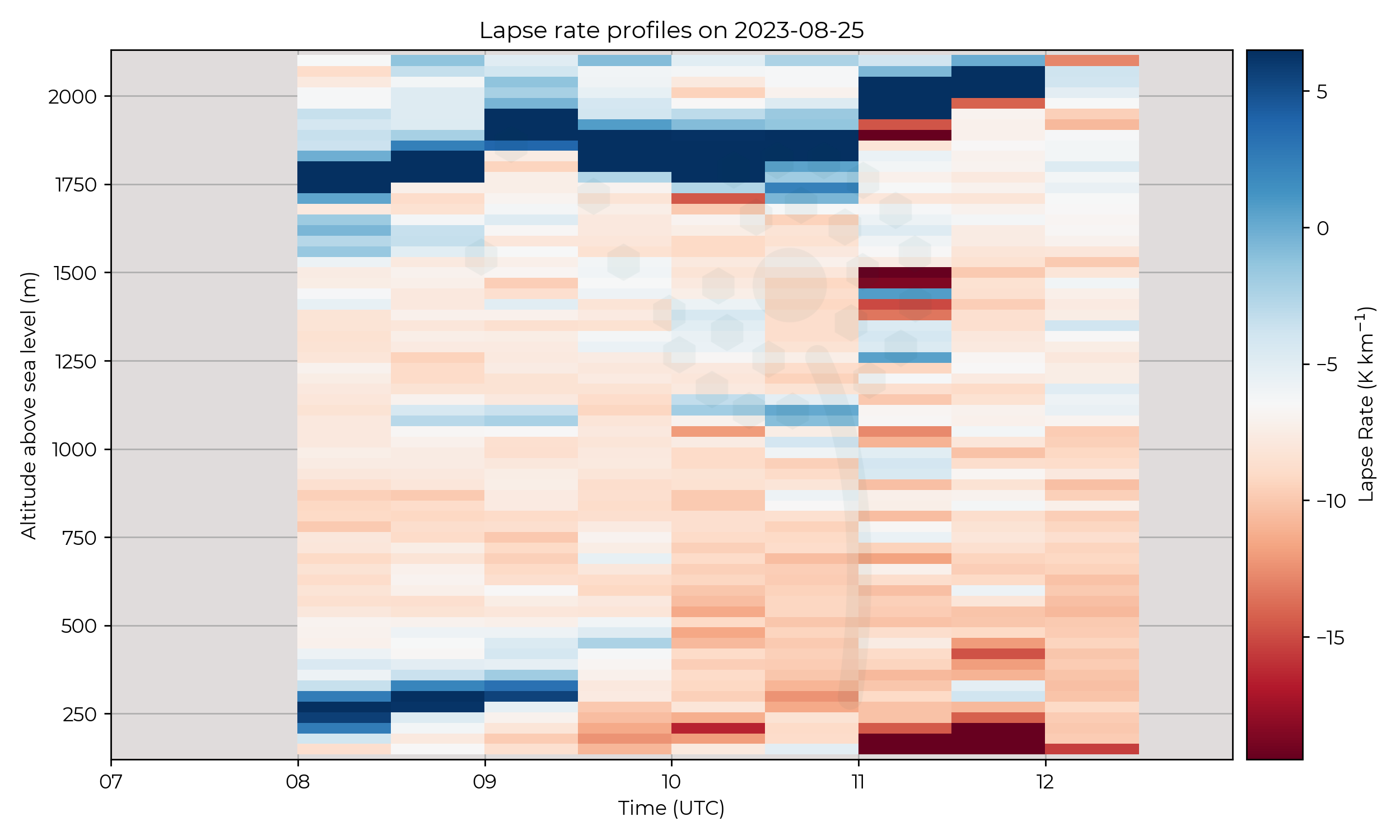
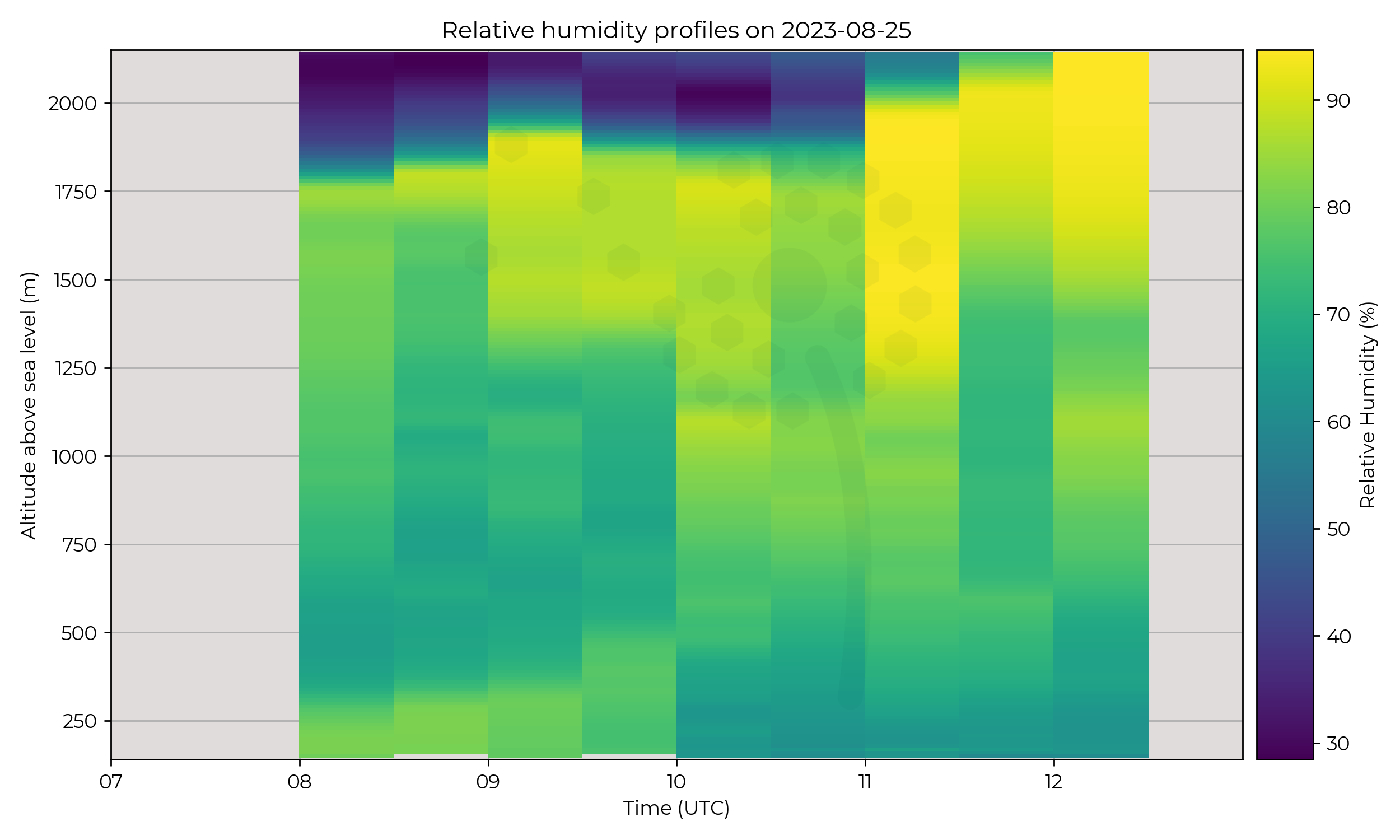
A strong inversion at the top of the boundary layer existed but was slowly eroded over the day as the BL top altitude increased.
The 11 UTC profile is of interest as the column characteristics changed more than other profiles.
Temperature appeared to have more variance (seen in all sensors) on the ascent and descent compared with surrounding profiles.
Known Issues
None yet reported
2023-08-24
Synoptic Overview
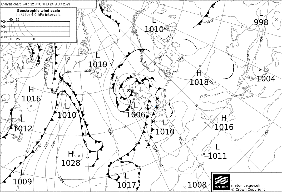
A complex series of frontal boundaries influenced the region overnight, all associatd with a weakly-forced surface pressure minima. An upper-level warm front reversed direction in the early hours to become a cold front undergoing frontogenesis. A cold front undergoing frontolysis followed closely behind.
Flight Patterns
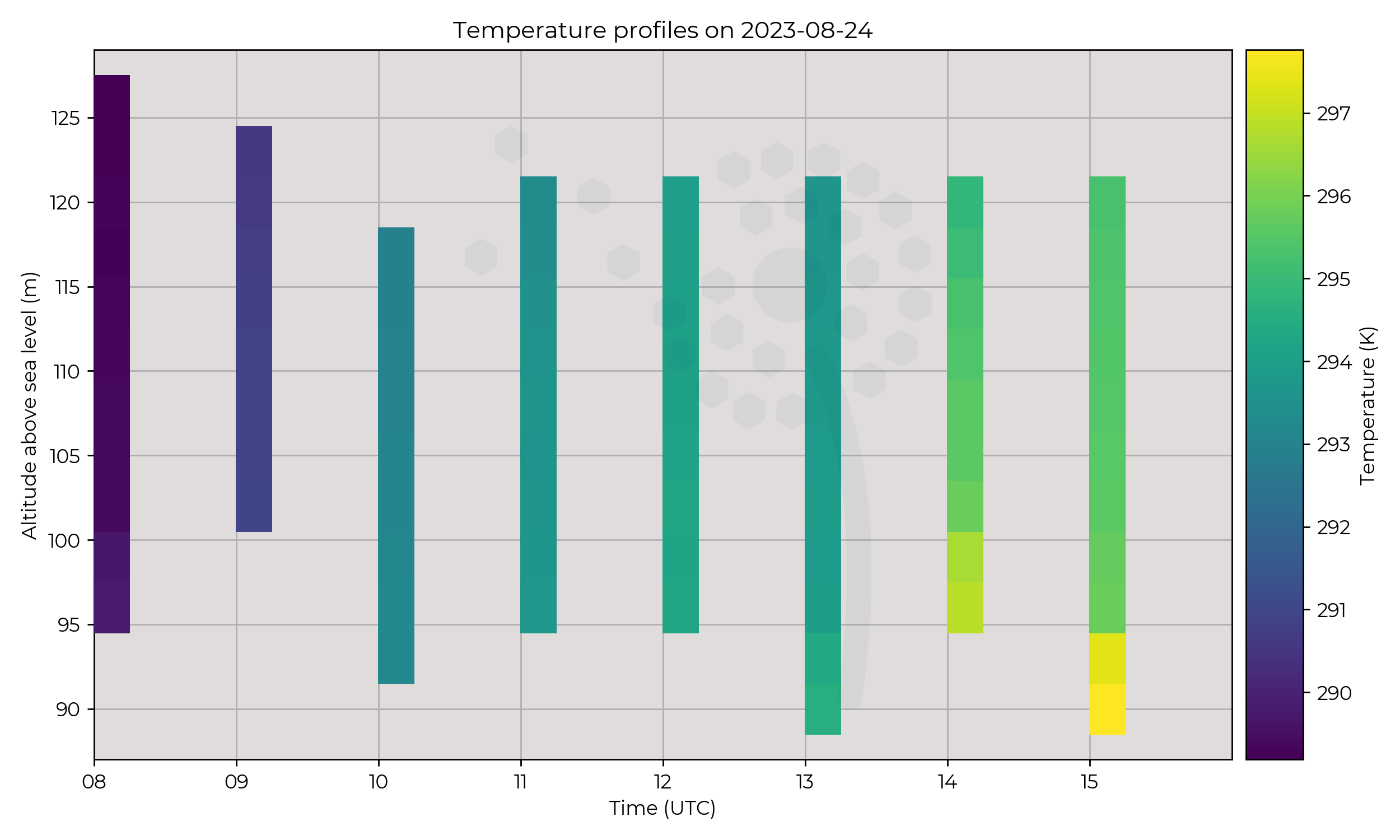
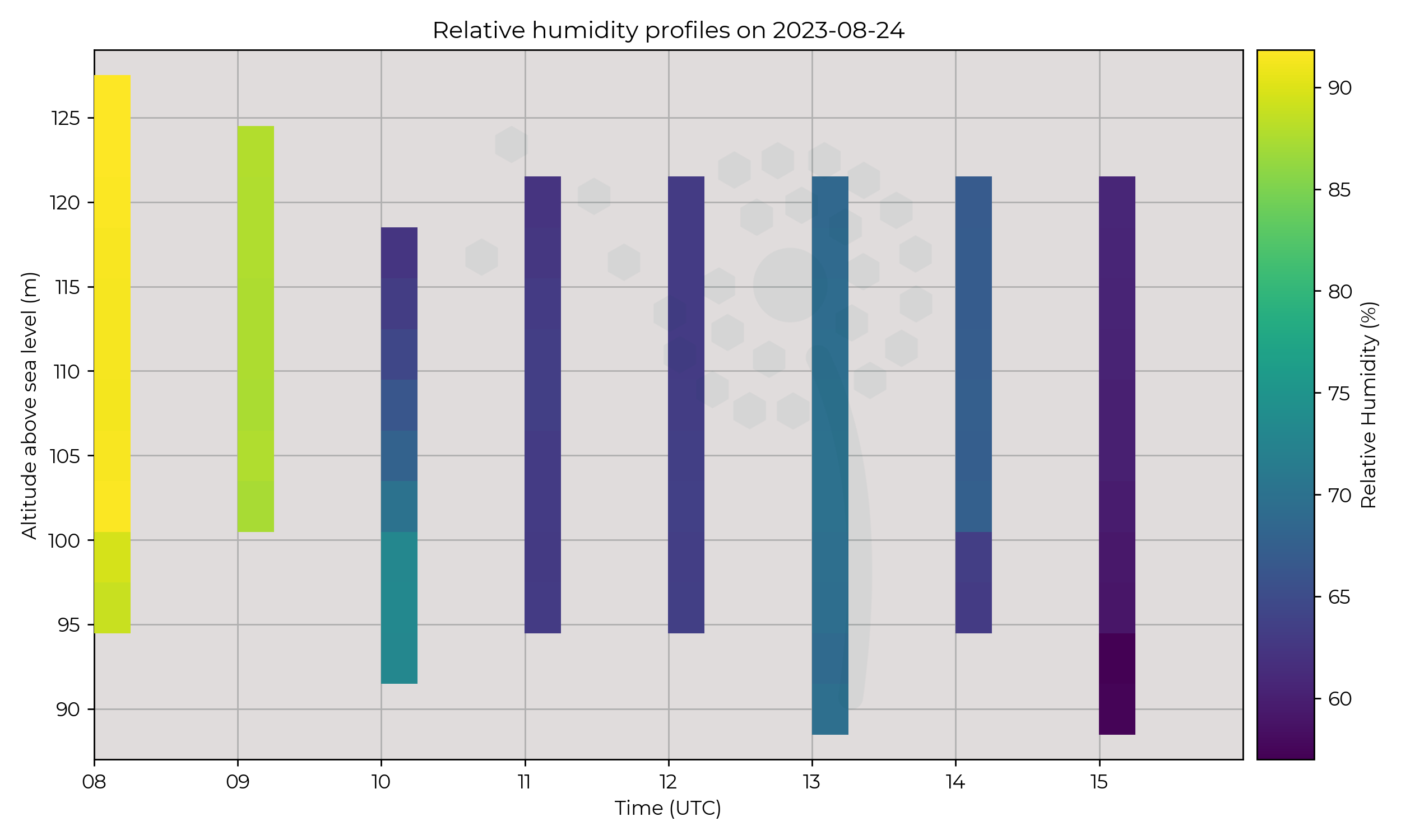
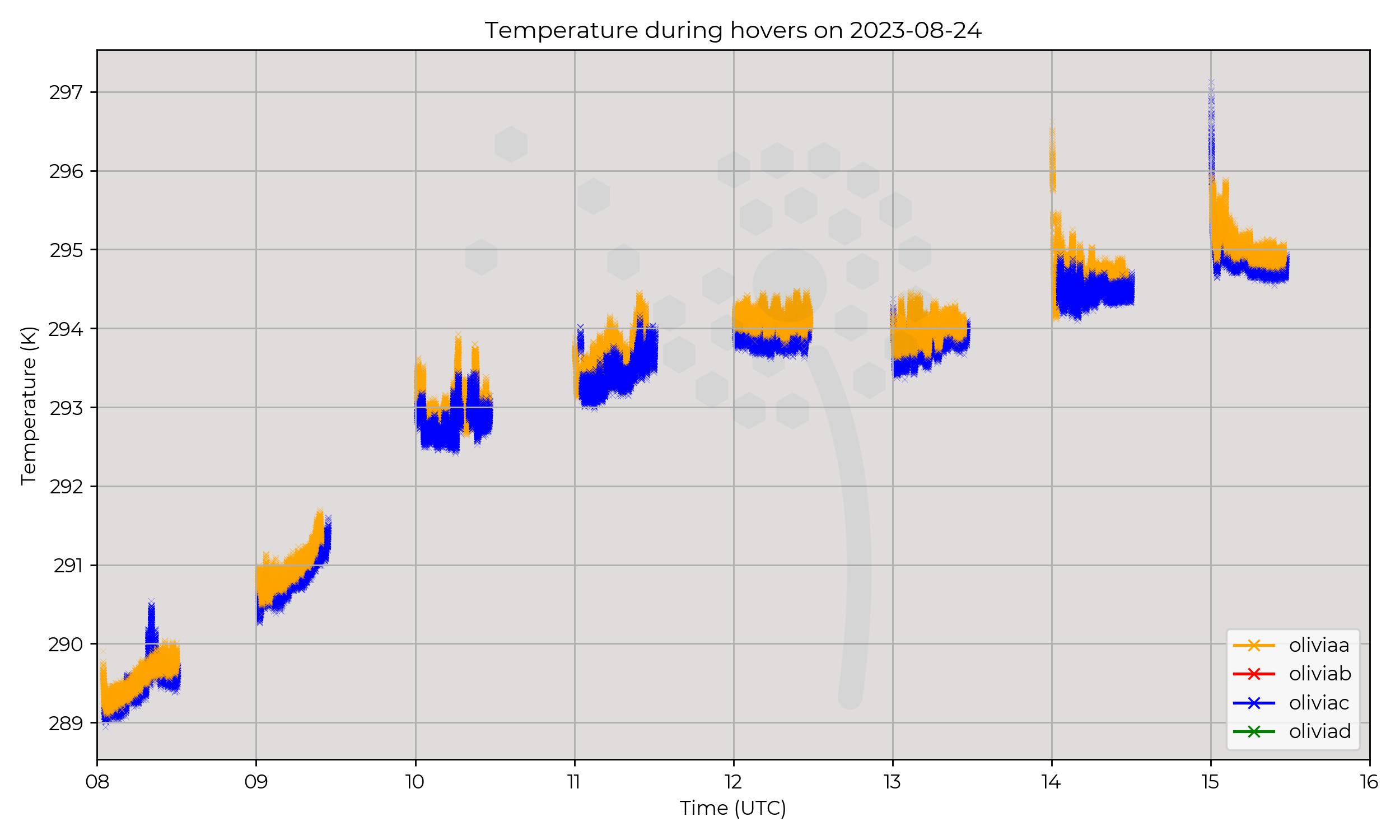
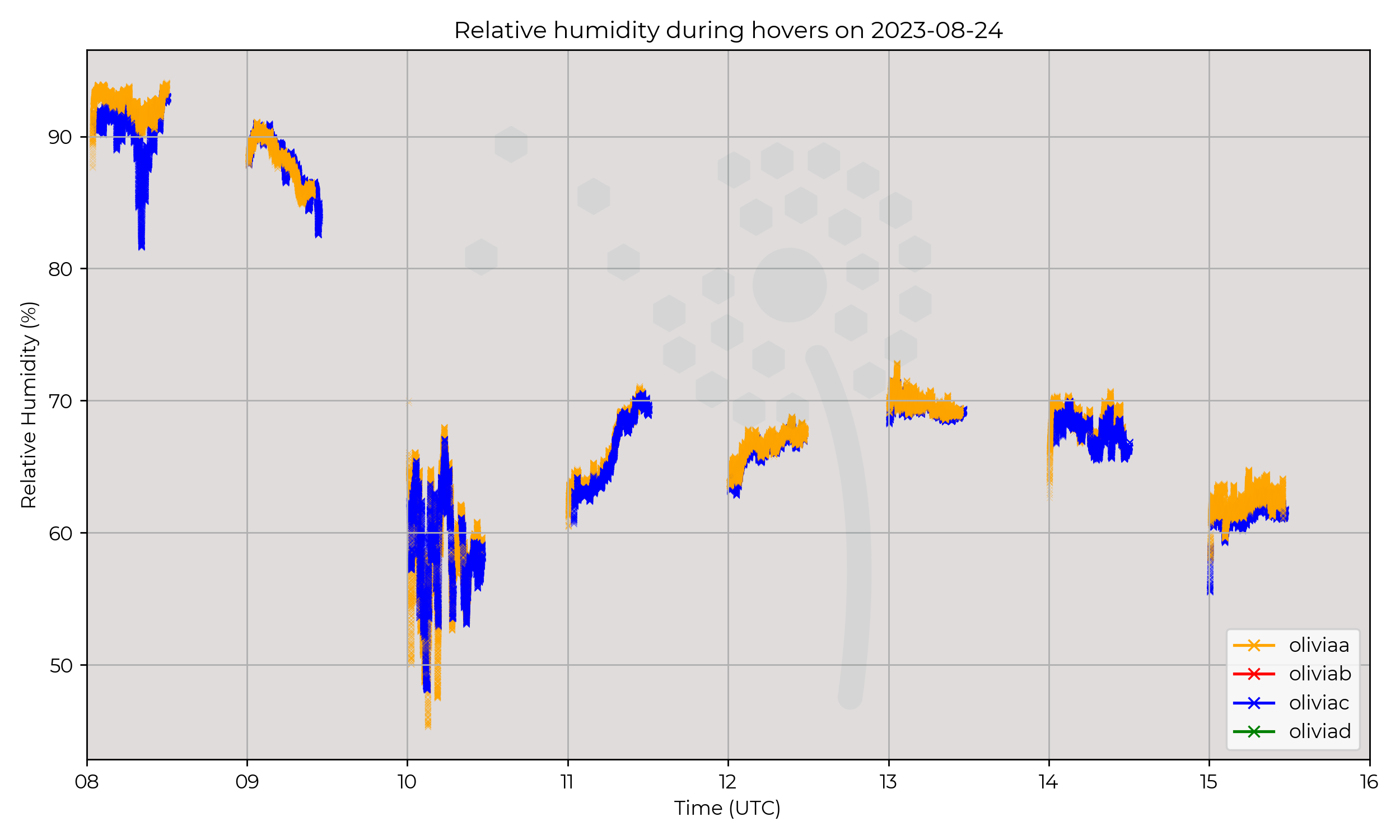
A unique pattern was flown for the only time during WesCon–WOEST. One MetSprite hovered for the duration of a full battery at 20 metres, and one other MetSprite hovered for the duration of a full battery at 40 metres. Flights started at the top of every hour starting at 08 UTC with the last flight taking place at 15 UTC.
Observations
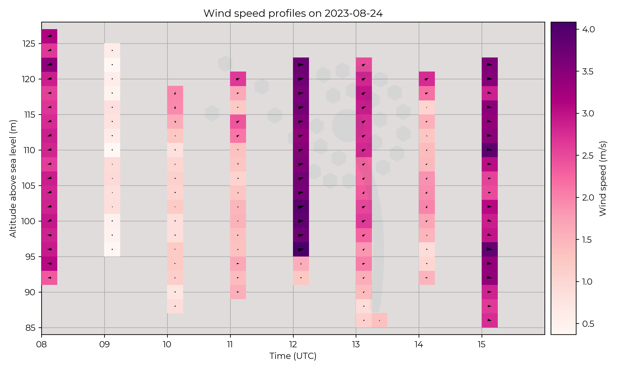
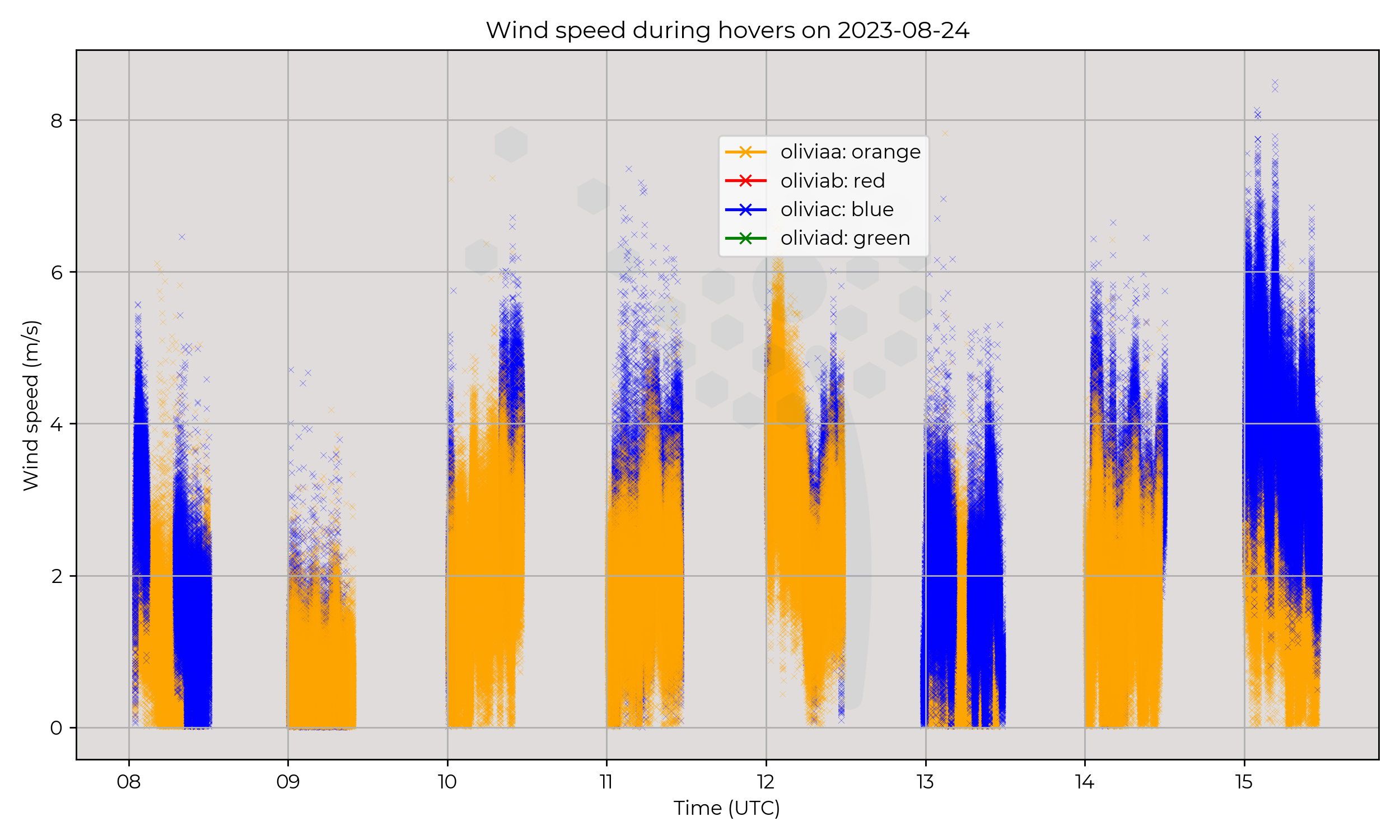
Winds were calm throughout the day. Due to the unique flight pattern, the profiles extend no higher than 40 m AGL.
Known Issues
- One of the sensors on metsensor_0018 (oliviab) reads –45 ºC at all times.
- In wind speeds below 1 m s-1, the WindVane v1.0 algorithm used on WOEST (which steers the UAS facing into the wind) struggles to lock onto the wind direction. Wind direction values when speed is below 1.0 m s-1 should be treated with caution/cross-referenced.
2023-08-23
Synoptic Overview
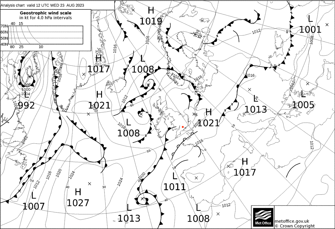
Between surface pressure minima, mostly antcyclonic-dominated flow from the SW. A near-stationary front sits to the north whilst a connected cold front approaches from the west. Both part of a slowly deepening shortwave trough becoming a local surface pressure minima.
Flight Patterns
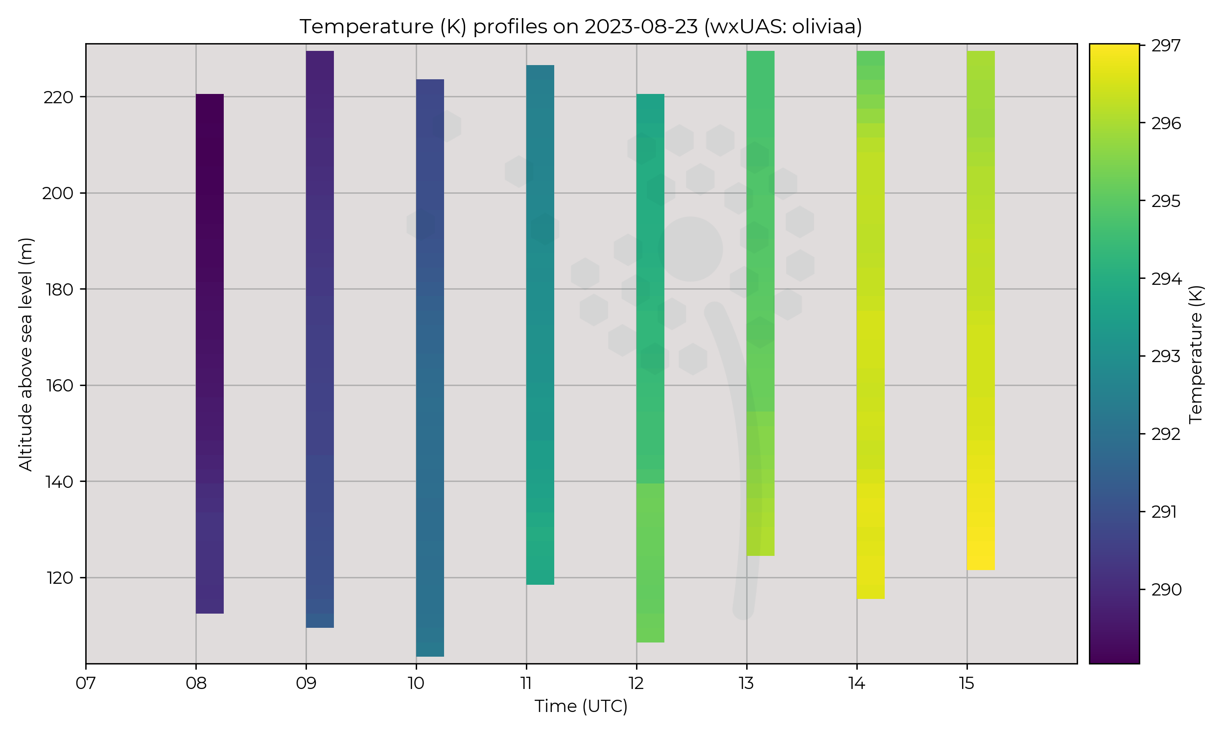
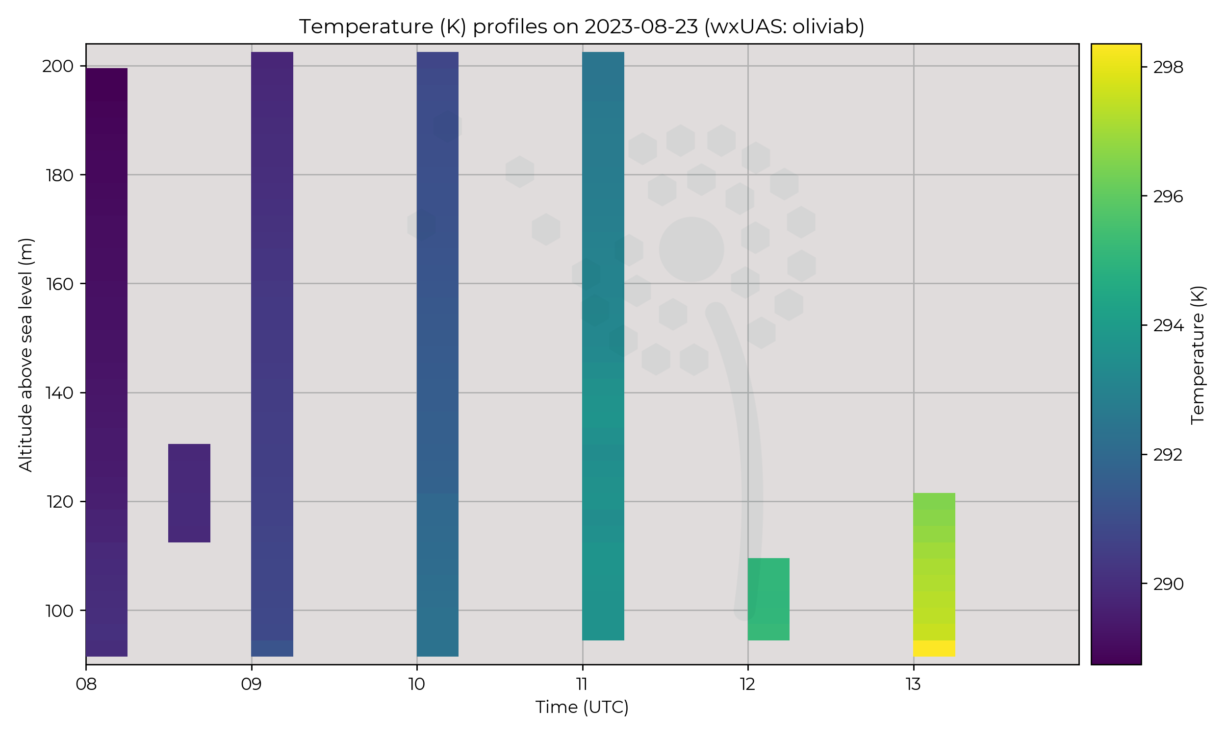
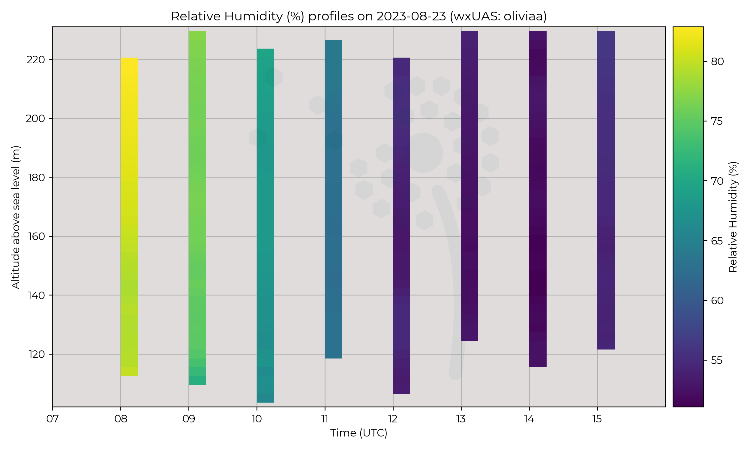
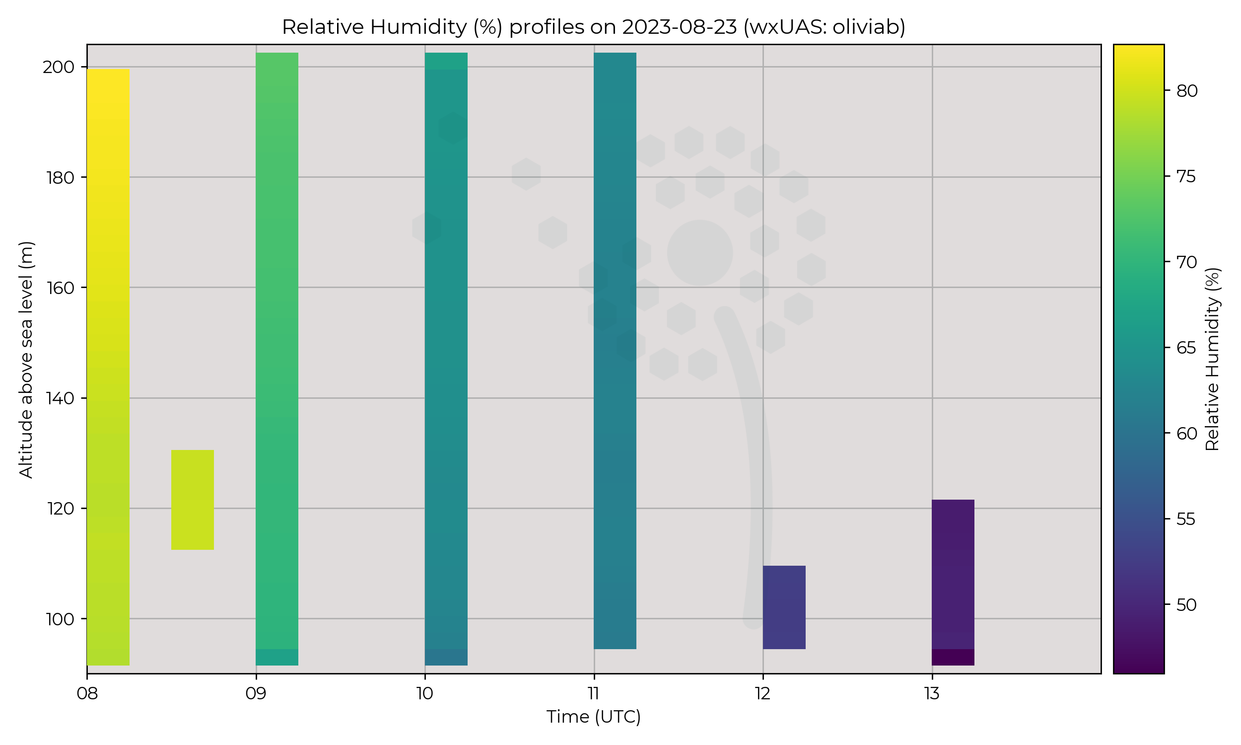
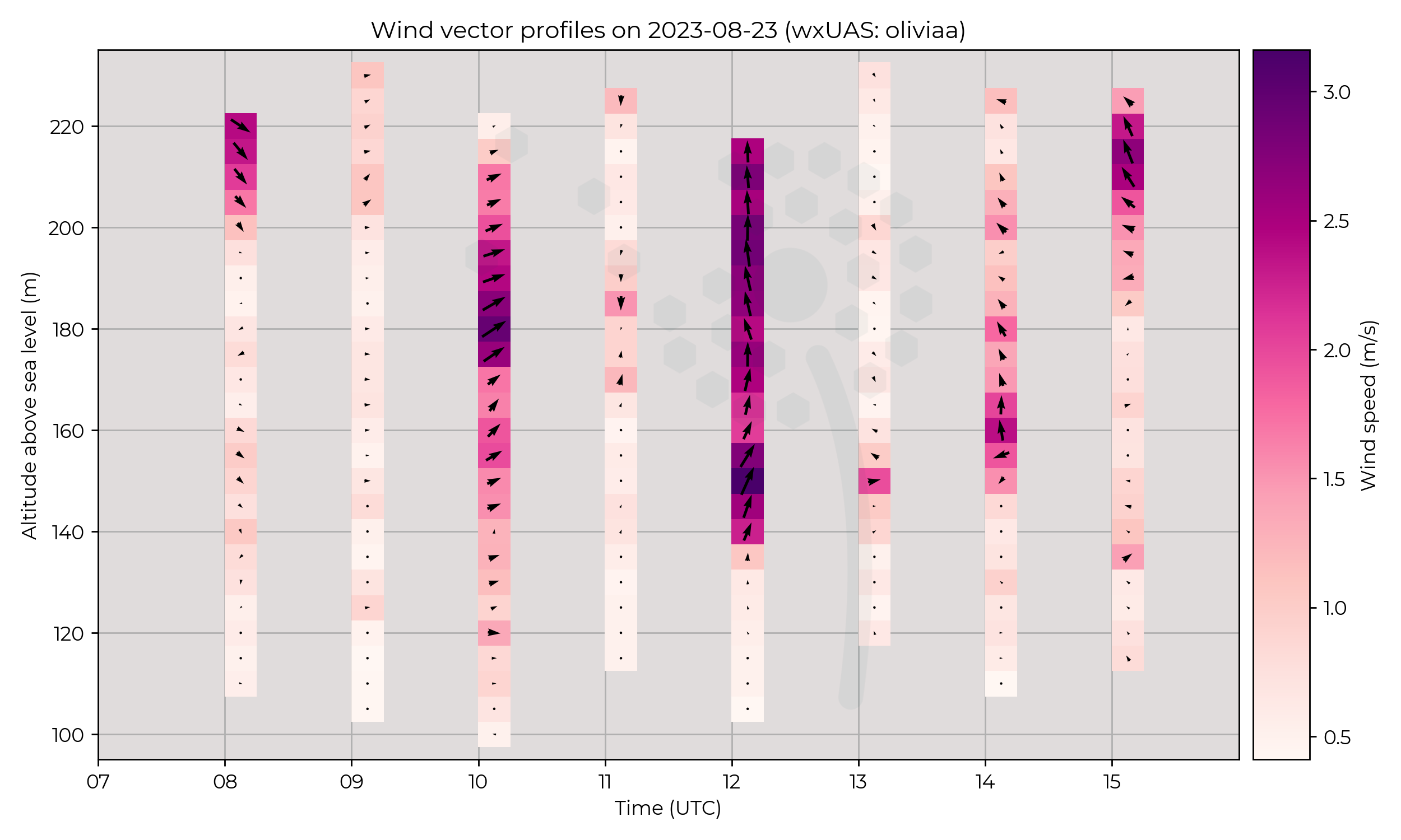
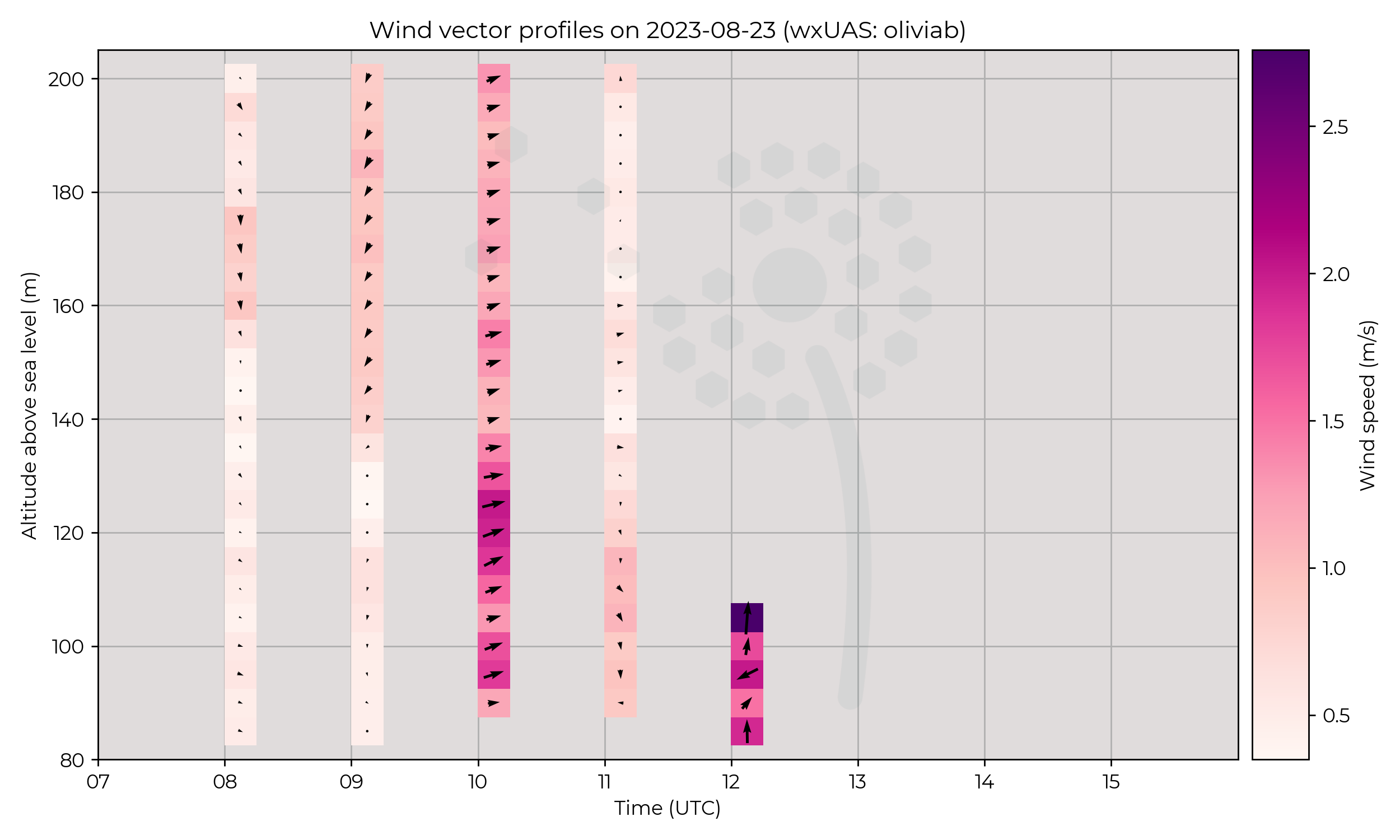
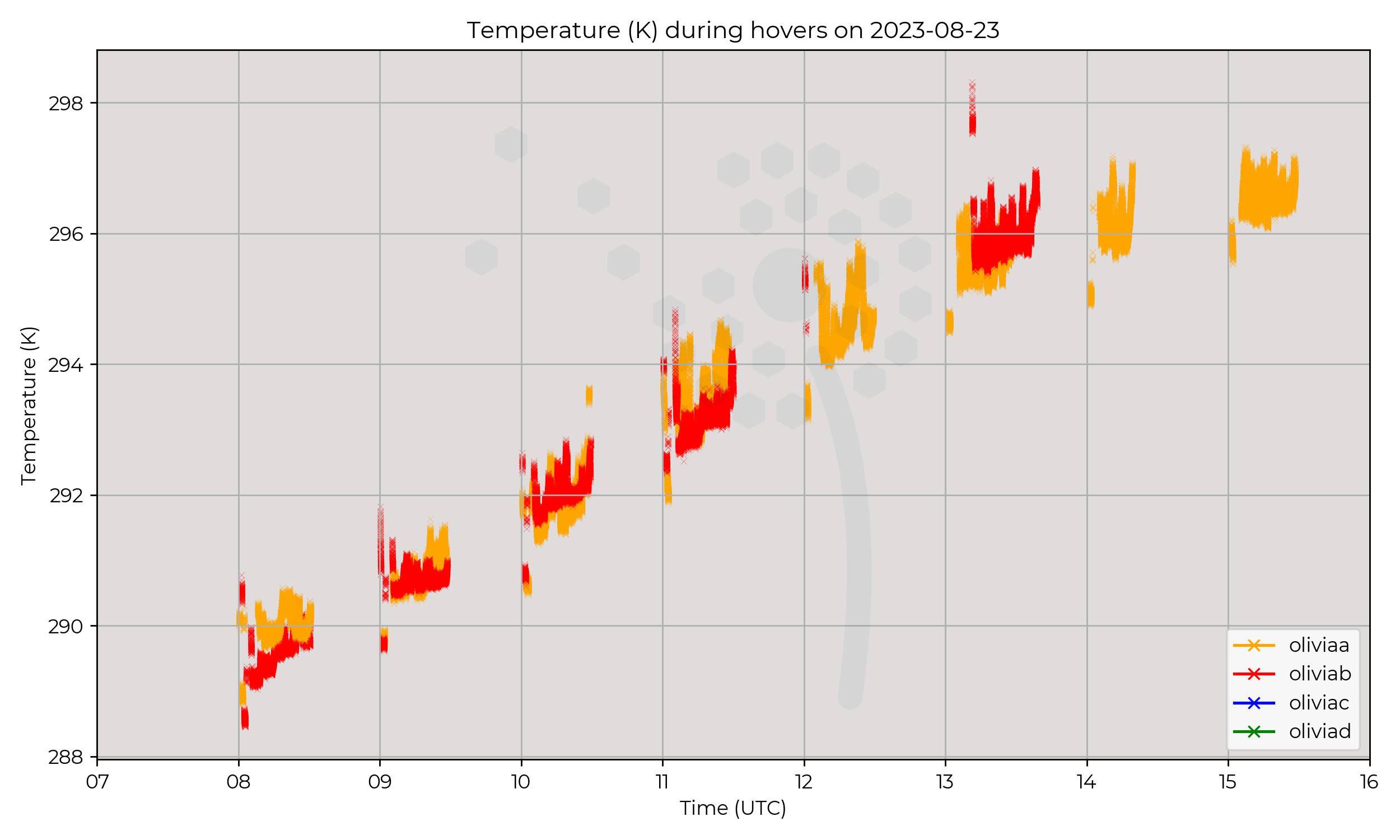
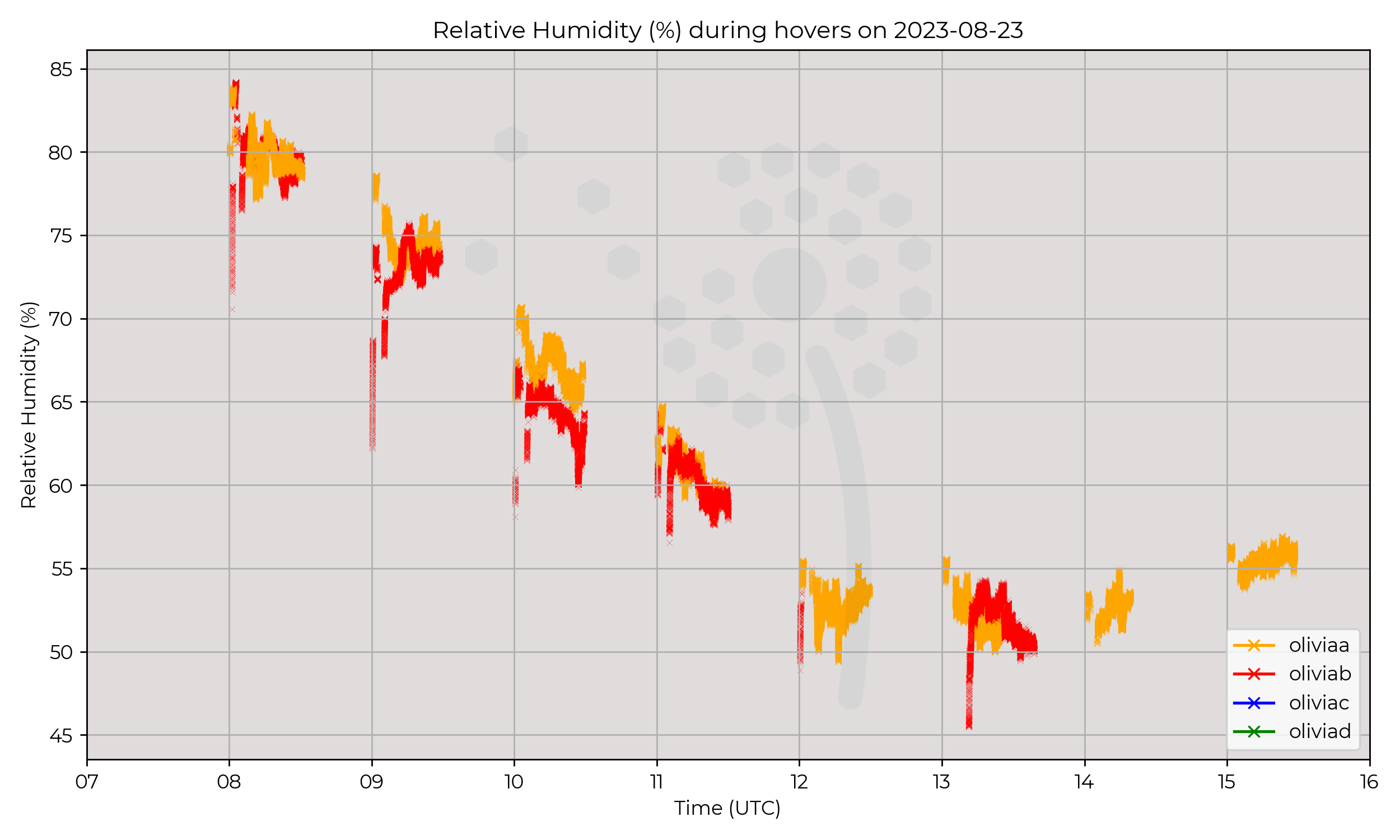
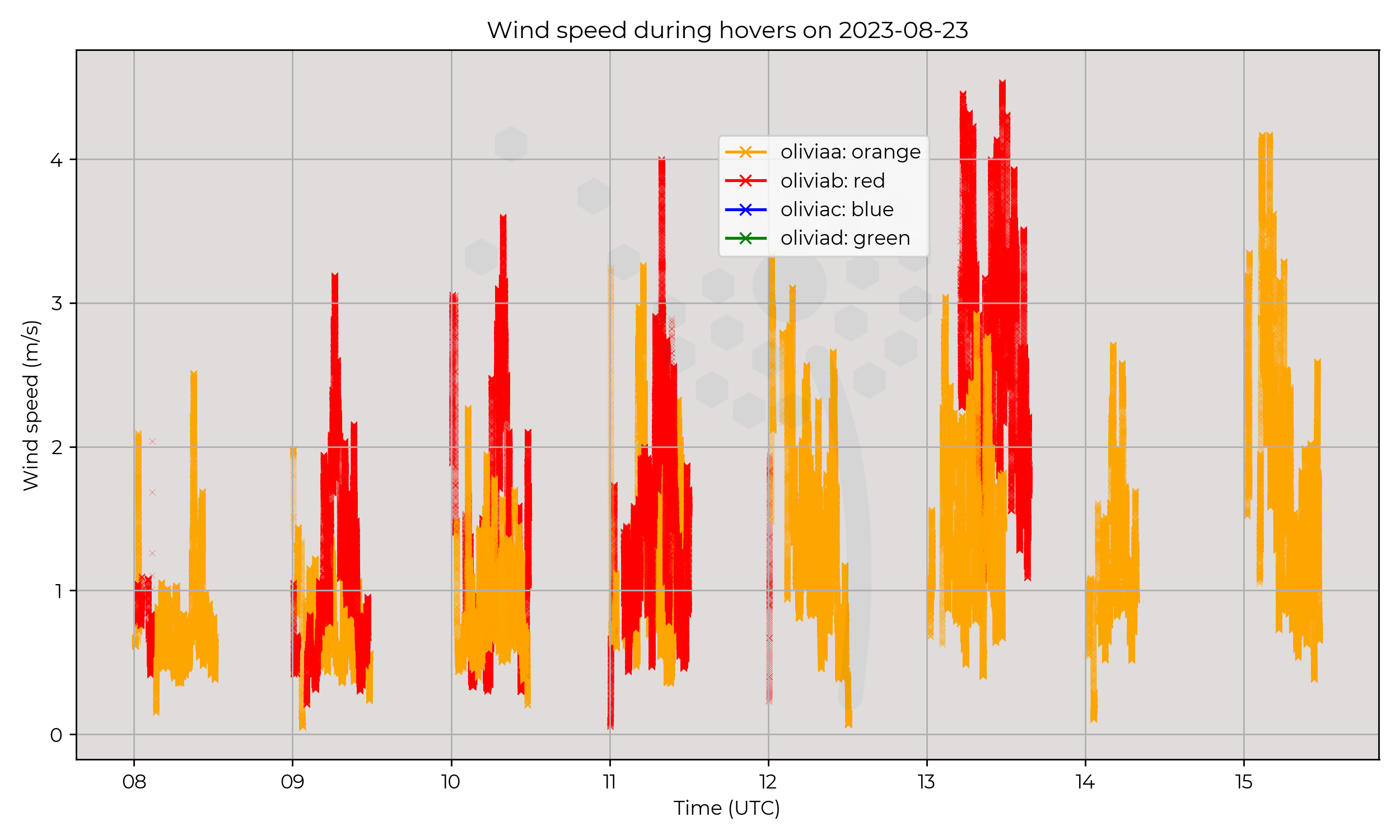
Syncronised dual-site flights ~10 km apart. Olivia-A (orange) MetSprite was flown in Wherwell Forest, tree canopy around 30 metres AGL, and Olivia-B (red) MetSprite was flown at Chilbolton Observatory, arable land. Each MetSprite was flown in a profile to 120 m, landed, and then flew for ~20 minutes in a hover at 40 metres AGL. This cycle took place every hour.
Observations
Generally cooler and more humid at the forest site, to be expected. There is an interesting flip in temperature where Wherwell Forest was warmer than Chilbolton initially at 08 UTC. This could be overnight residual warmth or differences in wind profile near the surface.
Known Issues
- The flights at Chilbolton encountered issues in the afternoon which ceased flight operations there. The issue was not related to data quality.
- In wind speeds below 1 m s-1, the WindVane v1.0 algorithm used on WOEST (which steers the UAS facing into the wind) struggles to lock onto the wind direction. Wind direction values when speed is below 1.0 m s-1 should be treated with caution/cross-referenced.
2023-08-22
Synoptic Overview
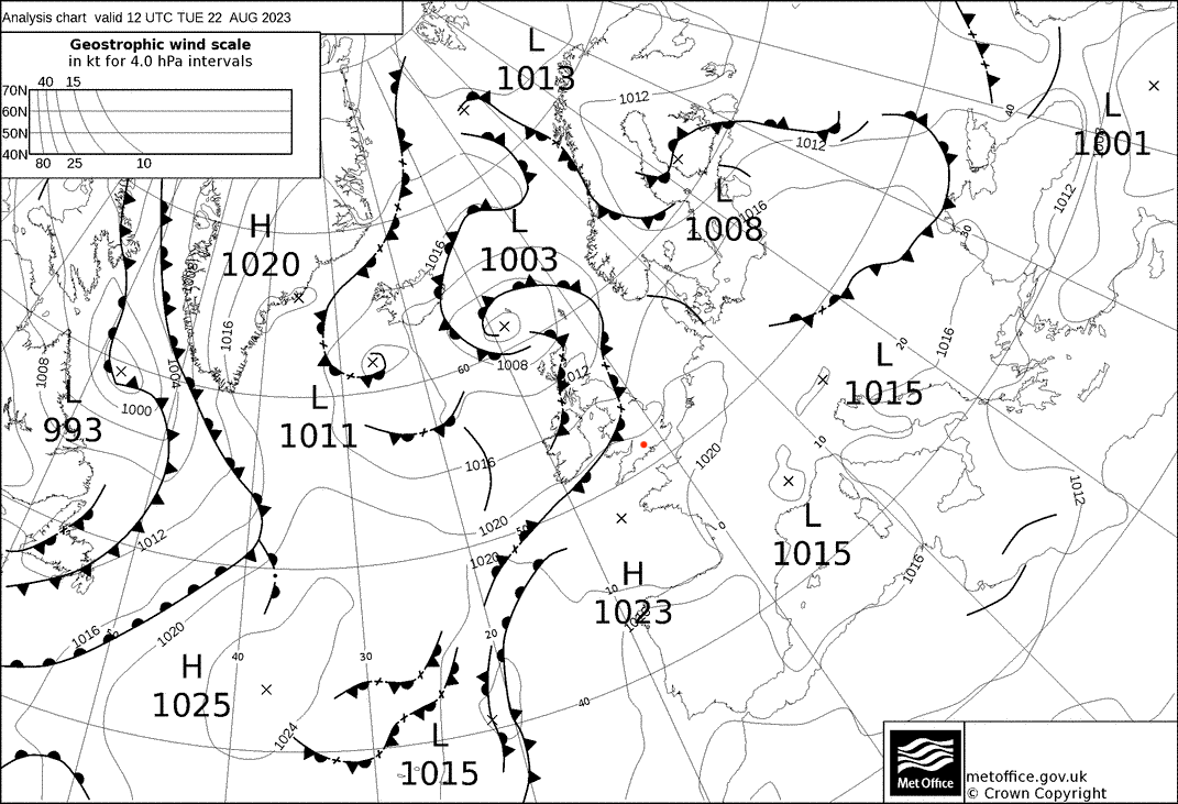
Decaying occluded fronts moved slowly SE over the region, associated with a weak 1003 hPa surface pressure minima to the north of the UK.
Flight Patterns
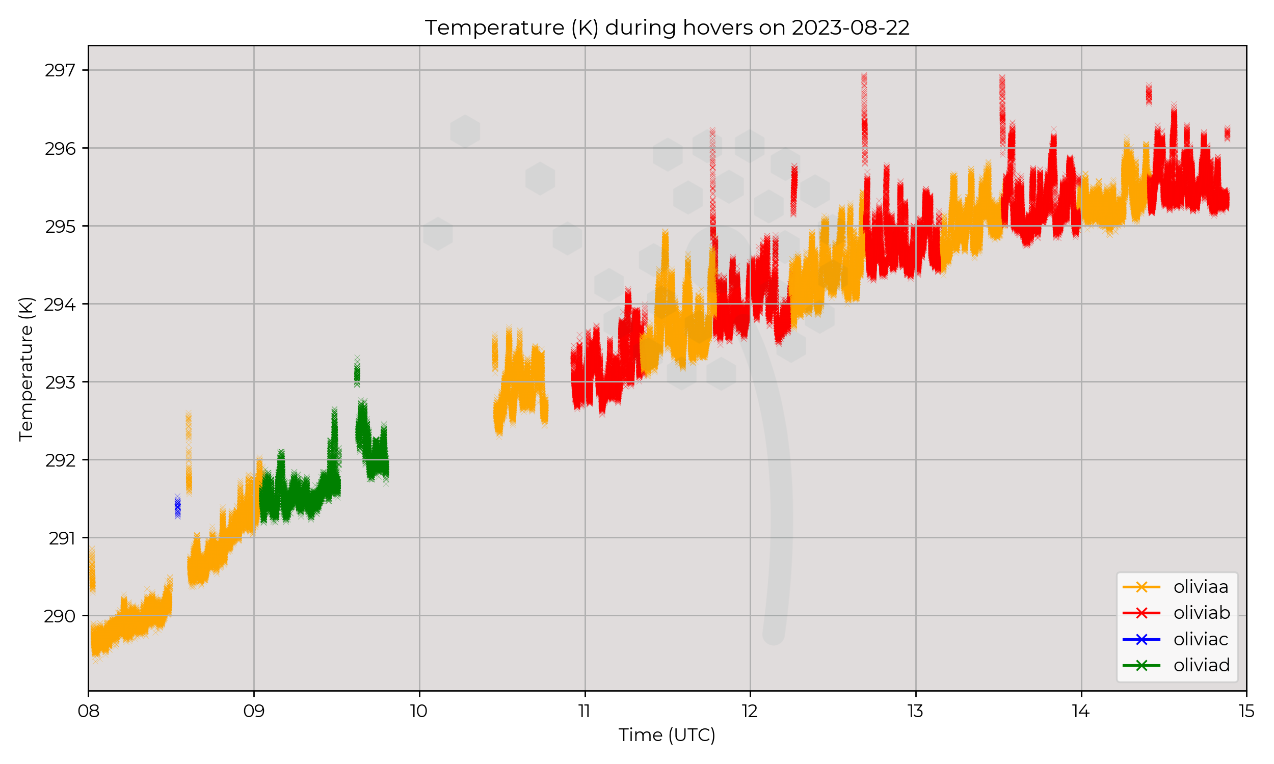
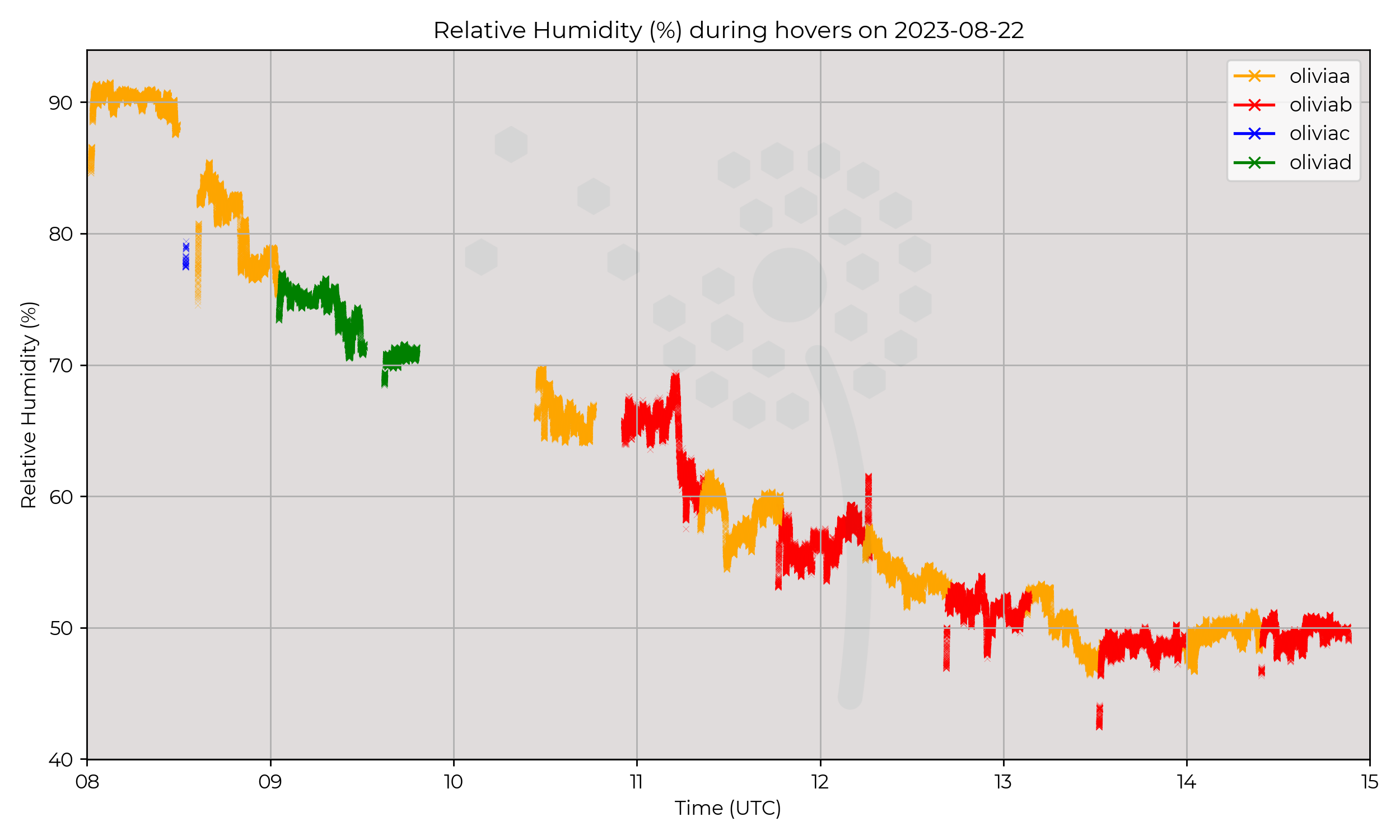
Constant presence at 60 m AGL.
Observations
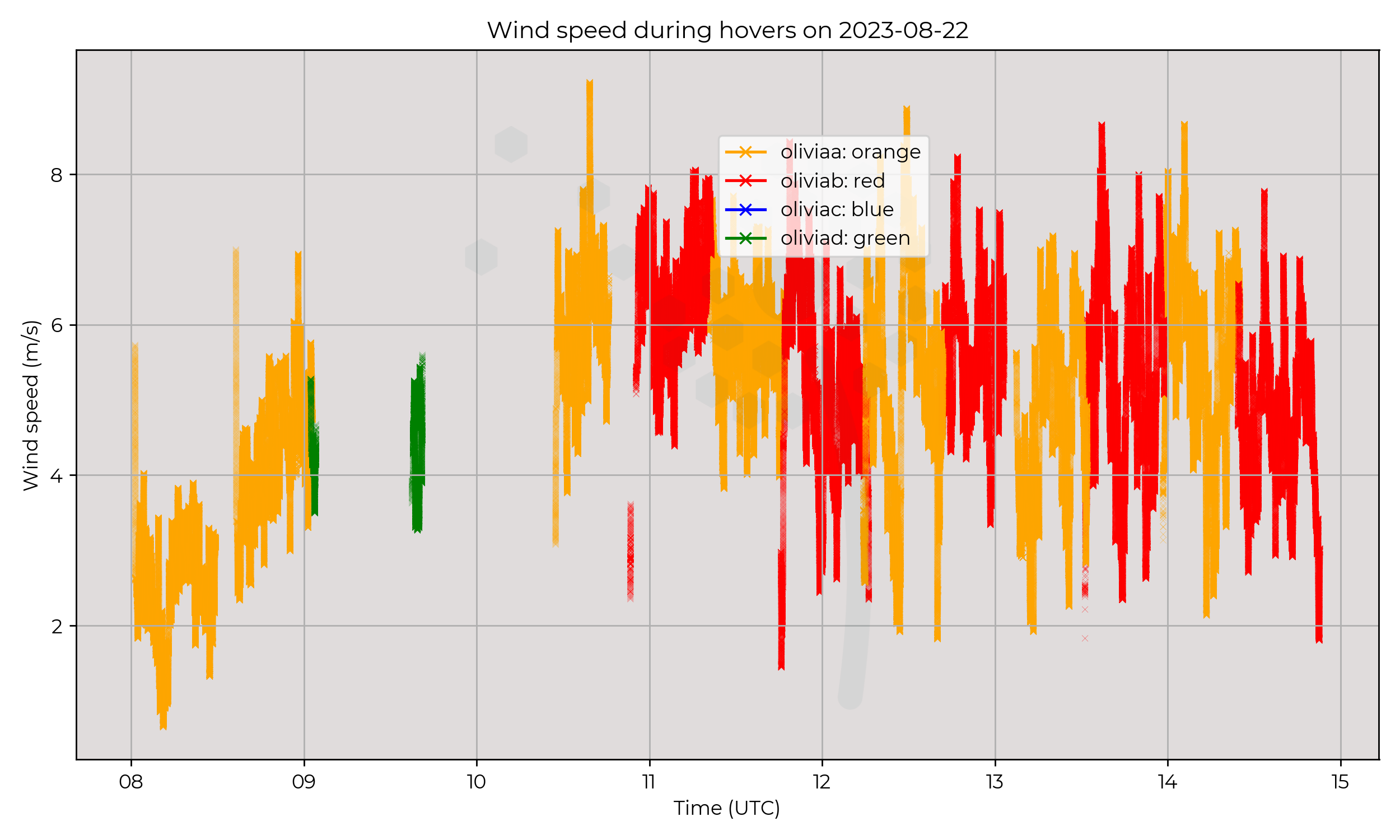
Wind speeds remained consistent at around 4–6 m s-1.
Known Issues
- The sonic anemometer on Olivia-D (green) stopped communicating between 09:06 and 09:38 UTC, resolved with a system reboot.
- Flights by Olivia-B (red) reported altitude AMSL approximately 20 metres greater than the other wxUAS. Height above the surface ("z" variable) was unaffected.
2023-08-21
Synoptic Overview
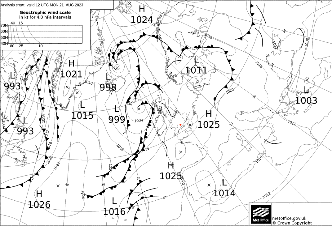
A surface pressure minima of 999 hPa situated to the NW of the UK and moving NE, brought approaching occluded fronts.
Ahead of these occluded fronts, two shortwave troughs developed in the afternoon/evening.
Flight Patterns
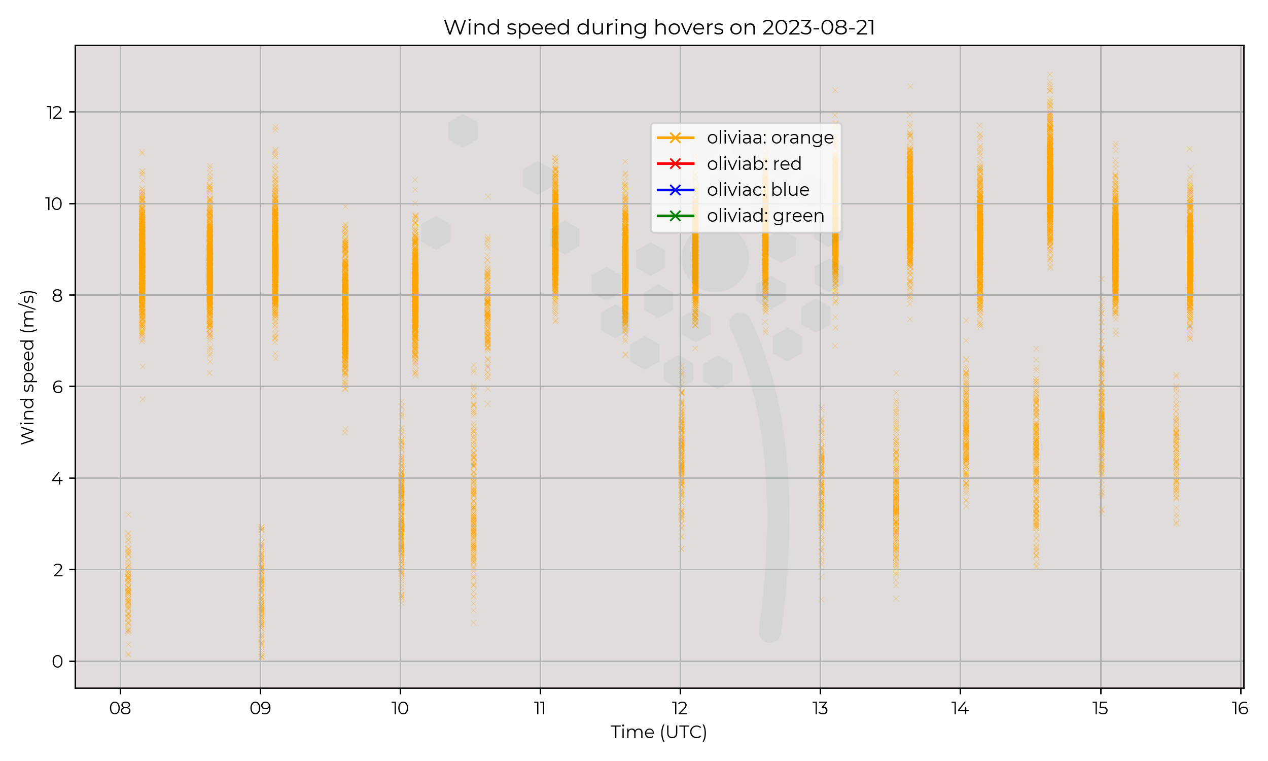
Ground to 2 km AGL profiles at 6 m s-1 ascent speed, every 30 minutes. All performed by Olivia-A (orange).
Observations
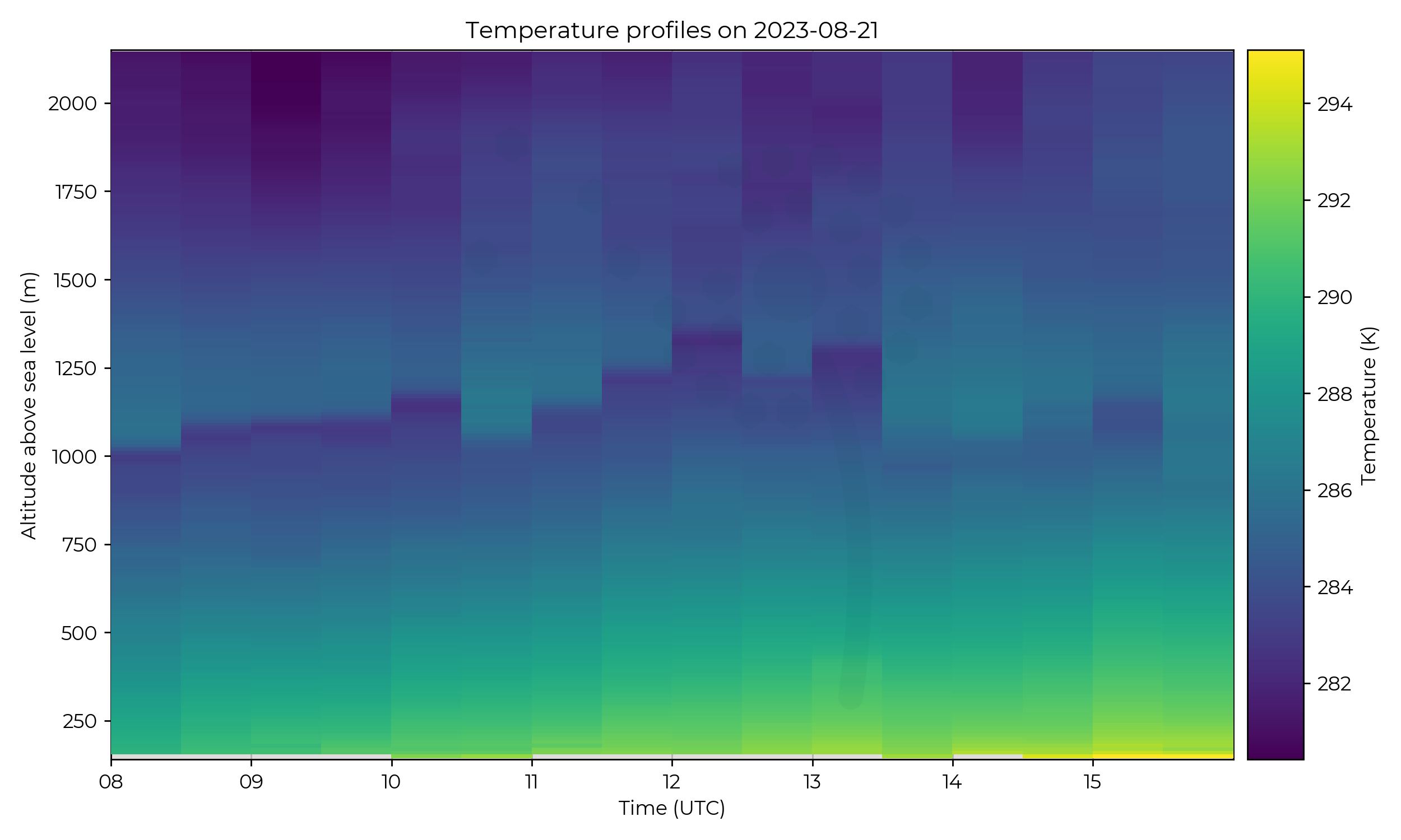
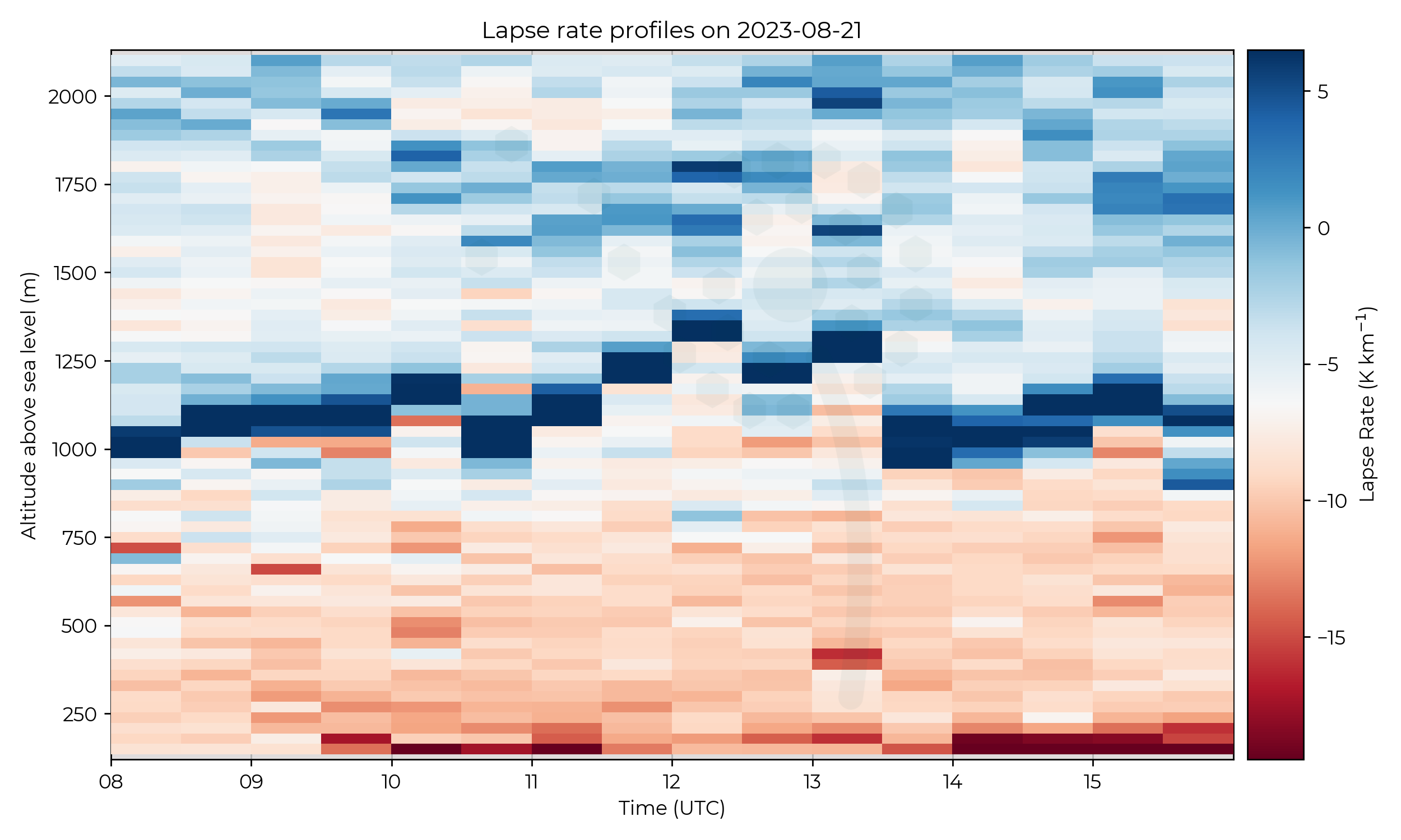
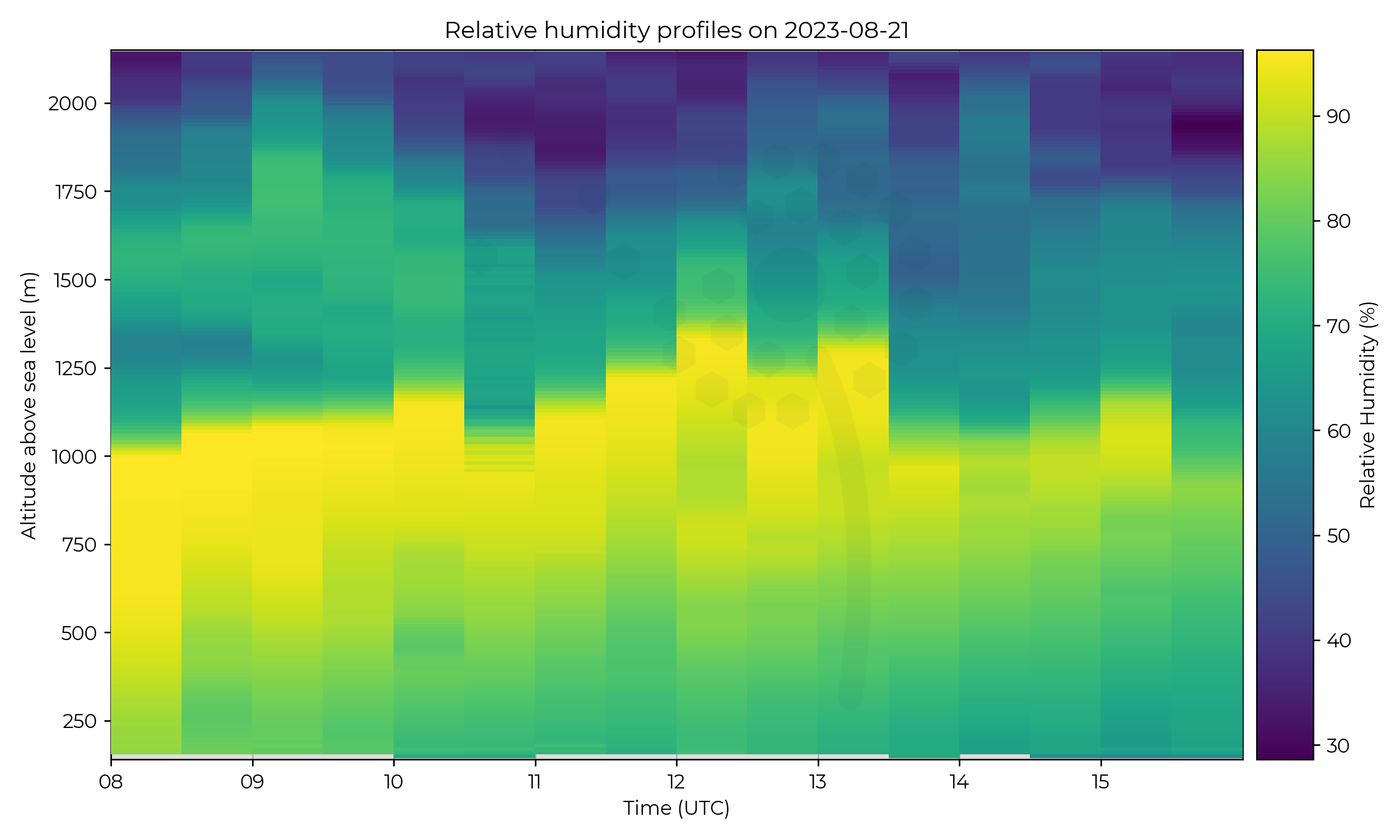
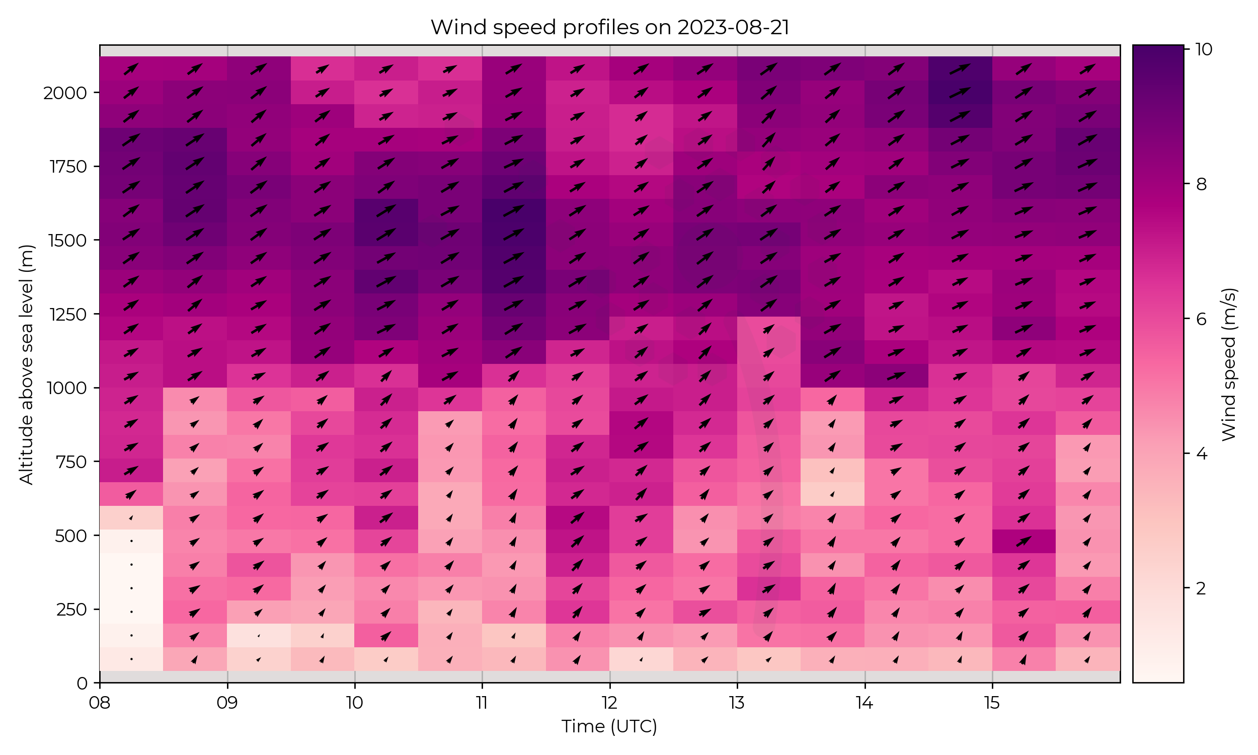
Boundary layer (BL) inversion height grew from 1 km at 08 UTC to 1.3 km at 12 UTC before decreasing in altitude and becoming weaker in gradient.
At 1330 UTC there is a significant drop in the BL inversion height of approximately 300 metres in a 30-minute window.
This is accompanied by a decrease in humidity at the top of the BL.
Known Issues
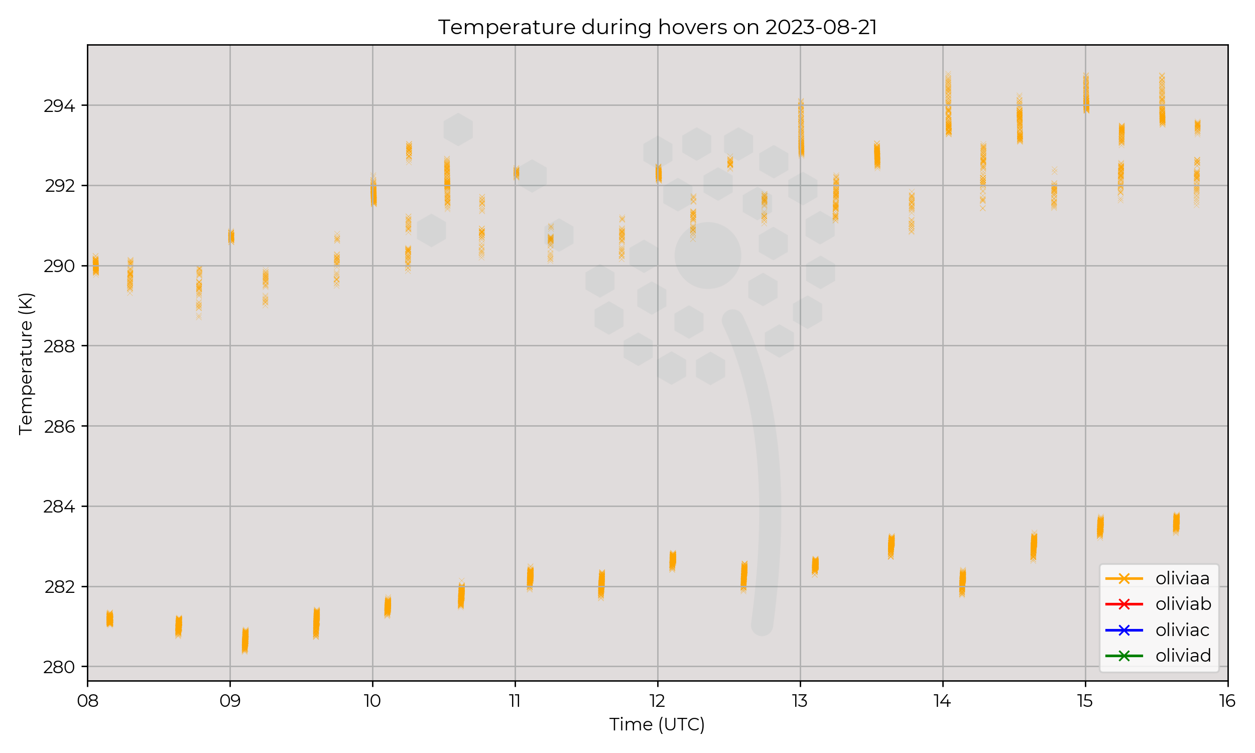
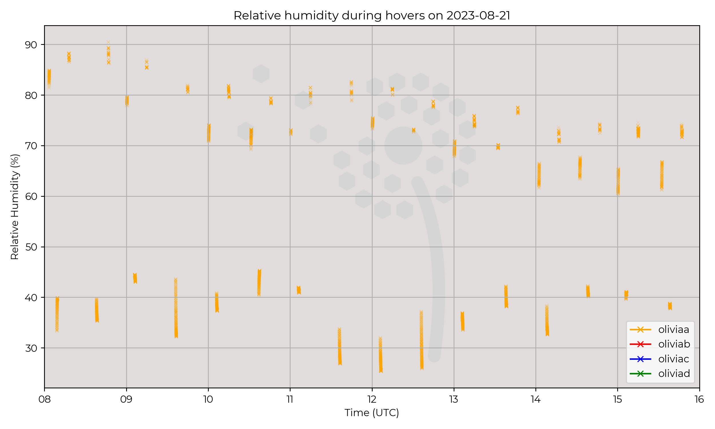
- Flight number 6 (1030 UTC take-off) encountered a issue where some timestamps were incorrectly logged, the result is that some unrepresentative values are scattered into the data.
Week 9
2023-08-18
Synoptic Overview
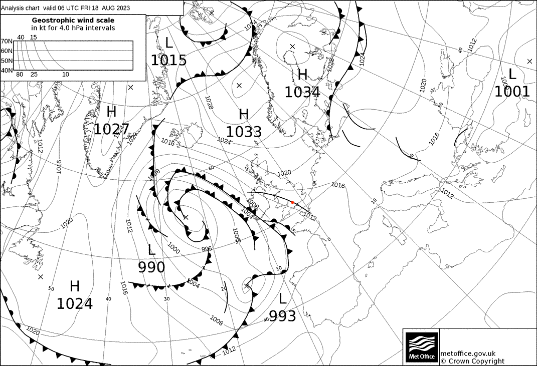
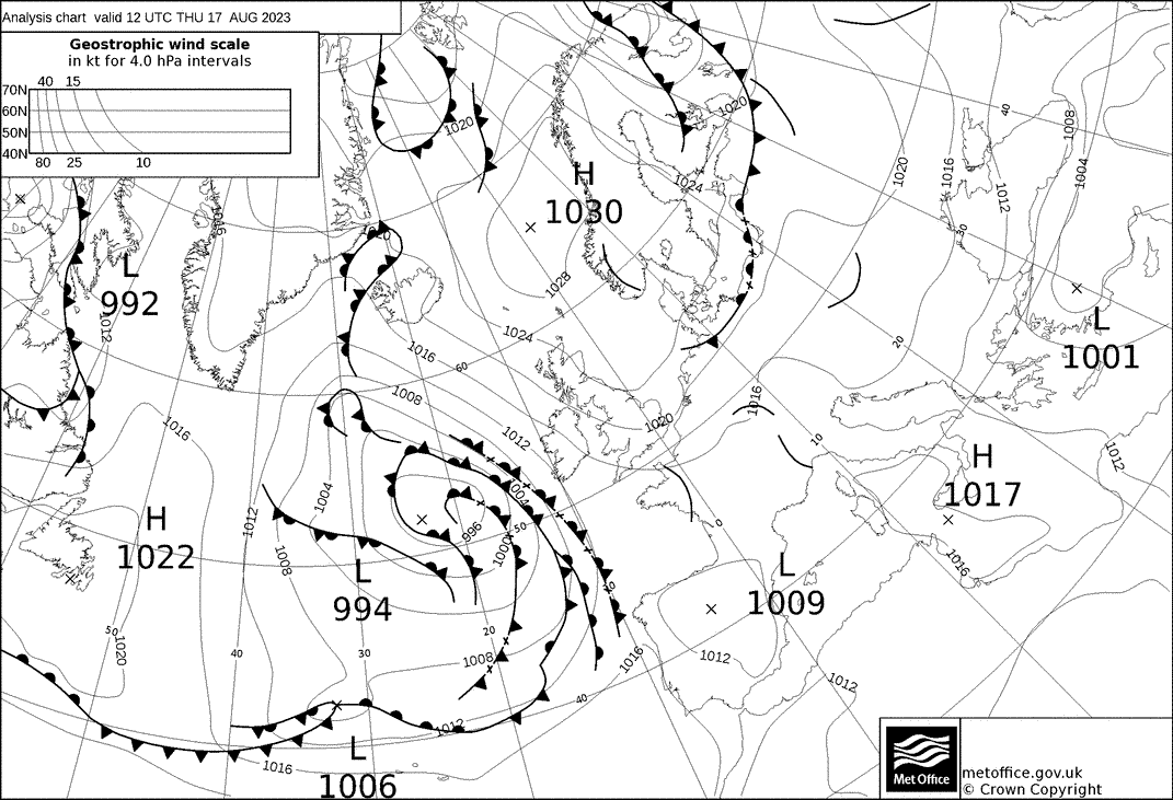
Note that this synoptic chart is for 06 UTC compared to the usual 12 UTC as the IOP began earlier in the day.
An approaching system, composed of a two surface pressure minima interacting to the west of the UK. brought a series of fronts to the region.
Ahead of the frontal structure on the more southerly surface pressure minima, a shortwave trough moved over the Wessex region (red dot) which
brought convection and heavy precipitation.
Flight Patterns
Ground to 2 km AGL profiles at 6 m s-1 ascent speed, every 30 minutes. All performed by Olivia-A (orange).
Observations
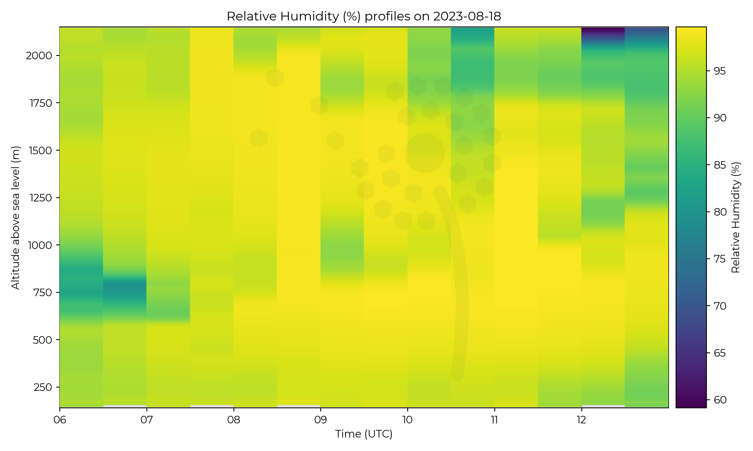
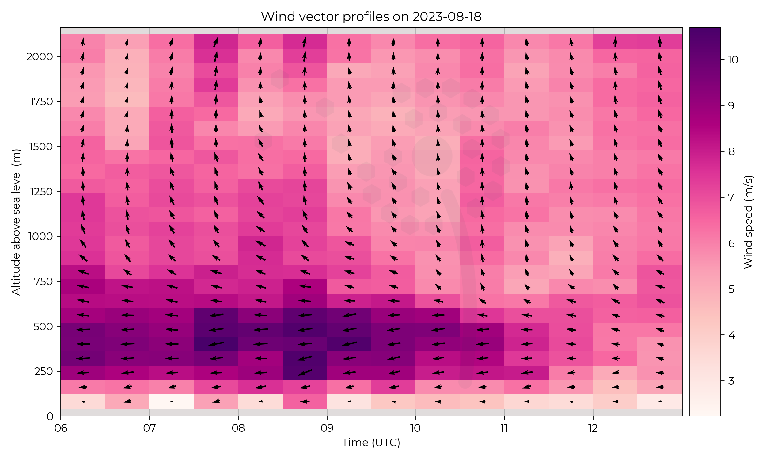
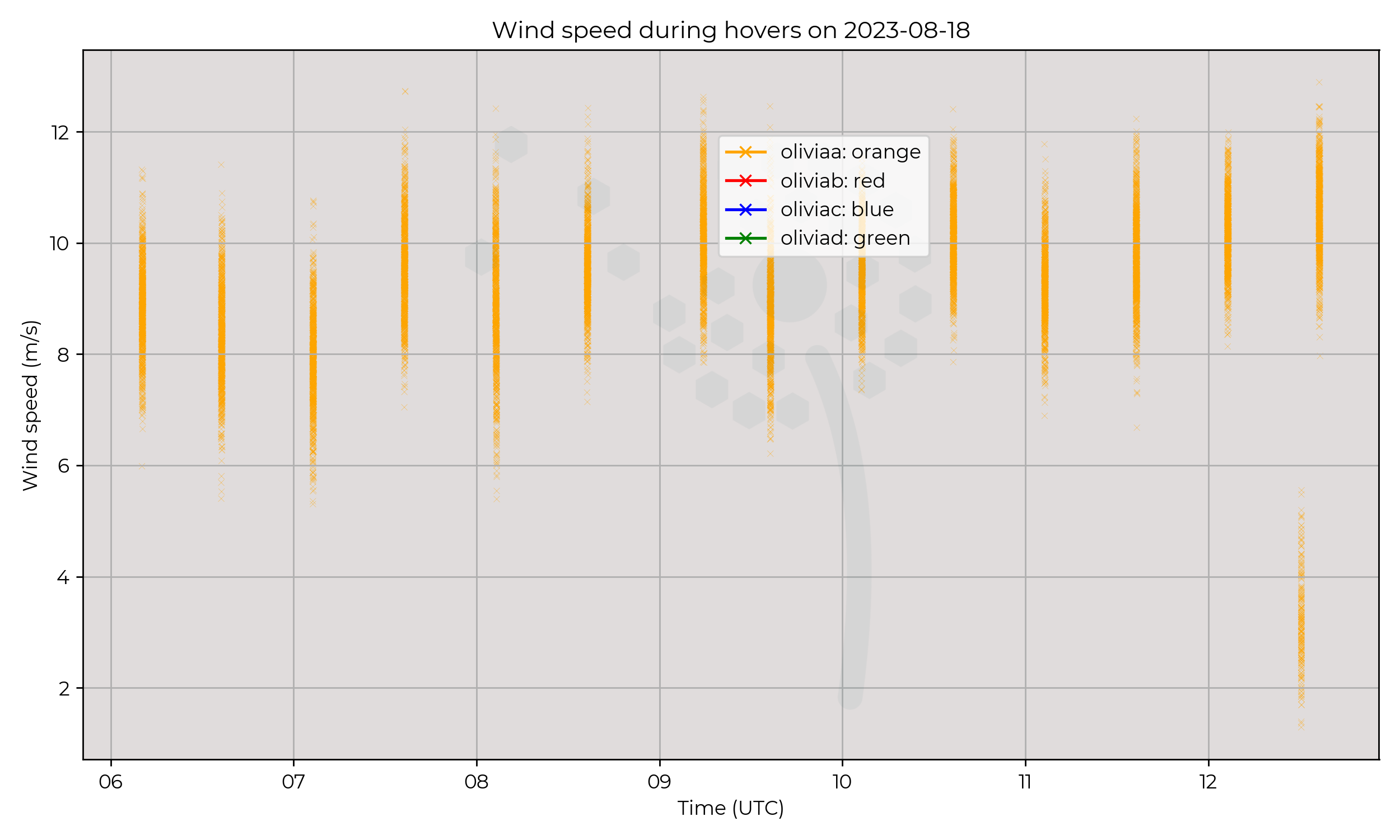
Moderate precipitation, heavy at times, fell for a large portion of the IOP. This is evidenced by the high RH values throughout.
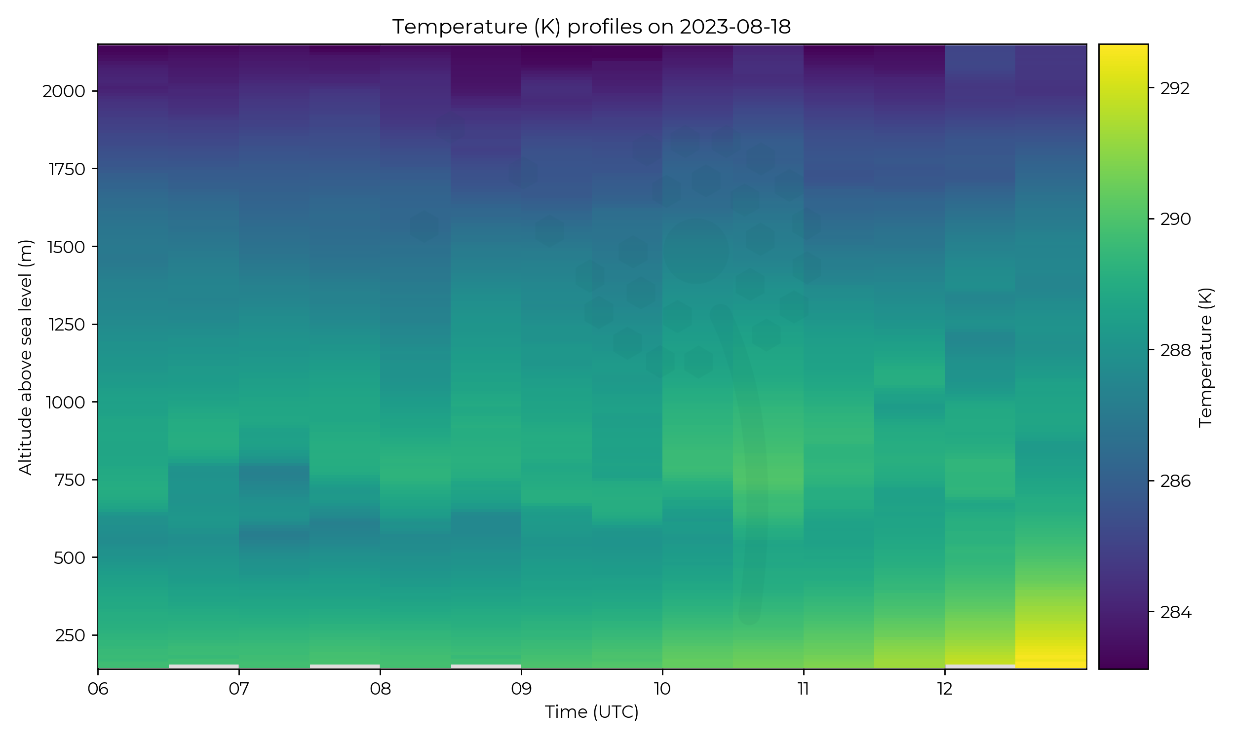
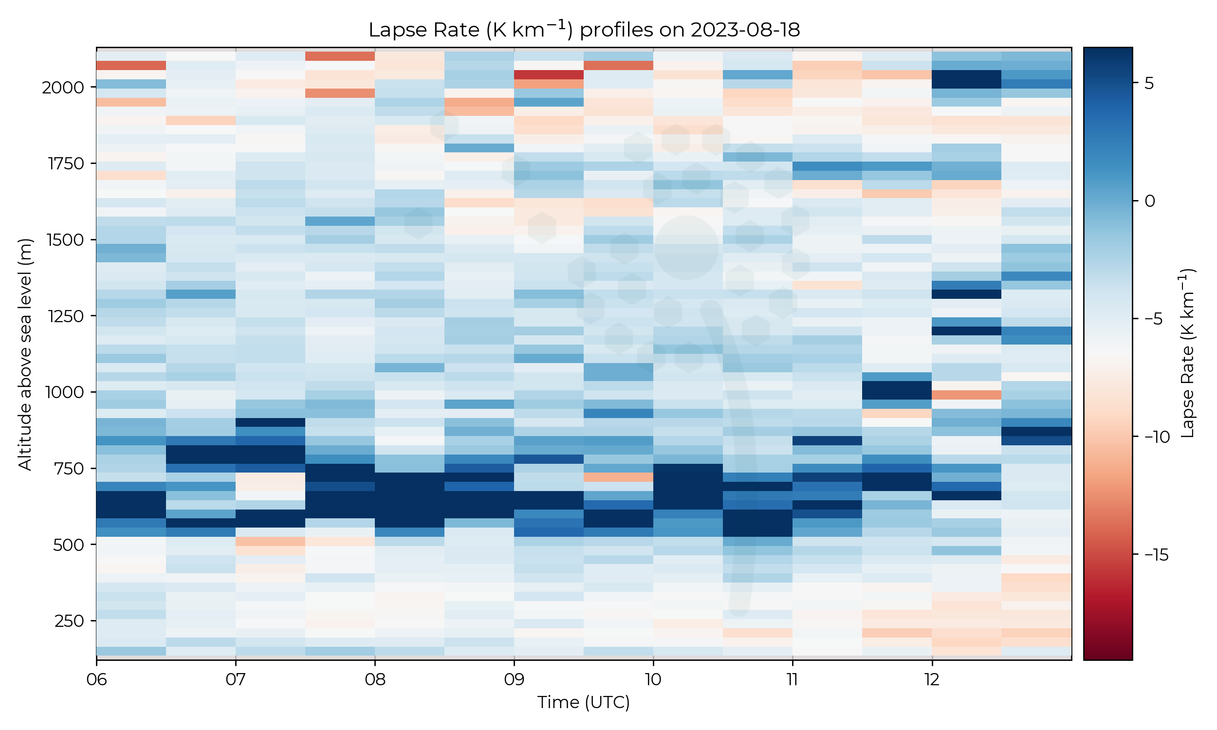
An inversion at approximately 500 m AGL lasted from 06 UTC to 12 UTC. There is evidence that this inversion split into a double-layered inversion twice during the IOP.
Once at 07 UTC and again at 11 UTC where the structure of the boundary layer changed, possibly with the passing of a warm front not labelled on the synoptic chart, or a mesoscale feature.
The inversion at 500 m AGL began to lift, and a drier layer existed toward the top of the flight profile at 2 km AGL. Surface heating began to occur at 12 UTC.
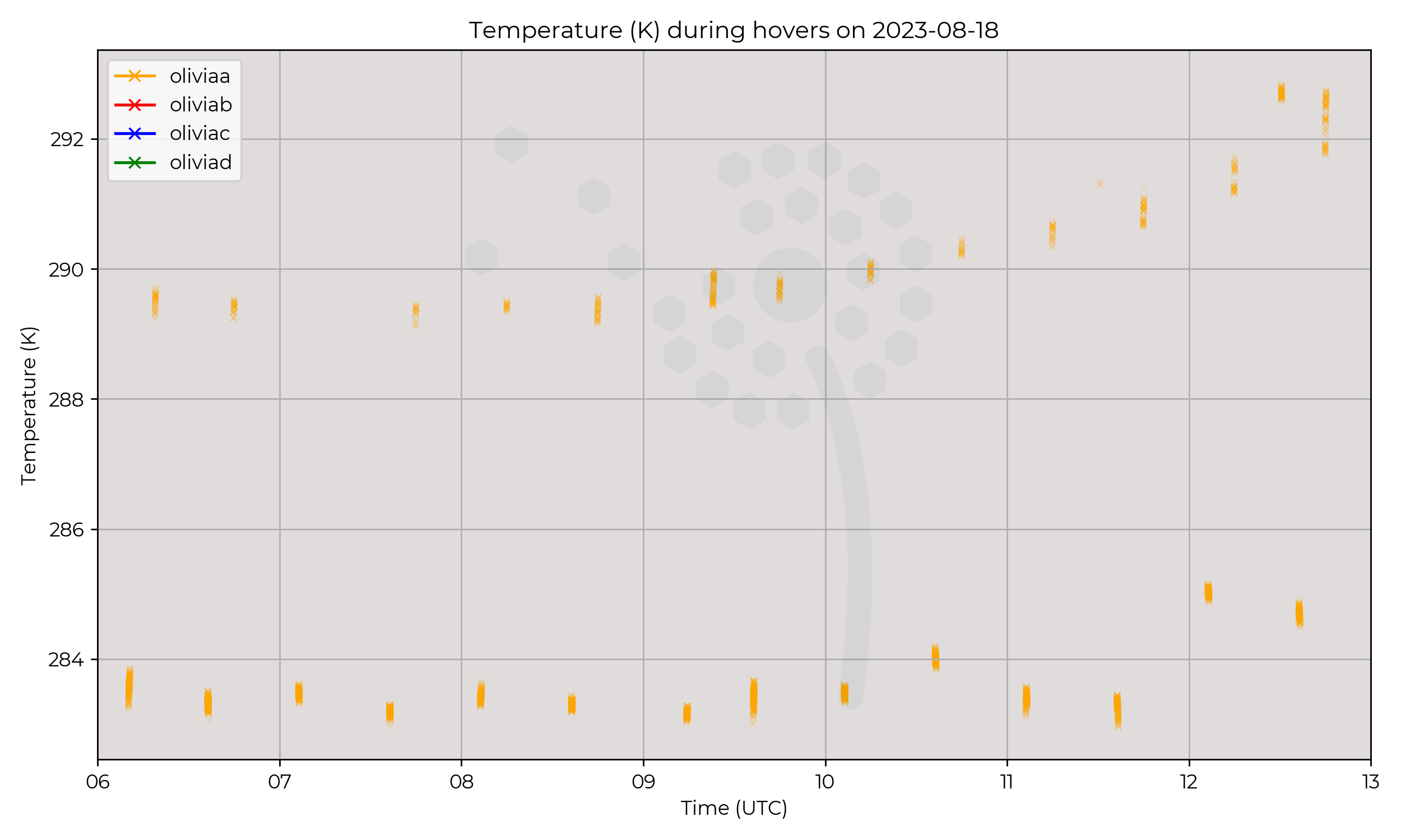
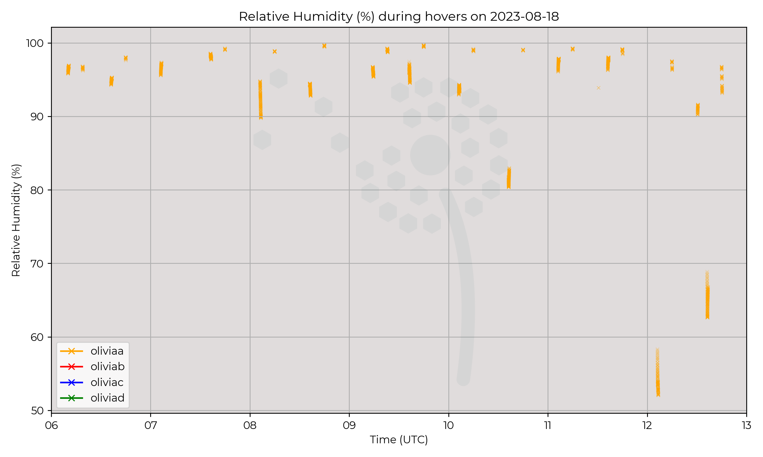
The MetSprite hovers for a short time at the base and top of the profile to allow sensors to acclimatise.
These are extracted in the hover plots, serving as a good reference for ground and 2 km AGL values of temperature and humidity.
Note that the temperature at 2 km AGL remained reasonably constant throughout the IOP, until 12 UTC.
Known Issues
- Metsensor_0020 on Olivia-A (orange) was reported to have intermittent connection.
2023-08-17
2023-08-16
Synoptic Overview
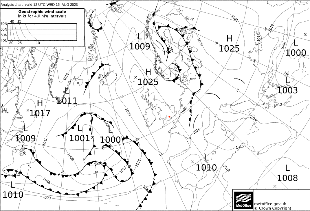
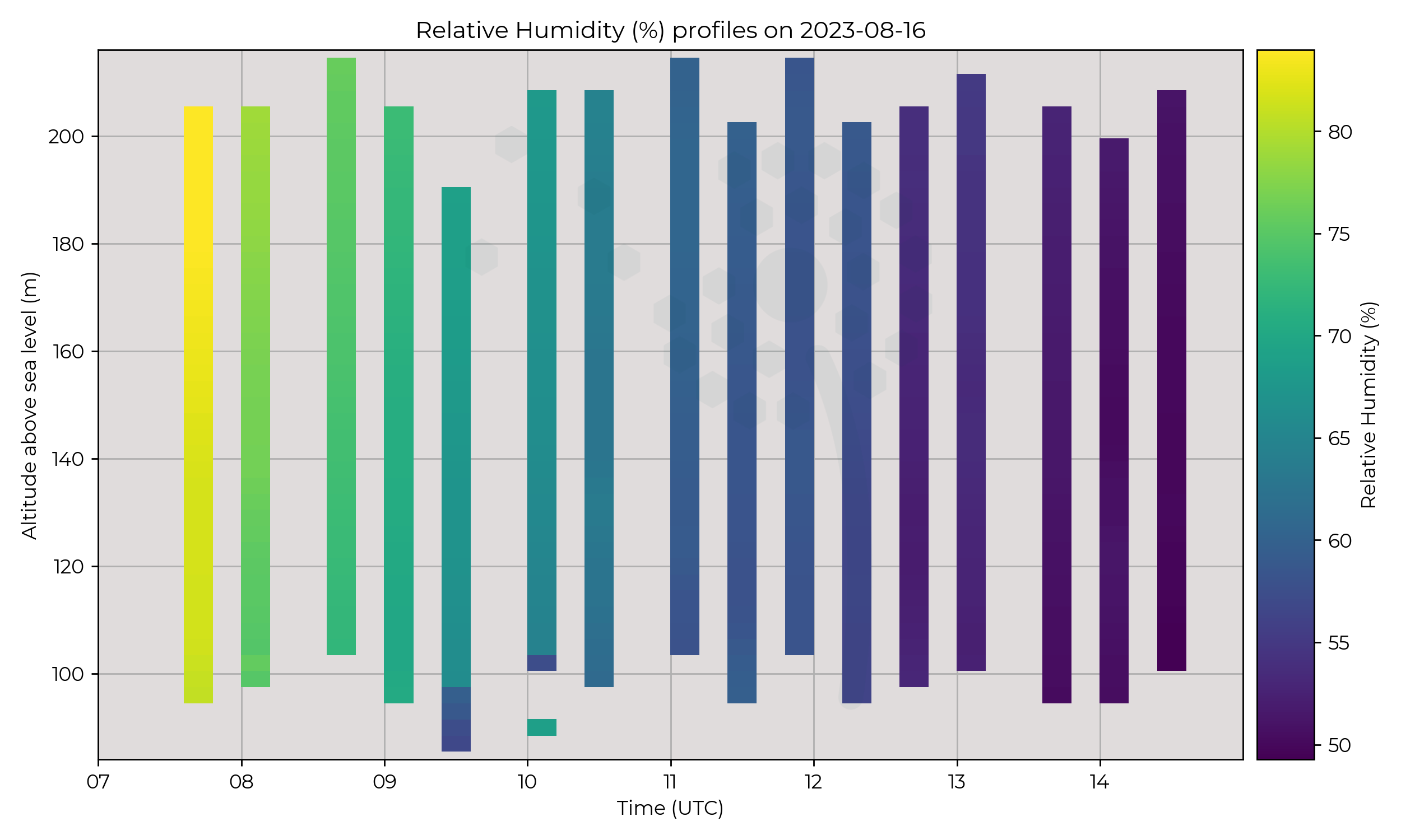
Anti-cyclonic dominated, calm conditions. No frontal activity or troughs influencing the region.
Flight Patterns
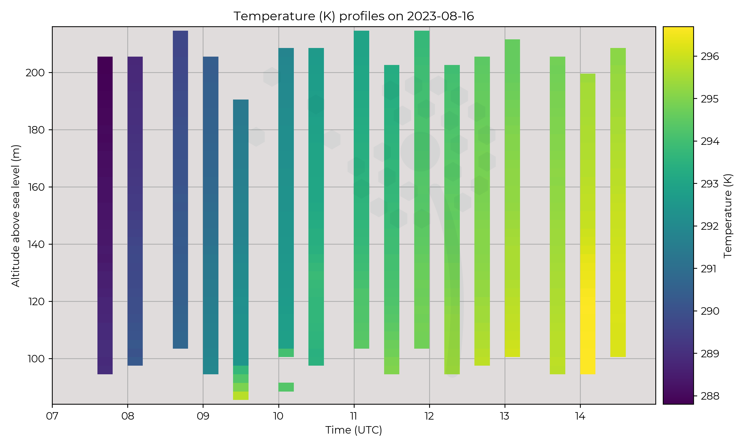
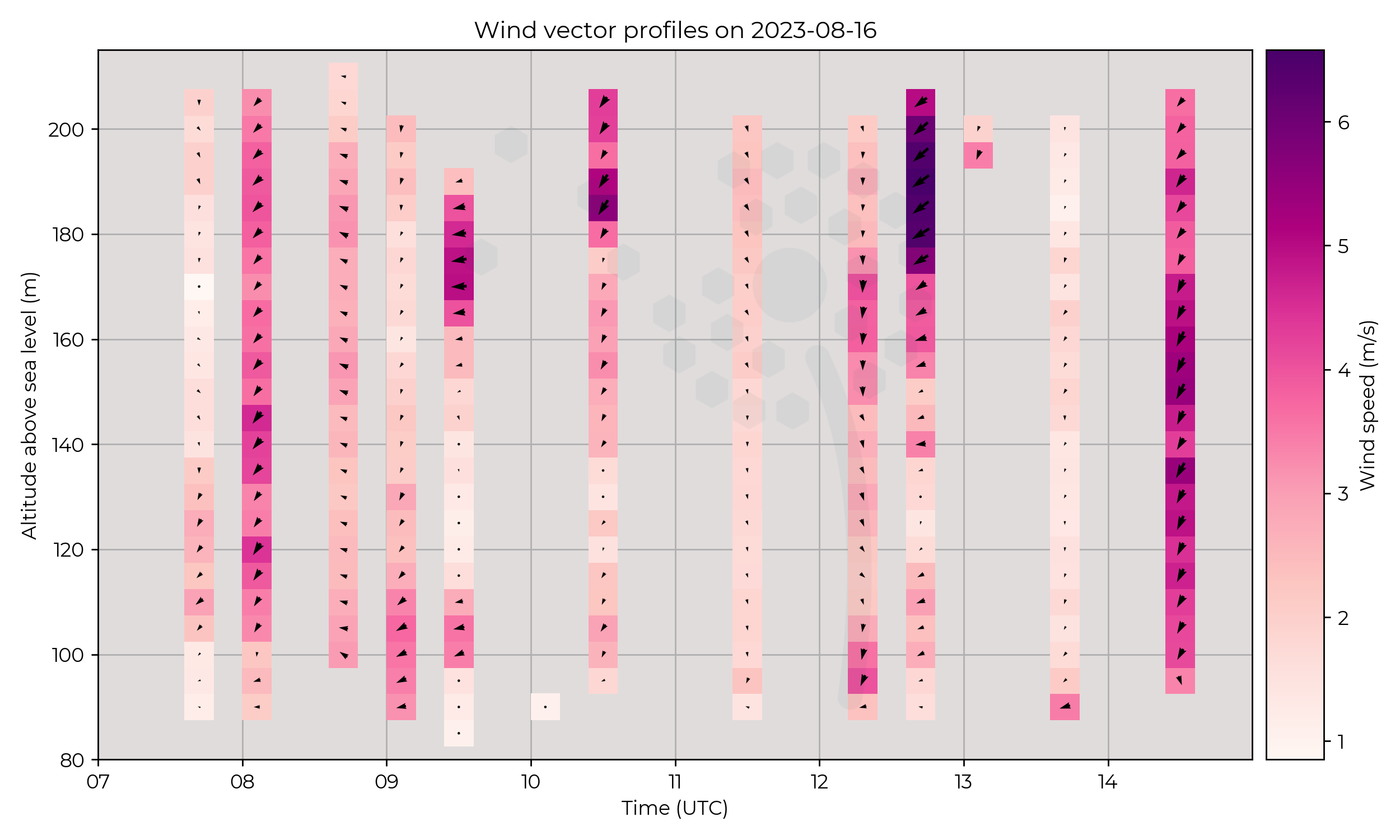
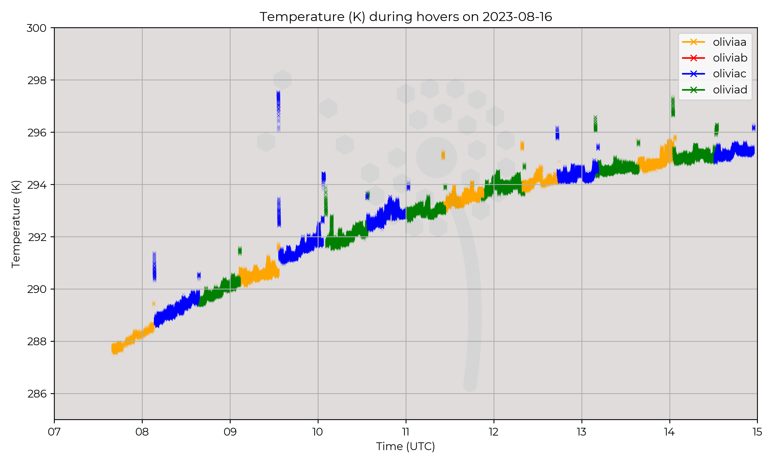
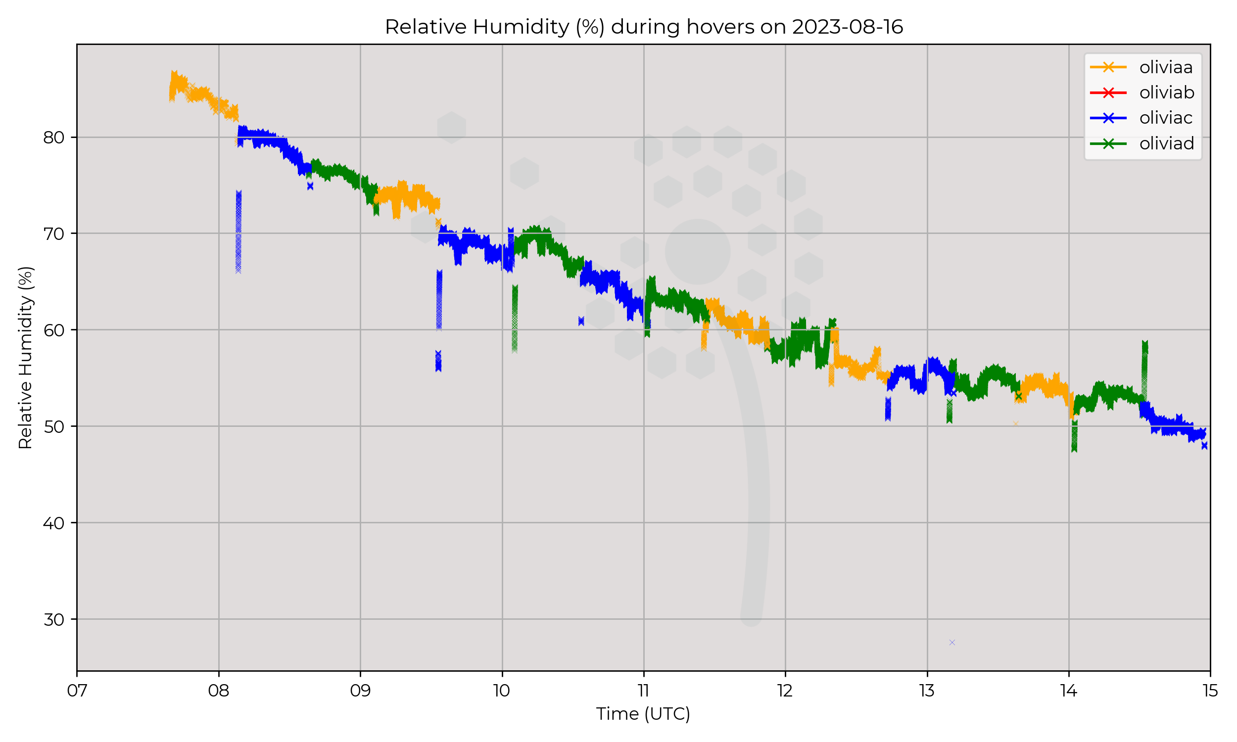
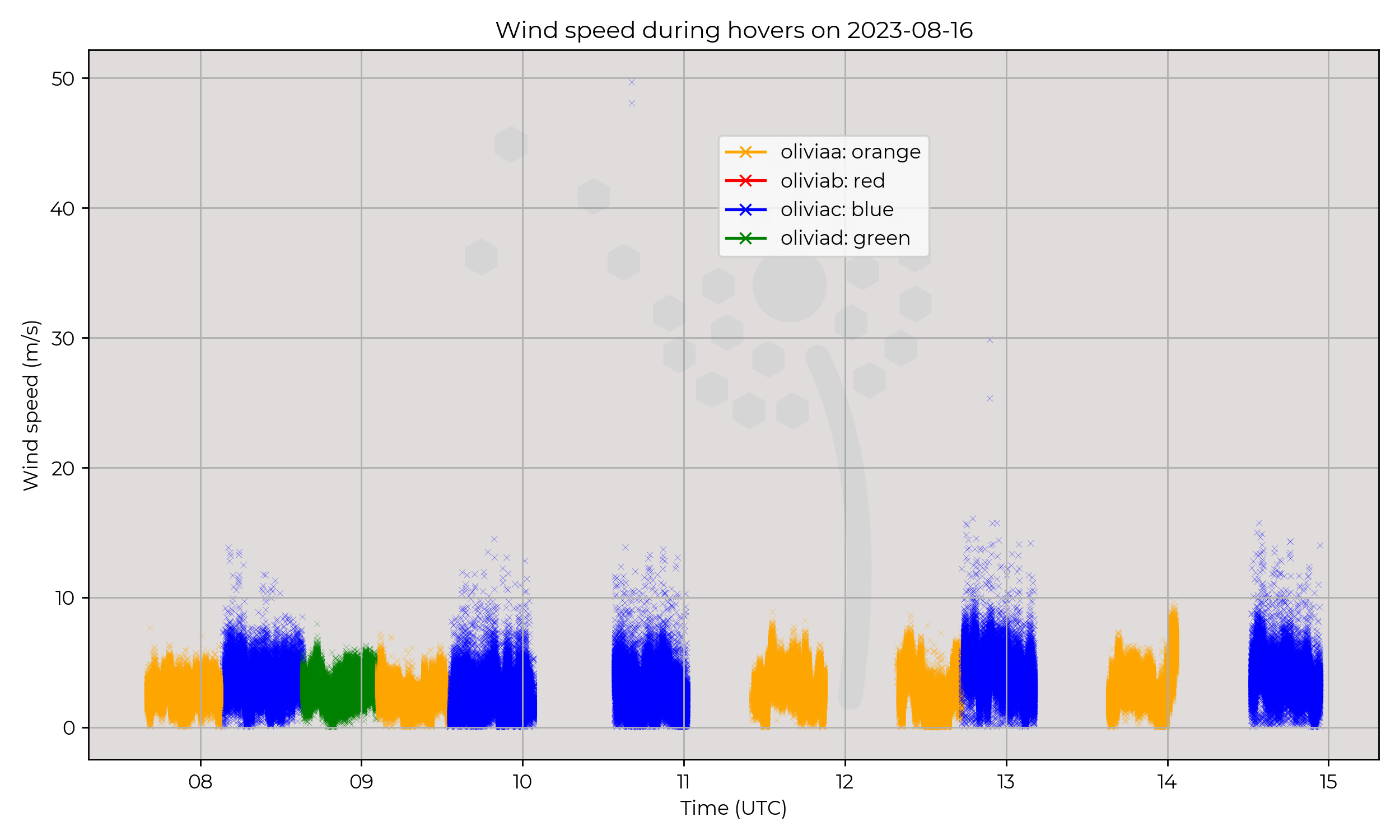
Constant presence at 120 m AGL from 0740 UTC to 1500 UTC.
Observations
Winds around 4 m s-1 for the day, temperature and humidity changing gradually.
Known Issues
- The blue anemometer was noted to have higher noise levels in the raw 40 Hz data. Time averaged values apprear to be in-line with the other flights.
- Green wind sensor was not recording for some flights.
2023-08-15
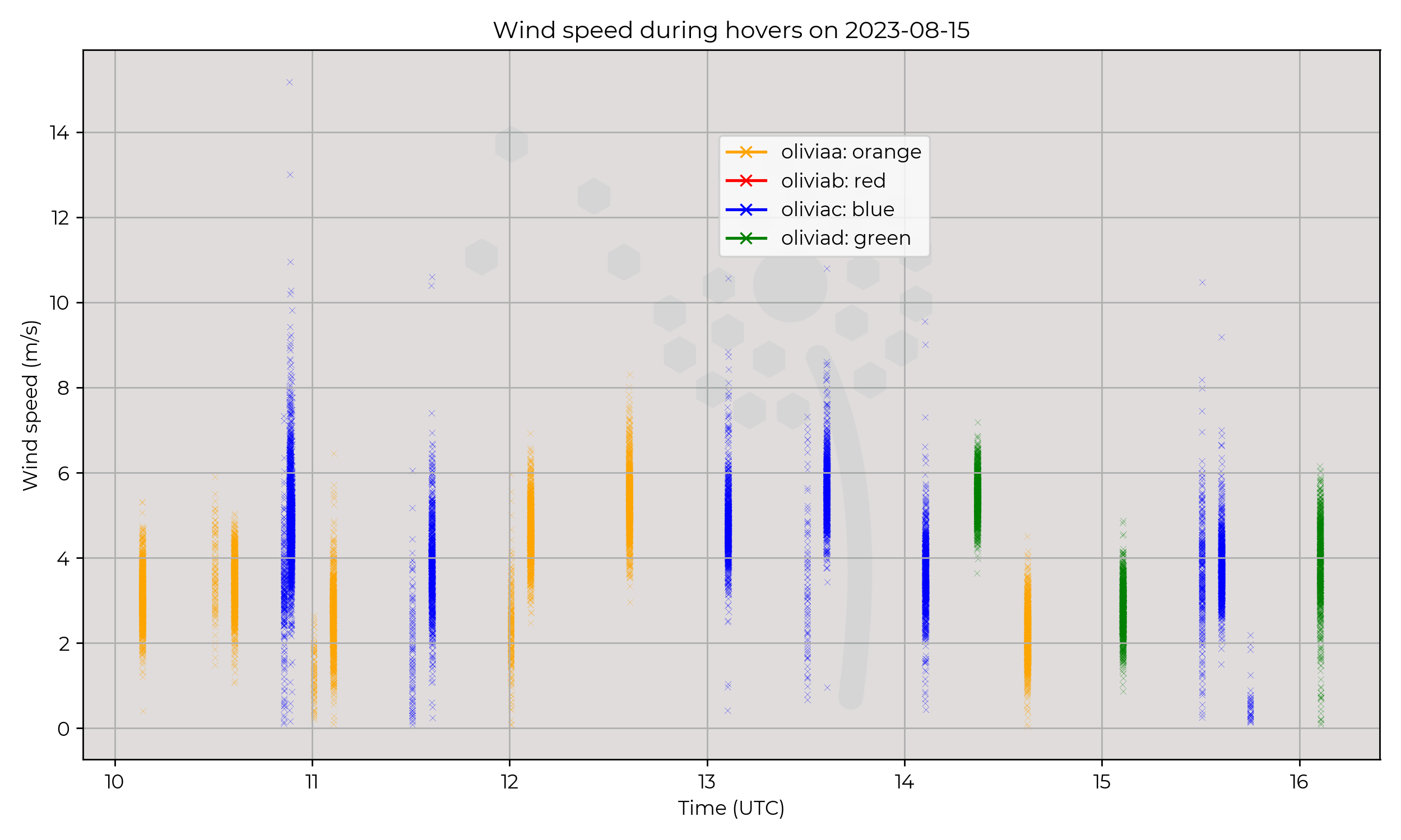
Synoptic Overview
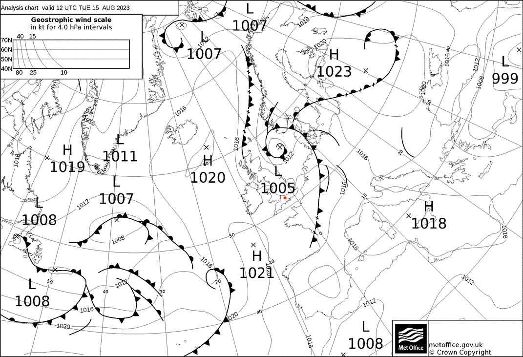
A surface pressure minima moved NE away from the region in the early hours, leaving cold sector maritime airmass and gradually rising pressure. A tongue of higher surface pressure progressed north from the Bay of Biscay.
Flight Patterns
Ground to 2 km AGL profiles at 6 m s-1 ascent speed, every 30 minutes. All performed by Olivia-A (orange).
Observations
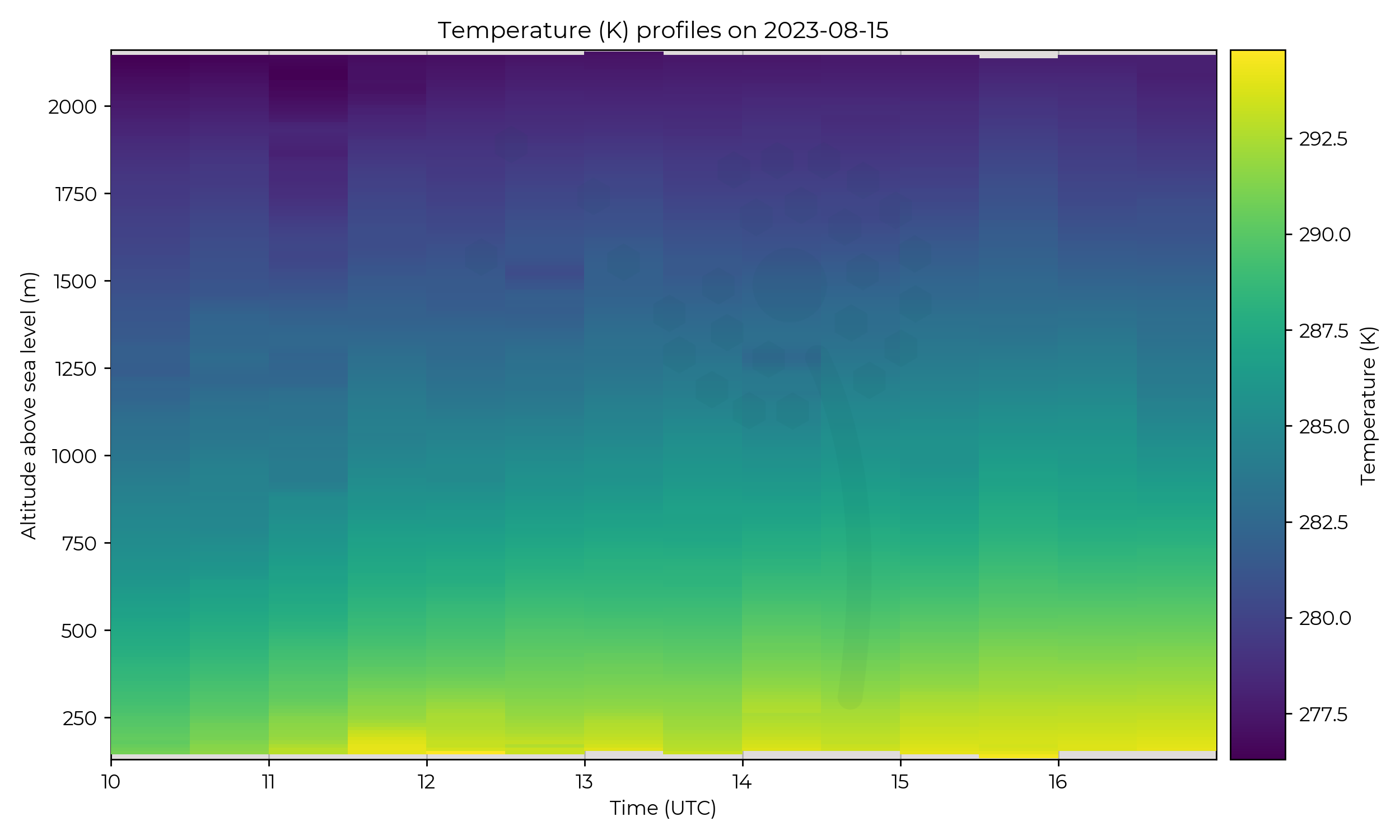
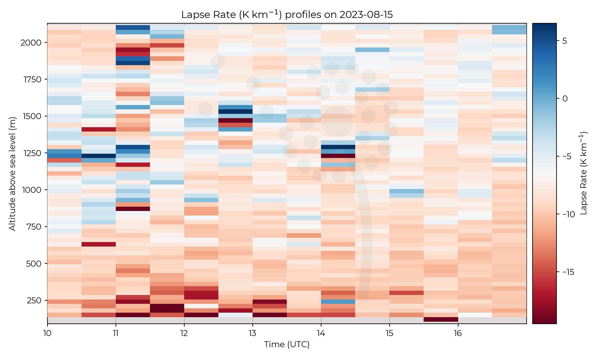
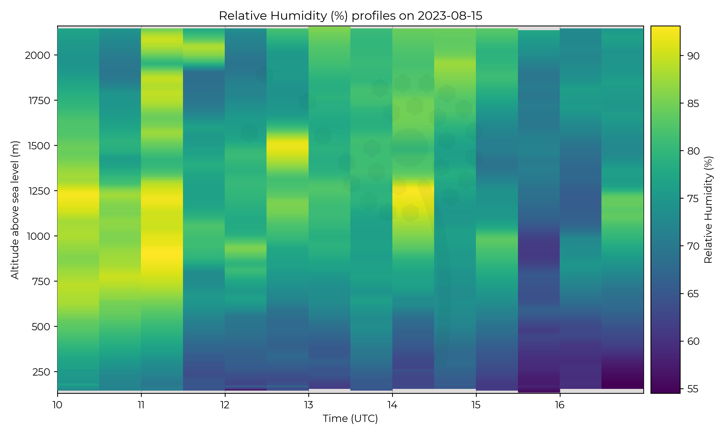
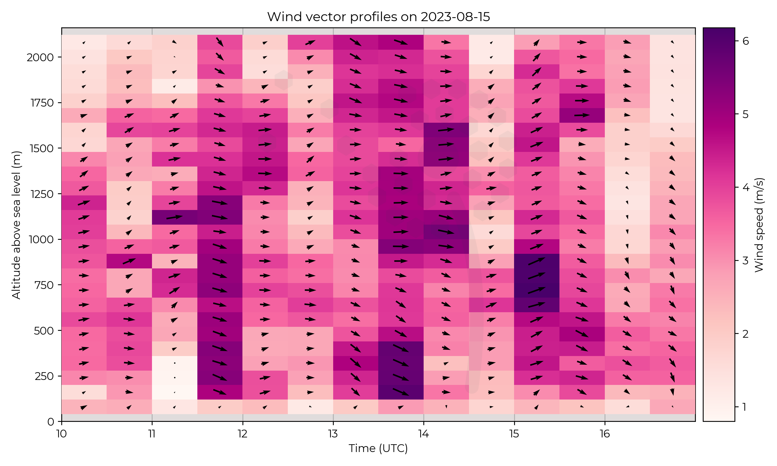
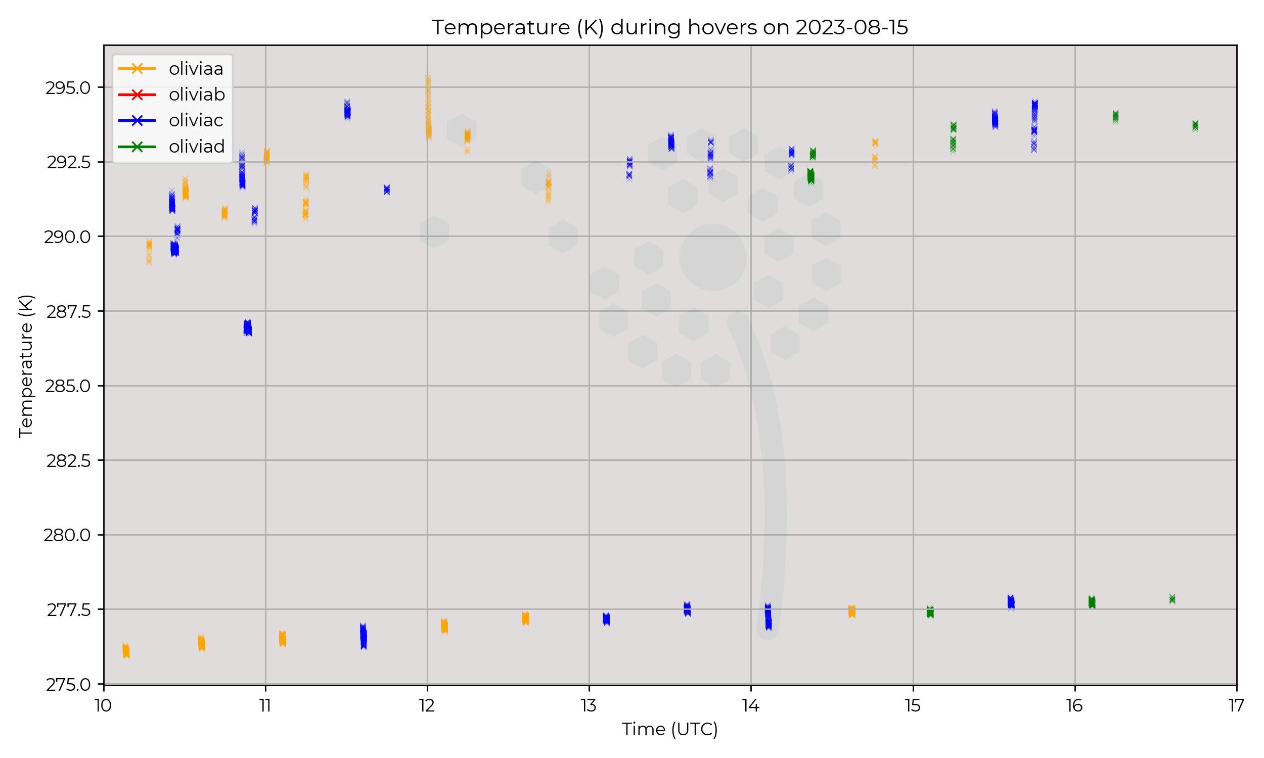
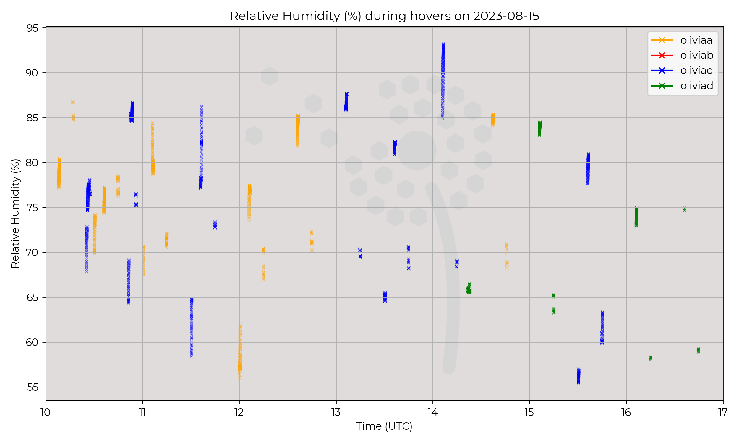
Convective boundary layer with high turbulence and sporadic cumuli at different heights.
Known Issues
None yet reported.
2023-08-14
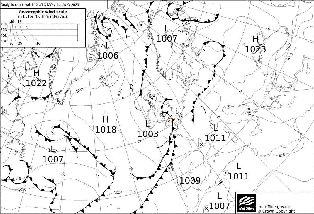
Synoptic Overview
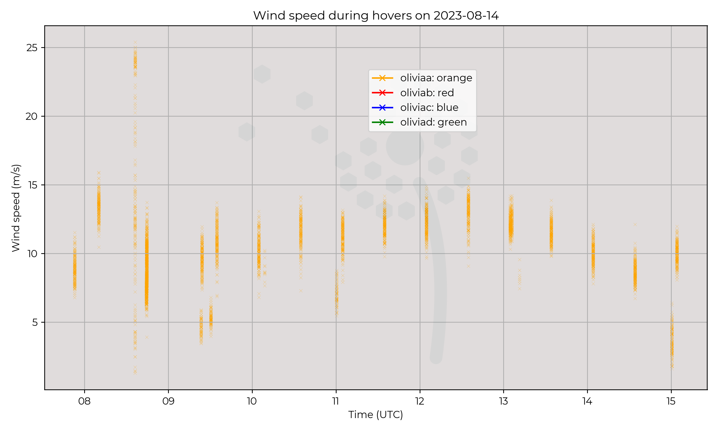
A shallow surface pressure minima of 1003 hPa brought a cold front across the region.
Flight Patterns
Ground to 2 km AGL profiles at 6 m s-1 ascent speed, every 30 minutes. All performed by Olivia-A (orange).
Observations
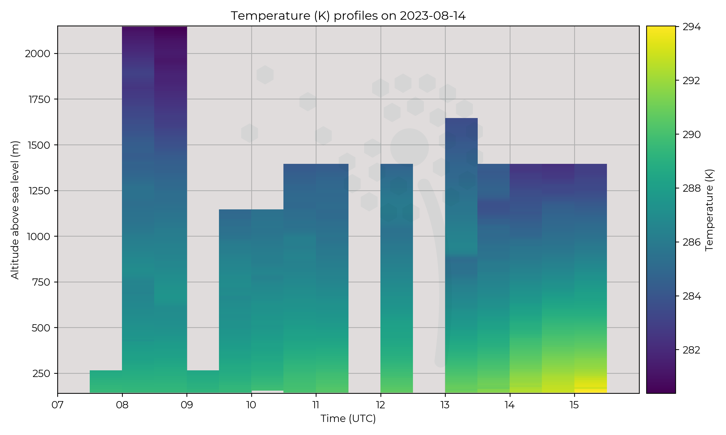
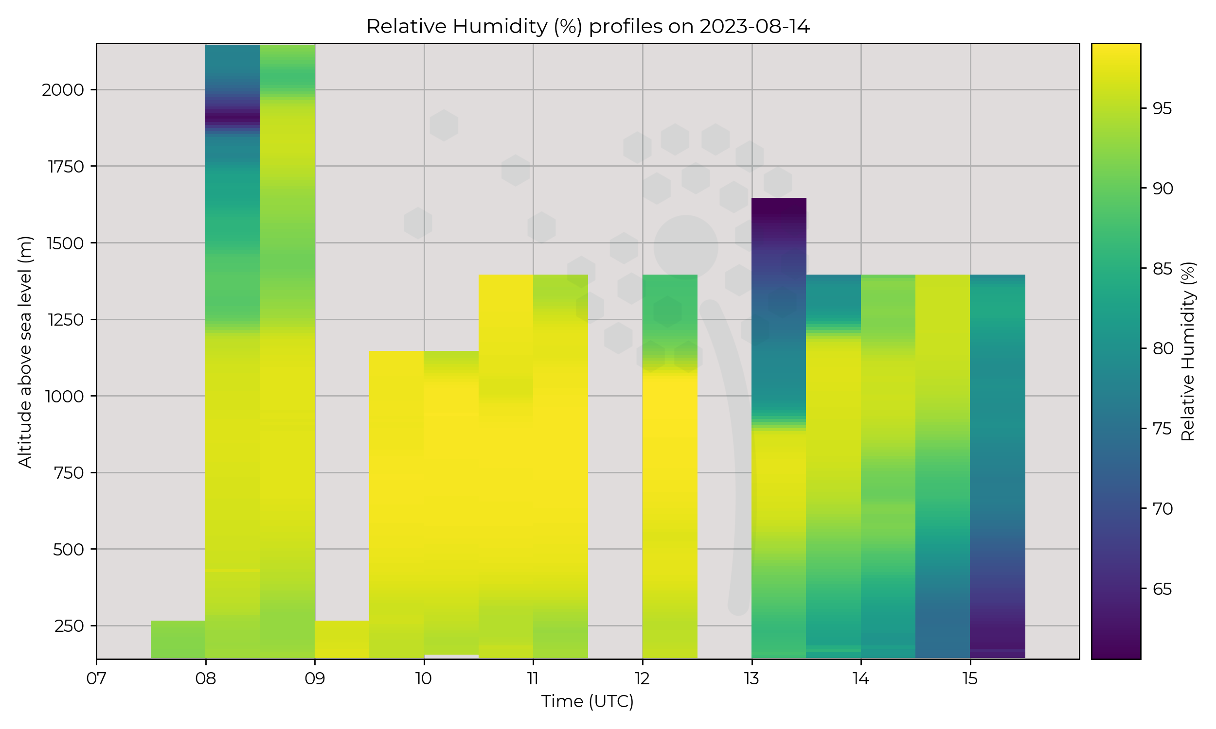
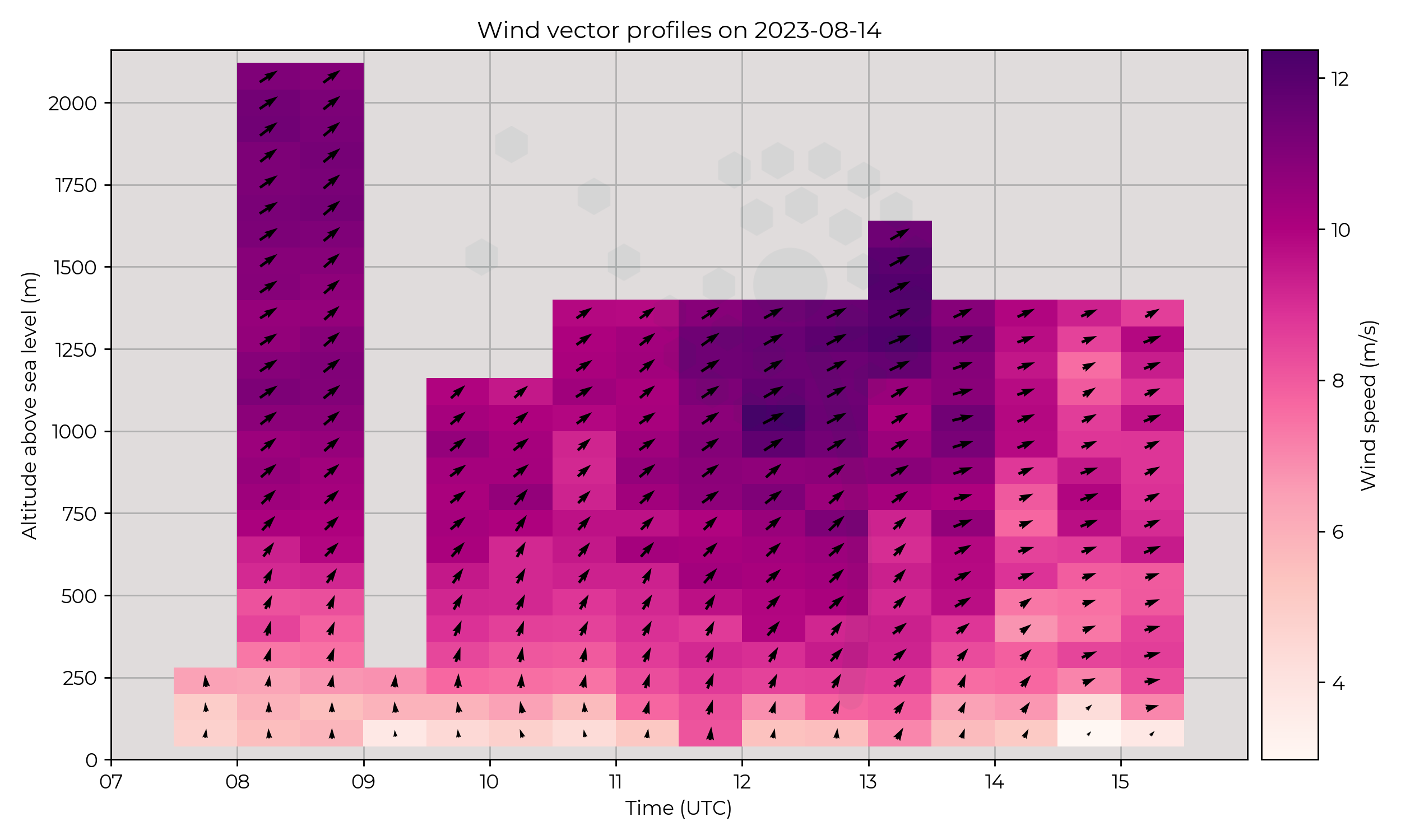
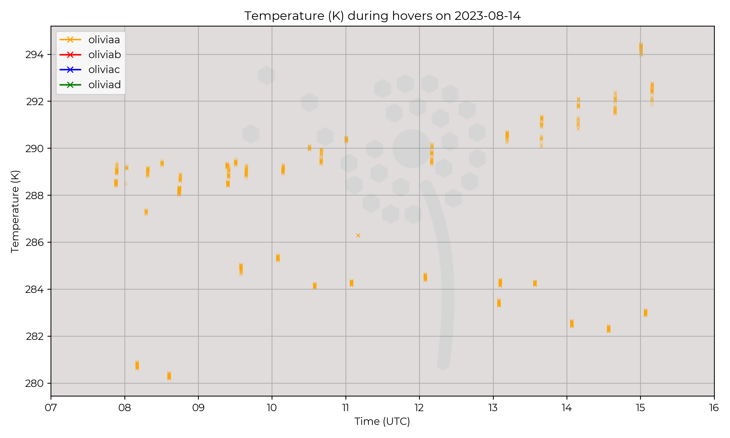
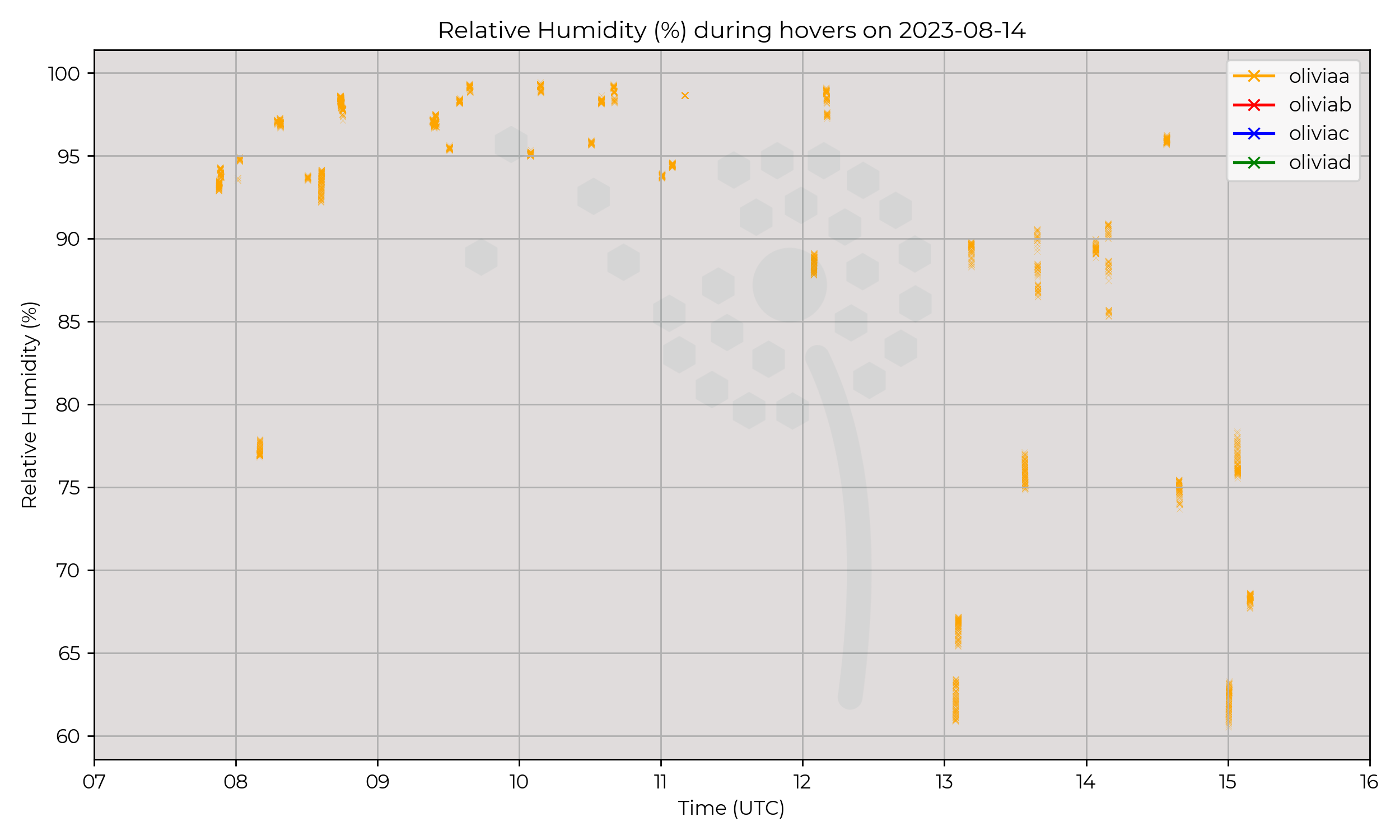
Potentially interesting observations of the passing cold front.
Subtracting the effect of surface heating, the above-surface air temperature drops, starting just above the surface at 1300 UTC and growing in height over time.
This fits with the vertical cross-section of a cold front, arcing steeply "backwards" relative to the flow and thus from a stationary point growing in height.
The relative humidity also decreases aloft after the passage of the front, from warm sector to cold sector.
High RH indicaing cloud is correlated with the temperature decrease along the cold front.
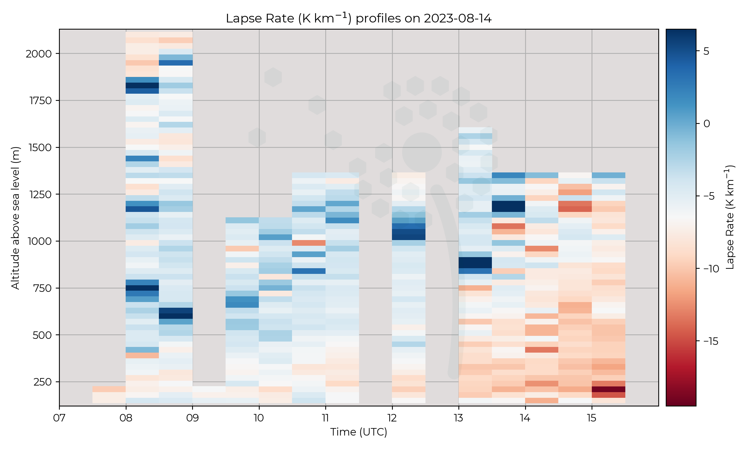
Examining the lapse rate plot, the stability of the air changes from more stable (–4...–6 K km-1) to less stable (≈–10 K km-1) after the passage of the front.
Also of note are the characteristics just before the passage of the cold front.
Known Issues
- On flight 11 (1130 UTC) and flight 13 (1230 UTC), Metsensor_0040 reported erronous values. These flights have been omitted from the plot.
- Metsensor_0020 did not report values for some flights.
Week 8
2023-08-11
2023-08-10
Synoptic Overview
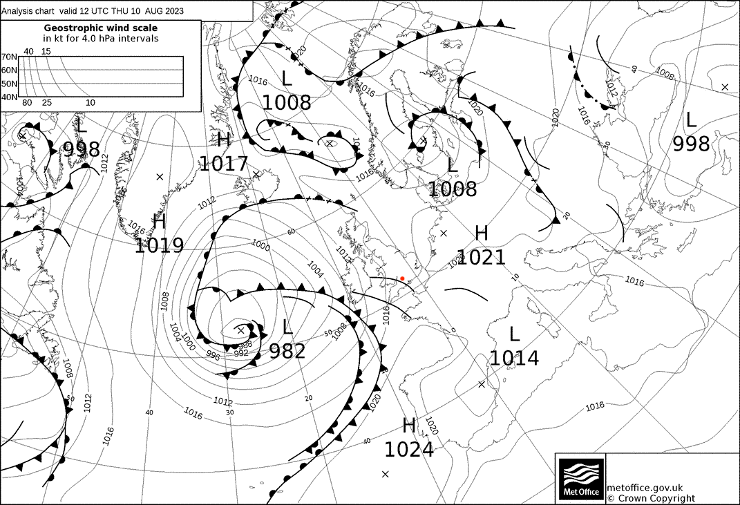
An approaching surface pressure minima brings an approaching cold front, with several troughs ahead of it. Geostrophic winds are generally light and from the SSW.
Flight Patterns
Ground to 2 km AGL profiles at 6 m s-1 ascent speed, every 30 minutes. All performed by Olivia-A (orange).
Observations
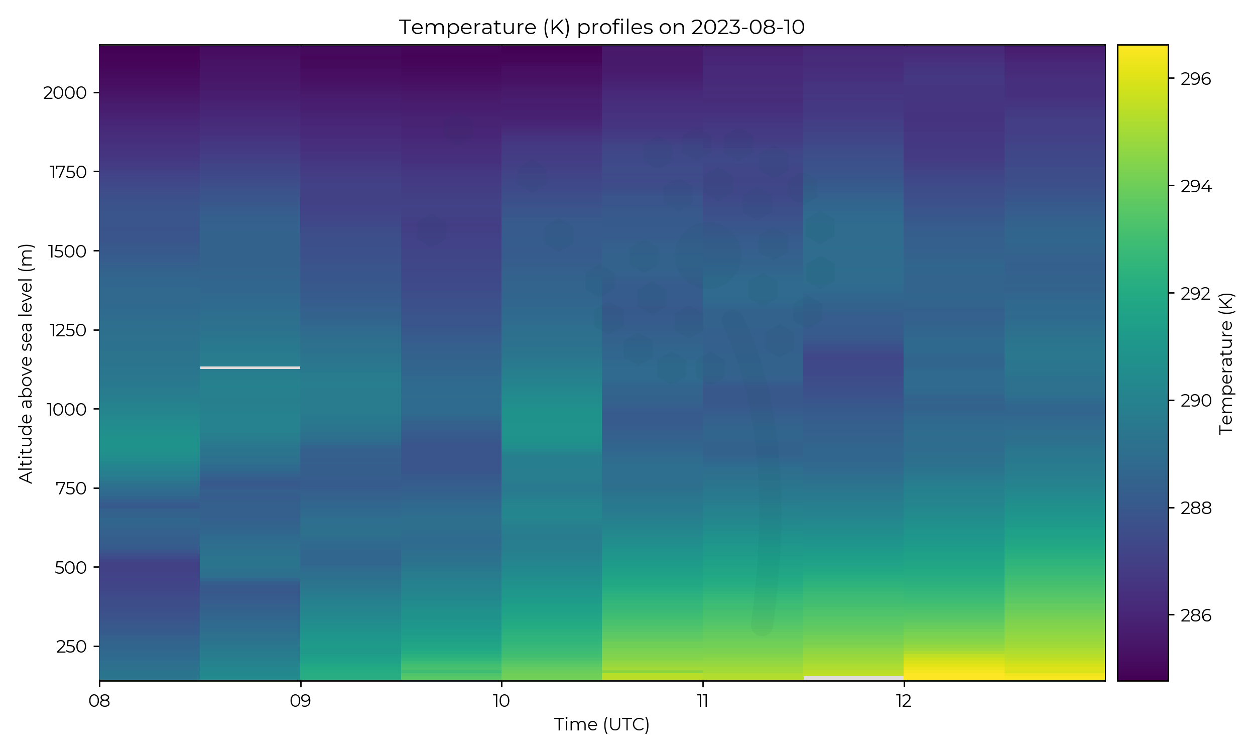
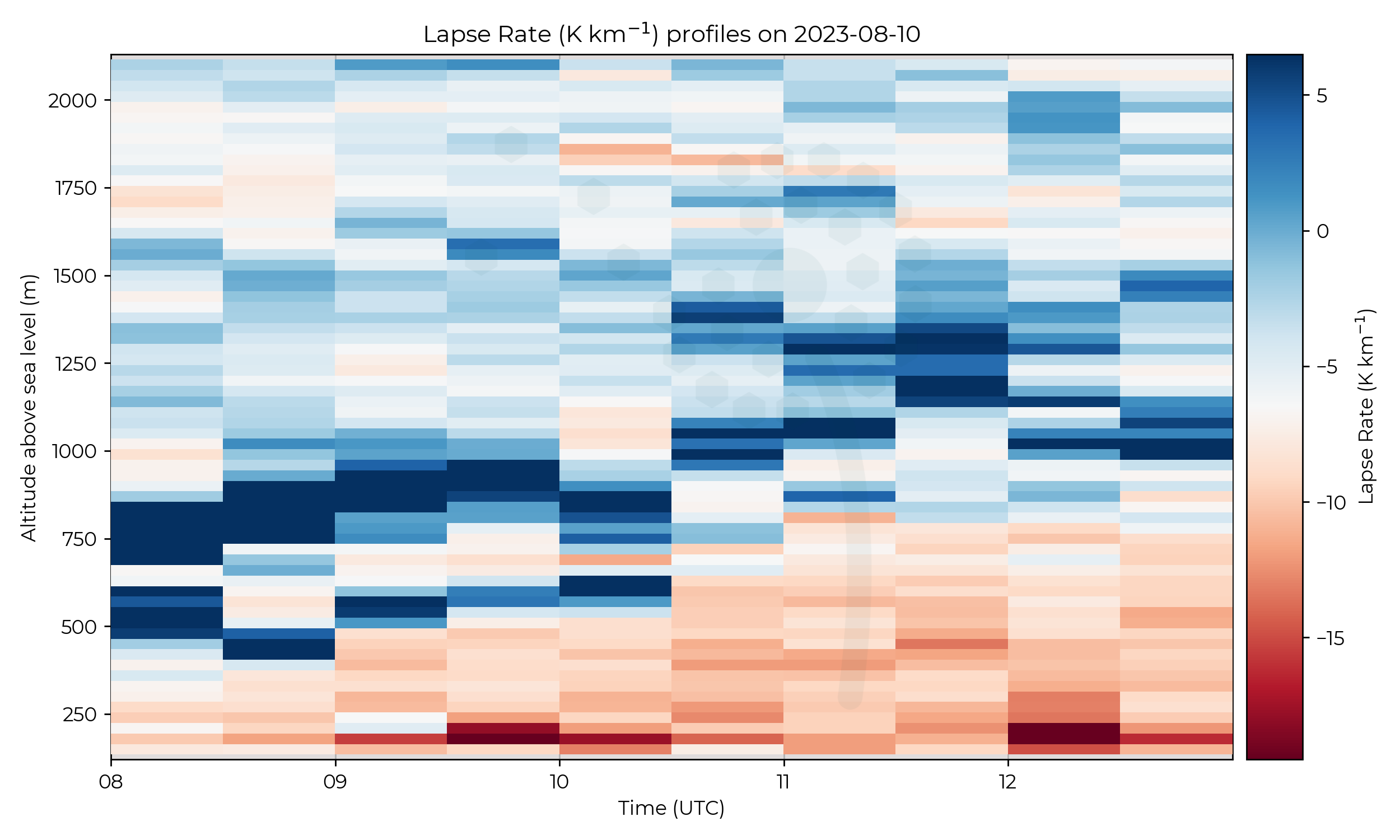
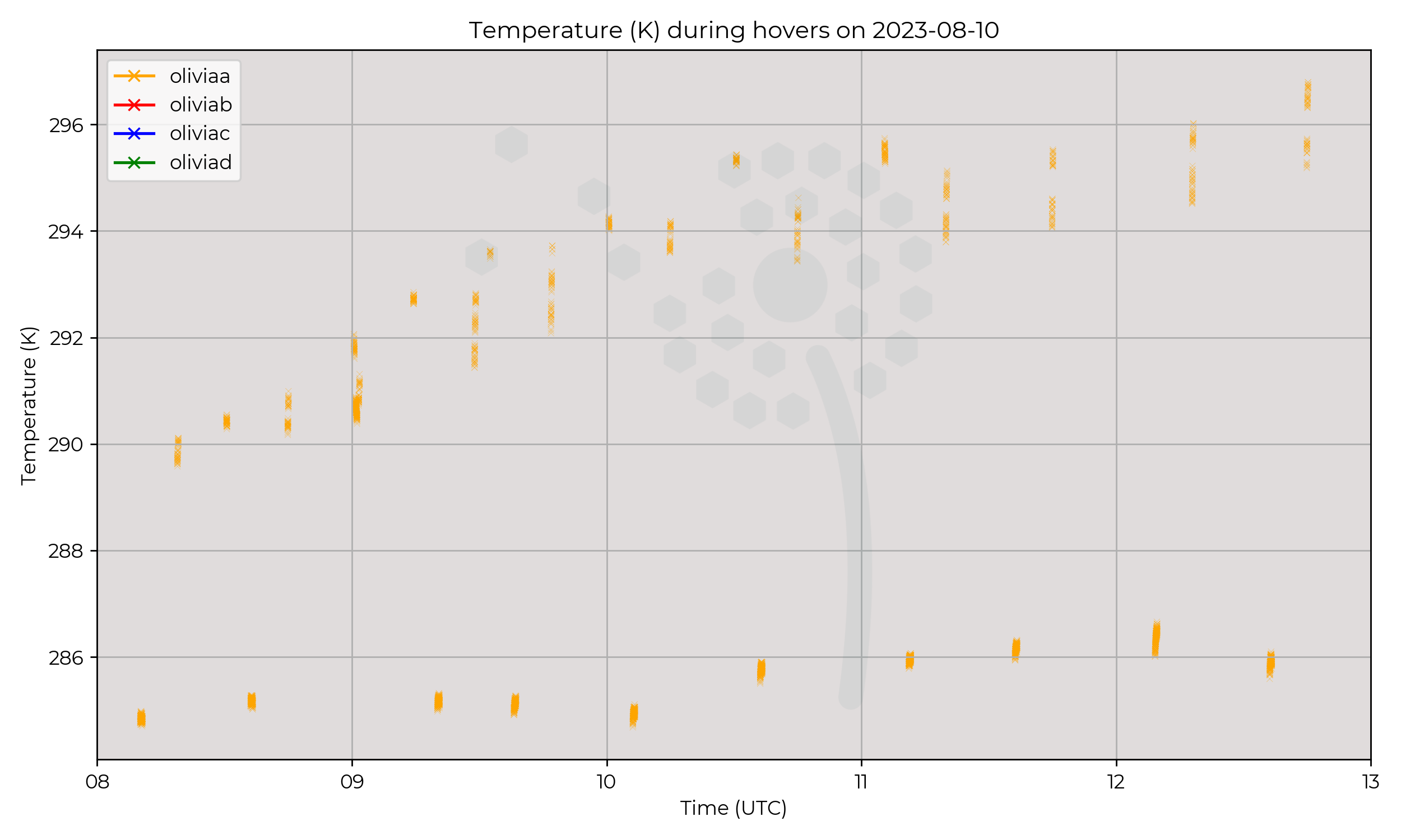
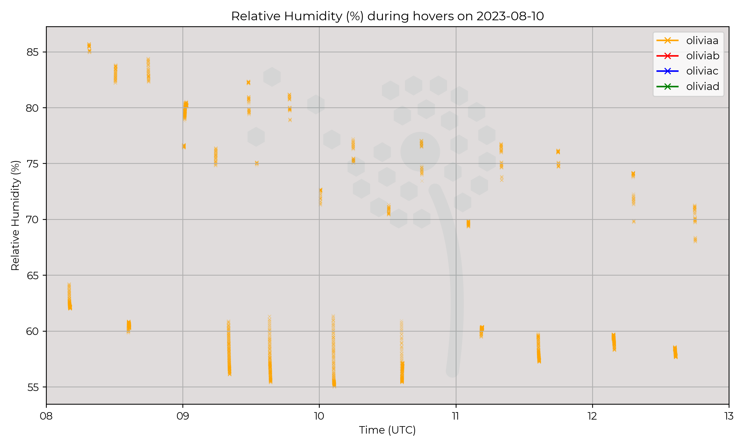
A double inversion existed at first, with stable air below. The surface warmed gradually throughout the day.
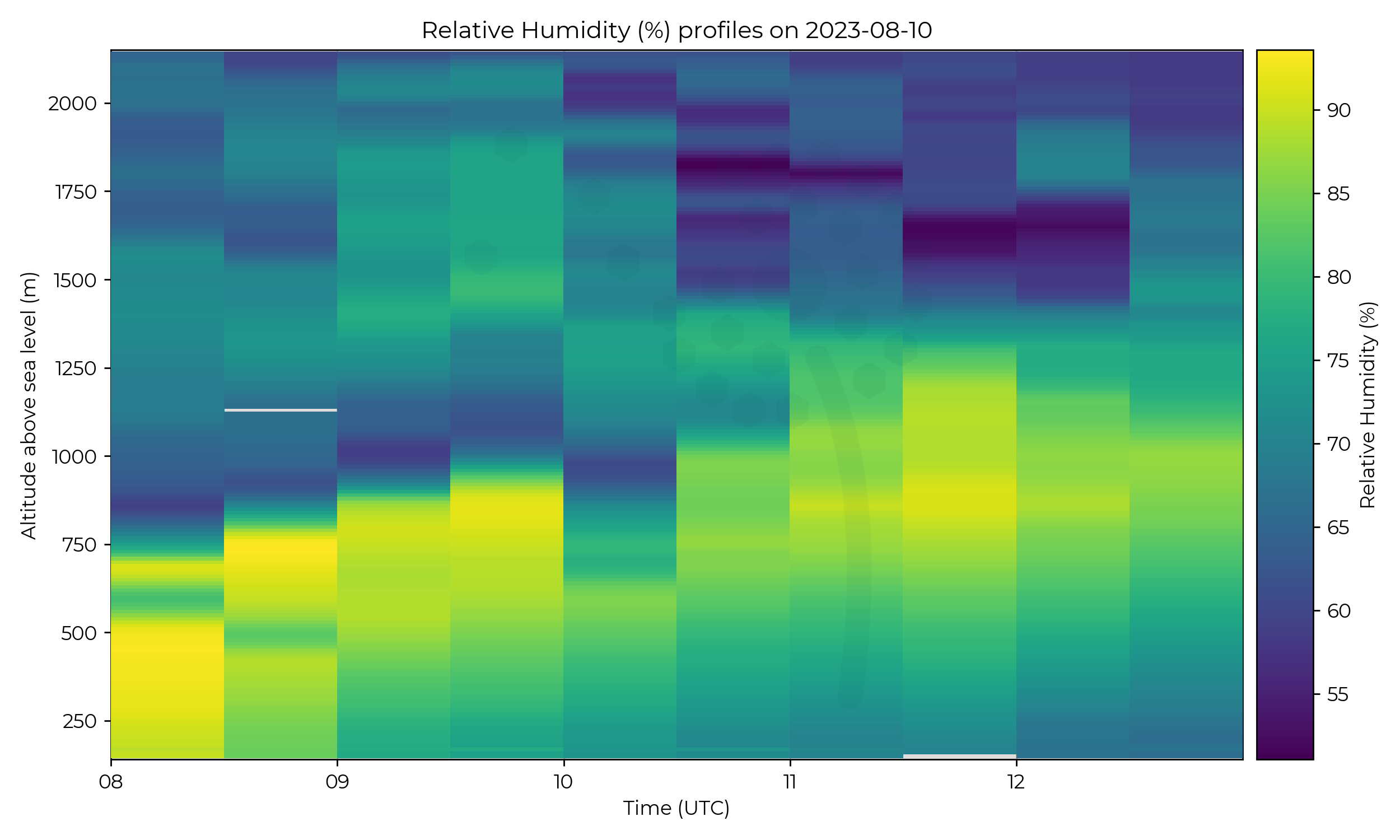
At 10 UTC the height of the inversion dropped by more than 100 metres, which may associated with the trough marked on the synoptic chart.
After this time, the atmosphere above the inversion became much drier.
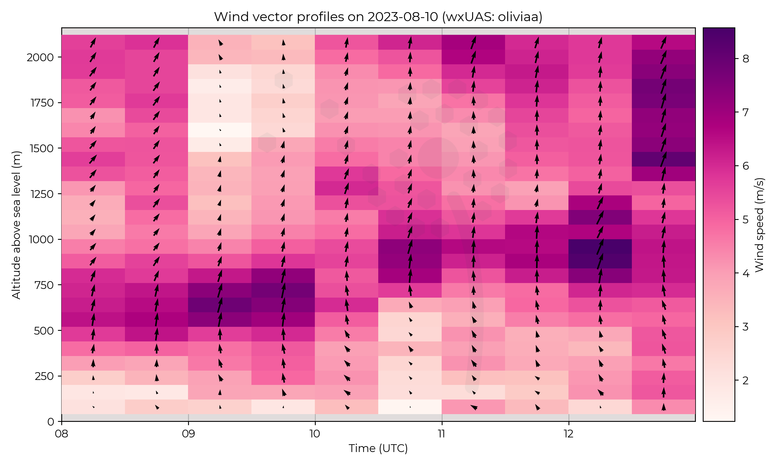
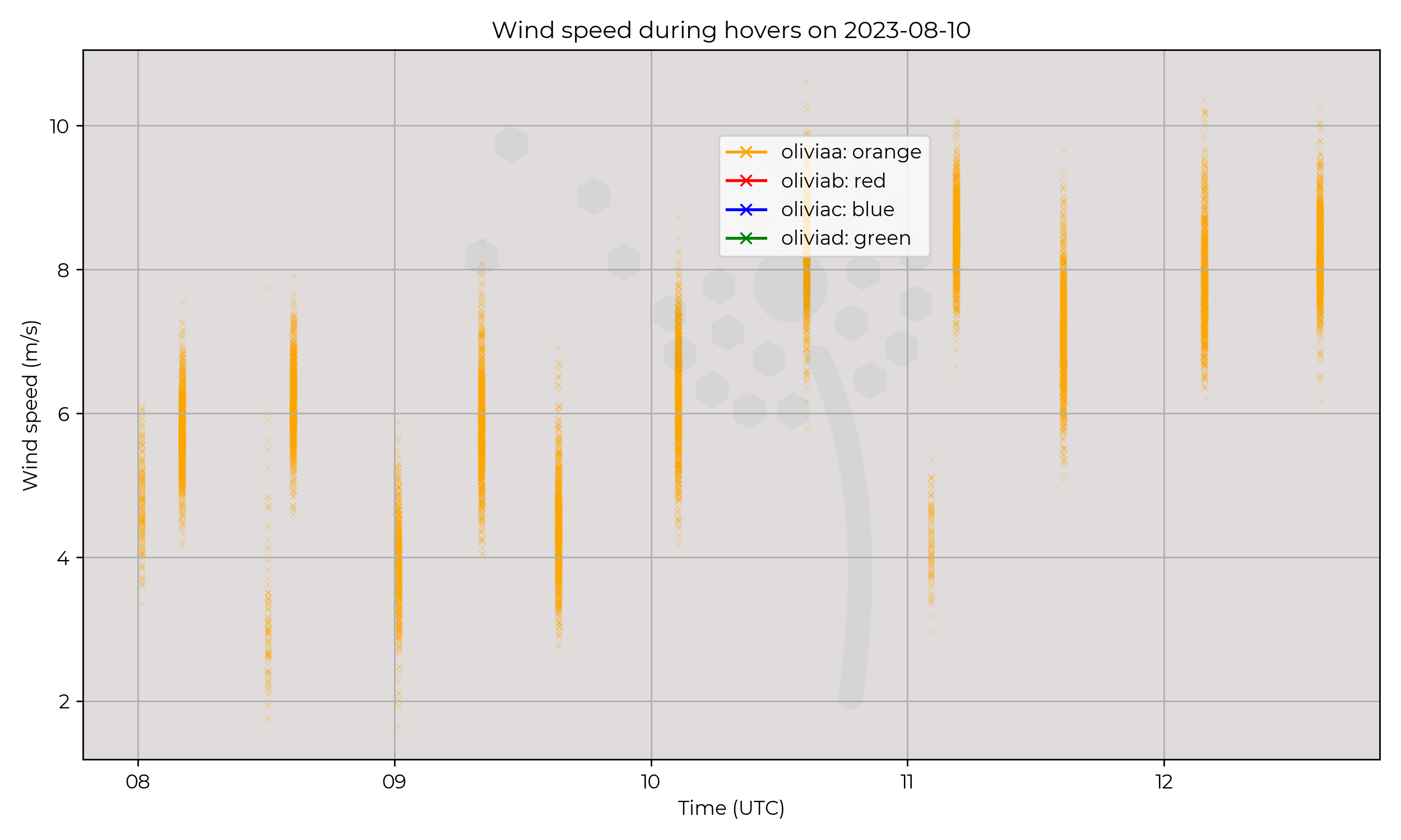
Winds were veering with increasing height for the entire IOP, except in the 0900 and 0930 profiles which had decreased and backing winds associated with a high RH region.
Known Issues
- Flight number 2 (0830 UTC) has a small gap in the data recording at an altitude around 1,150 metres AMSL.
2023-08-09
Synoptic Overview
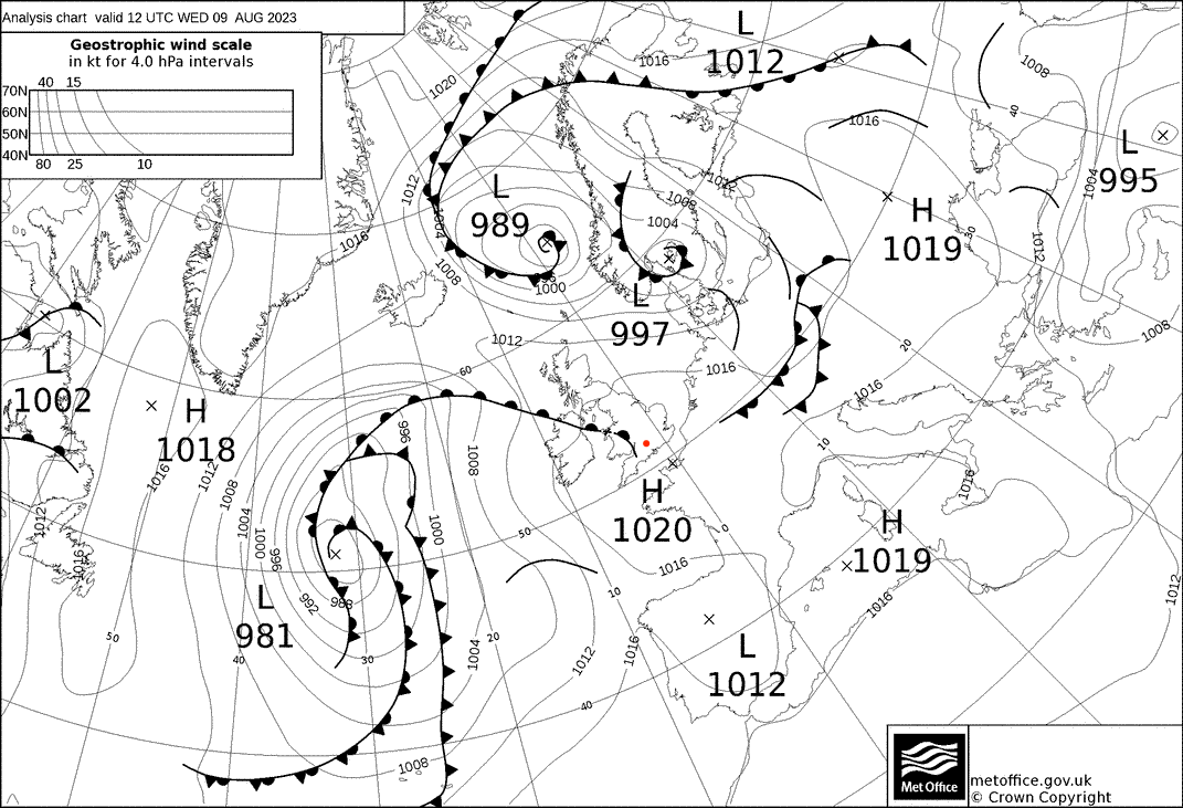
Whilst the predominent synoptic effect was a surface pressure maxima almost directly over the region,
an approaching tail end of a surface warm front undergoing frontoloysis passed over the region
shown in the 12 UTC synoptic chart. Surface pressure isobars suggest very weak surface flow.
Flight Patterns
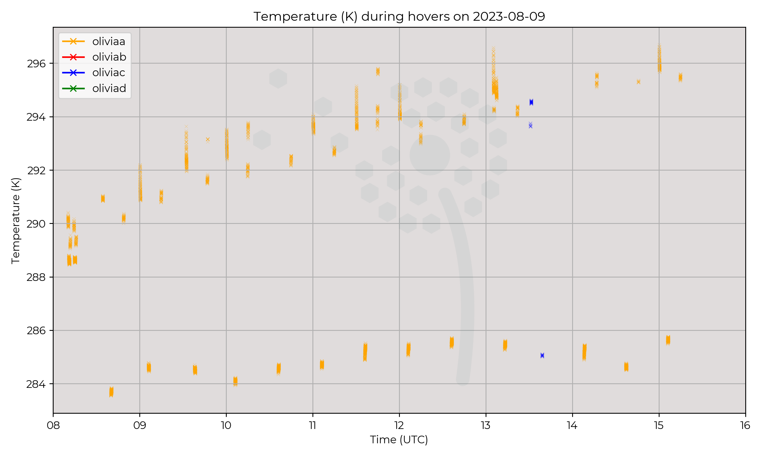
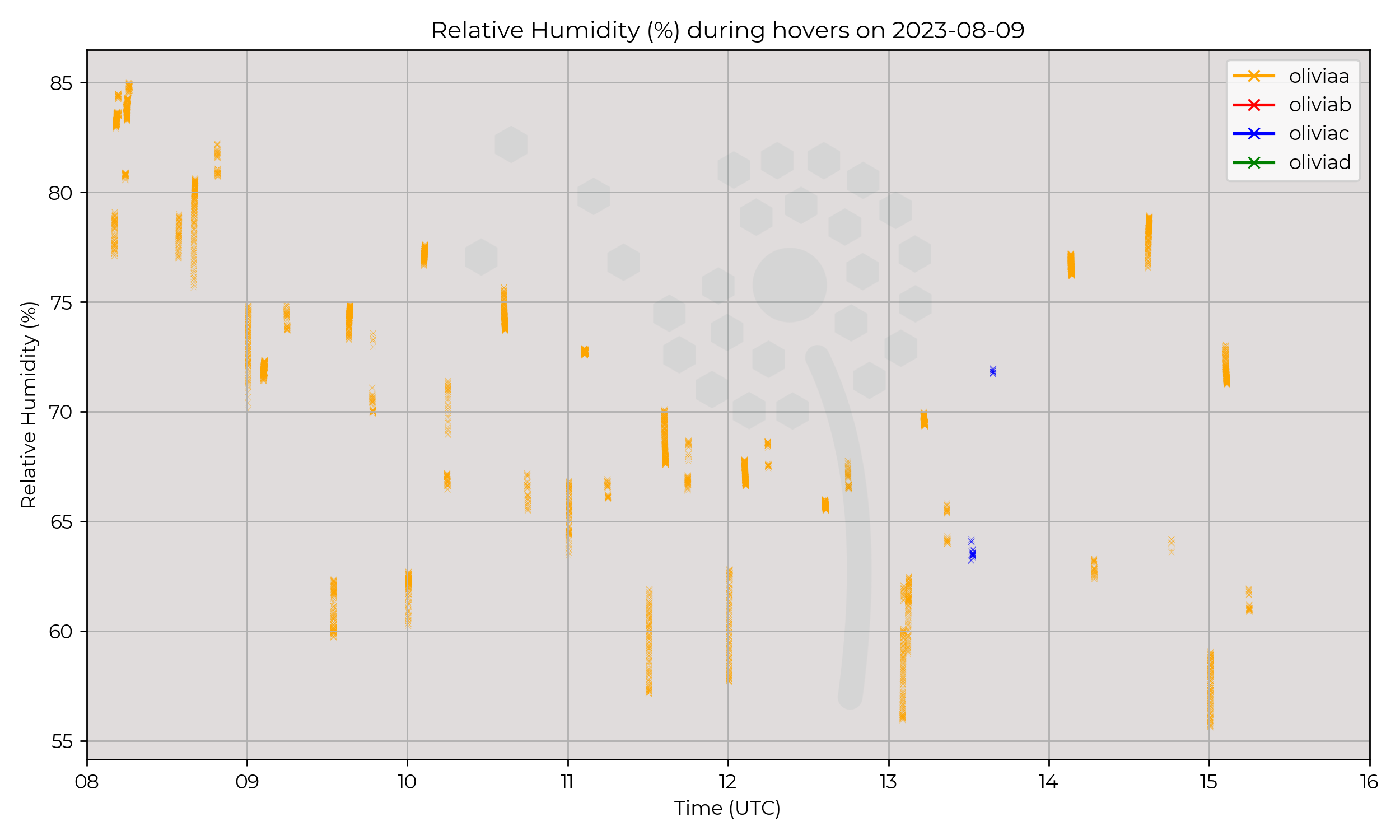
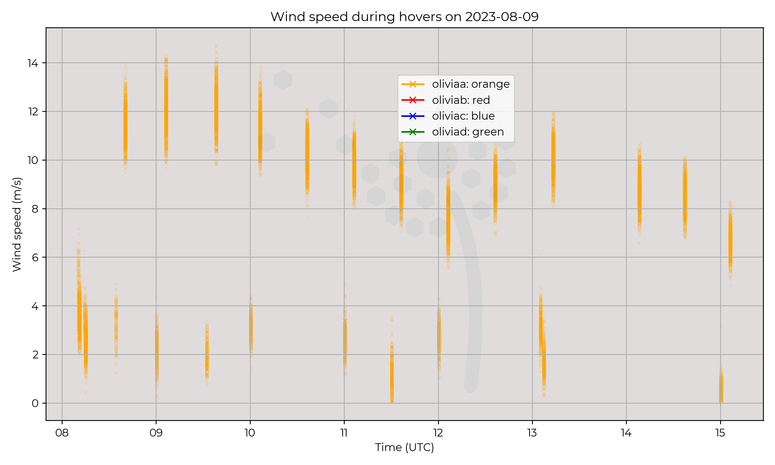
Ground to 2 km AGL profiles at 6 m s-1 ascent speed, every 30 minutes. Mostly performed by Olivia-A (orange), one flight at 1330 UTC performed by Olivia-C (blue).
Observations
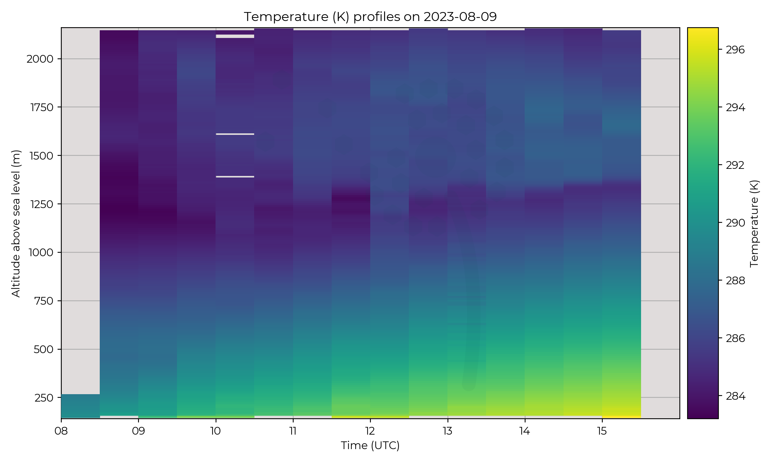
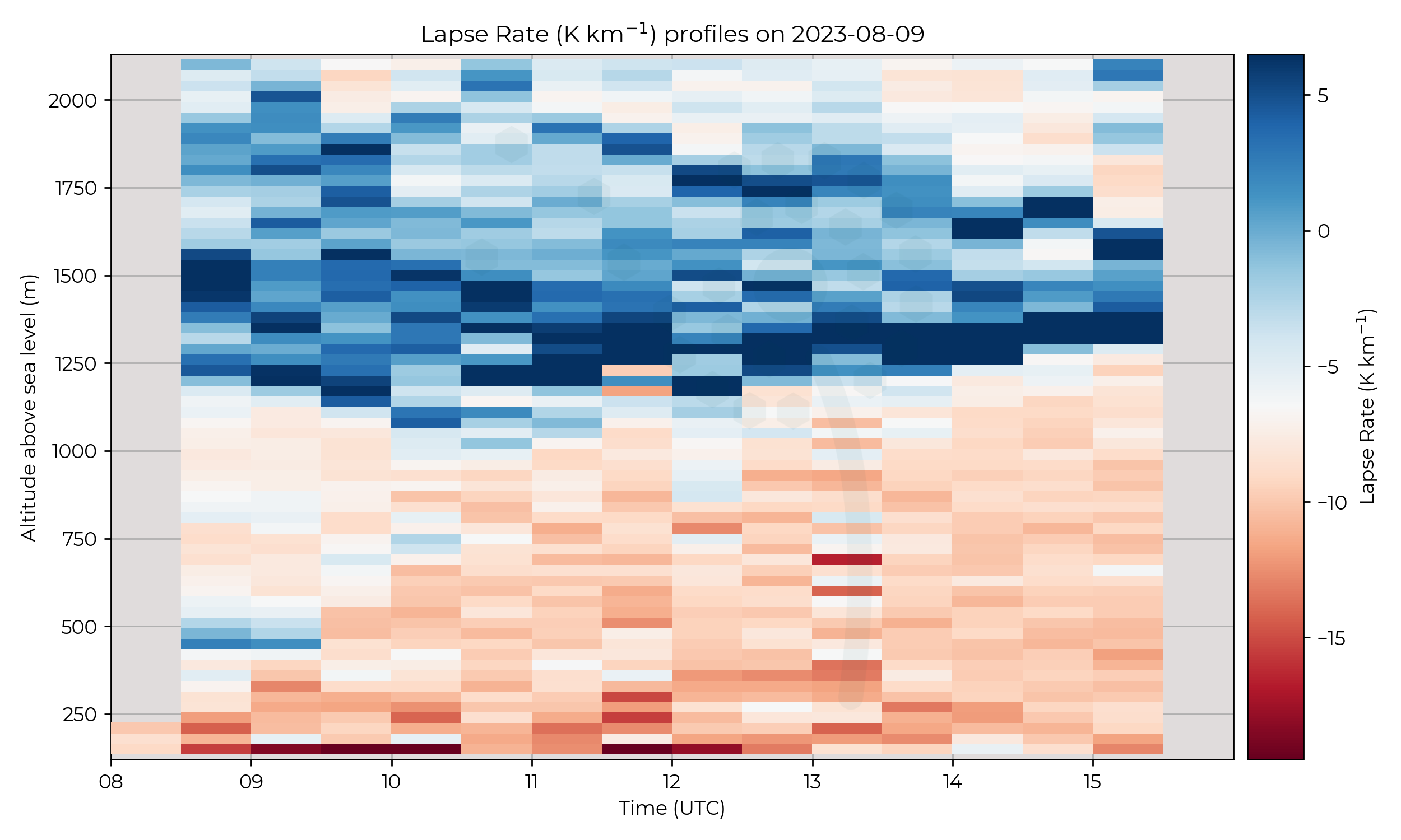
A small inversion in the first few profiles at 500 m AMSL dissipated at 0930 UTC.
A descending inversion at the top of the PBL began to ascend gradually at 1030 UTC.
The behaviour at the start of the IOP may be a capping inversion of a nocturnal boundary
layer being replaced by an entrainment zone in a mixed, convective boundary layer.
There is a slight signal of the lower altitude inversion ascending to the height of the higher inversion between 0930 and 1100 UTC.
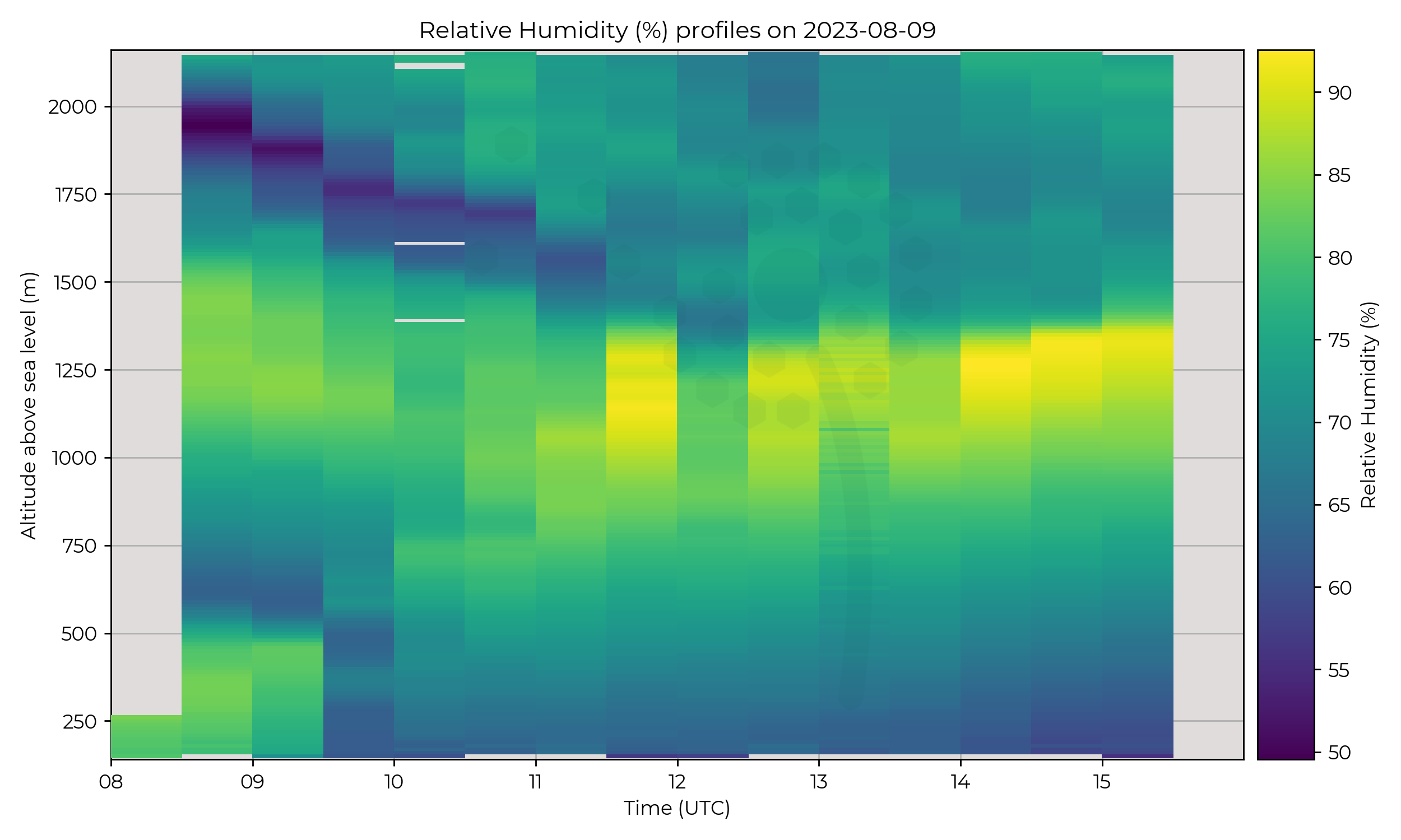
The RH plots have a few interesting features. A notably dry layer of around 50% RH descends from 2 km to 1.5 km in the first 6 profiles of the day,
at which point the PBL inversion at 1.25 km increases in RH to near-saturation, indicating cloud formation.
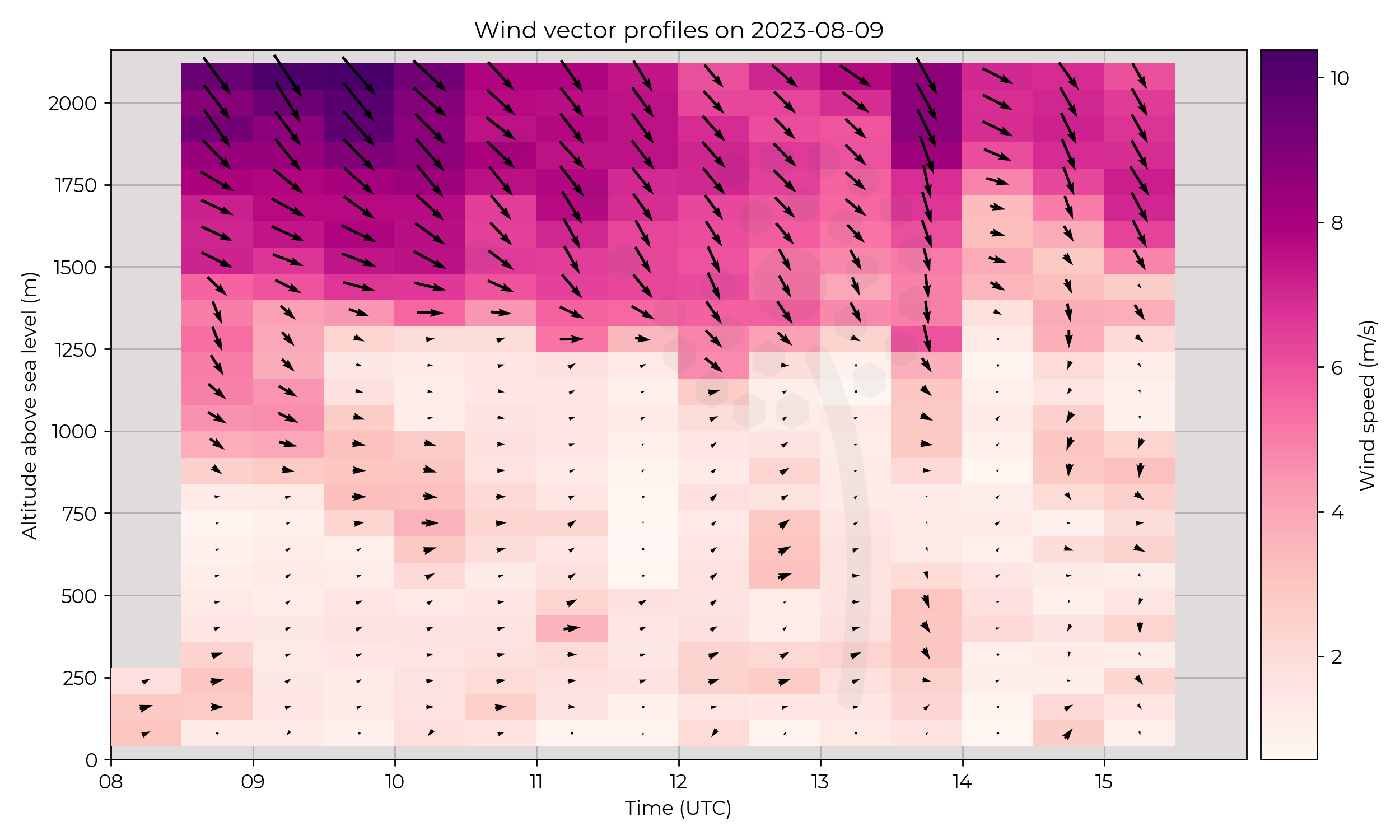
Winds remain very calm in the PBL, and higher aloft. An interesting region of higher winds descends from 1.3 km to 0.7 km, weakening as it does so, between 0830 UTC and 1030 UTC.
Known Issues
- The 1000 UTC flight has a few breaks in the data recording at an altitudes above the PBL inversion.
- The 1300 UTC flight was performed by Olivia-C (blue) which was experiencing an issue with timestamps. Therefore some values were recorded with incorrect timestamps, being amalgamated with genuine data.
- In wind speeds below 1 m s-1, the WindVane v1.0 algorithm used on WOEST (which steers the UAS facing into the wind) struggles to lock onto the wind direction. Wind direction values when speed is below 1.0 m s-1 should be treated with caution/cross-referenced.
2023-08-08
Synoptic Overview
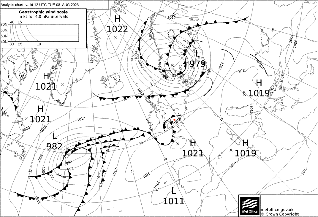
A minor frontal system with a warm, cold and occluded front passed over the region at around midday. High pressure to the south bringing WSW winds.
Flight Patterns
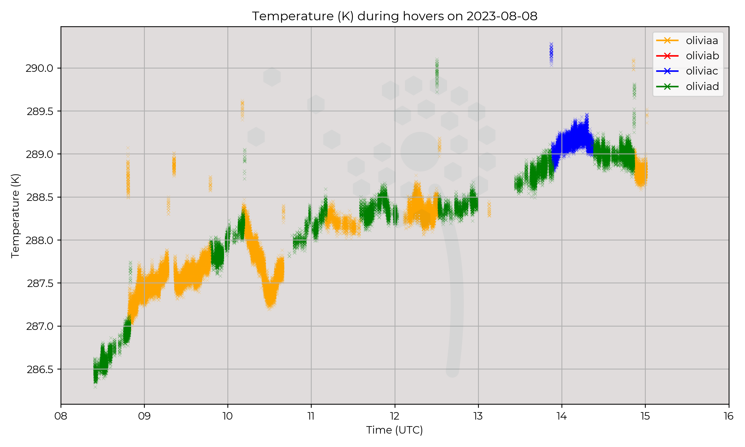
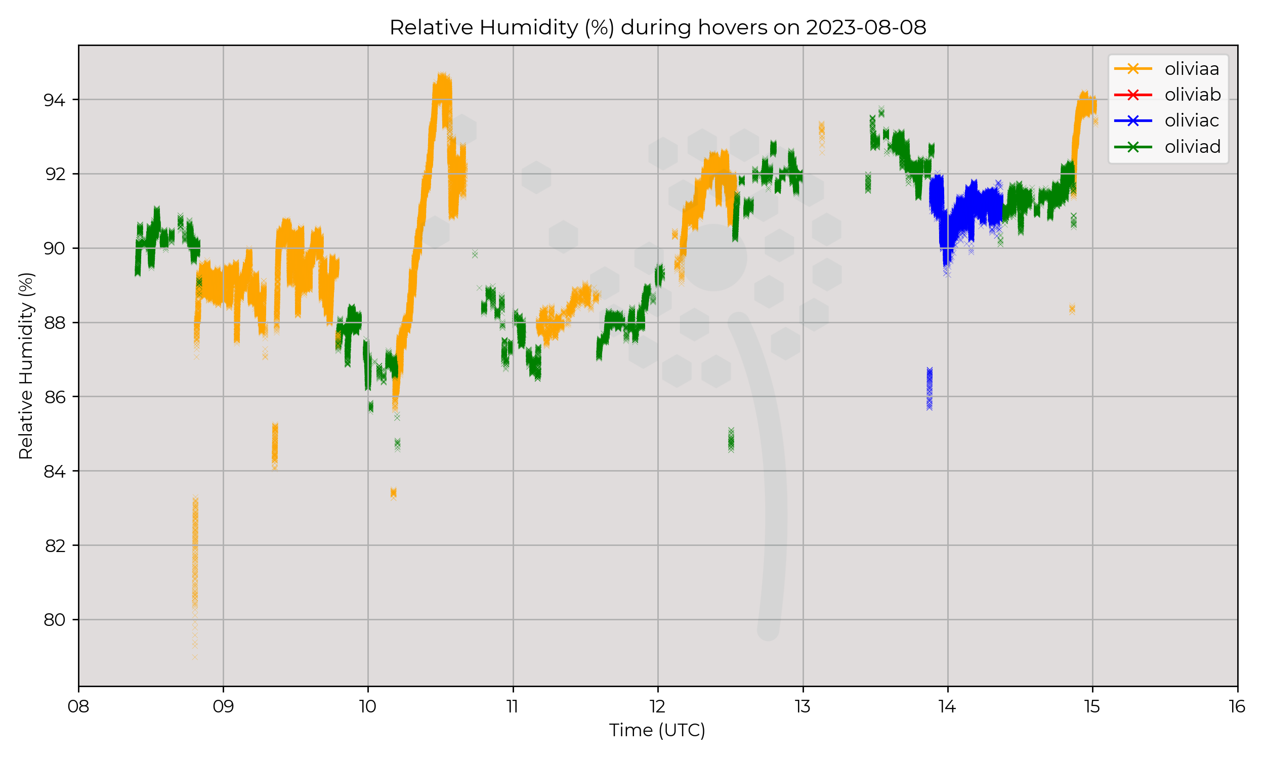
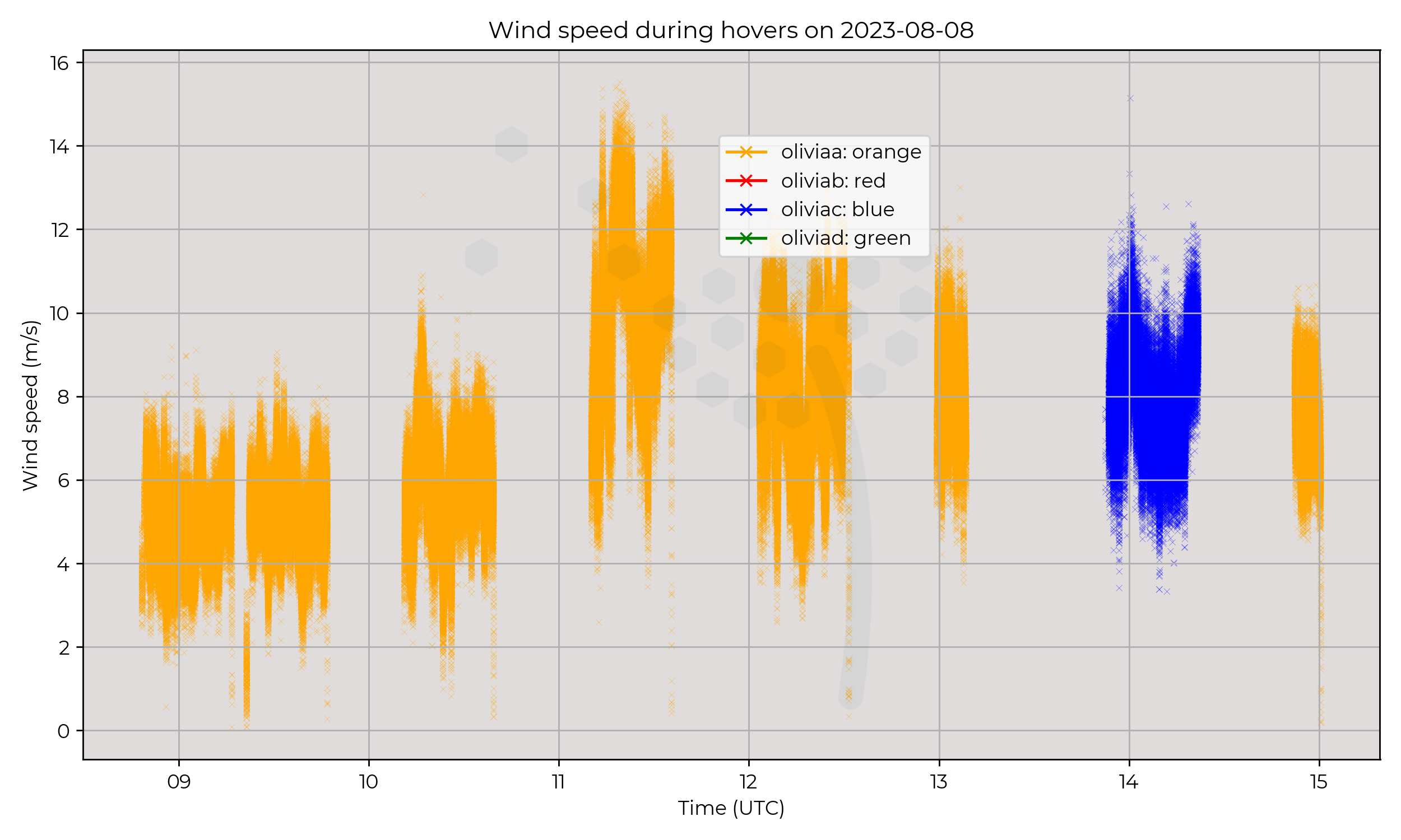
Constant presence at 120 m AGL at Chilbolton Atmospheric Observatory. Performed mostly by Olivia-A (orange) and Olivia-D (green) with one flight at 1351 UTC performed by Olivia-C (blue).
Observations
Temperature steadily increased throughout the day except a 1 ºC temporary drop in temperature at 1030 UTC.
The decrease in temperature is associated with an increase in RH from 87% to 95%, which is indicative of precipitation.
Known Issues
- There were general issues with datalogging on Olivia-D (green) which meant P/T/RH reporting was intermittent on that wxUAS. The profiles for T/RH are missing data so have been omitted here.
- Wind data is was not reported on Olivia-D (green).
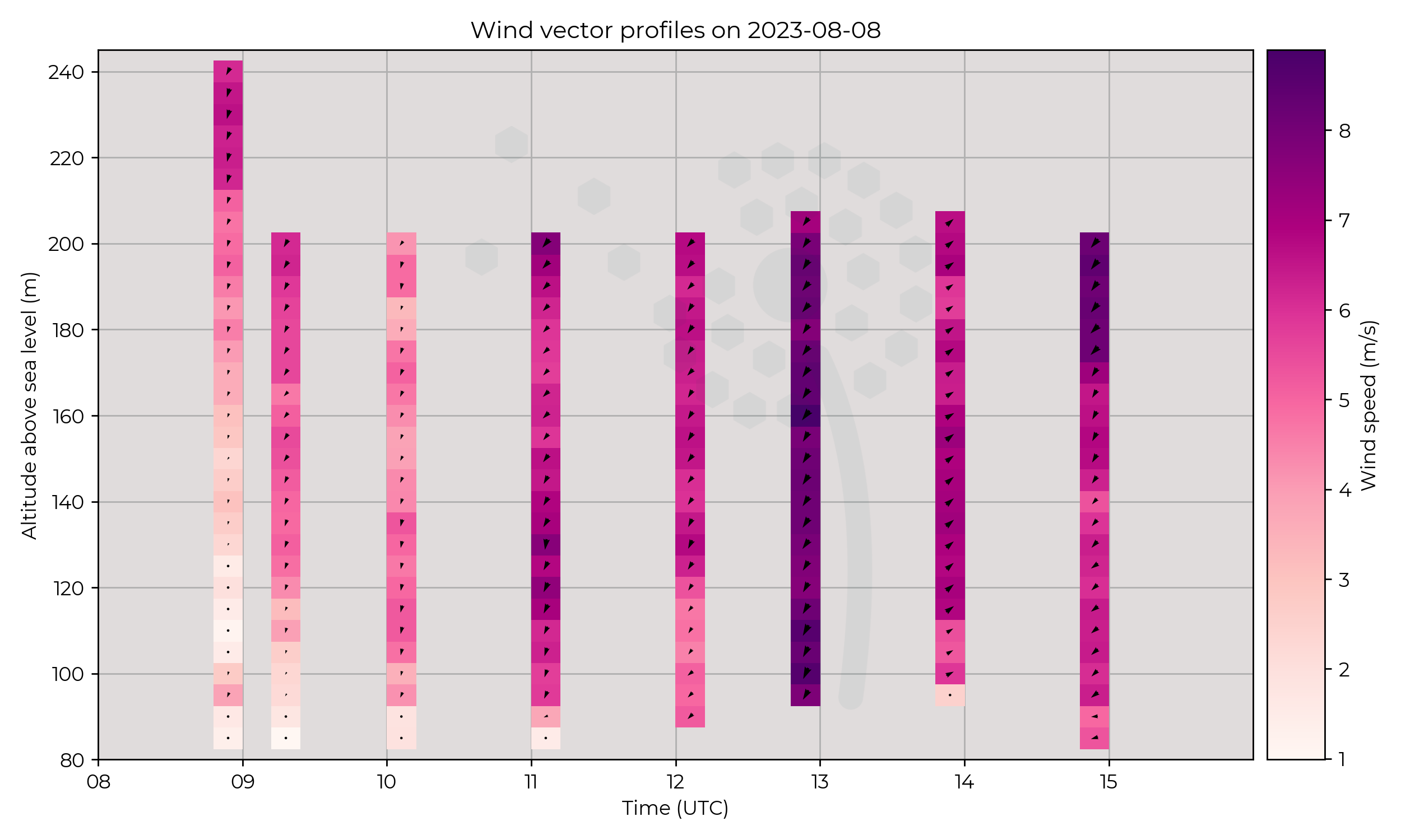
- One flight of Olivia-C (blue) had wind components inverse to those on Olivia-A (orange). The synoptic chart suggests that this anemometer was mounted backwards. Proceed with caution. Wind speed is still usable but direction will be reversed, shown in the wind vector profiles plot.
2023-08-07
Synoptic Overview
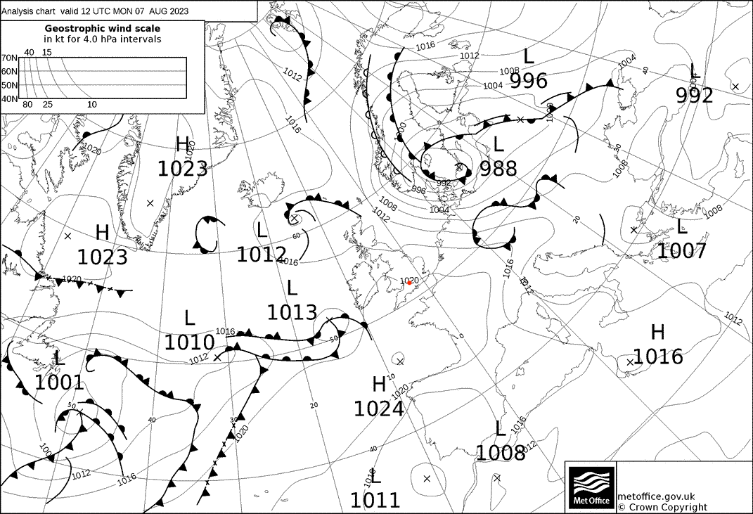
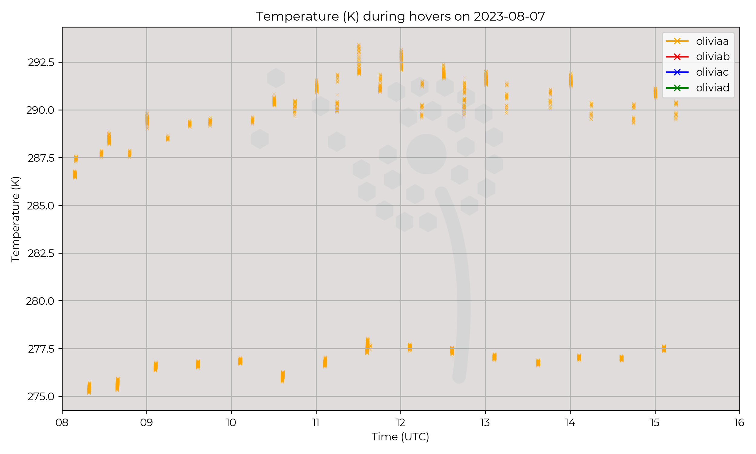
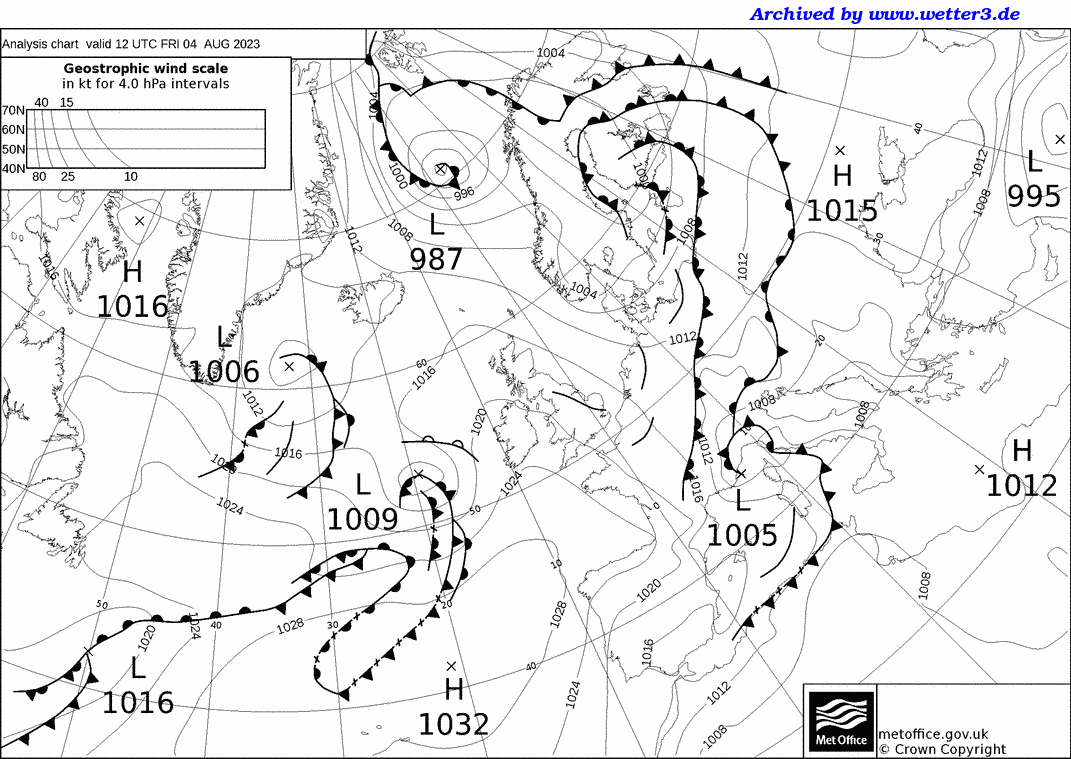
Between surface pressure minima, the approaching surface pressure minima from the west is weak with a minima of 1013 hPa on the 12 UTC synoptic chart.
A gradually increasing pressure gradient occured over the day, with geostrophic winds weak and primarily from the W–NW.
An elevated warm front associated with the incoming surface pressure minima may have influenced the region in the afternoon, and is shown on the 18 UTC synoptic chart.
Flight Patterns
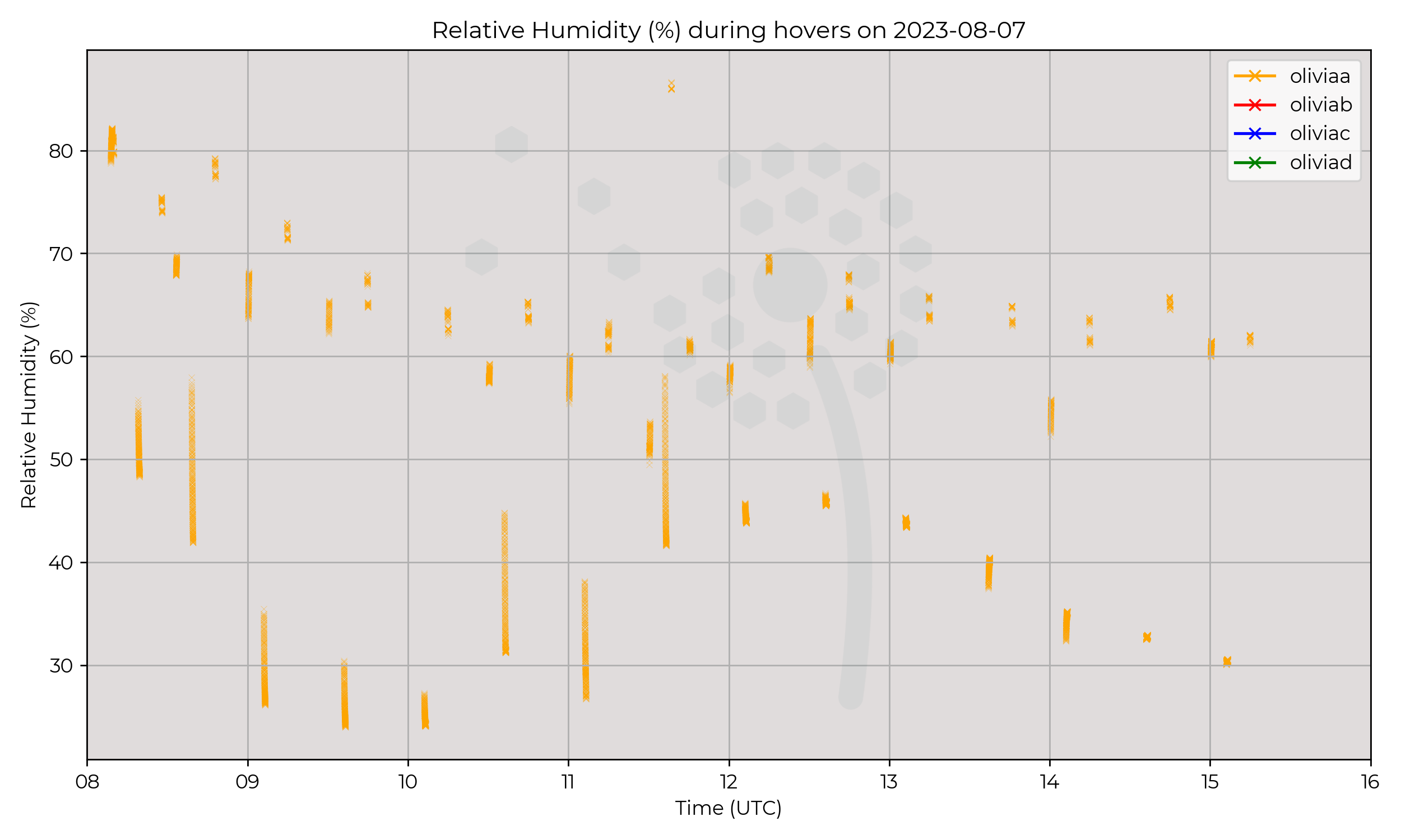
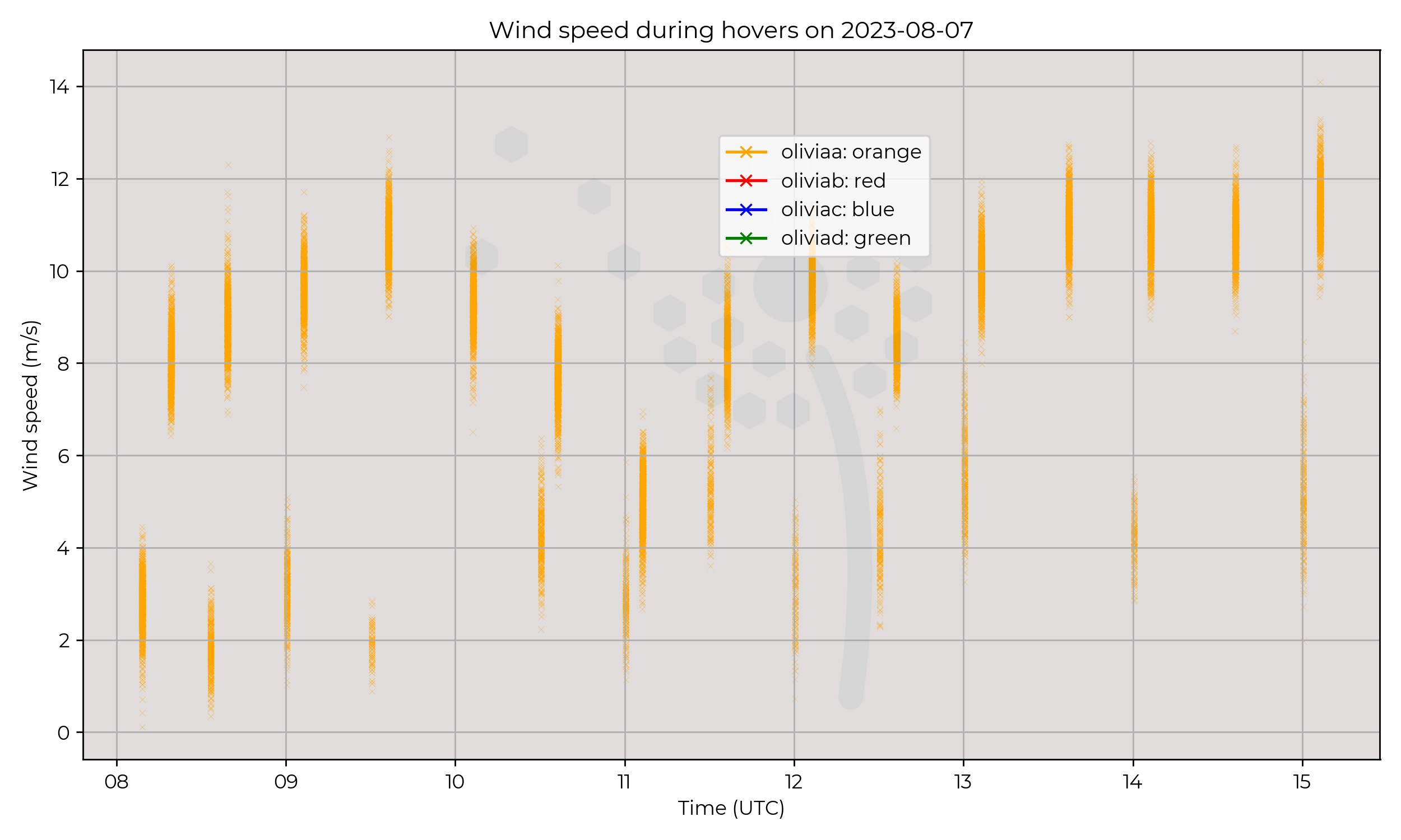
Ground to 2 km AGL profiles at 6 m s-1 ascent speed, every 30 minutes. All performed by Olivia-A (orange).
Flights halted at 1530 UTC for a planned airspace incursion.
Observations
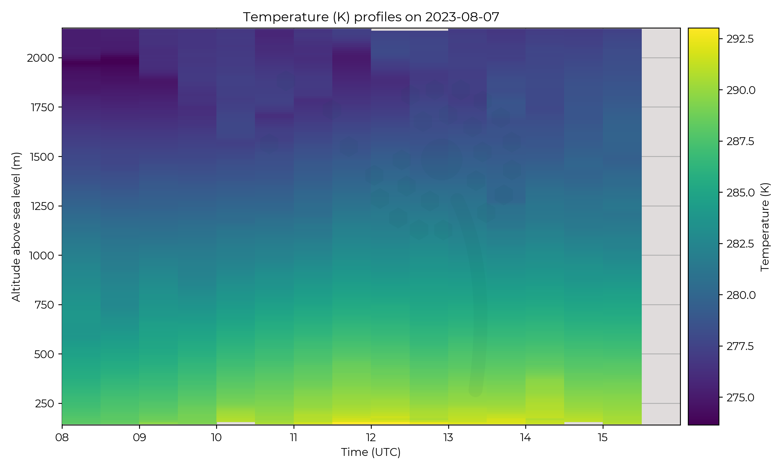
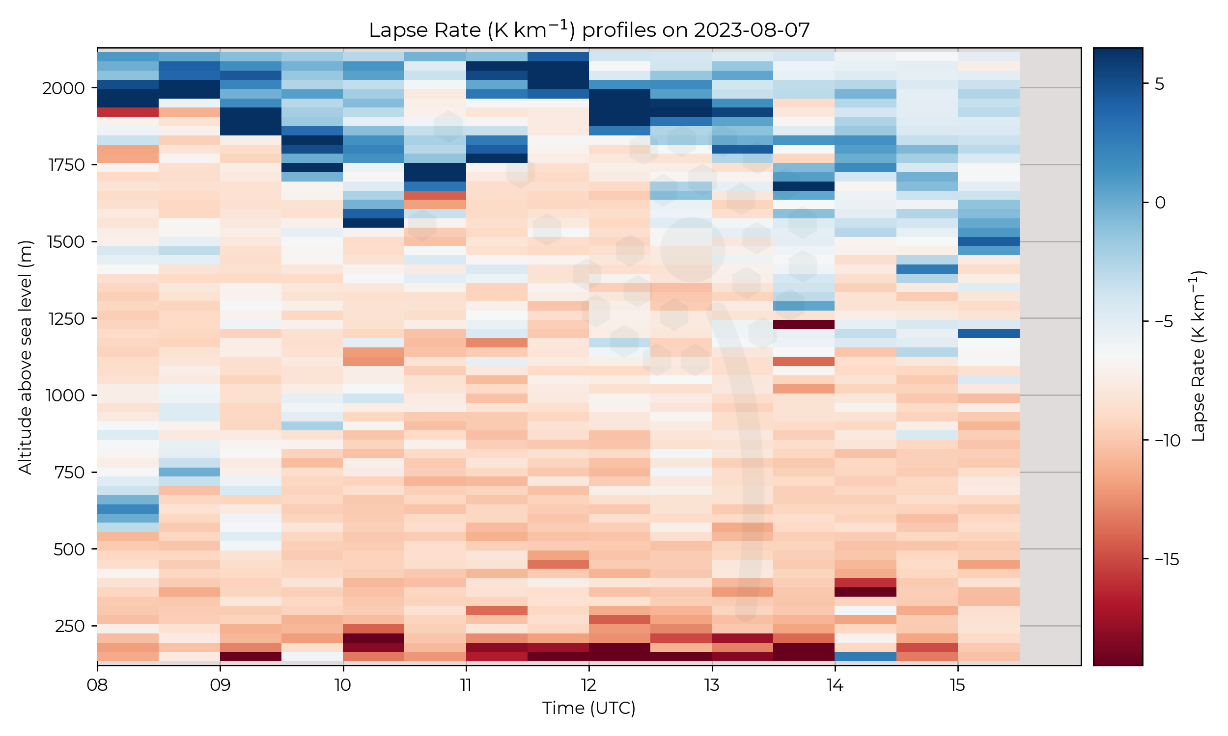
The inversion at the top of the PBL seemed to oscillate up and down in height before gradually lowering after 13 UTC whilst the inversion weakened.
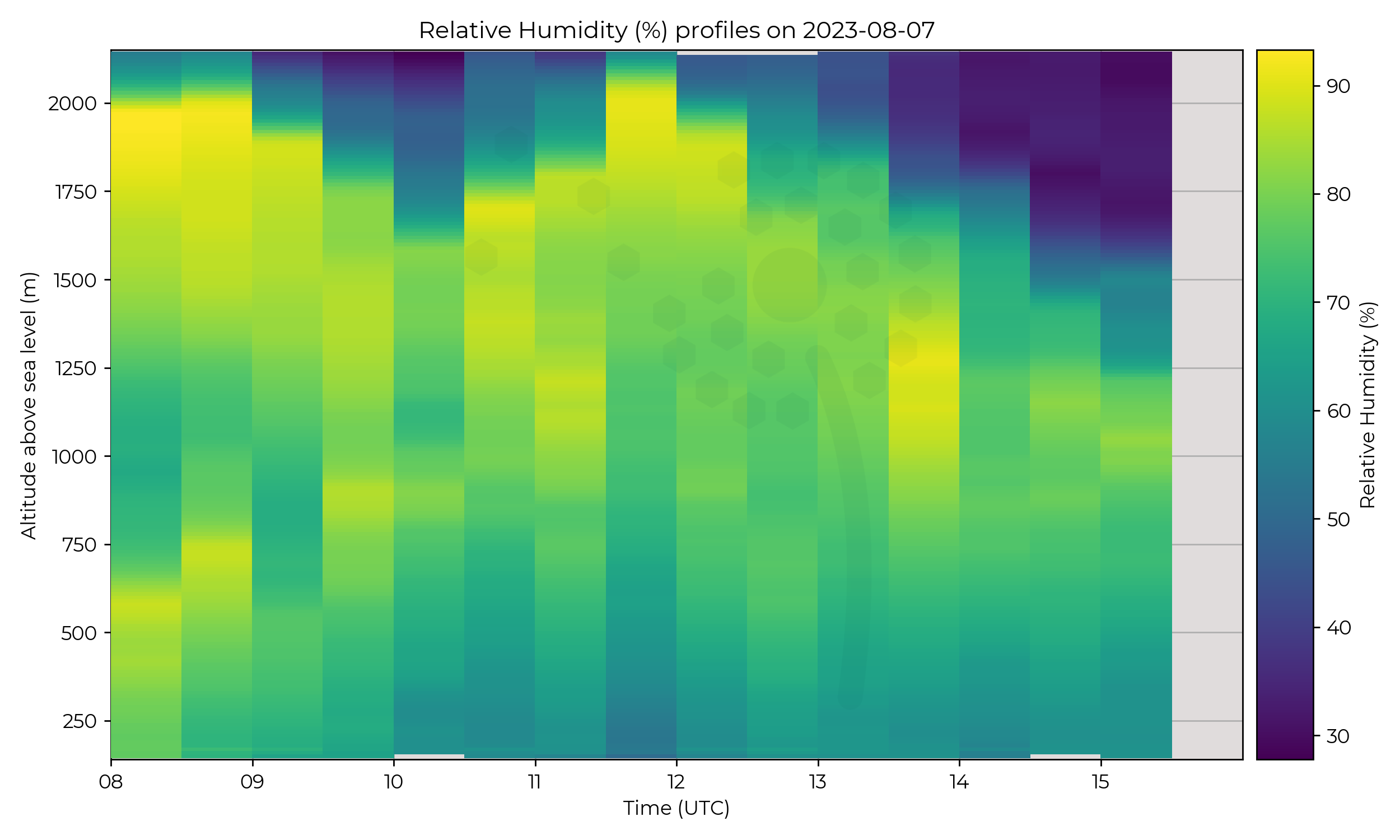
High RH indicative of cloud, followed the same pattern.
An additional high RH and more stable layer (cloud) existed at the start of the IOP around 600 m AMSL and ascended whilst dissipating up to 1130 UTC.
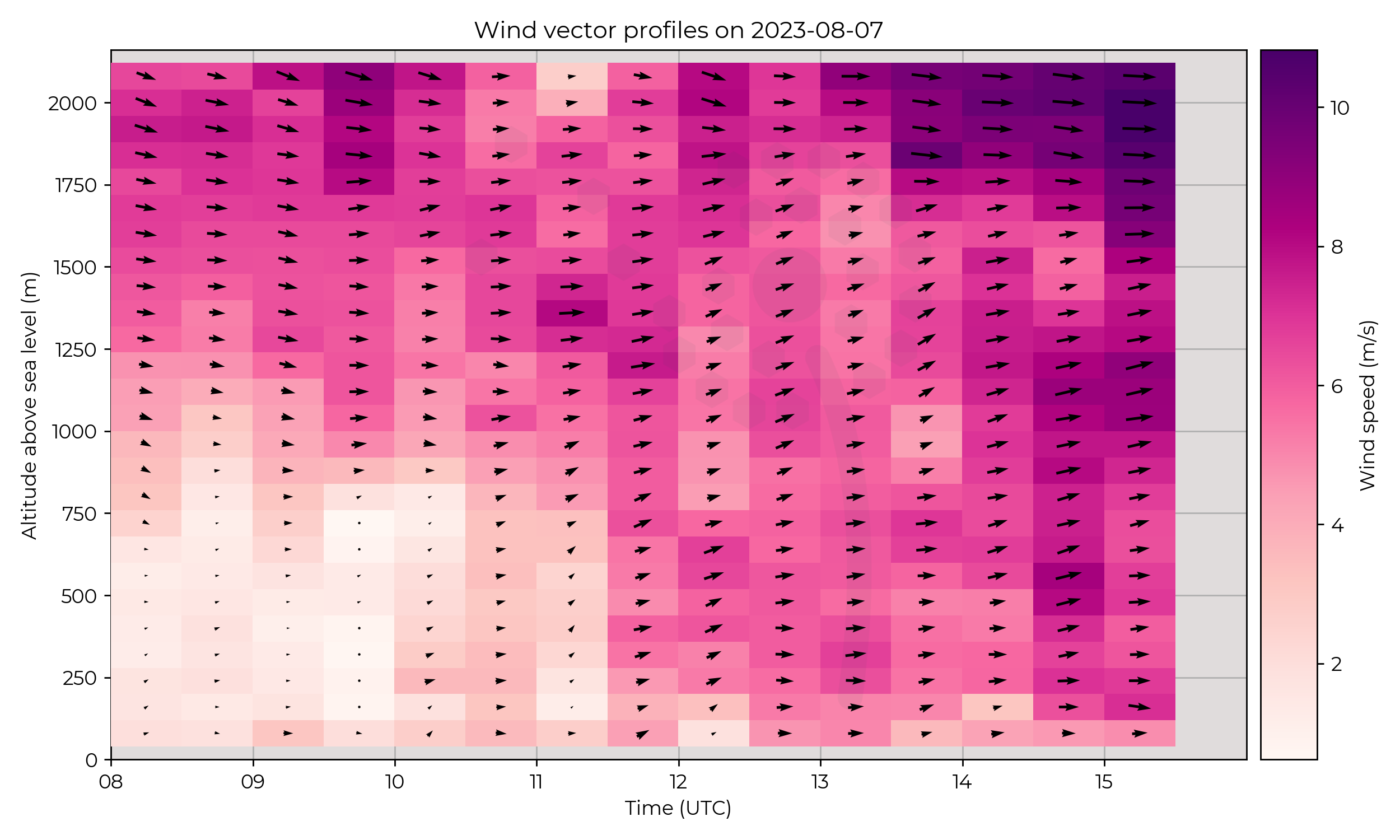
Weak winds at the surface with stronger aloft, which gre stronger and propogated to the surface over the IOP.
Known Issues
None yet reported.Week 7
2023-08-04
2023-08-03
Synoptic Overview
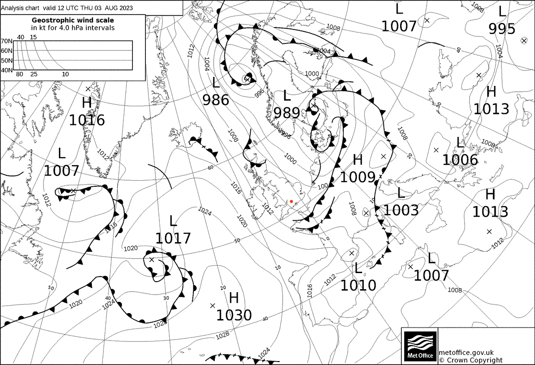
A surface pressure minima was moving away to the east, and an occluded front cleared south by midday.
Flight Patterns
Ground to 2 km AGL profiles at 6 m s-1 ascent speed, every 30 minutes. All performed by Olivia-A (orange).
Observations
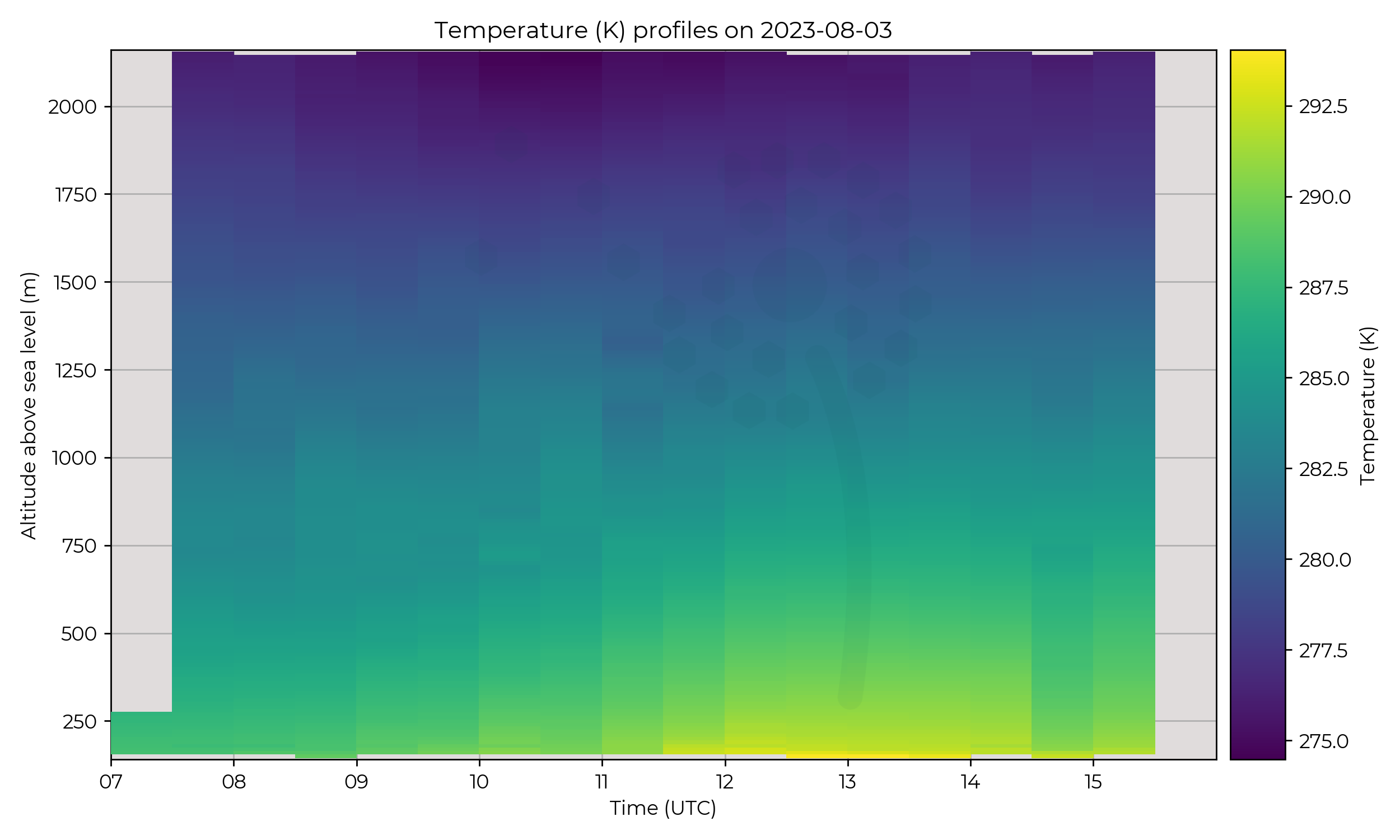
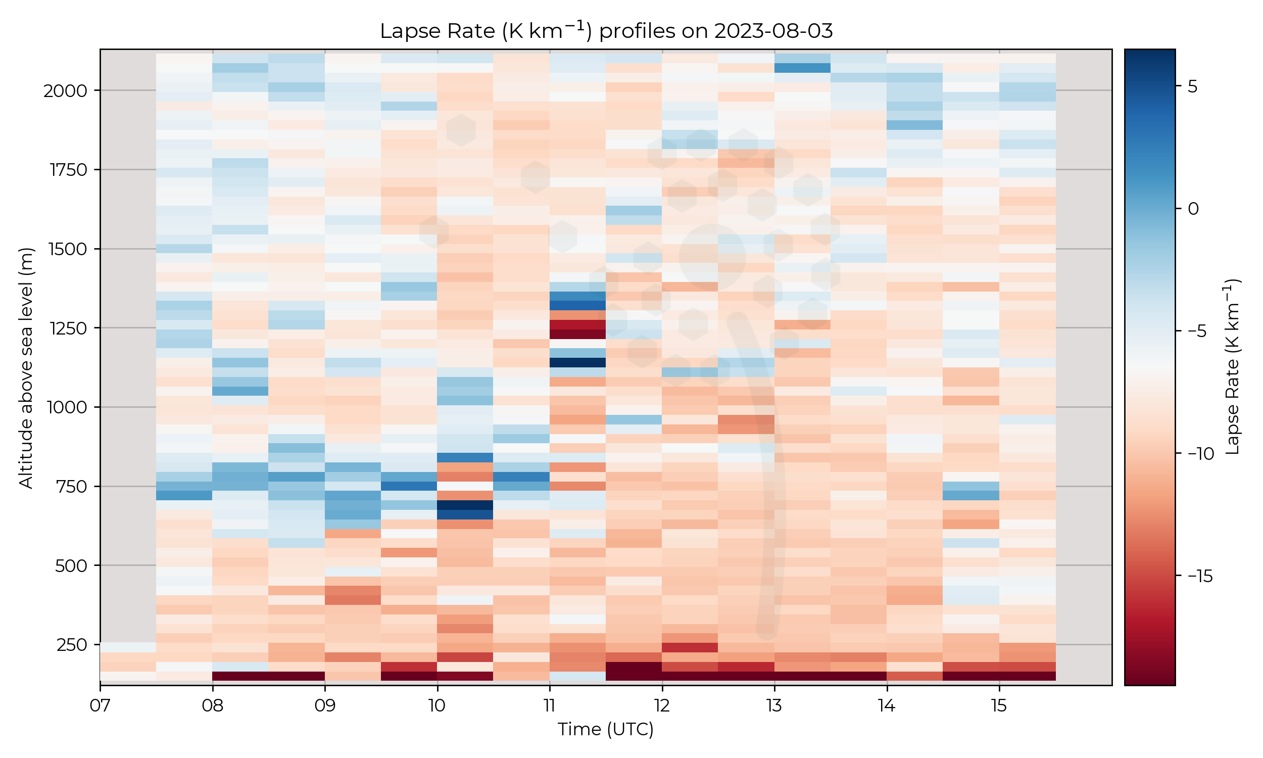
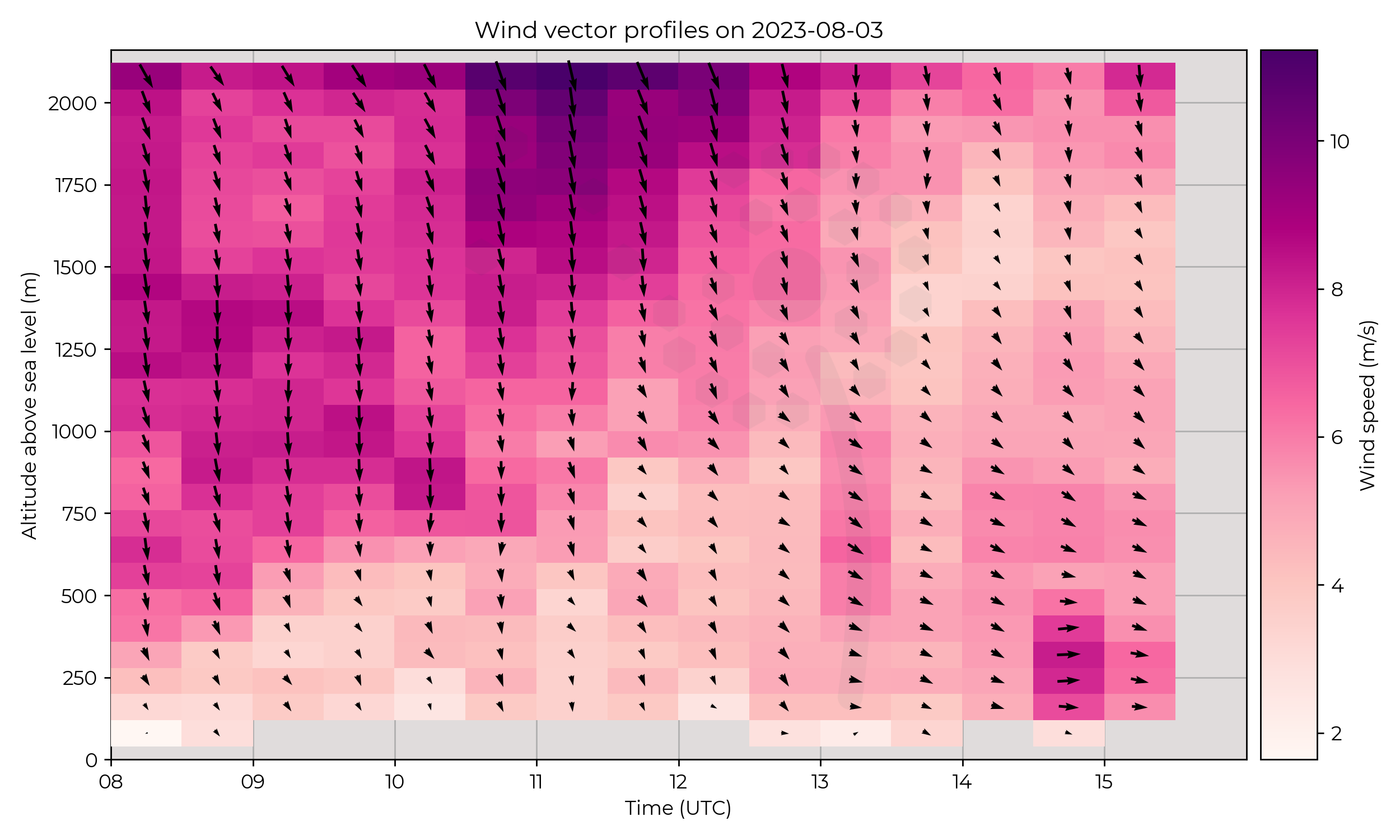
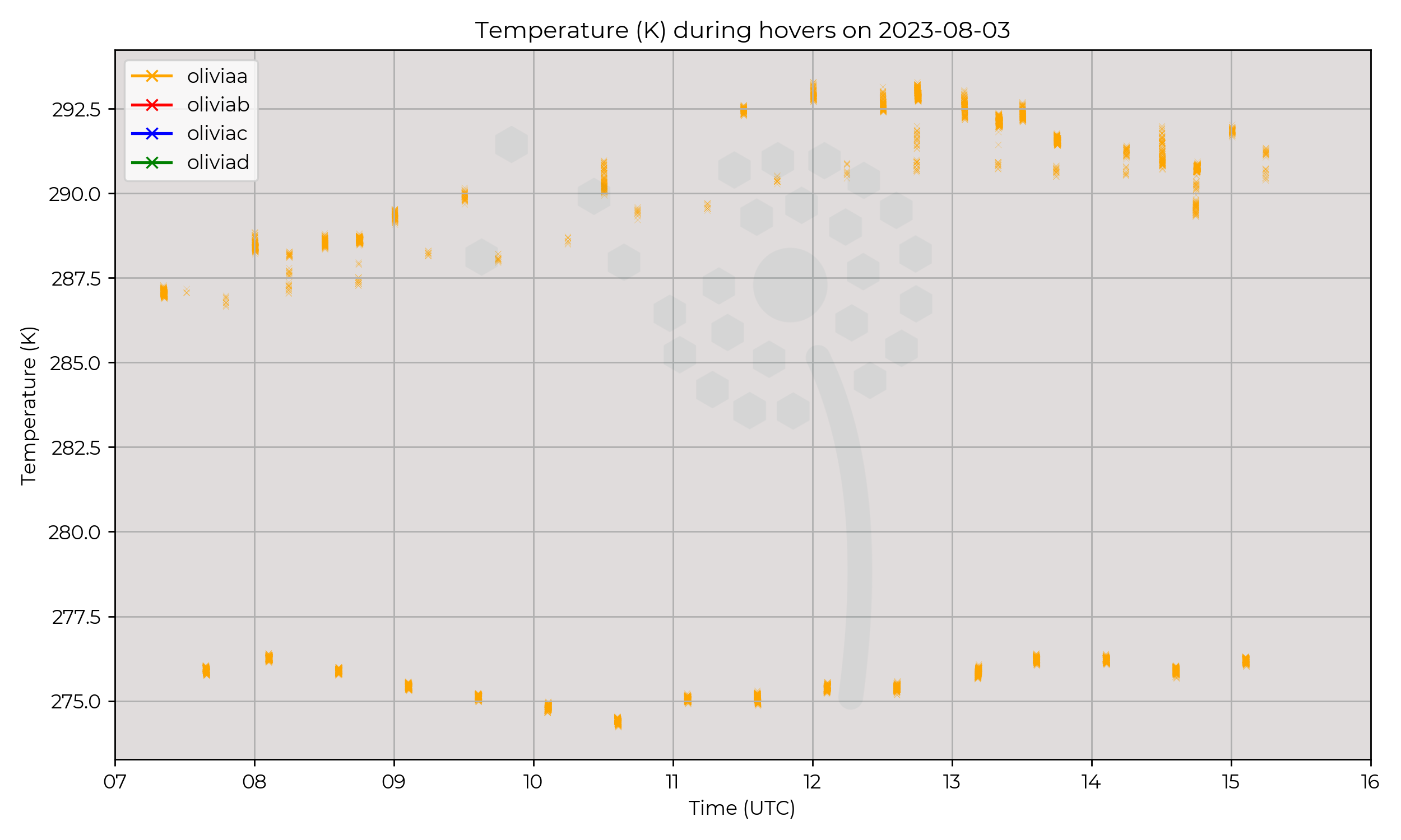
An initially well-defined stable layer at 750 m AMSL weakened at 11 UTC and gradually increased in altitude over the day.
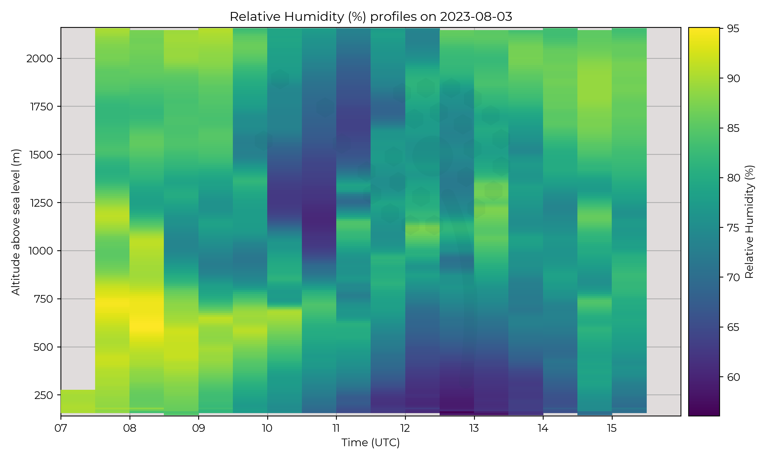
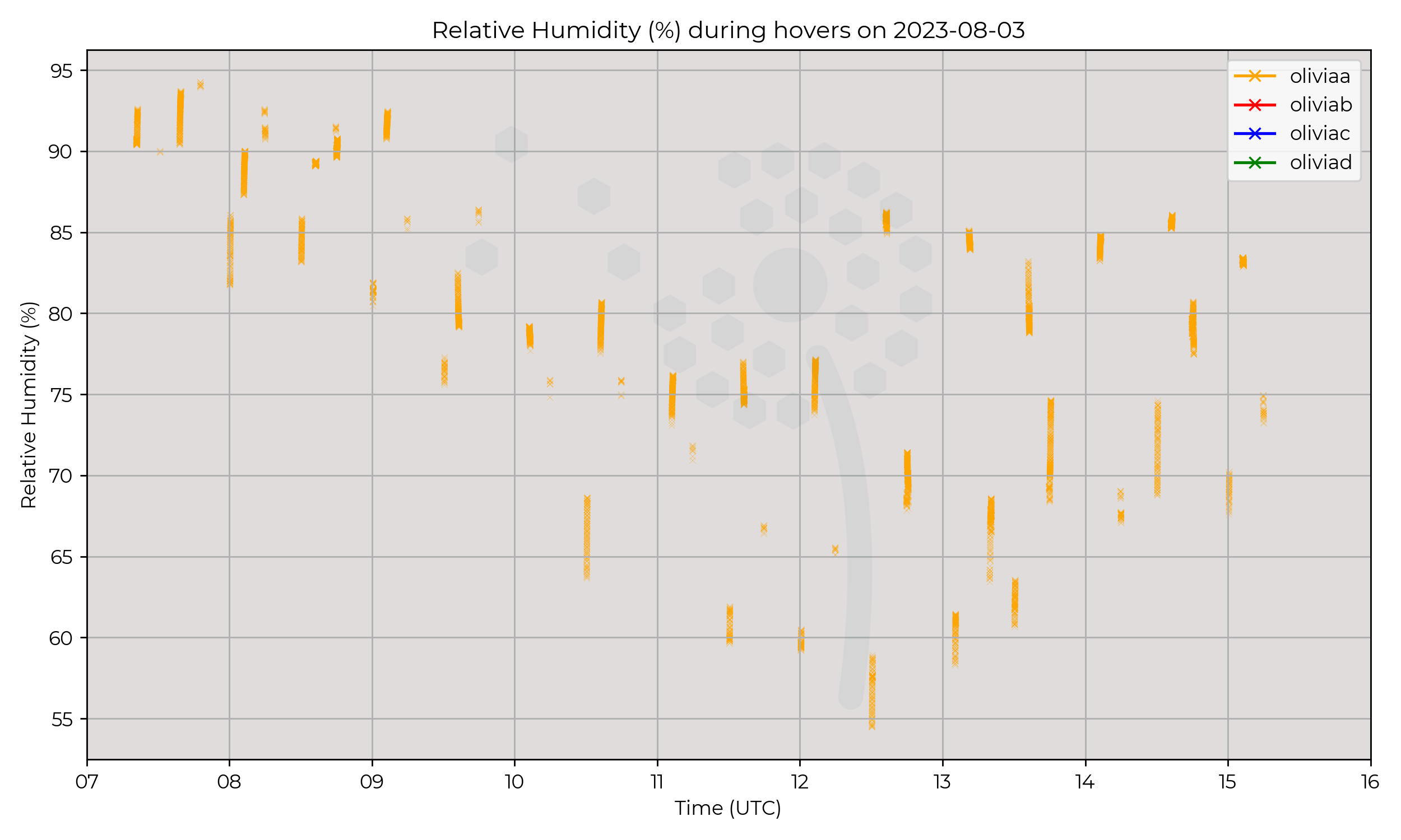
Surface heating is evident in the steep lapse rates near the surface, which acted to dry the near-surface air toward the local solar maximum.
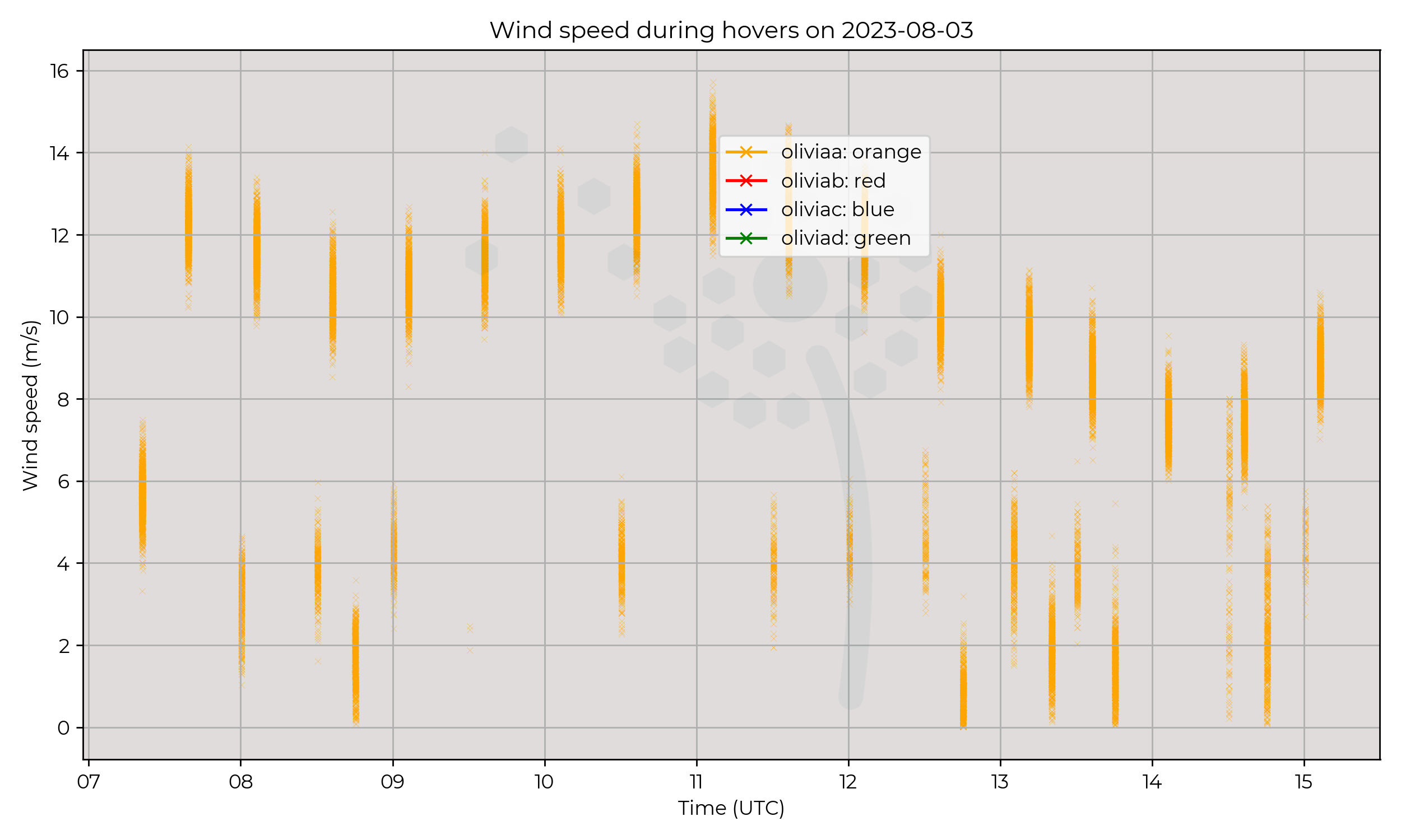
Geostrophic winds remained northerly, in-line with the isobars on the synoptic charts but winds below the PBL inversion were steered
more in-line with the pressure gradient force, which is evidence of surface frictional effects and therefore strong surface–PBL coupling.
Known Issues
None yet reported.2023-08-02
Synoptic Overview
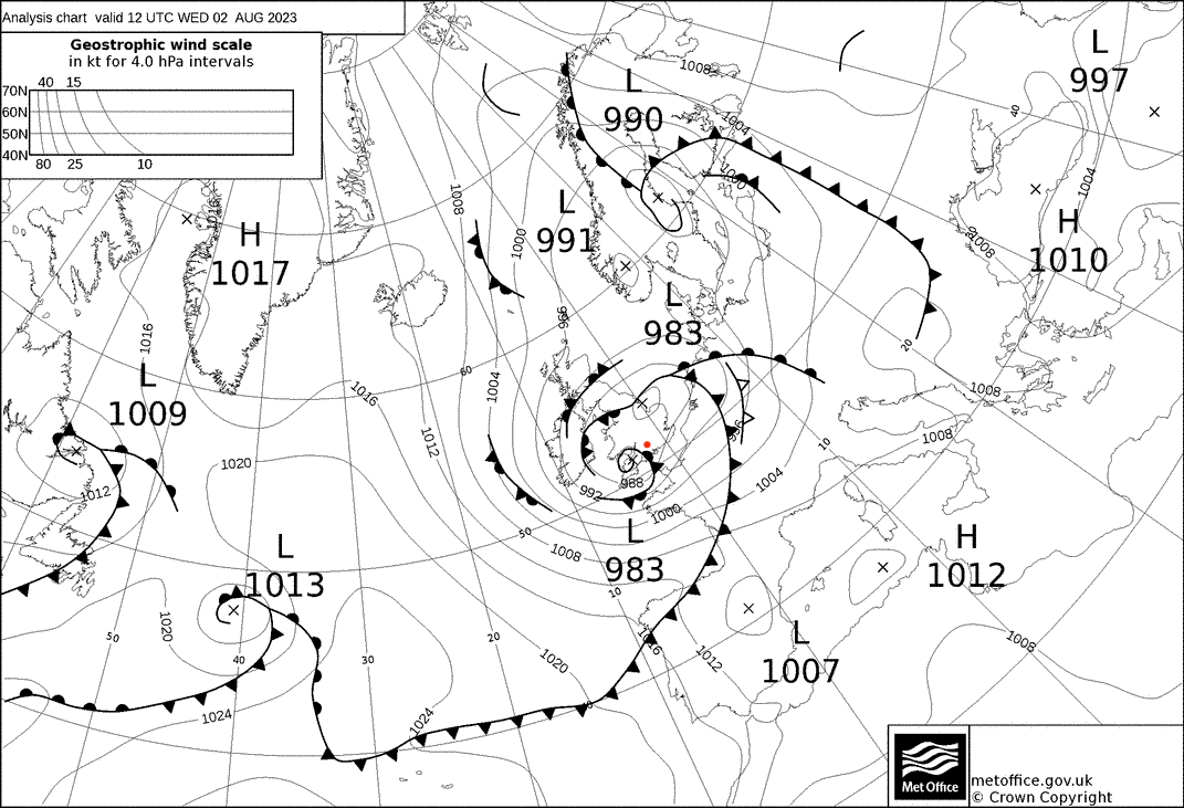
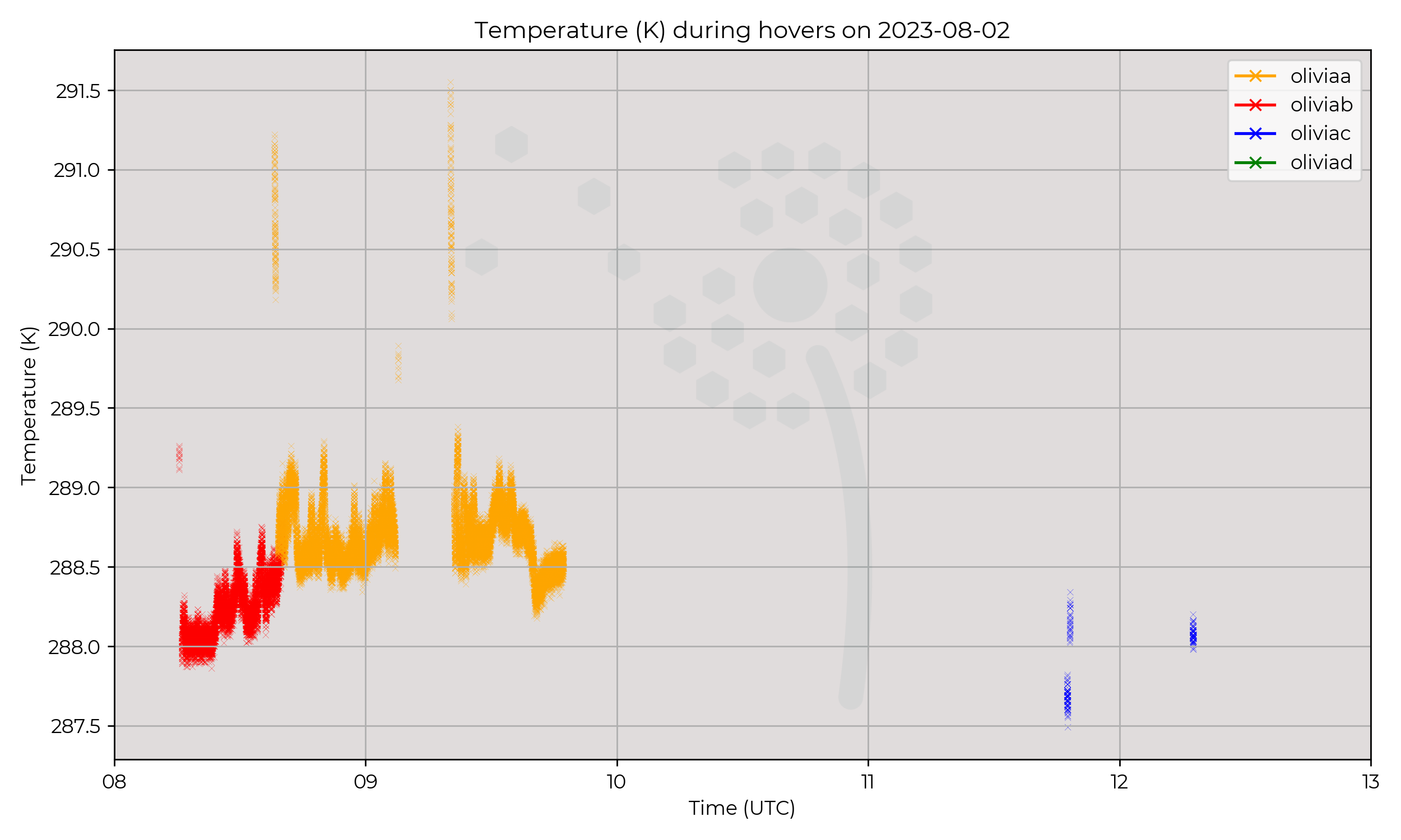
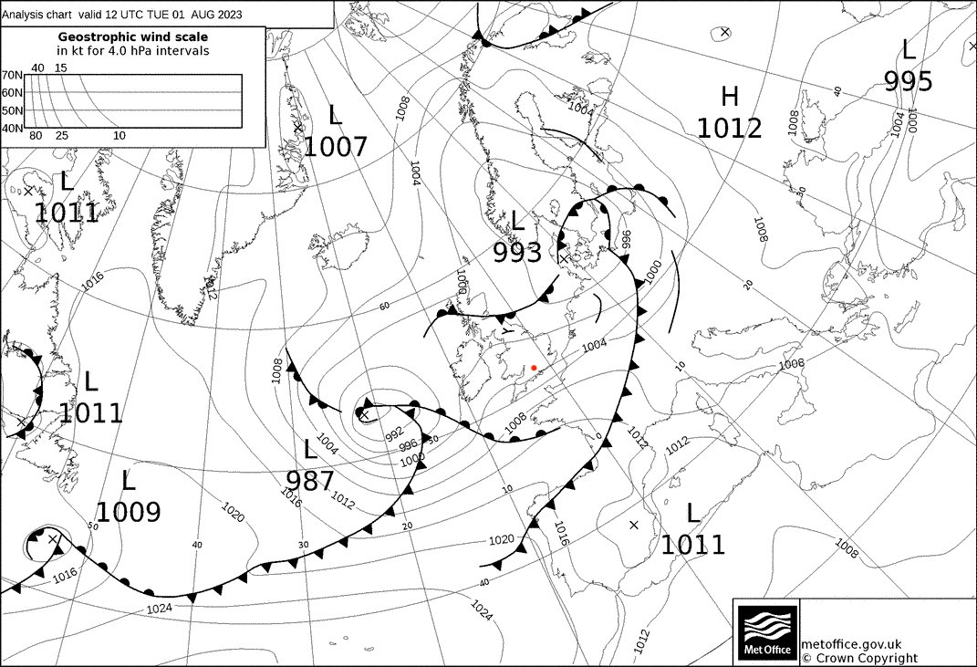
A surface pressure minima passed over the region, with a curled occluded front the predominant driver of observed conditions.
Flight Patterns
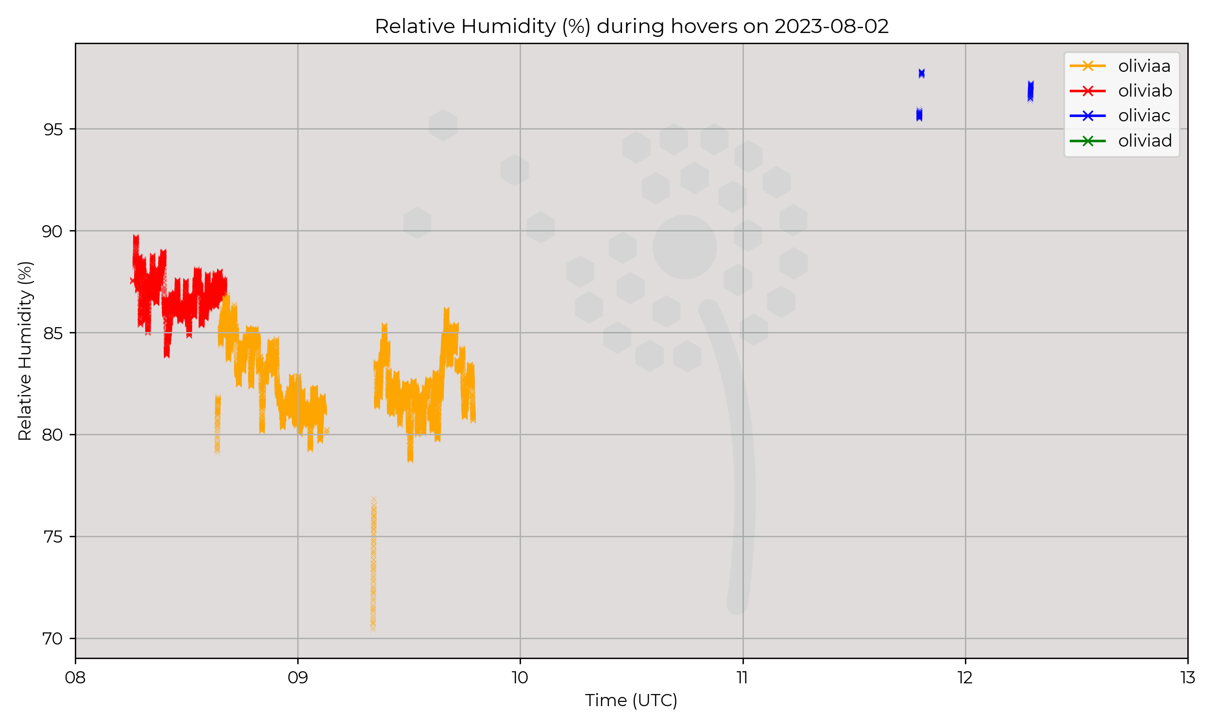
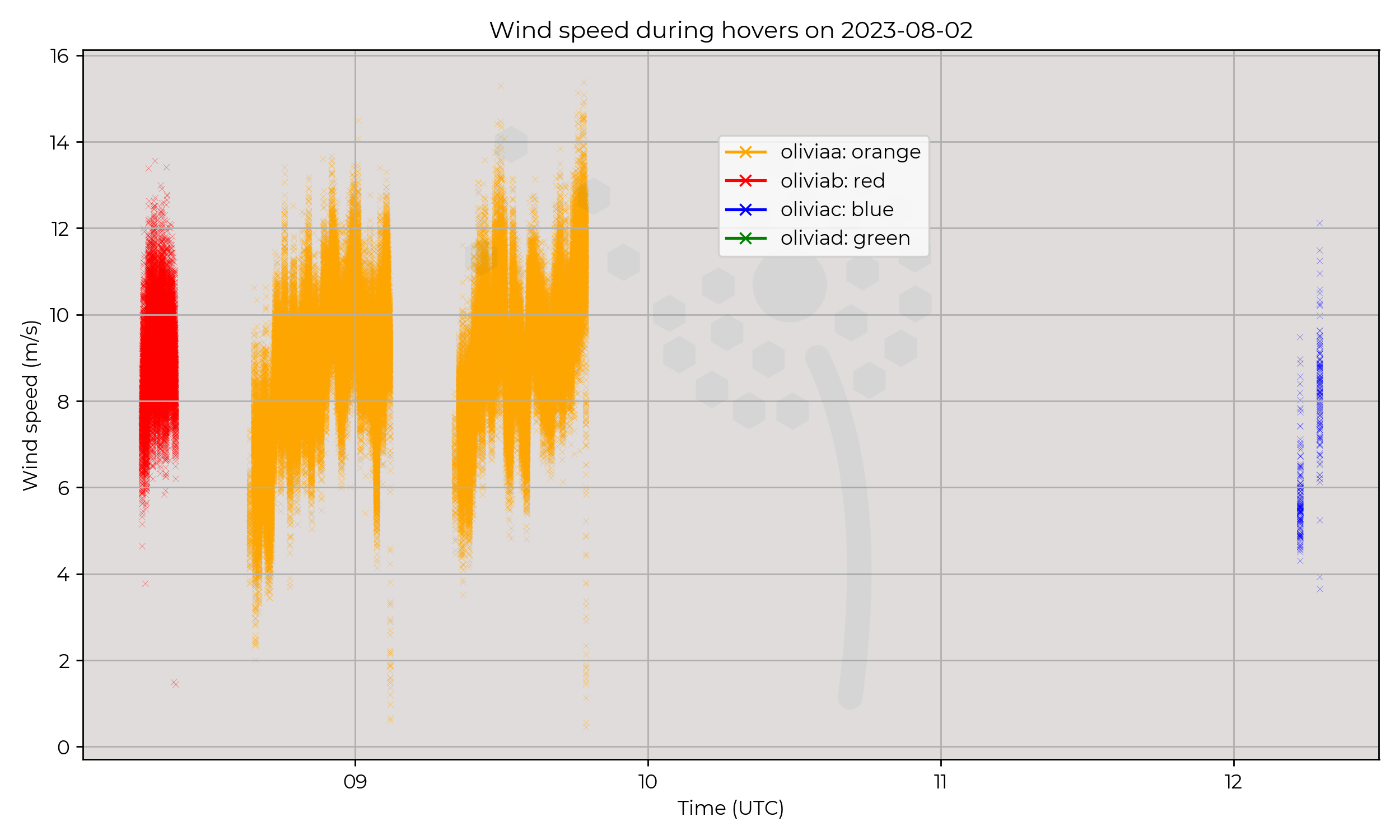
Constant presence was attempted, but was halted mid-morning due to telemetry issues.
Observations
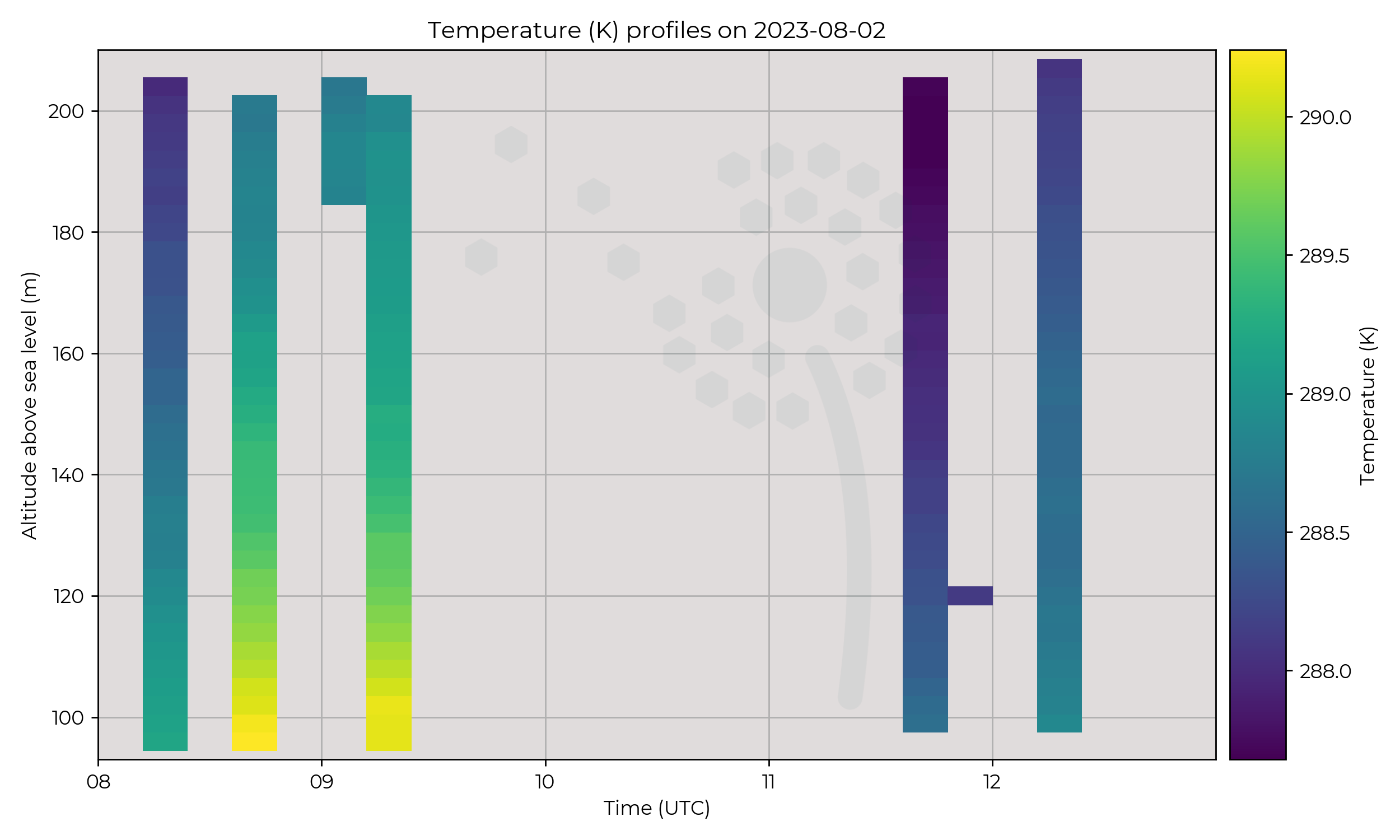
Very small temperature range (2 ºC) observed between the morning and afternoon flights.
A steep increase of 1 ºC was observed during the first flight which lasted approximately 30 minutes.
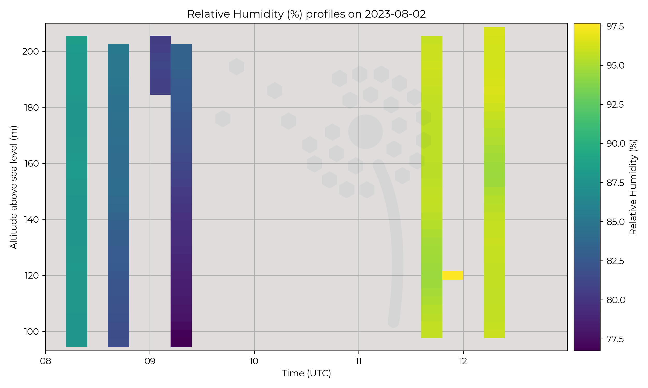
RH remained high all day (> 80%) and the afternoon flights were conducted during precipitation.
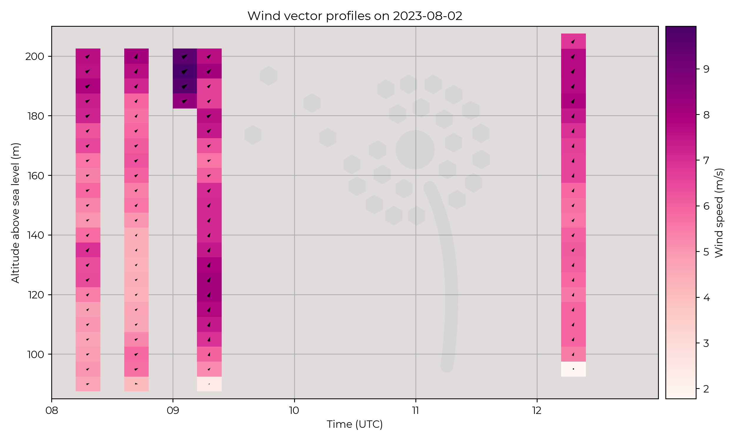
Winds remained moderate all day at an average of 9 m s-1.
Known Issues
- Reduced number of flights.
2023-08-01
Synoptic Overview
Between surface pressure minima, geostrophic winds were weak and westerly.
An approaching warm front may have influenced the region toward the end of the day.
Flight Patterns
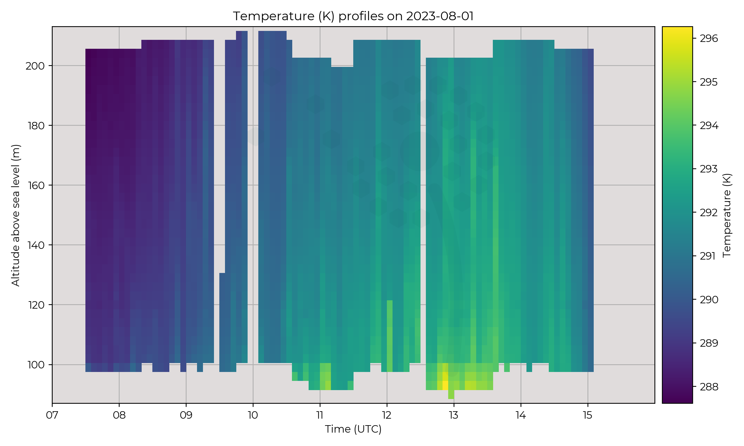
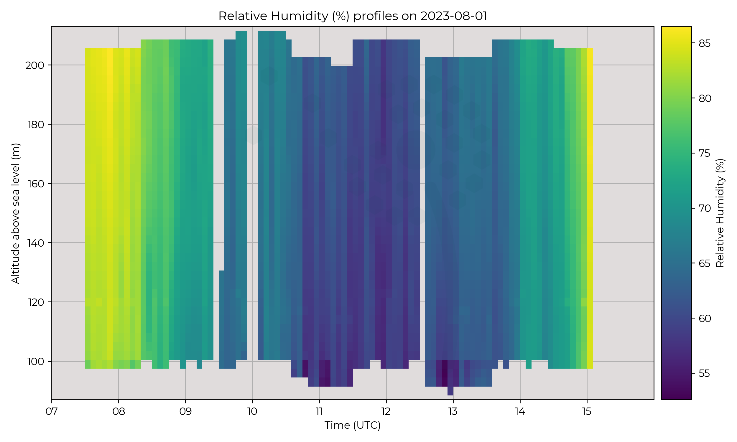
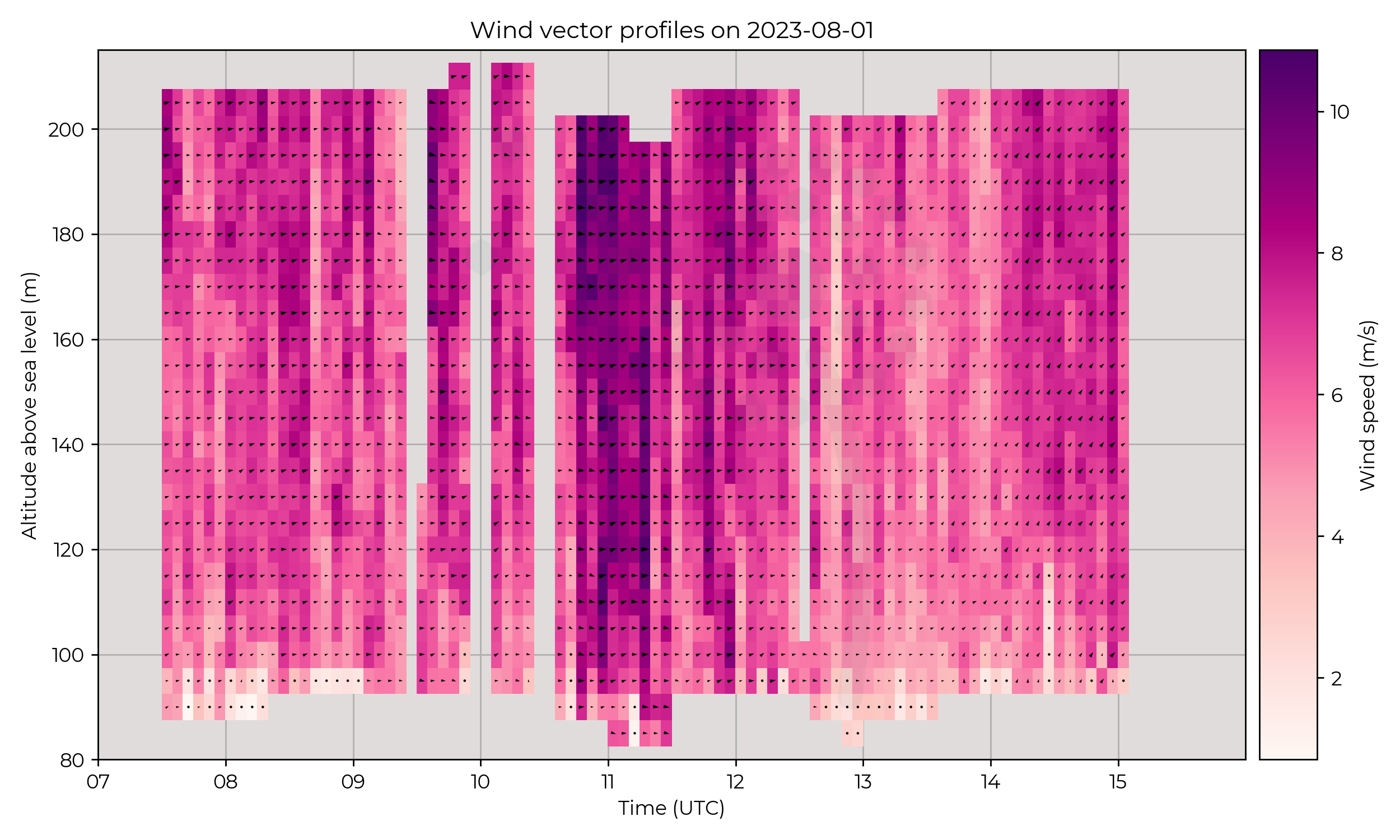
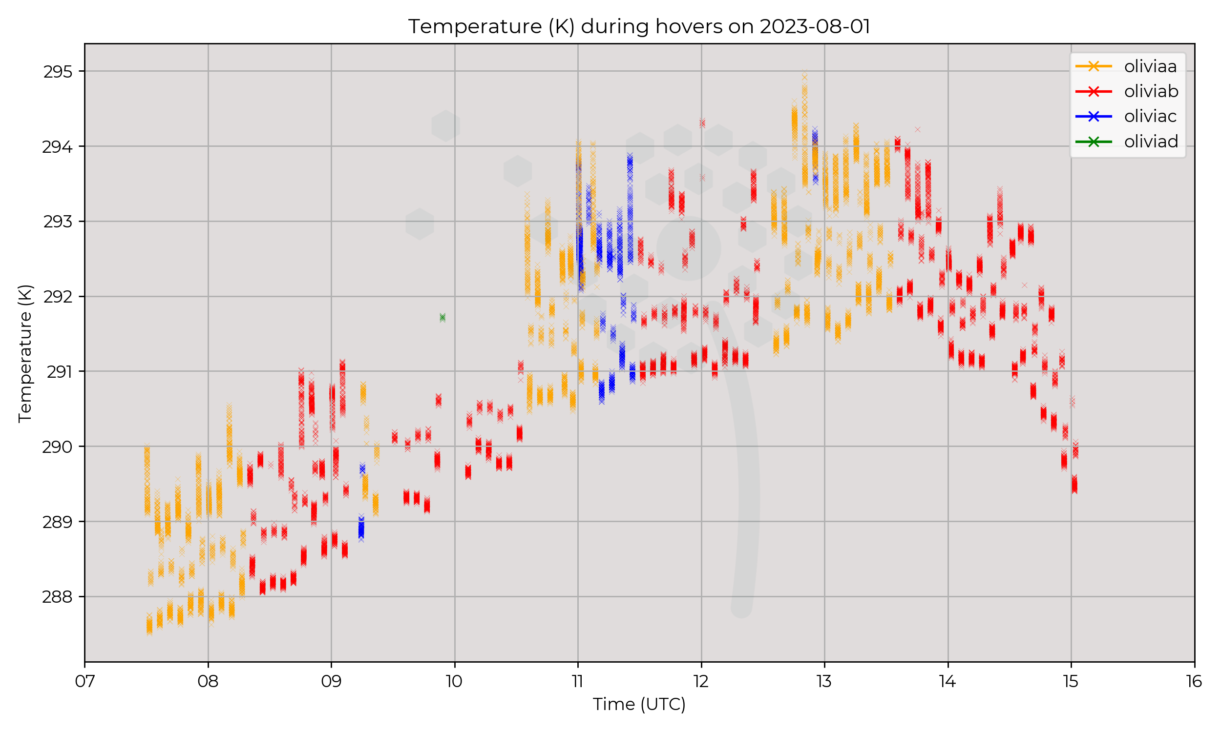
Rapid 120-metre profiles with 5-minute interval between profiles, for 8 hours.
Observations
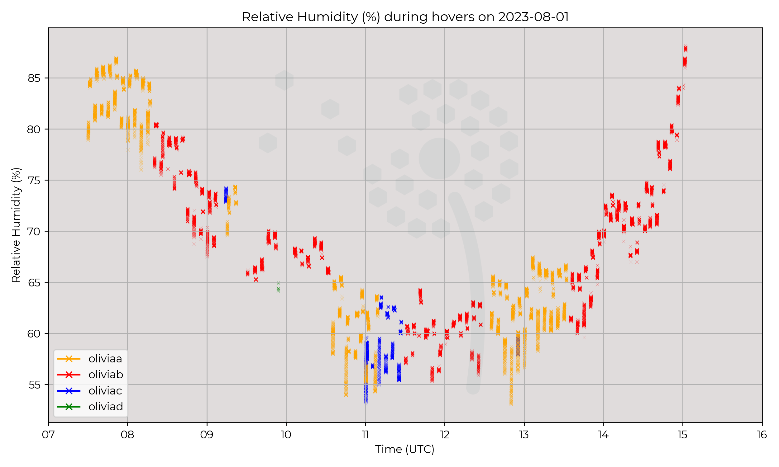
Predominantly a diurnal cycle day with the lack of fronts.
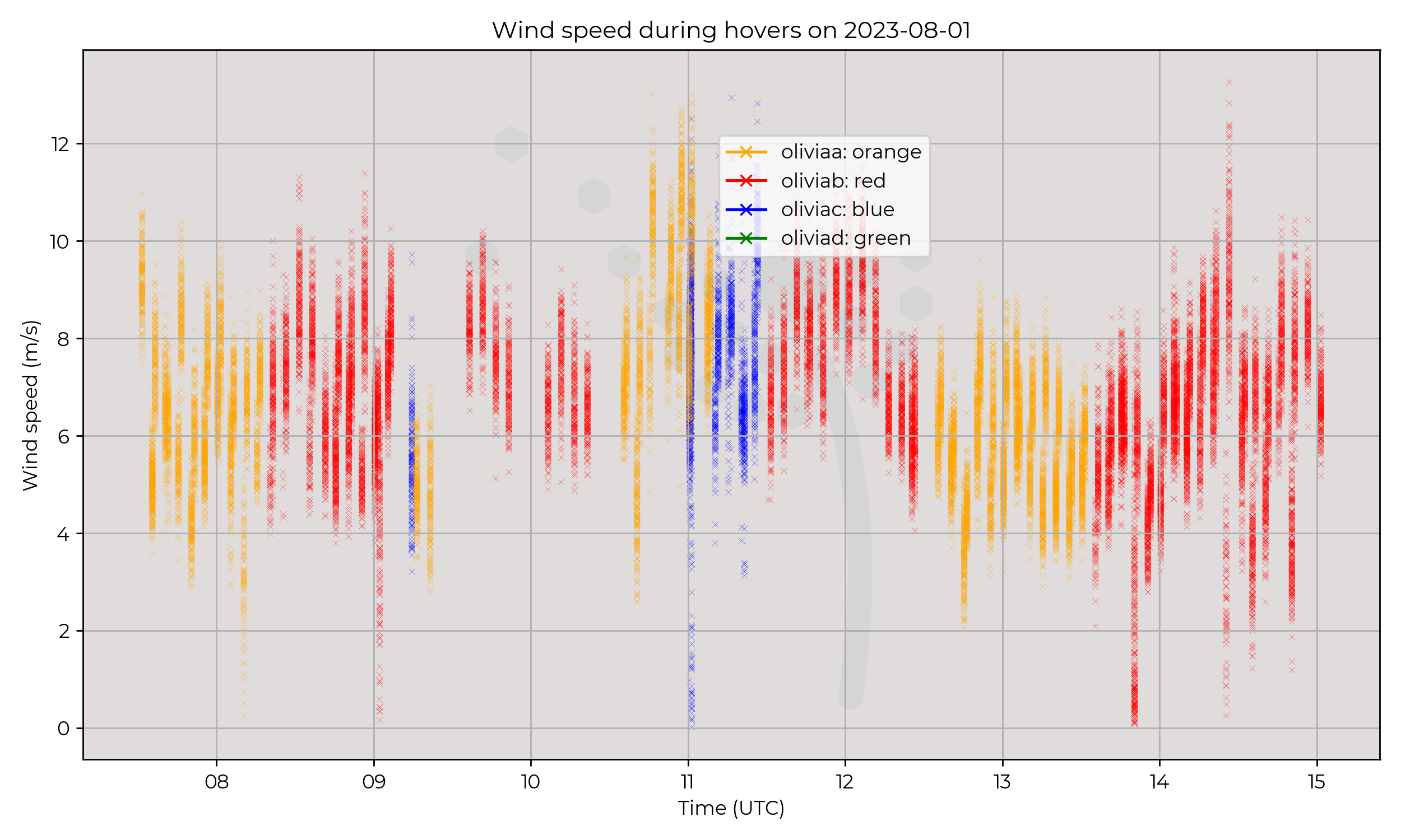
A temperature range of 9 ºC and a RH range of 40%,
but winds consistent between 6–8 m s-1 with a 10 m s-1 peak centred on 11 UTC.
Known Issues
None yet reported.2023-07-31
Synoptic Overview
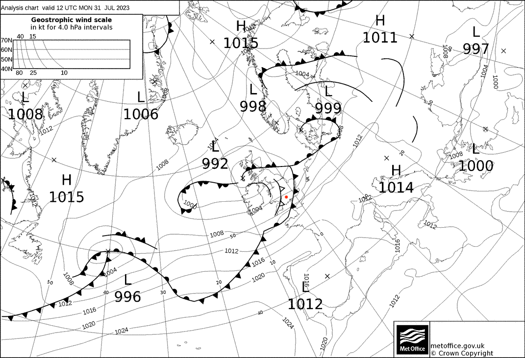
A series of fronts passed over the region, associated with a surface pressure minima over Scotland.
A cold front followed by an elevated cold front and a trough behind, moved sequentially over the profiling location.
Geostrophic winds were westerly and moderate in strength.
Flight Patterns
Ground to 2 km AGL profiles at 6 m s-1 ascent speed, every 30 minutes.
Observations
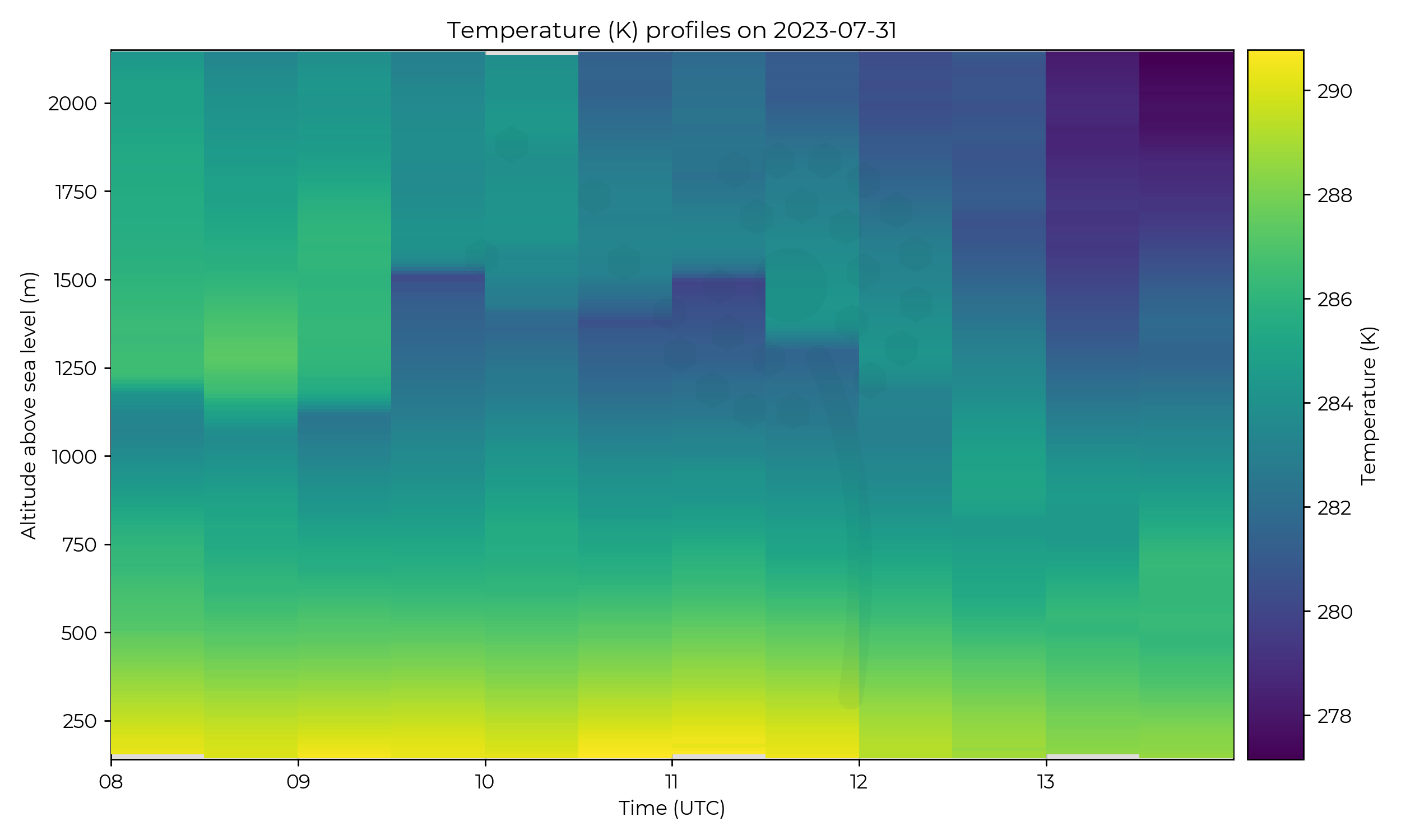
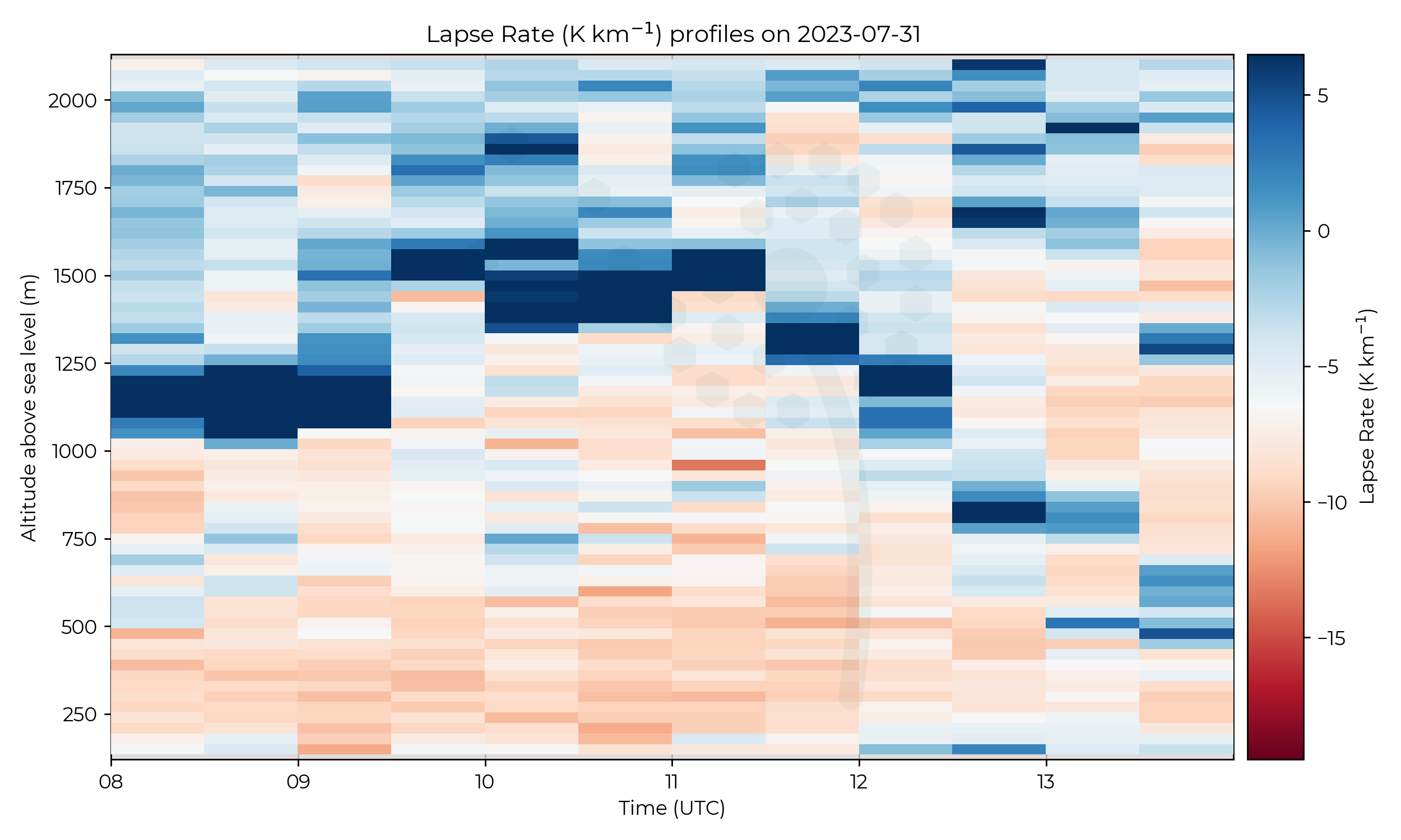
A strong 4 ºC inversion existed at 1.2 km AMSL for the first three flights,
before lifting to 1.5 km at 0930 UTC and weakening to a 2 ºC inversion.
After 11 UTC this inversion decended and reached 500 m AMSL at the end of the IOP.
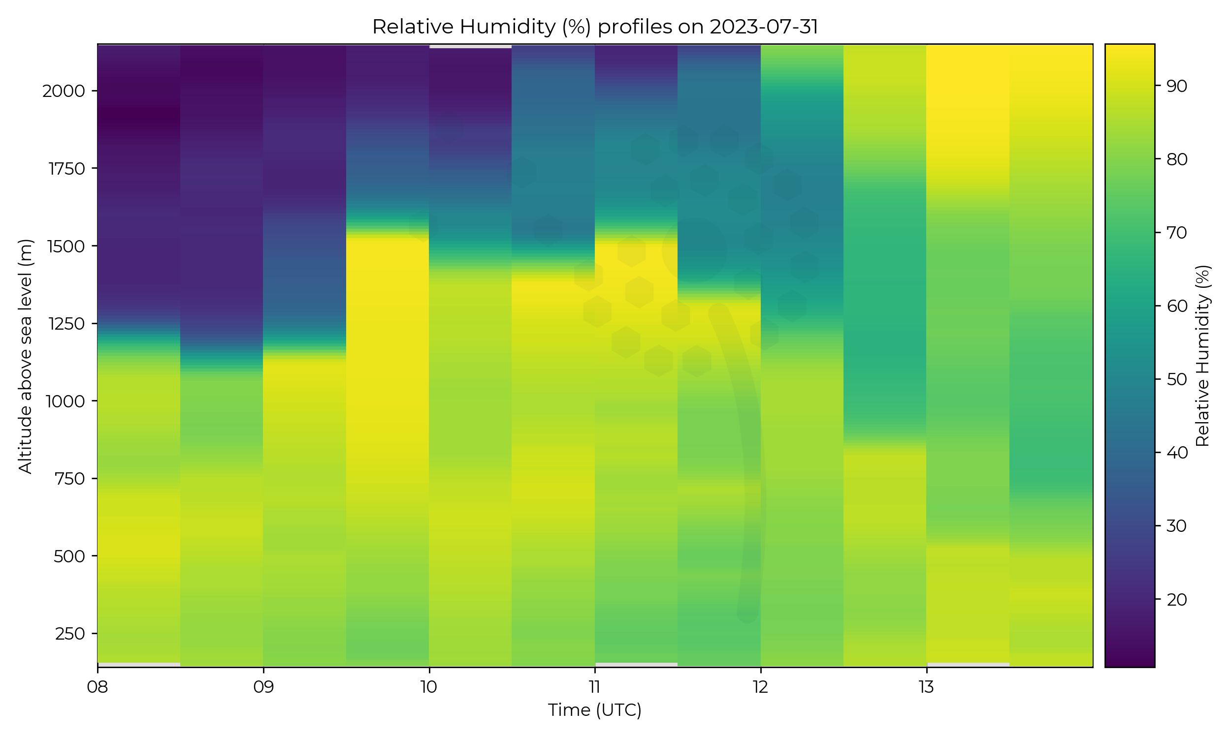
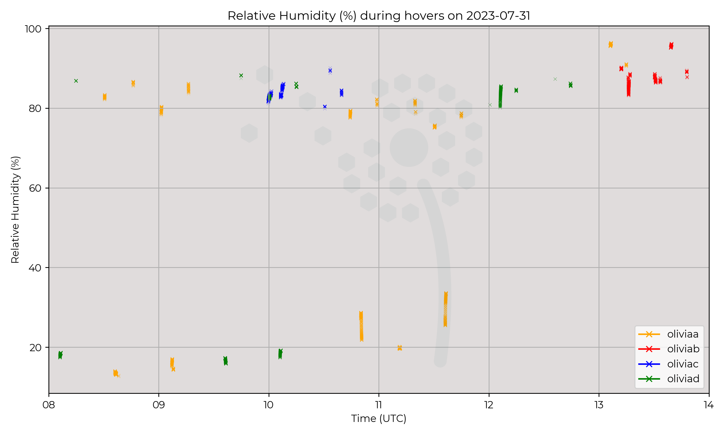
RH saw dramatic changes, with a drop of 70% wen exiting the cloud associated with the aforementioned temperature inversion.
This gradient weakened over the day and a secondary layer of cloud with a descending base was first detected at 12 UTC.
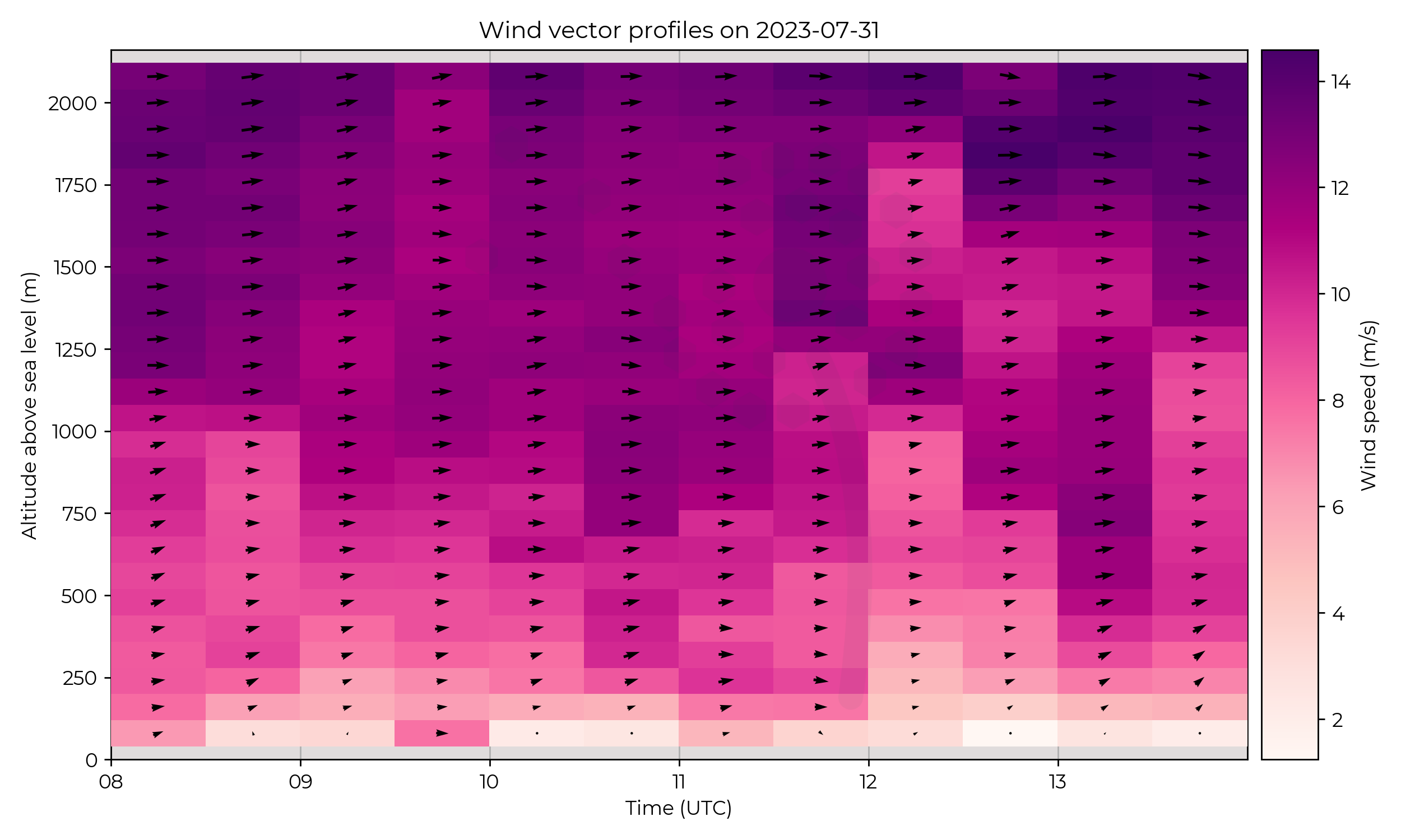
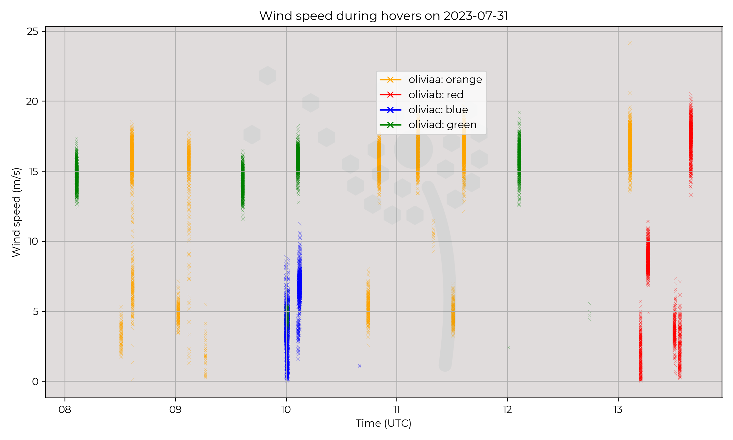
Winds remained westerly throughout the column and peaked at the start and end of the day at 14 m s-1.
Known Issues
None yet reported.Week 6
2023-07-28
Synoptic Overview
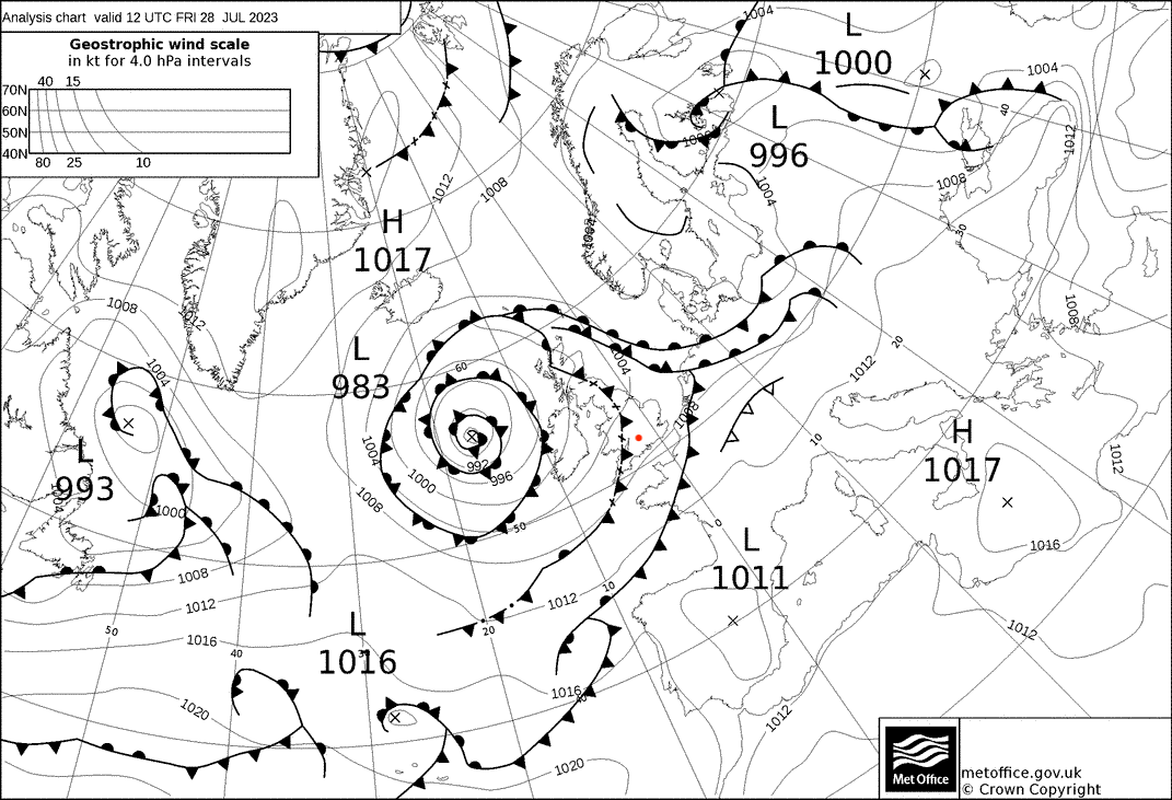
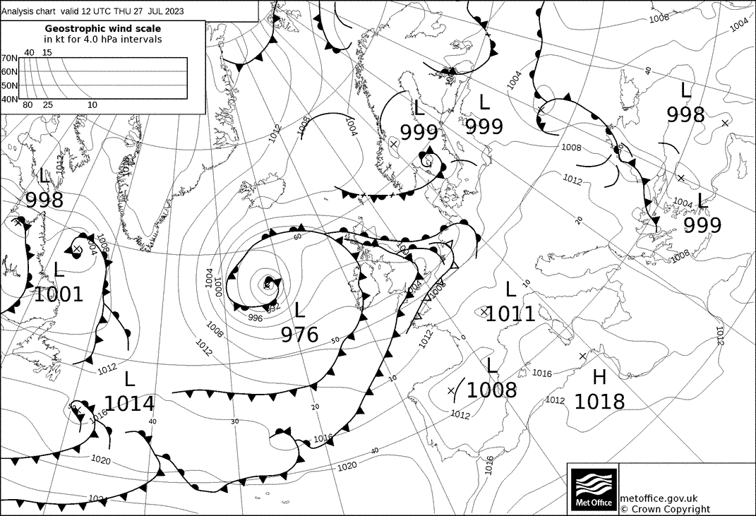
A surface pressure minima existed to the west of Scotland, with occluded fronts spiraling outward.
A slow-moving surface cold front undergoing frontolysis passed over the region just after 18 UTC.
Flight Patterns
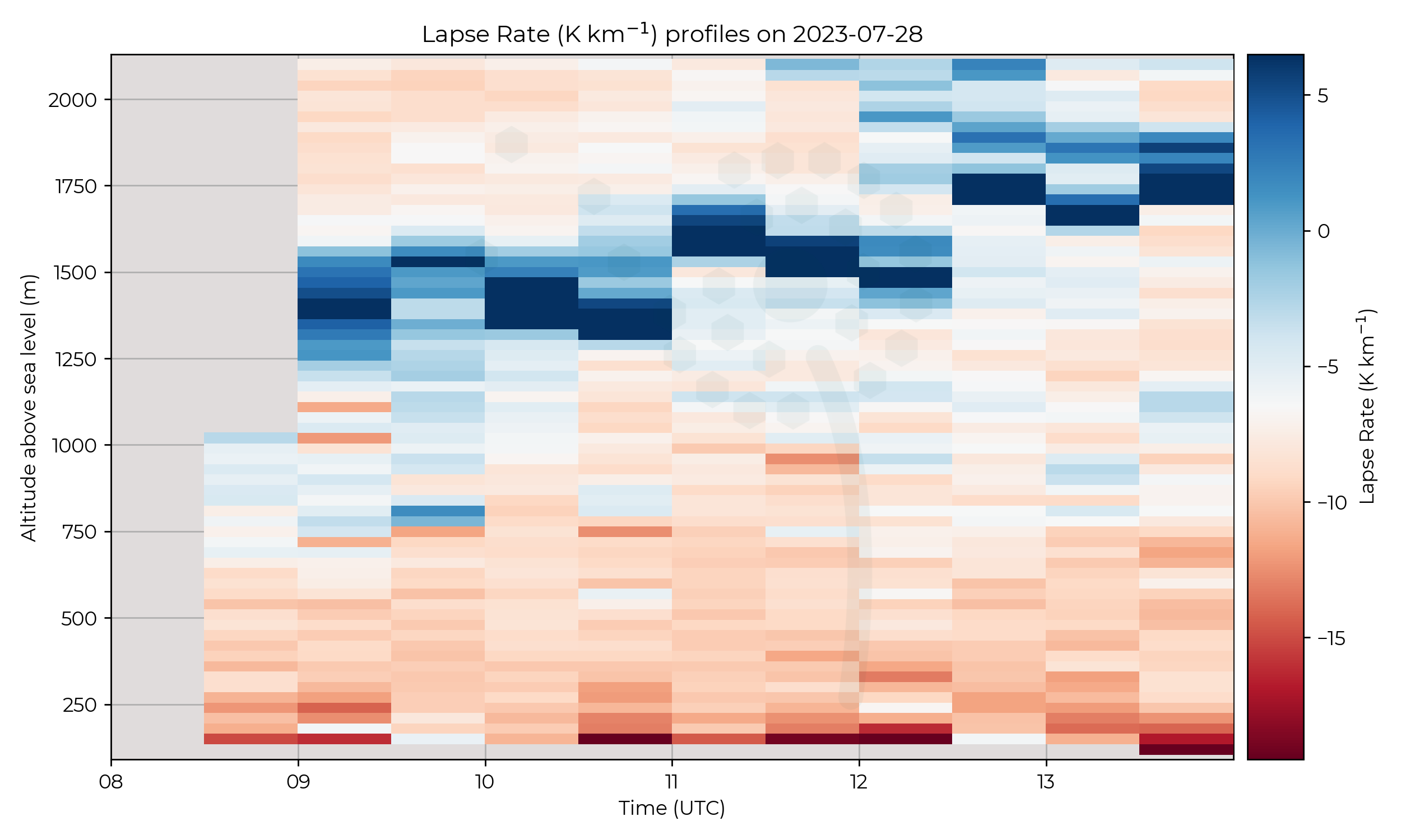
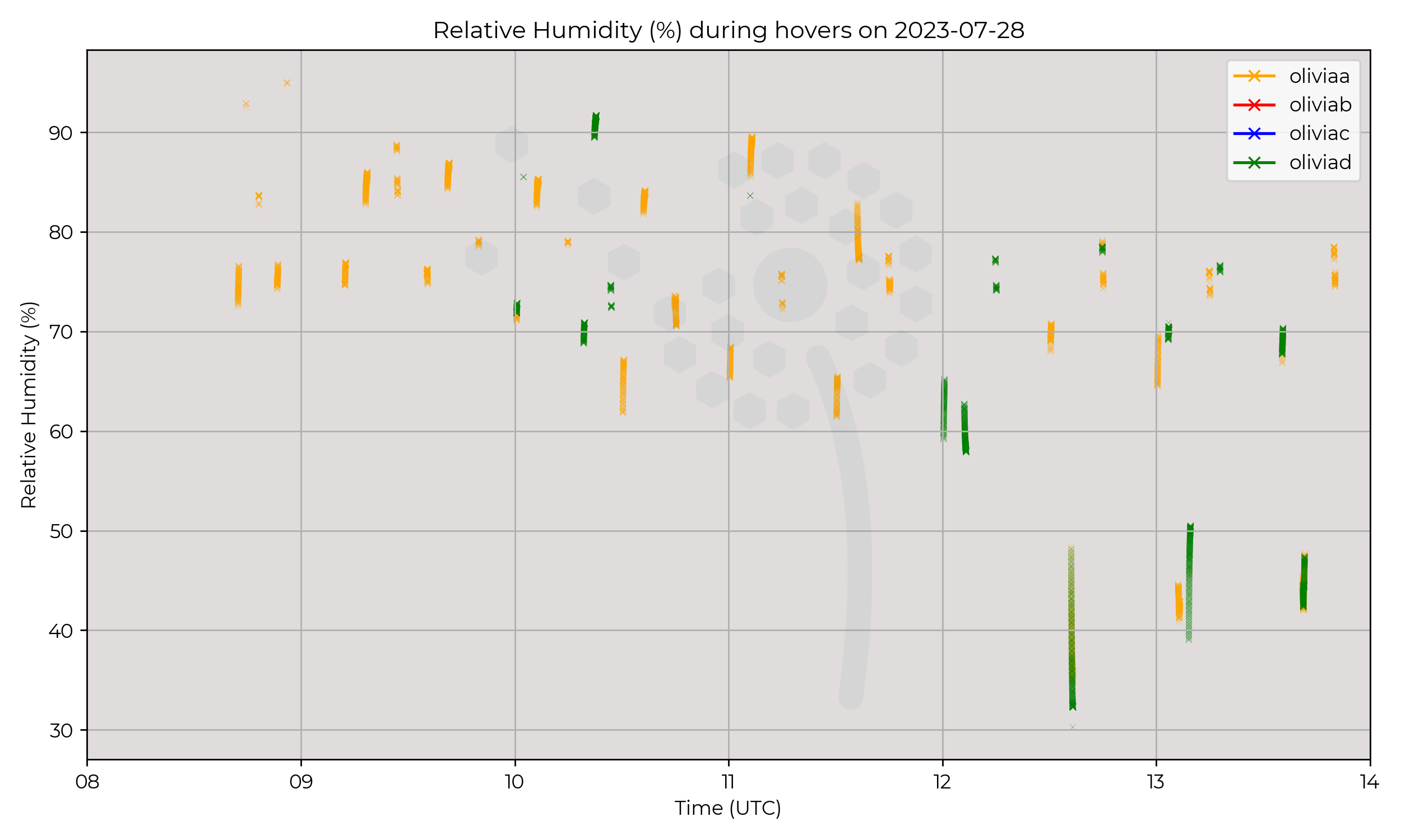
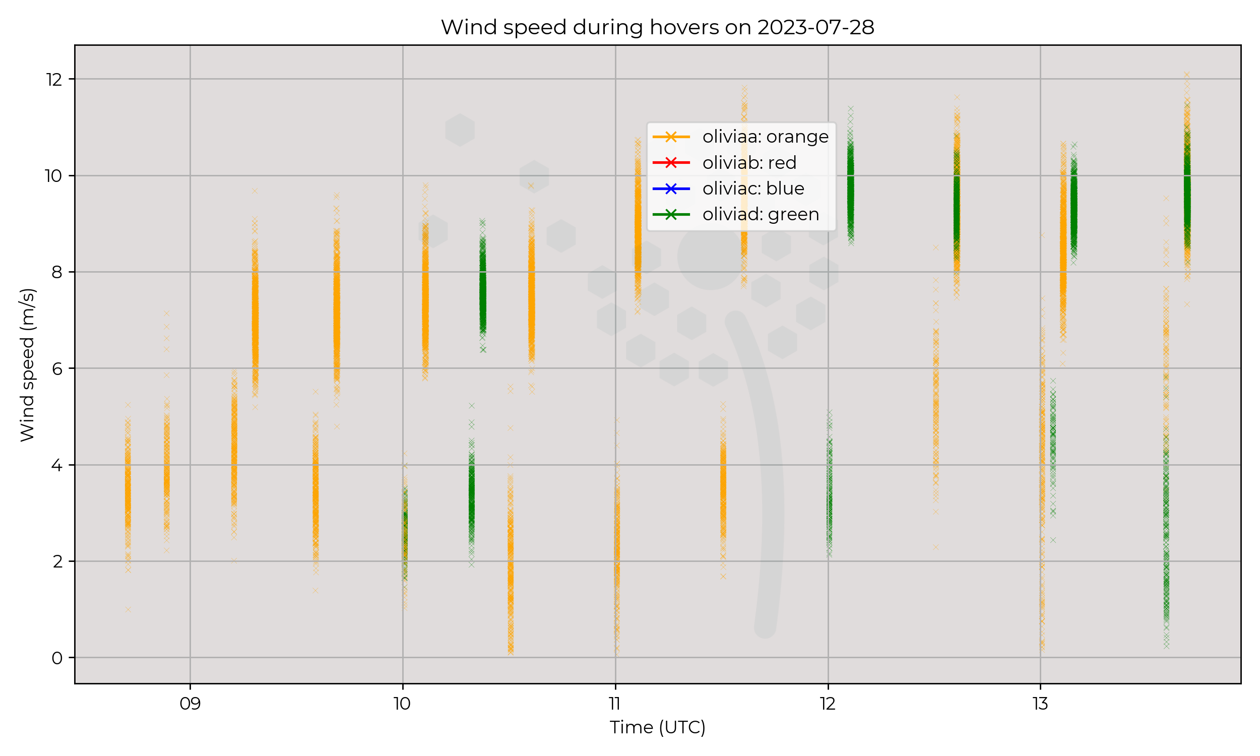
Ground to 2 km AGL profiles at 6 m s-1 ascent speed, every 30 minutes. Some profiles have two UAS flying synchronously, 30 metres apart.
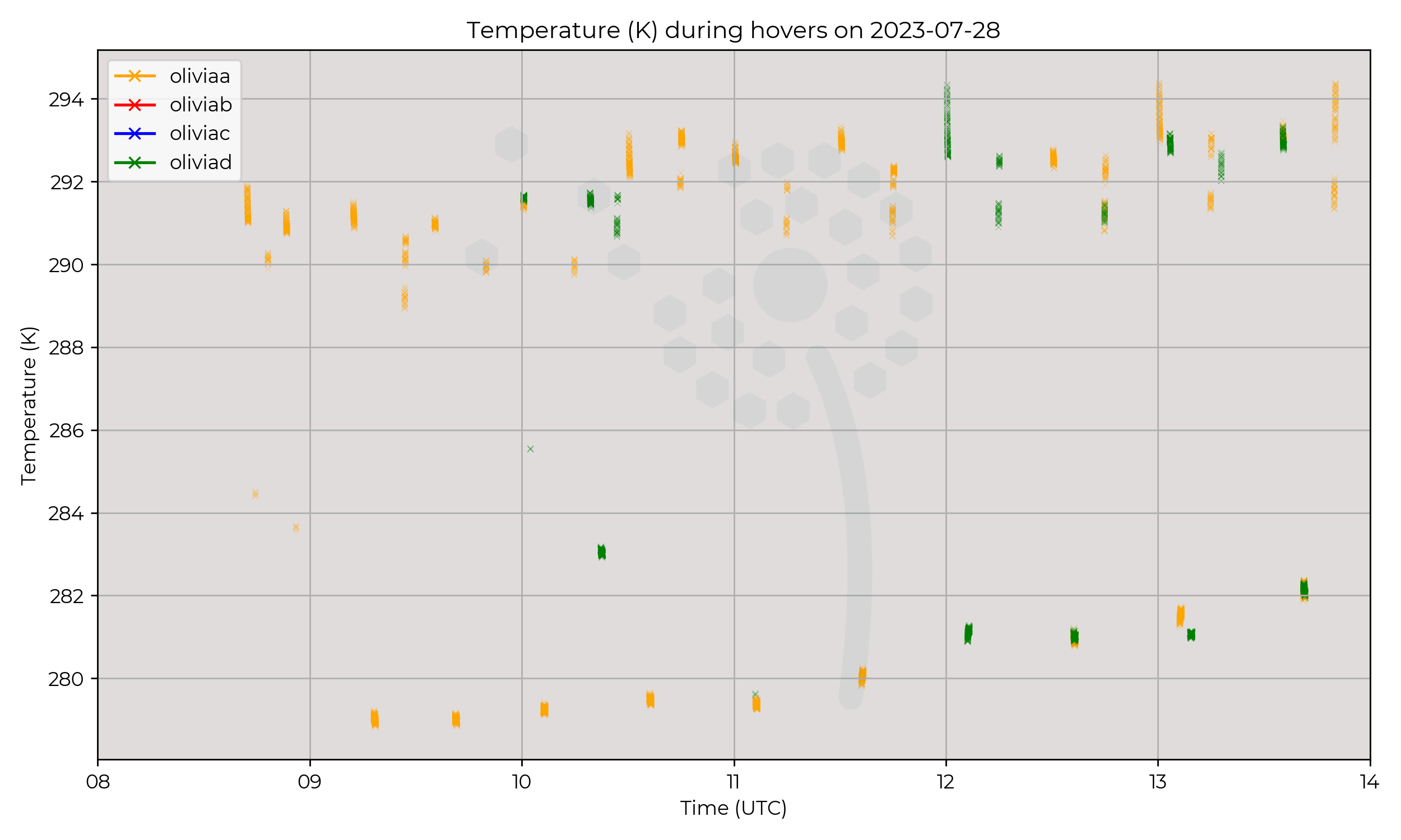
Flights at 10 UTC (up to 1.1 km), 11 UTC, and 12–14 UTC profiles include data from Olivia-D (green).
The flight at 12 UTC only had Olivia-D (green) flying, but all other 30-minute profiles had Olivia-A (orange) airborne.
360º video footage of the synchronous flights from on-board the wxUAS are available upon request, and show cloud structure at the BL inversion.
Observations
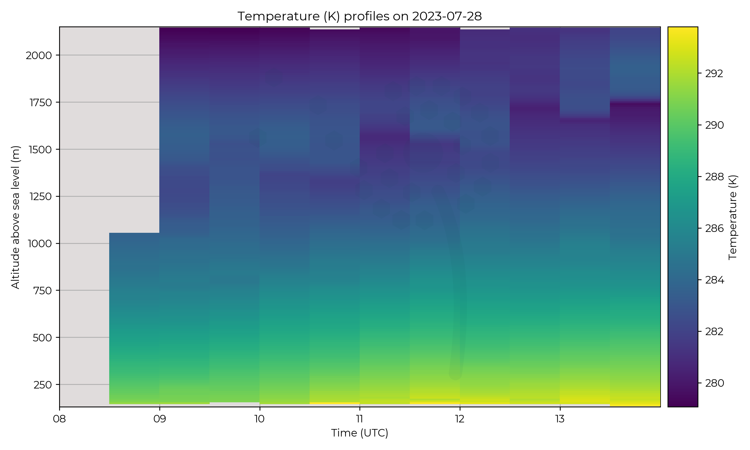
A steadily-increasing boundary layer inversion starting at 1.4 km (09 UTC) and
ascending to 1.7 km by 14 UTC, with a few perturbations throughout the day.
The inversion itself was greater than 5 ºC throughout the IOP.
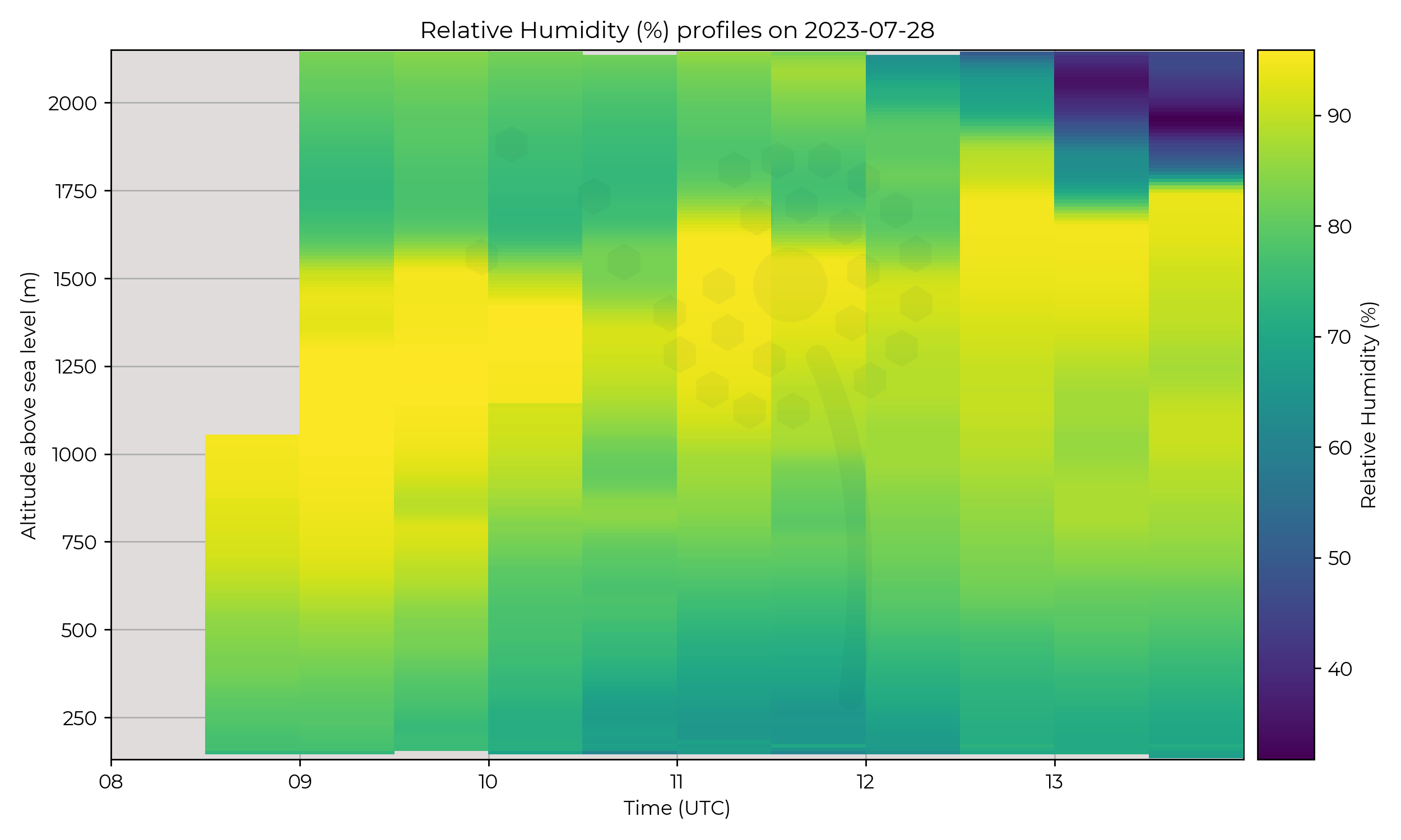
The RH plot shows that clouds were trapped by the inversion,
and after 12 UTC the region above the inversion became very dry (< 35% RH).
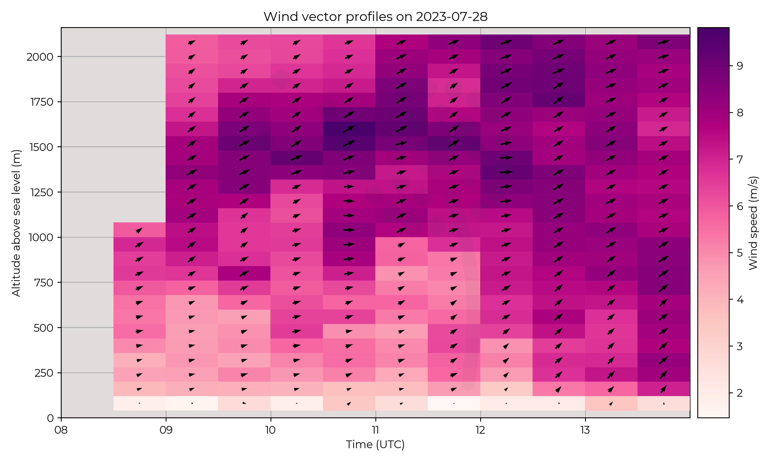
Higher winds of 8–9 m s-1 followed the height of the inversion until 11 UTC when
the region appeared to descend. At the same time the surface wind direction became more southerly.
Known Issues
- The profile at 10 UTC has a sharp change in RH at 1.1 km AMSL. This is because two wxUAS were flying, one wxUAS (Olivia-D, green) paused and returned to land which captured more datapoints at this altitude whilst it exited a cloud.
2023-07-27
2023-07-26
2023-07-25
2023-07-24
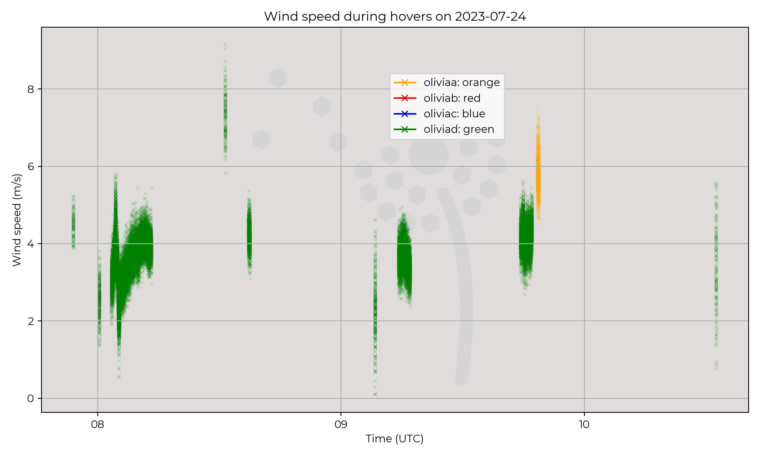
Synoptic Overview
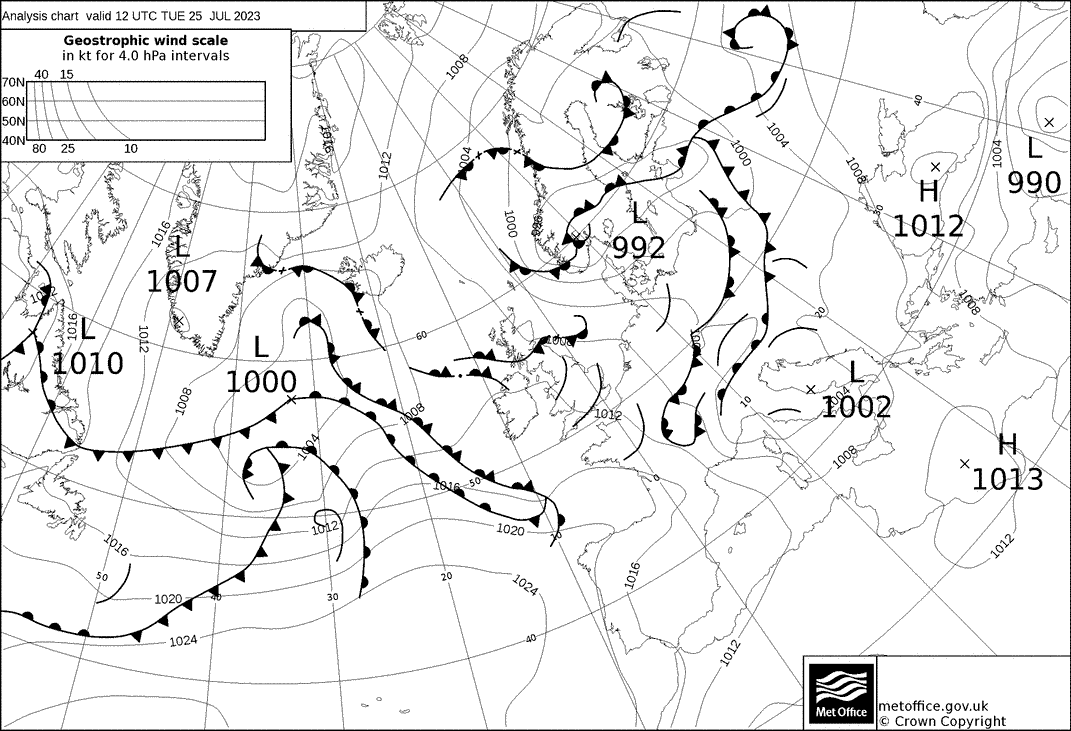
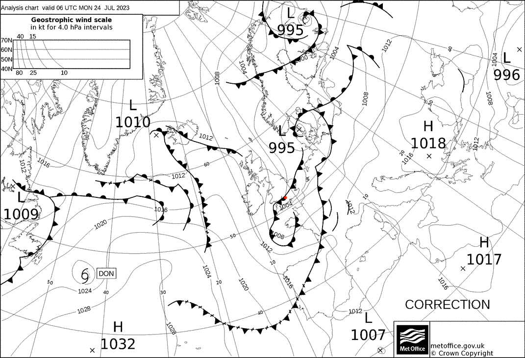
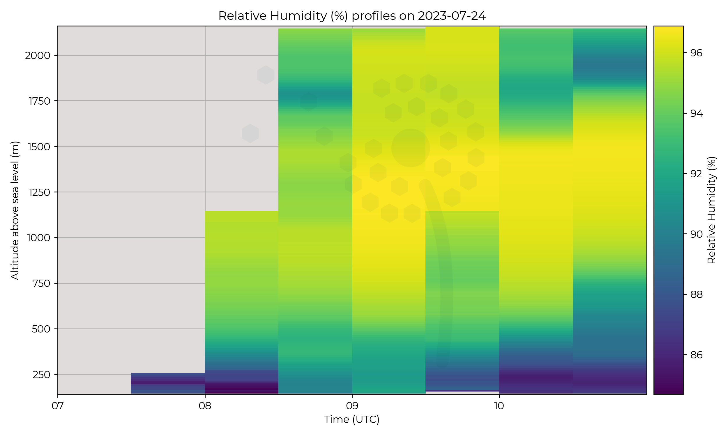
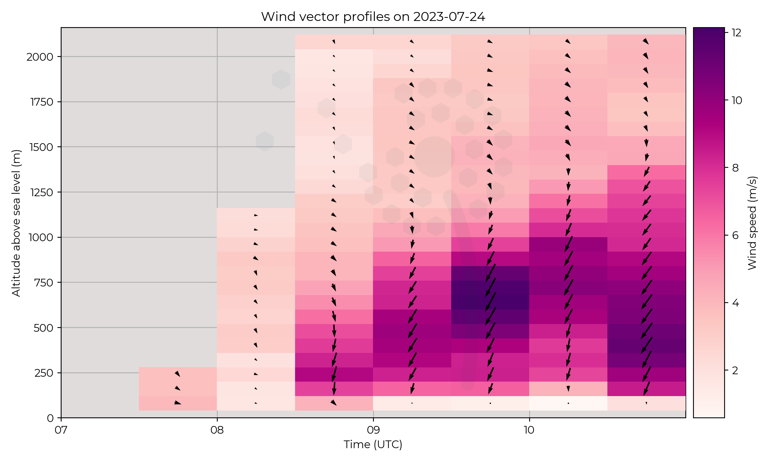
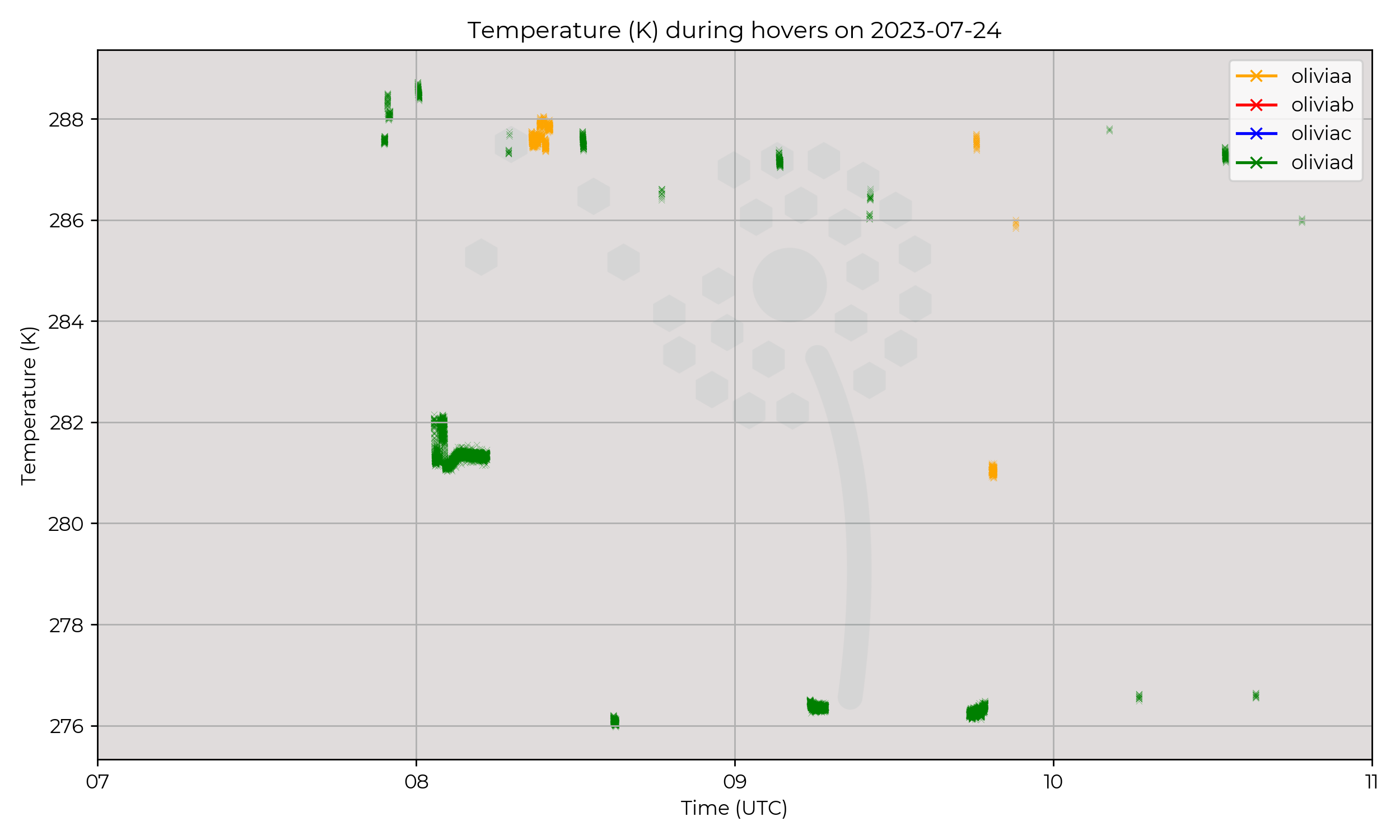
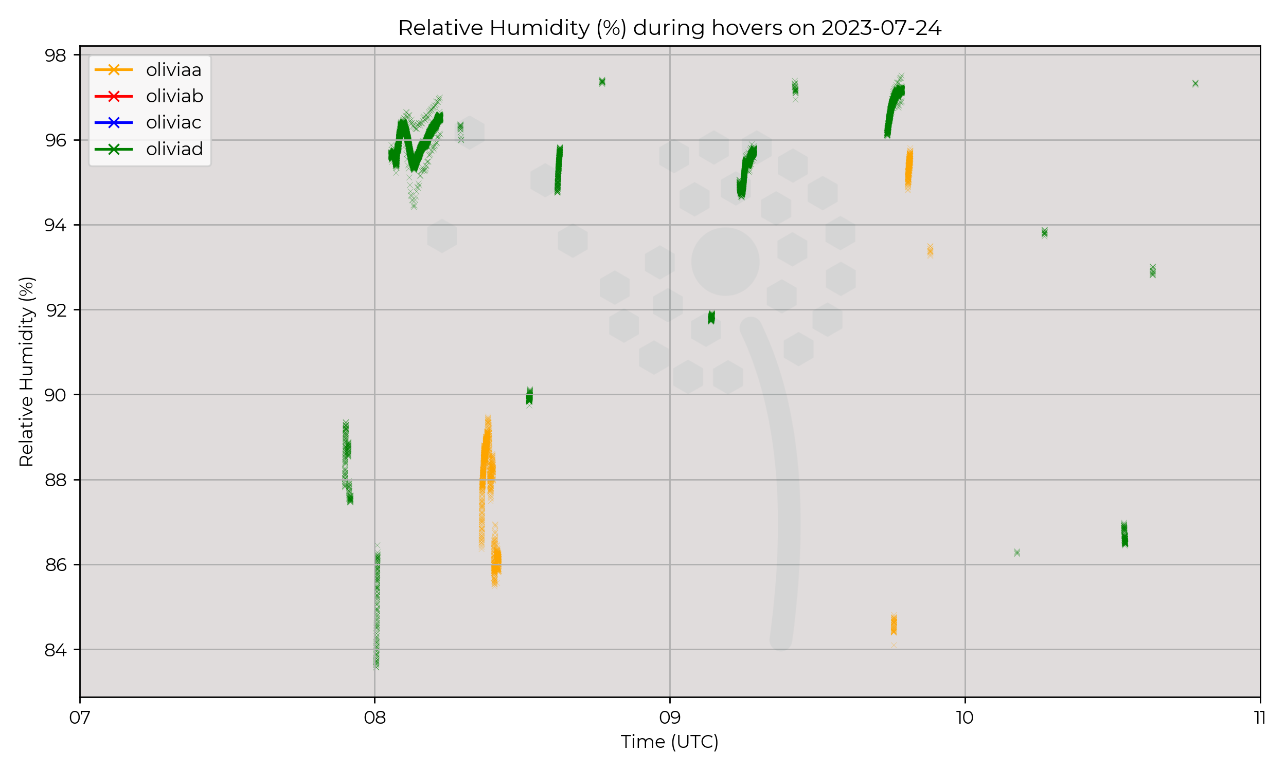
Slow passage of occluded front.
Flight Patterns
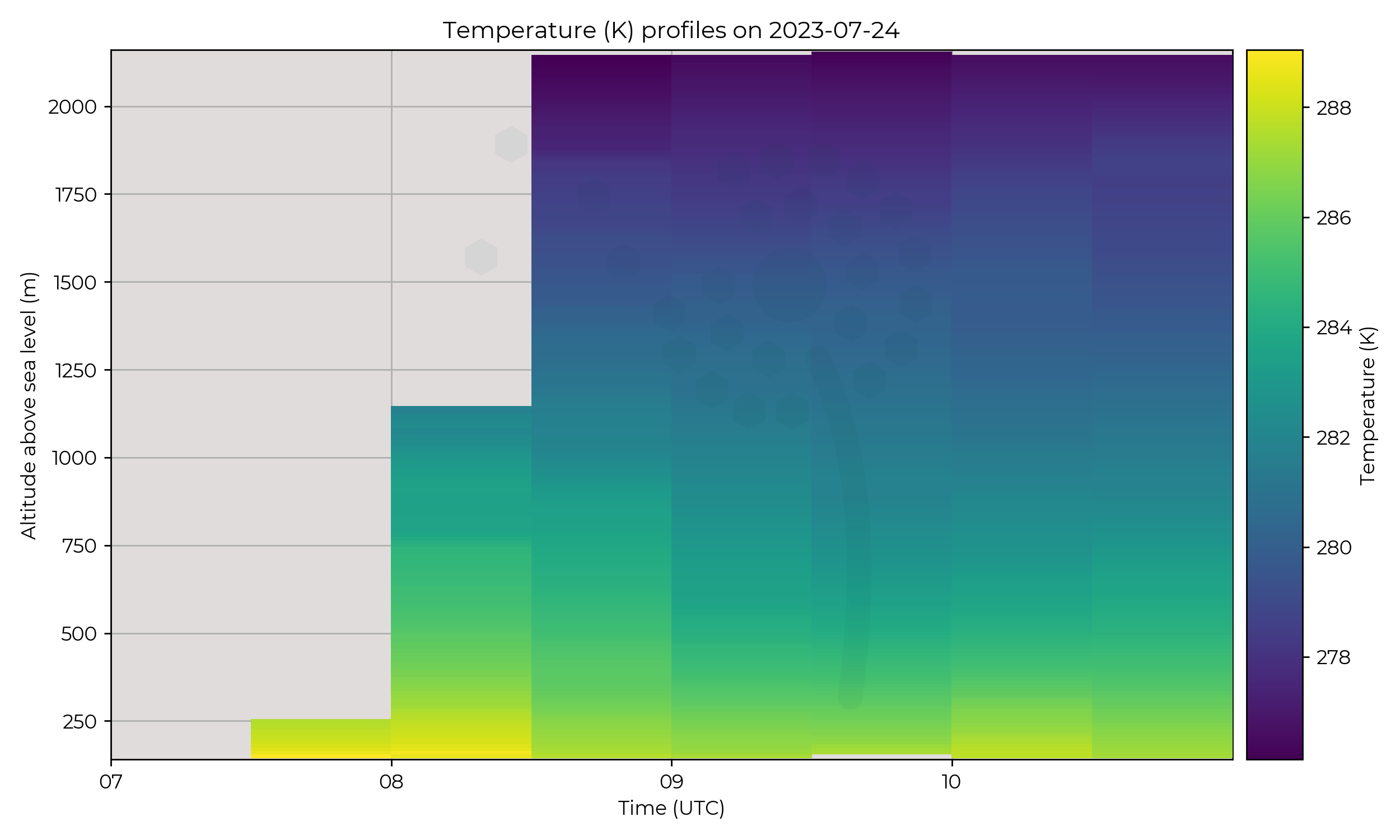
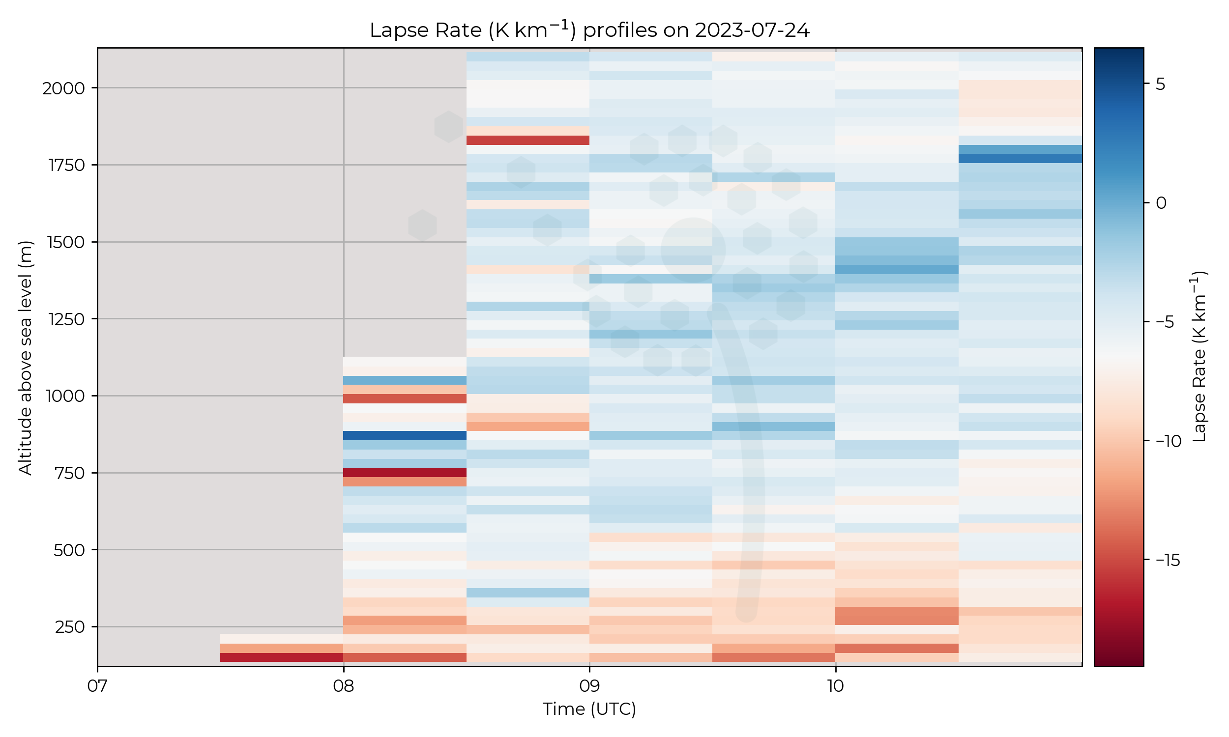
Ground to 2 km AGL profiles at 6 m s-1 ascent speed, every 30 minutes. Hours of operation between 07:30 to 11:00.
Observations
Interesting wind profile, development of strong wind band below / within cloudy region, but no change in temperature; may relate to the movement of the occluded front. Also a sharp humidity boundary in 09:30 profile.
Known Issues
- Wind conditions made UAV piloting dangerous, early finish to day
Week 5
2023-07-21
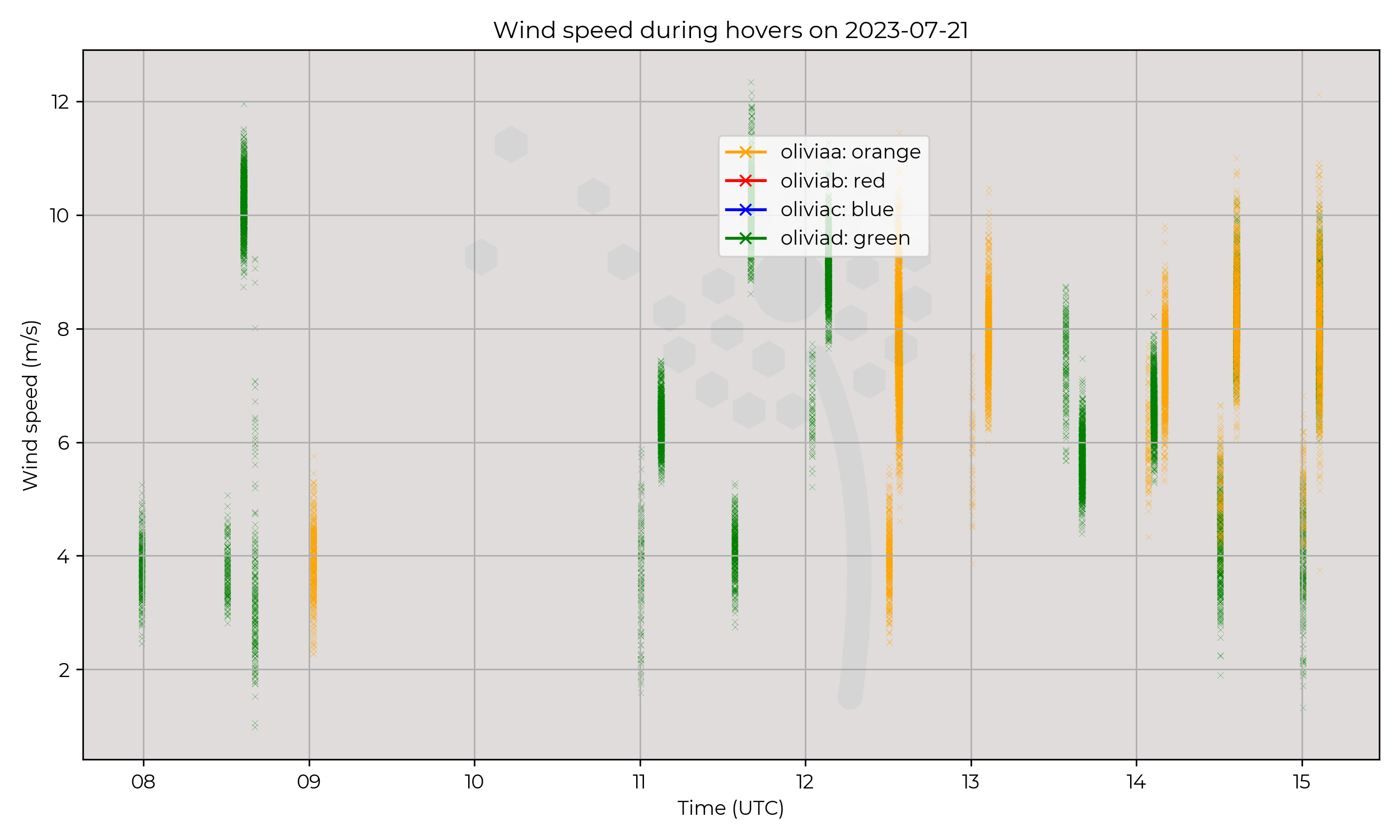
Synoptic Overview
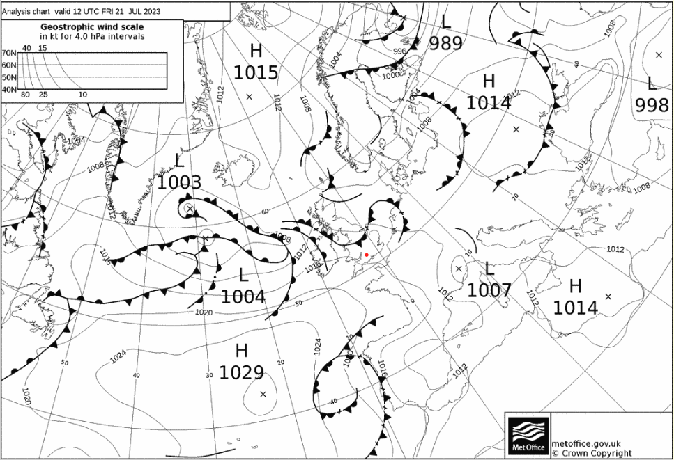
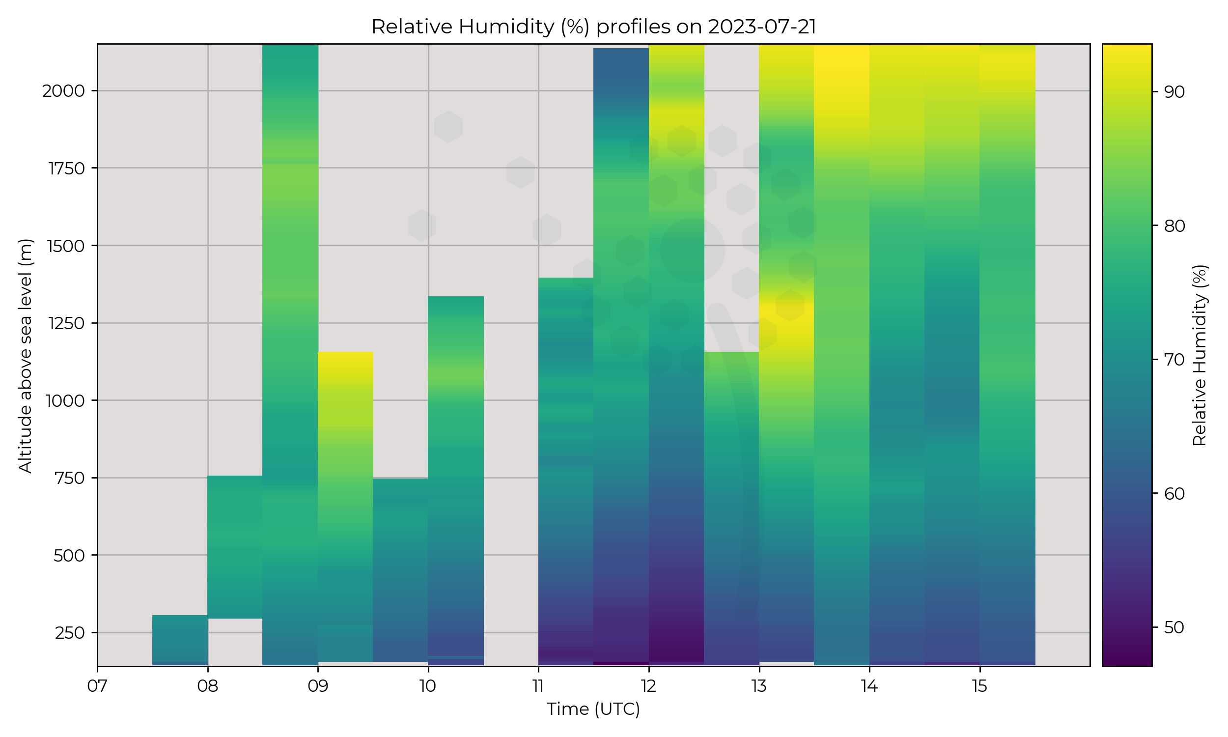
Dissipating warm front moving from the North of England south / east. Multiple warm fronts approaching the UK from the west.
Flight Patterns
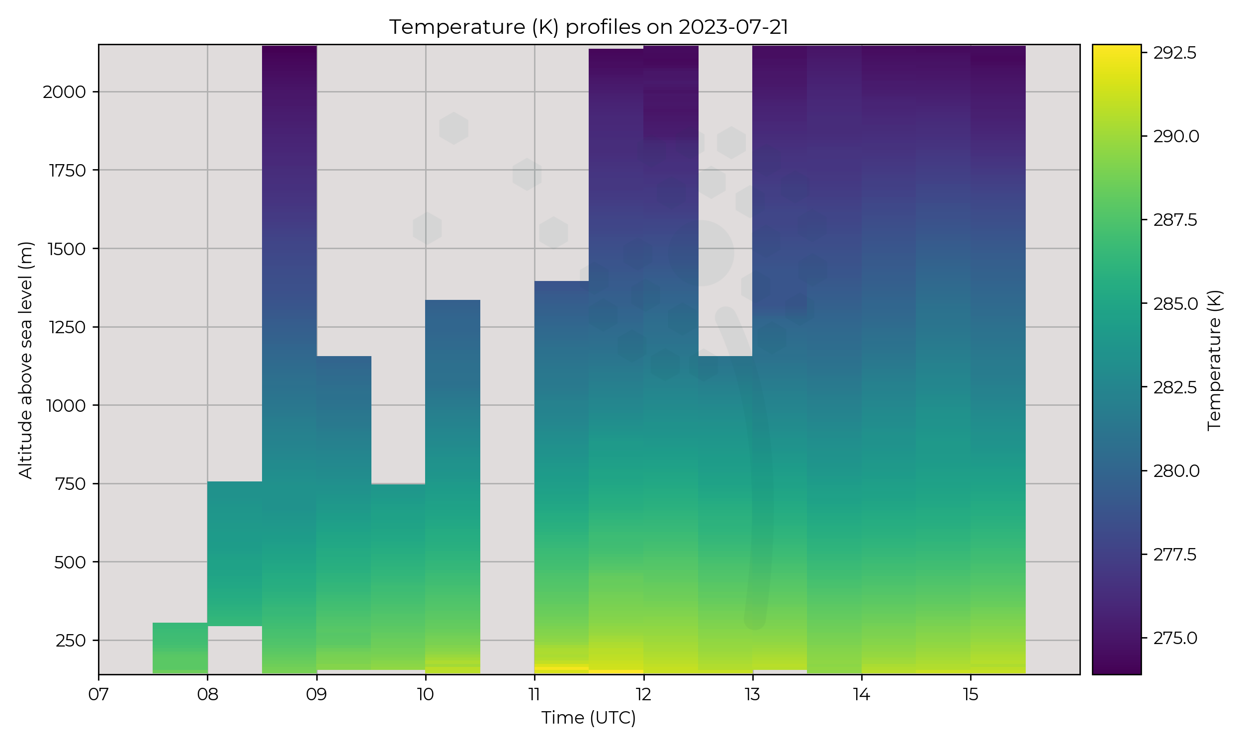
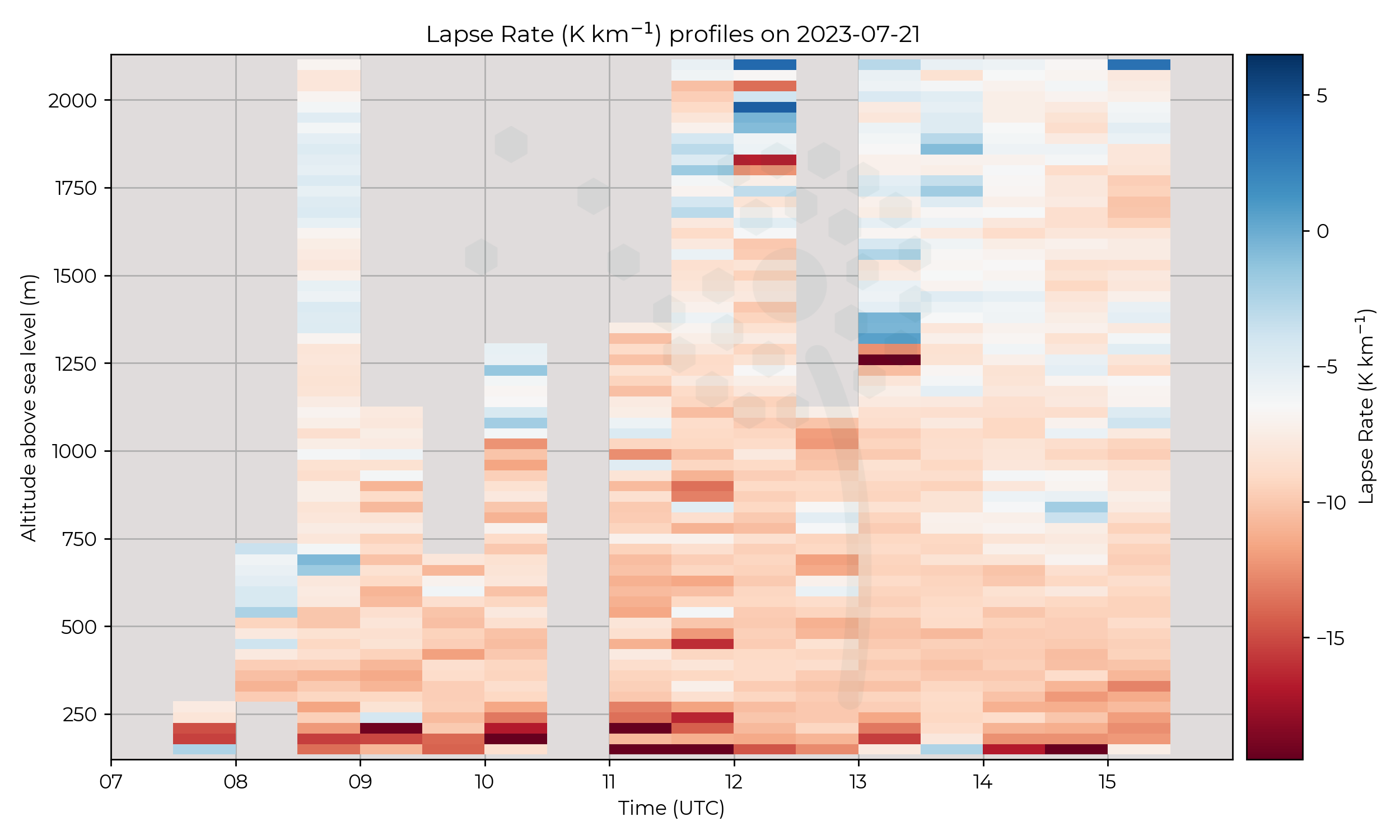
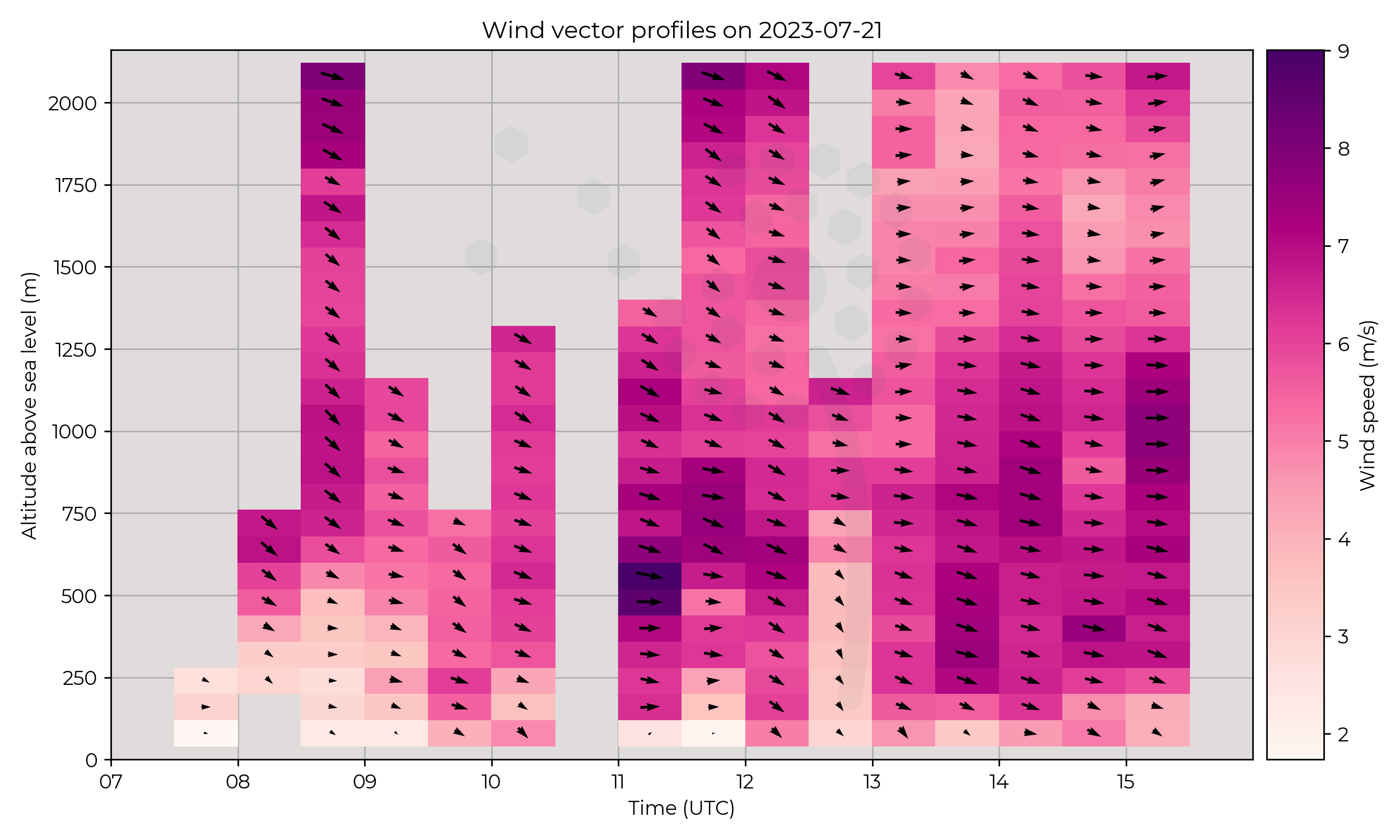
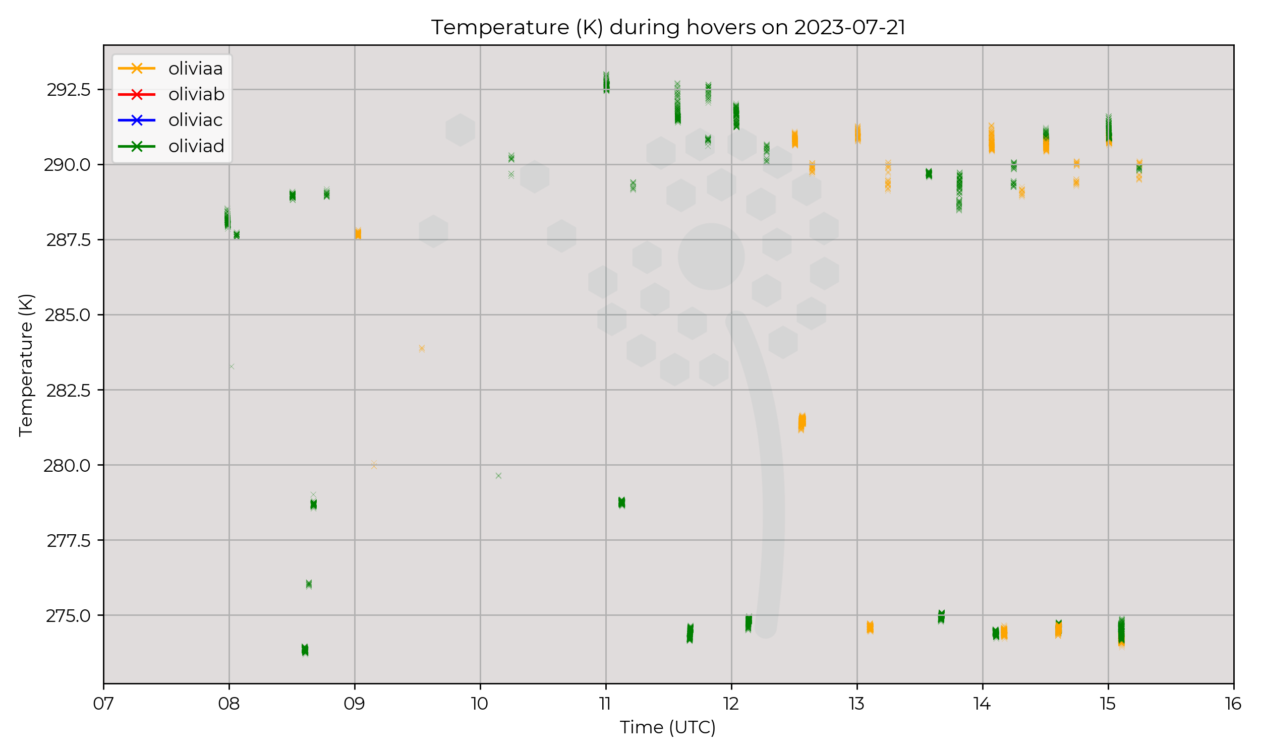
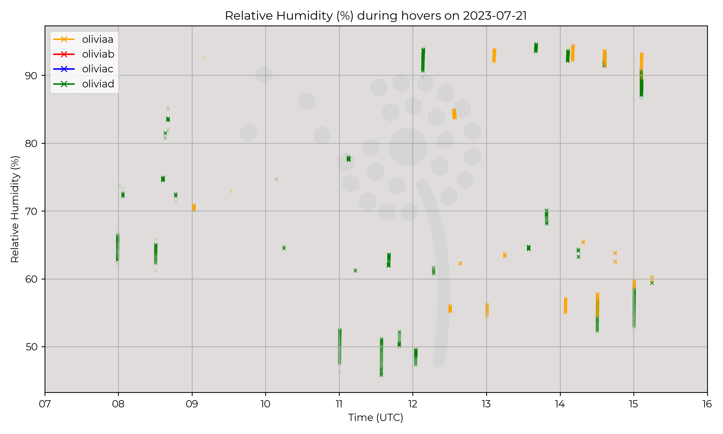
2km profiles every 30 mins at Breach Hill site, between 07:30 to 15:30 UTC.
Observations
Slightly windy day, two layers of cloud forming at different altitudes and dissipating, at ~1000 to 1250 m and at 2000 m. Faint signals of developing planetary boundary layer in the lapse rate of profiles.
Known Issues
- Issues with Olivia A connection to GCS.
- Standard proceedures allowed an approaching component failure to be detected before it occured in-flight. Drones grounded after 1500 UTC flight out of an abundance of caution. Issue was investigated over the weekend and components were replaced in time for Monday operations.
2023-07-20
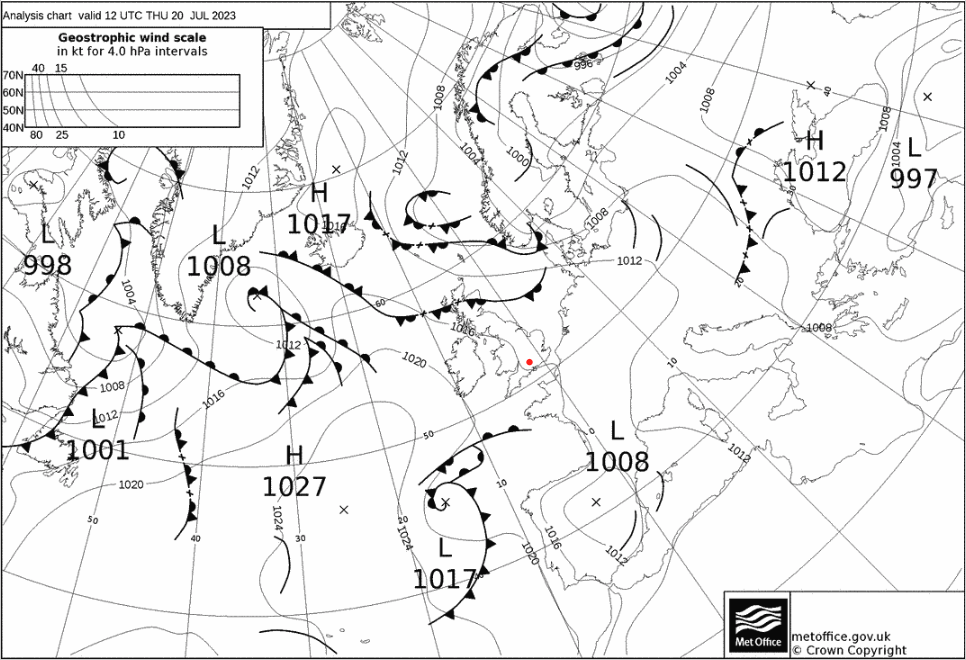
Synoptic Overview
No significant synoptic patterns in proximity to Chilbolton.
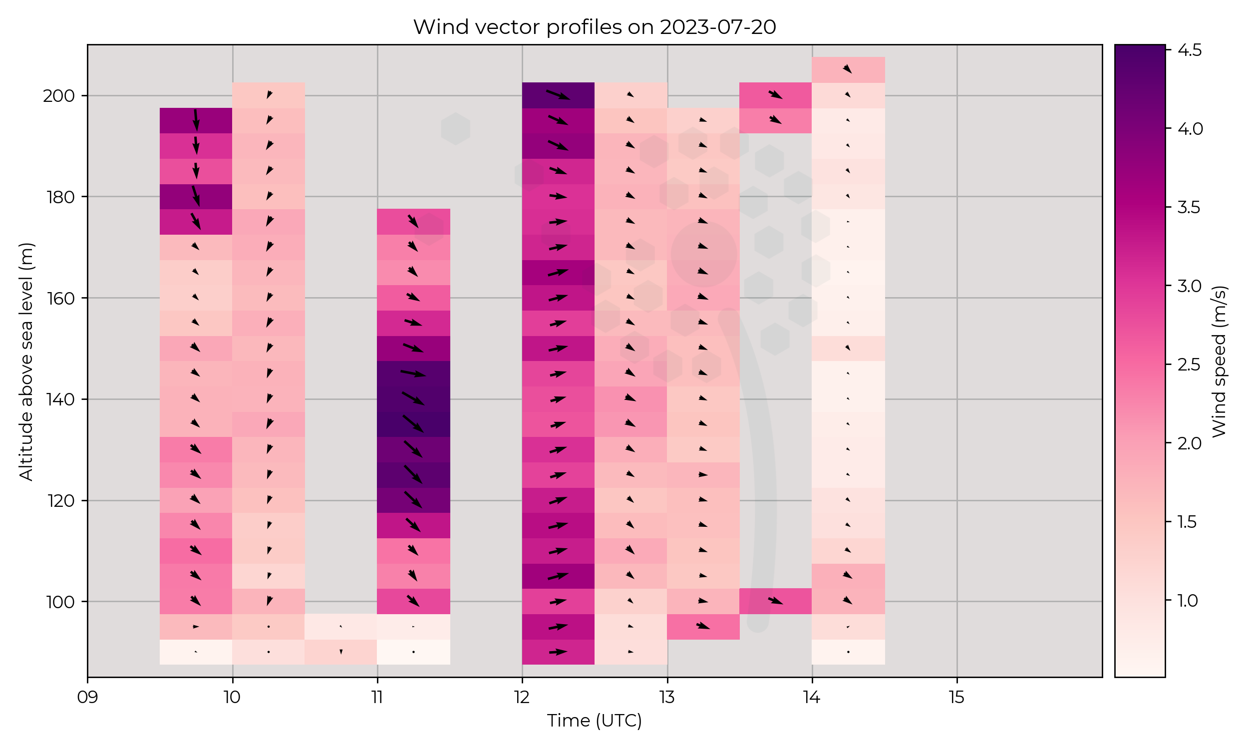
Flight Patterns
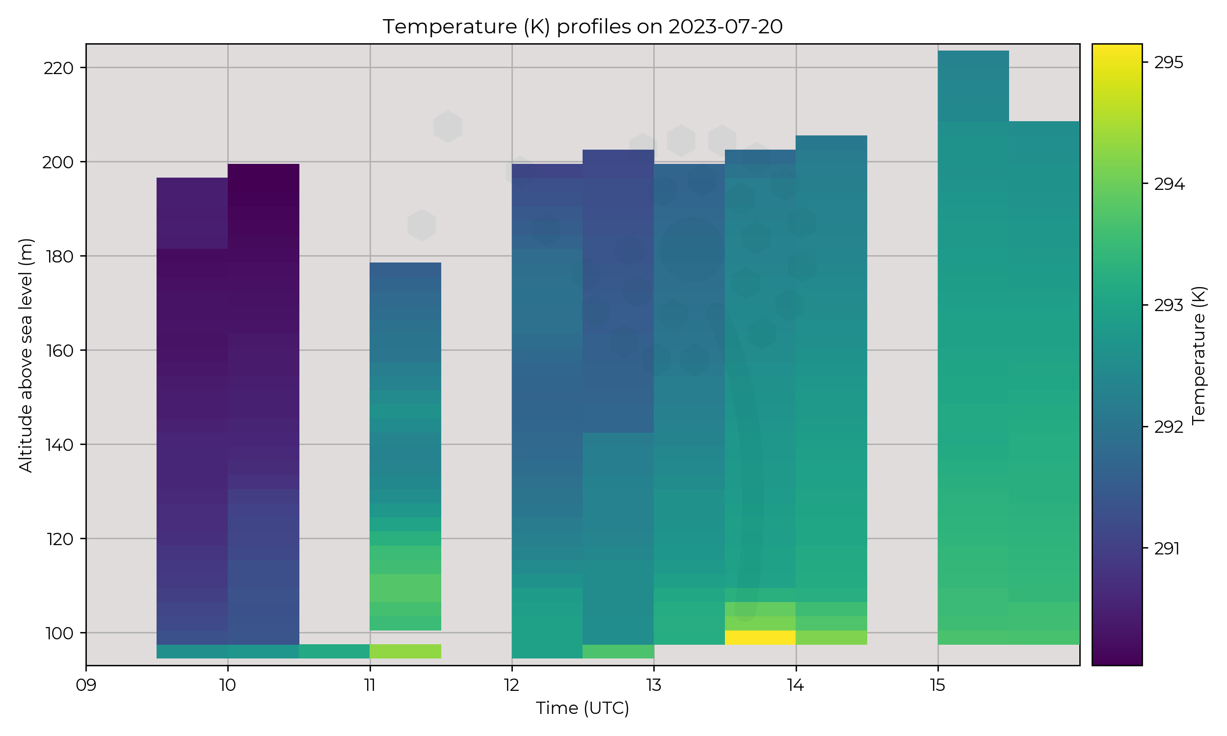
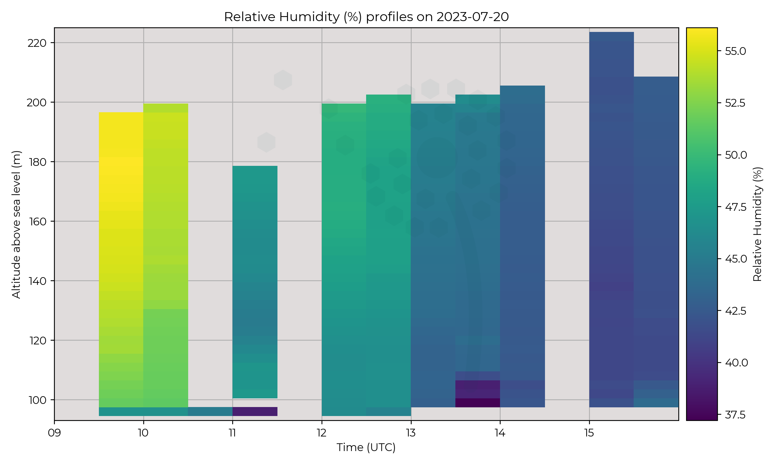
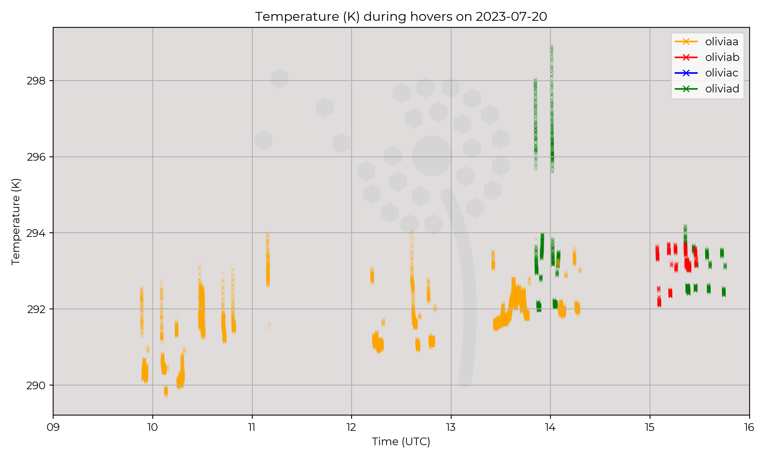
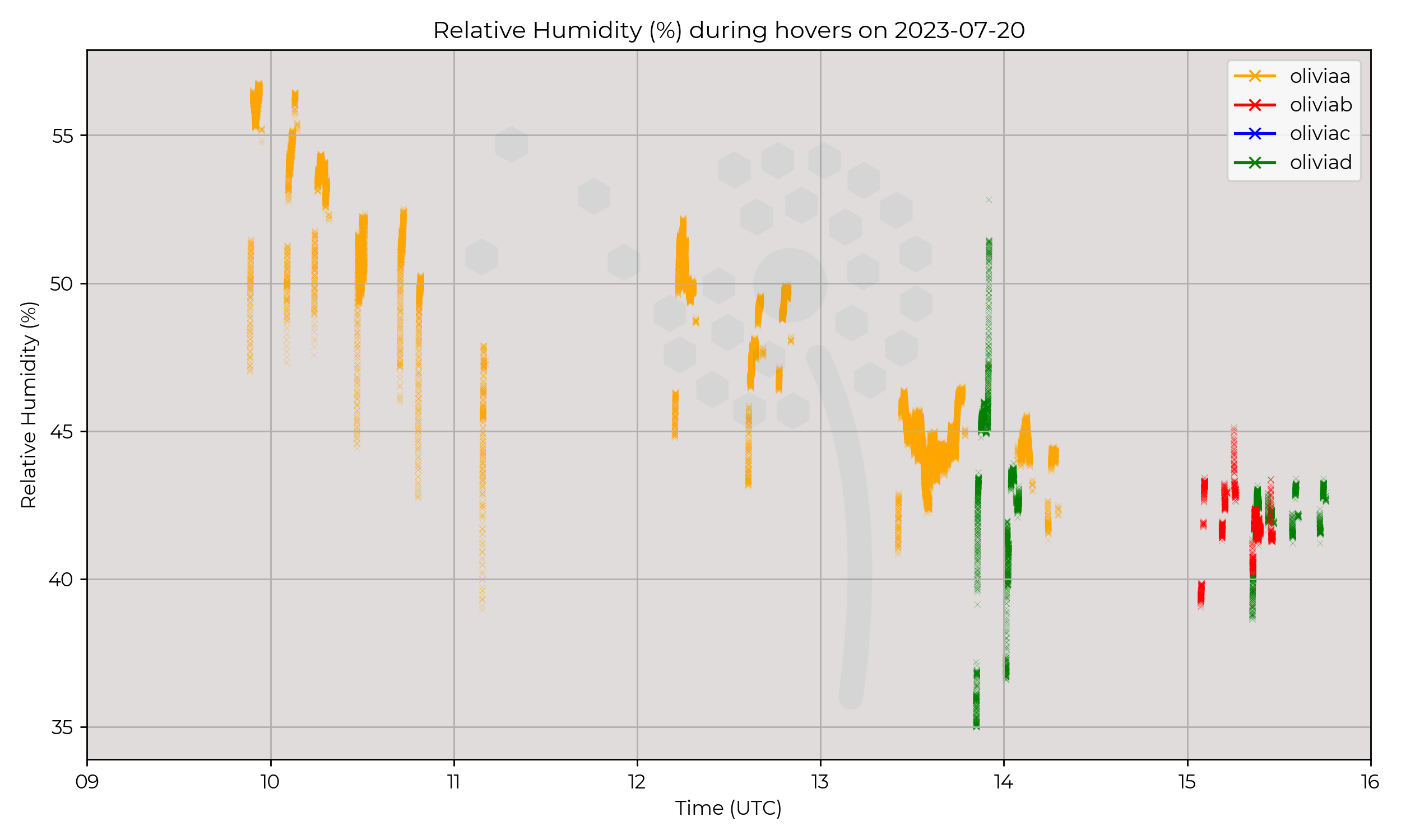
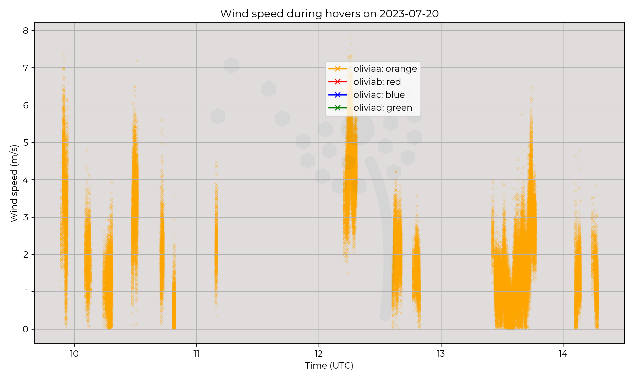
120m hovers with Olivia A, between 09:30 to 16:00. Olivia B and Olivia D were undergoing repairs, being test flown (and gathered opportunistic data).
Observations
Nice day, drying and warming of vertical profile through measurements. Winds appear relatively calm.
Known Issues
- Patchy data in hover measurements.
- No wind measurements for Olivia B and Olivia D.
2023-07-19
Synoptic Overview
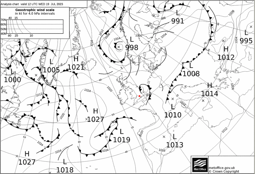
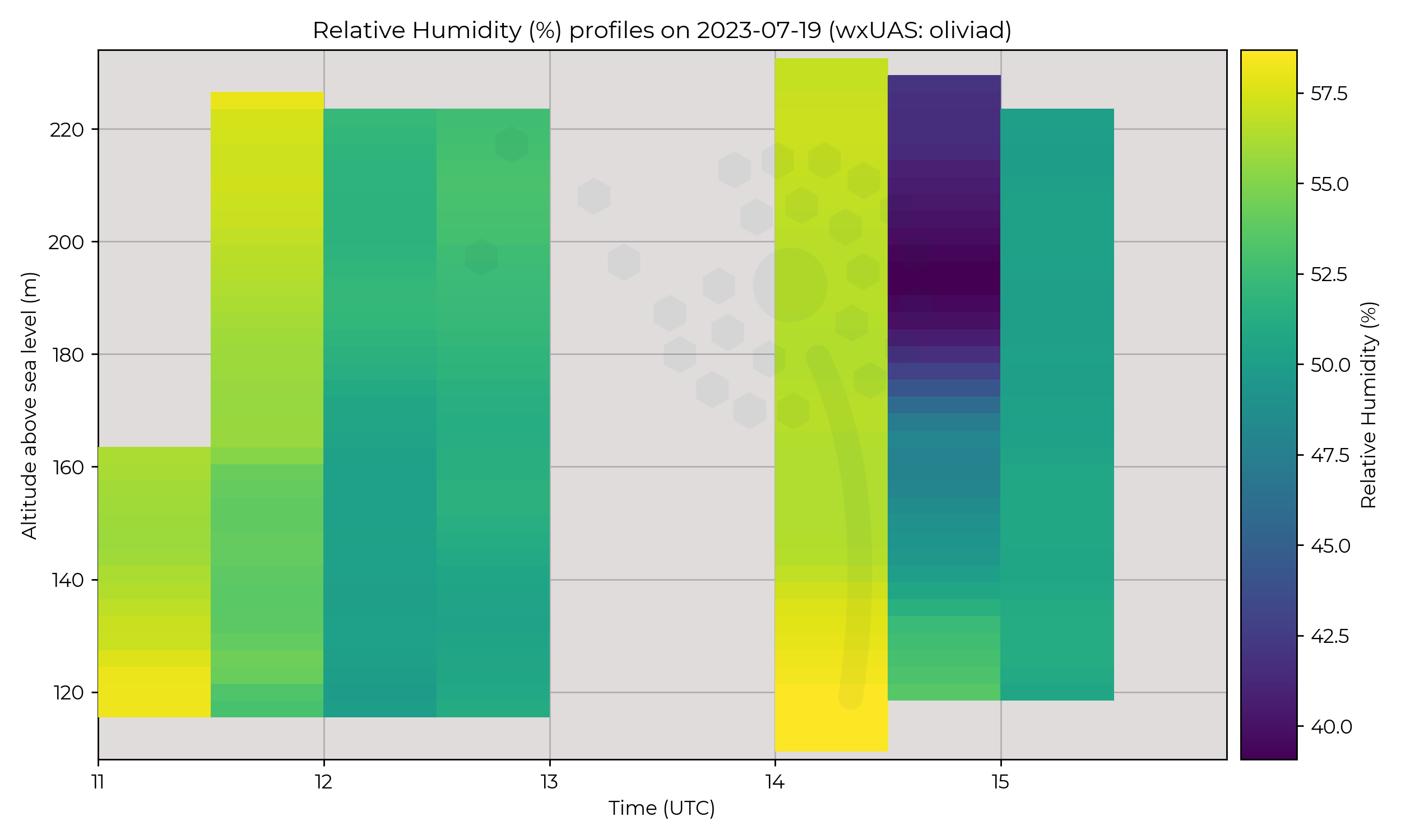
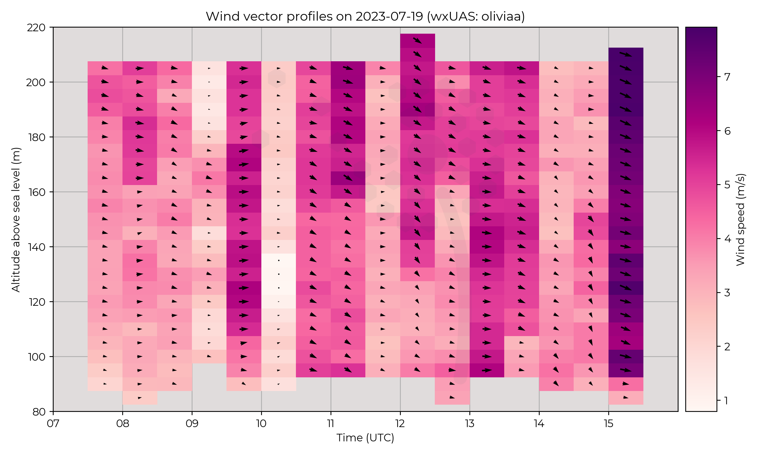
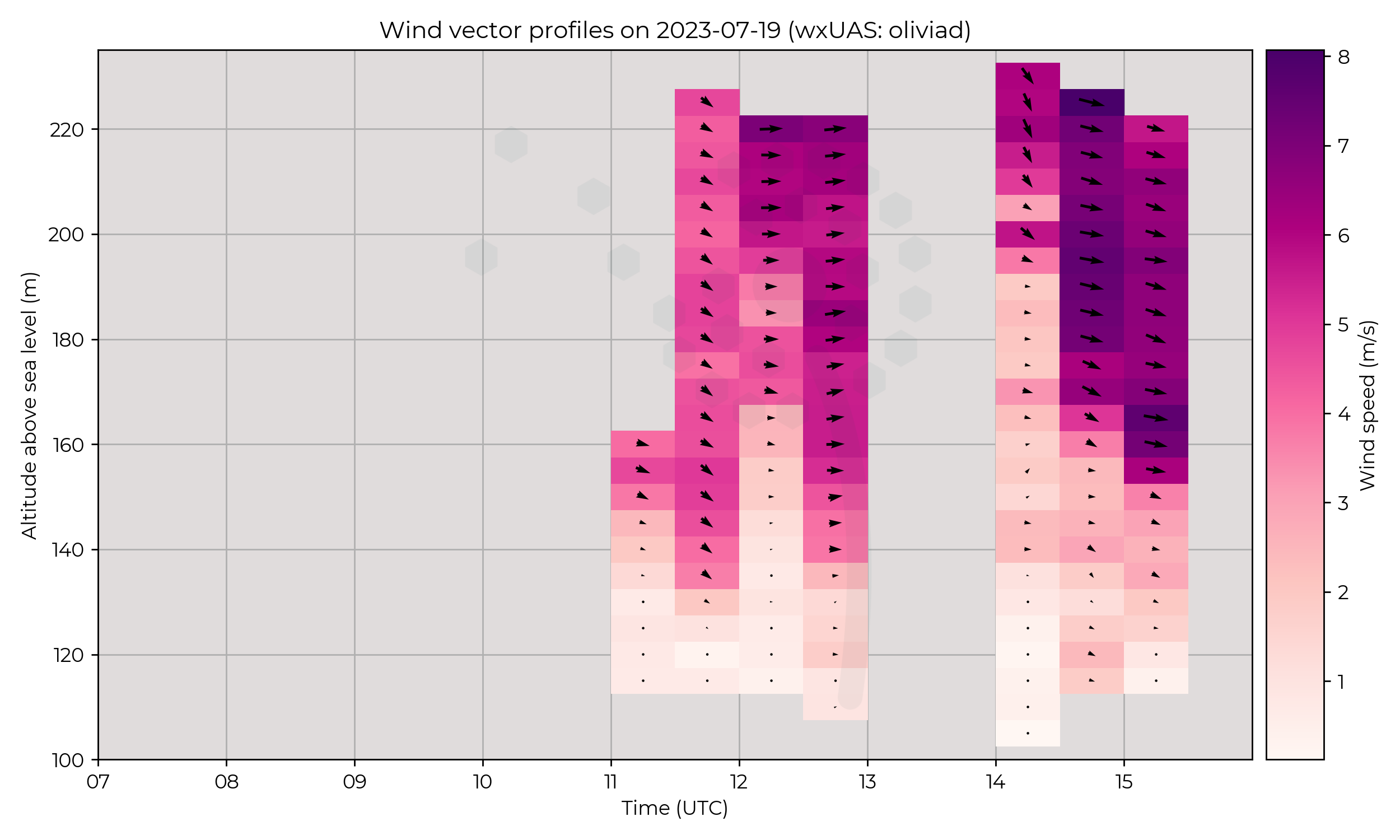
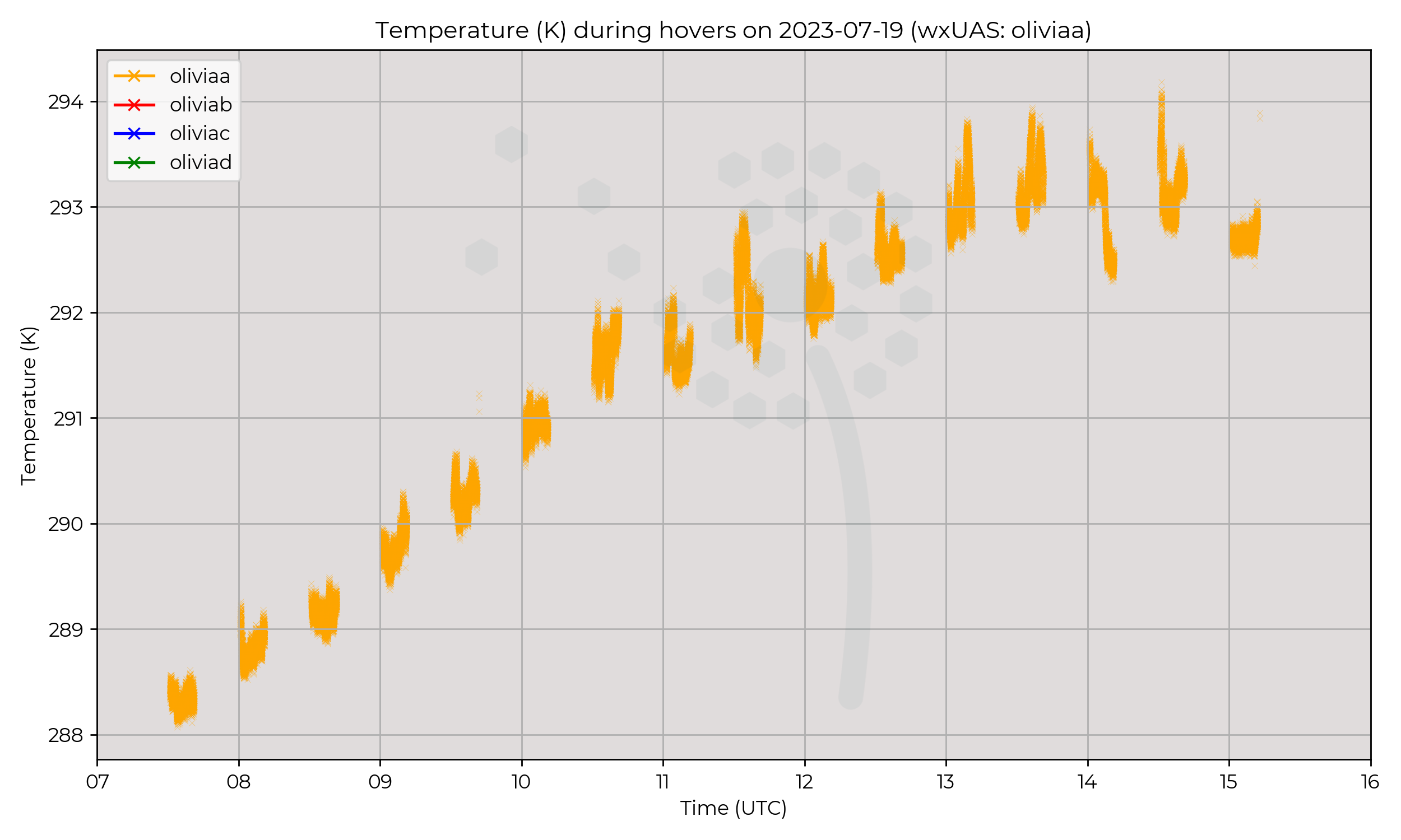
Passage of occluded front in morning, weakening in the afternoon. Pretty boring otherwise.
Flight Patterns
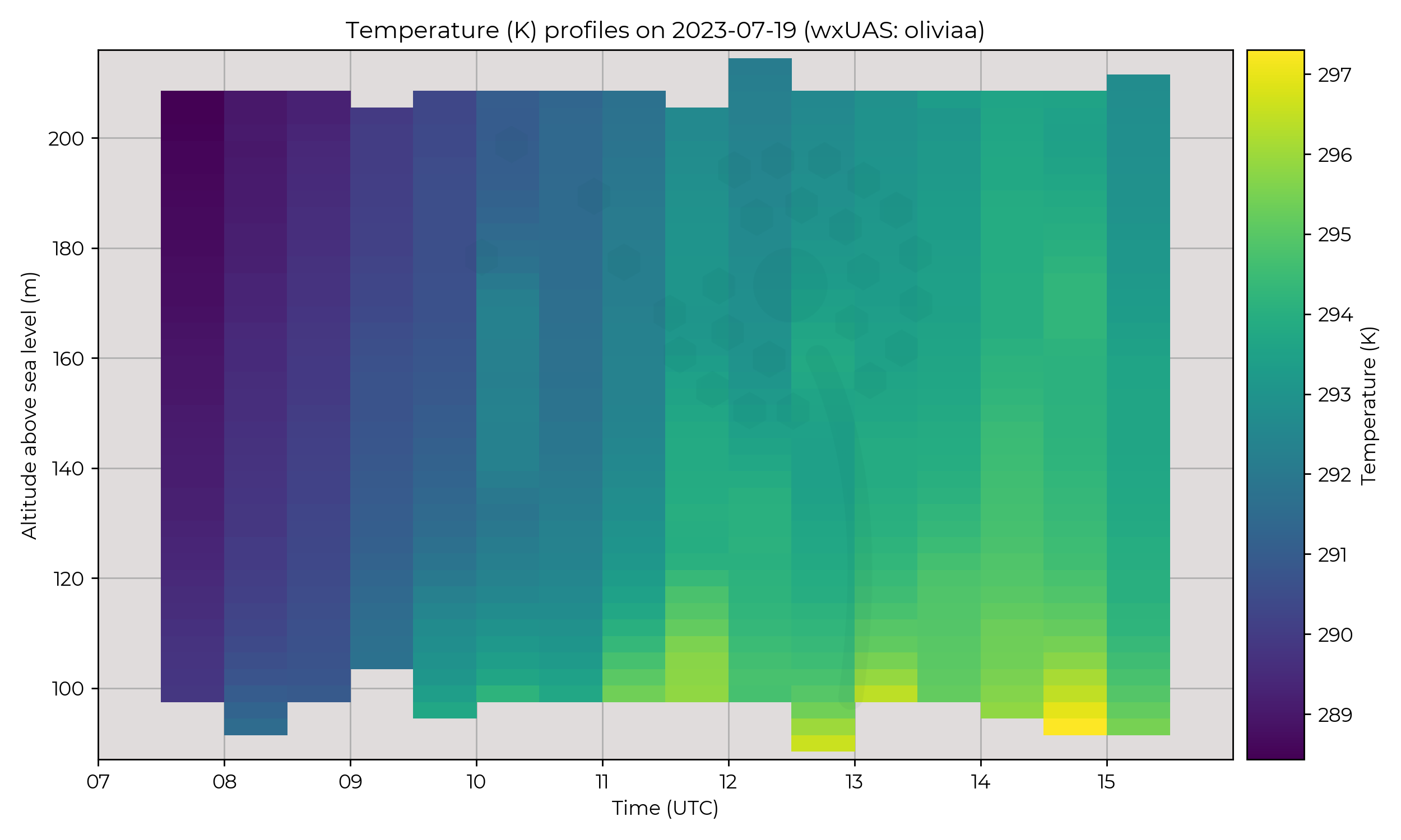
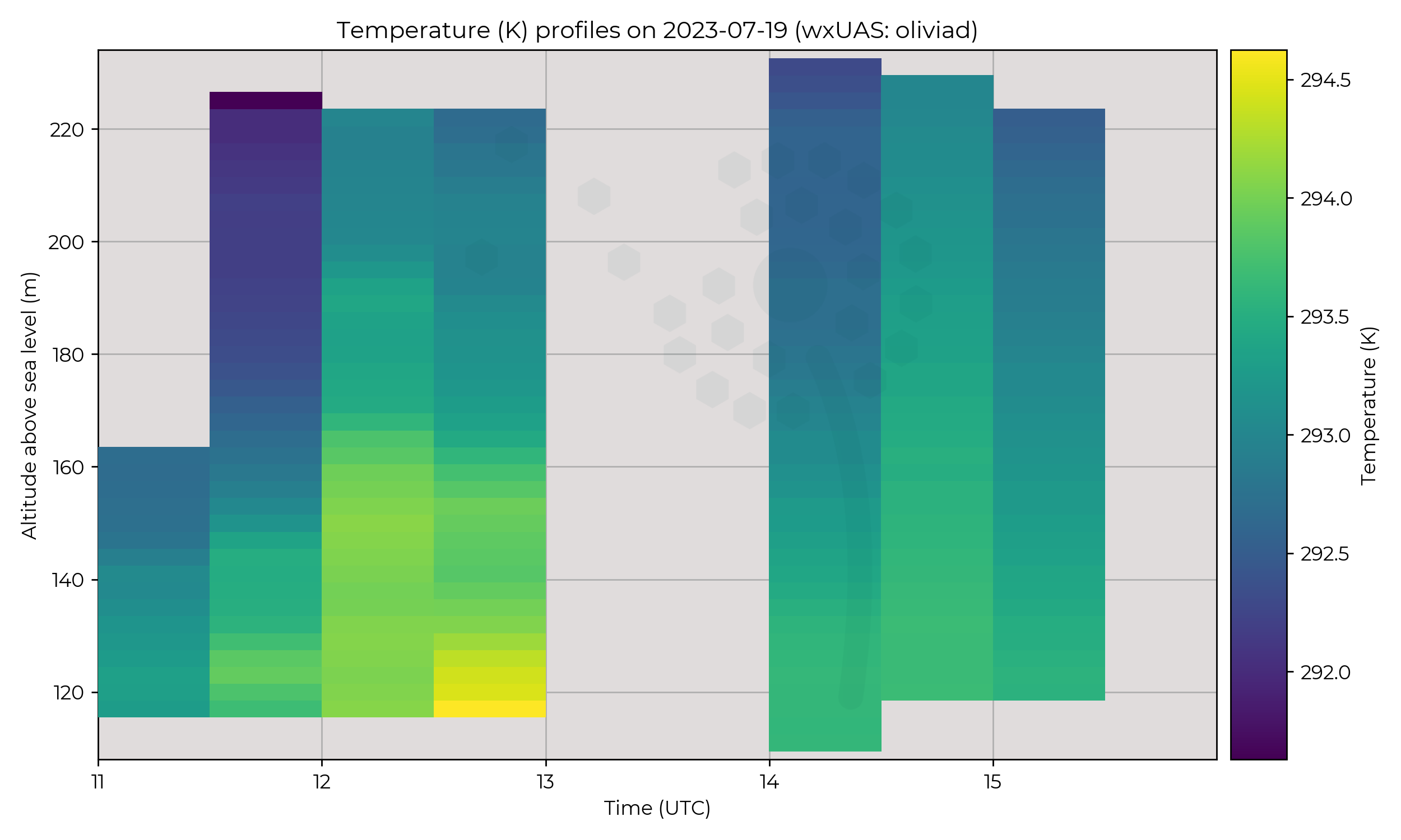
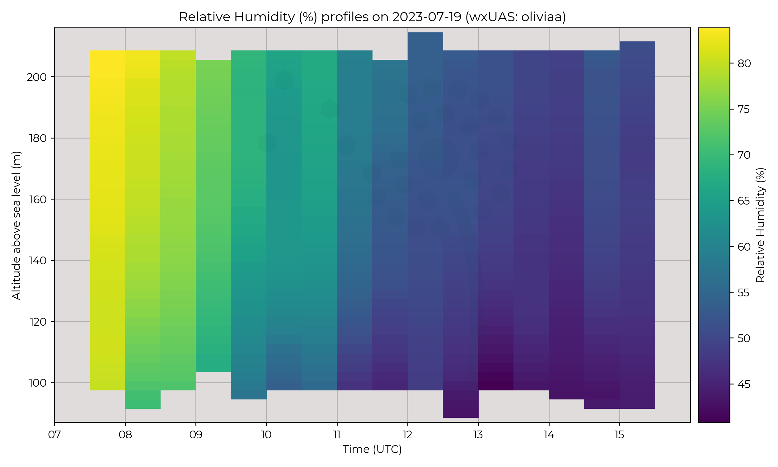
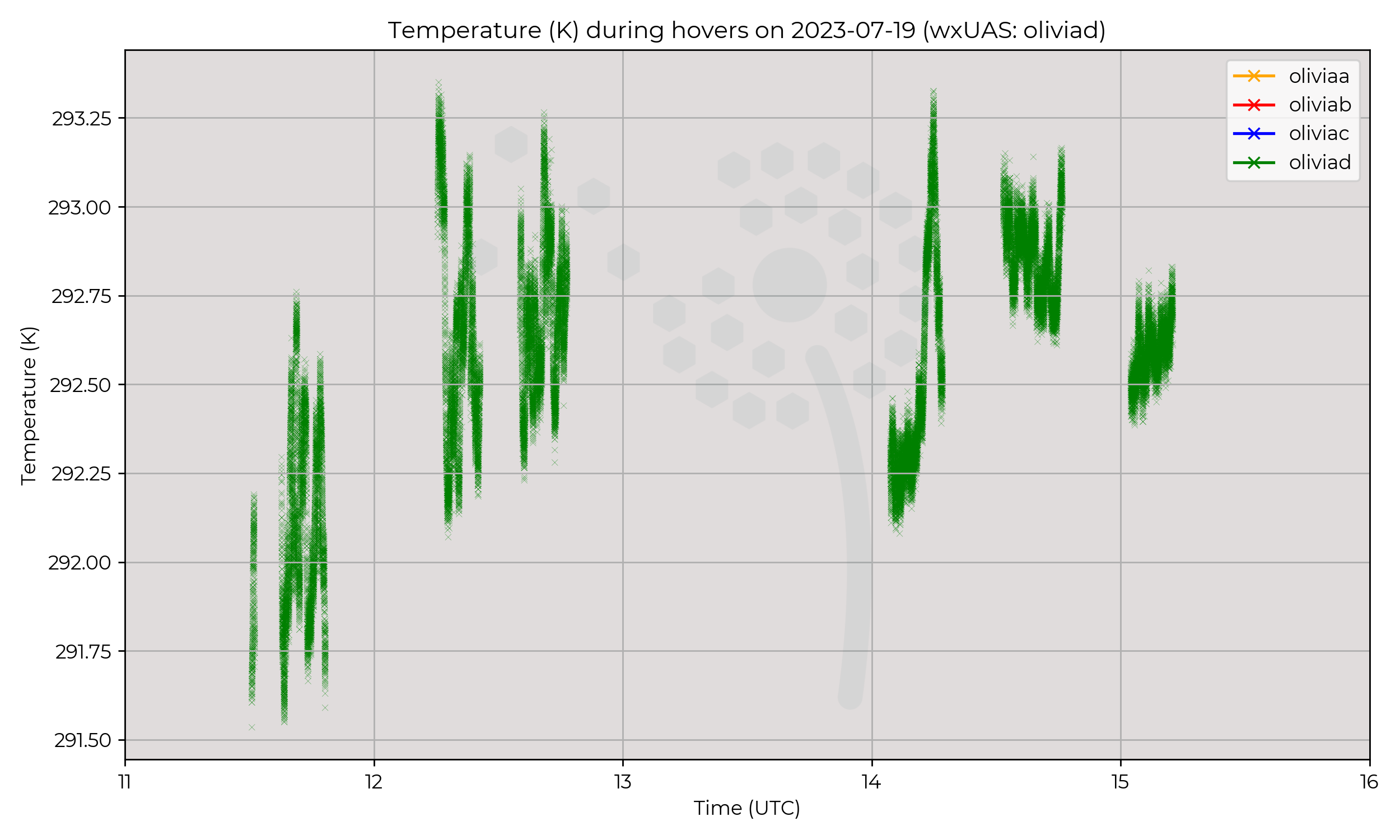
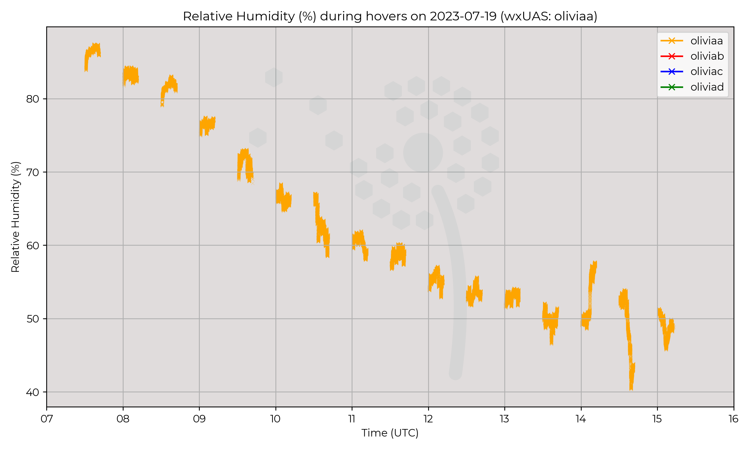
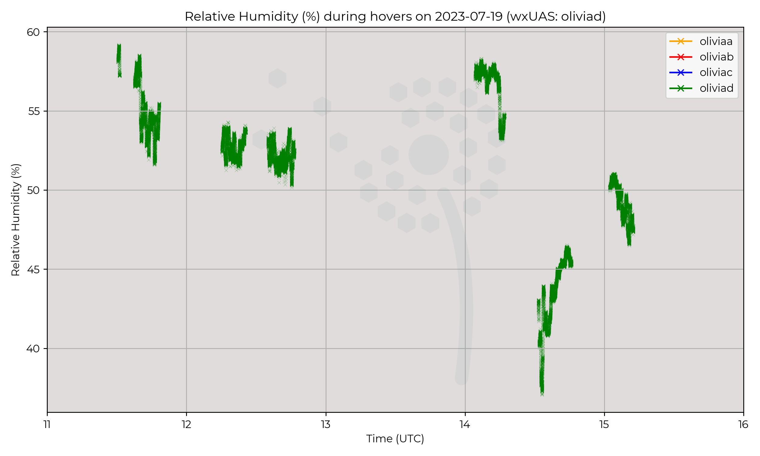
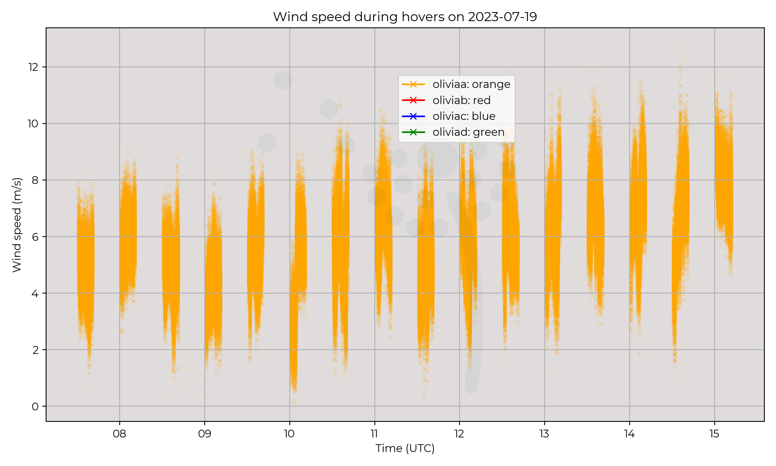
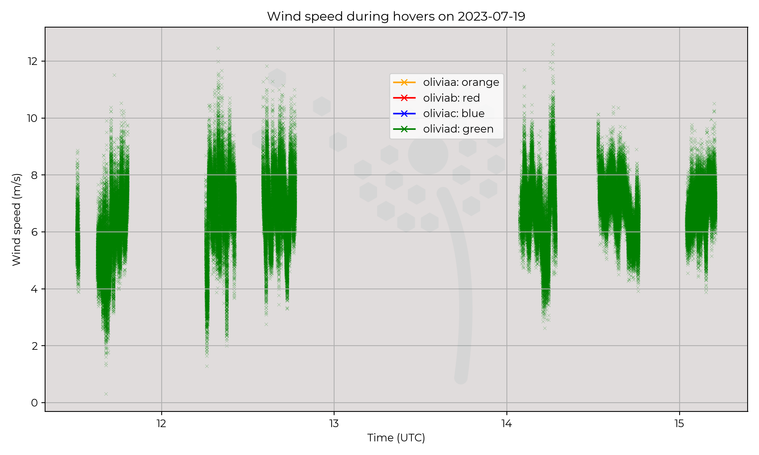
Two sites, Wherwell Forest (Olivia D) and Chilbolton (Olivia A), of 120m profiles every 30 minutes. Hours of operation between 07:30 to 15:30.
Observations
Profiles from Wherewell forest appear more humid throughout the day compared to Chilbolton. There is also a clear change in windspeed at the forest site, where the UAV reaches above the tree tops, around 130 m.
Known Issues
- Olivia D had issues with anemometer and data relaying.
2023-07-18
Synoptic Overview
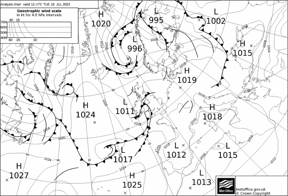
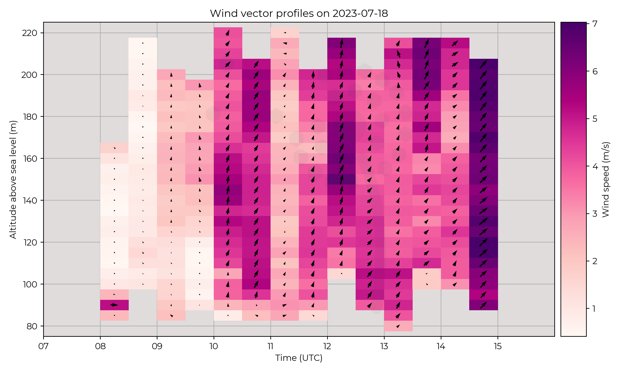
Area of low pressure to the West of Chilbolton, moving East and dissipating through the day.
Flight Patterns
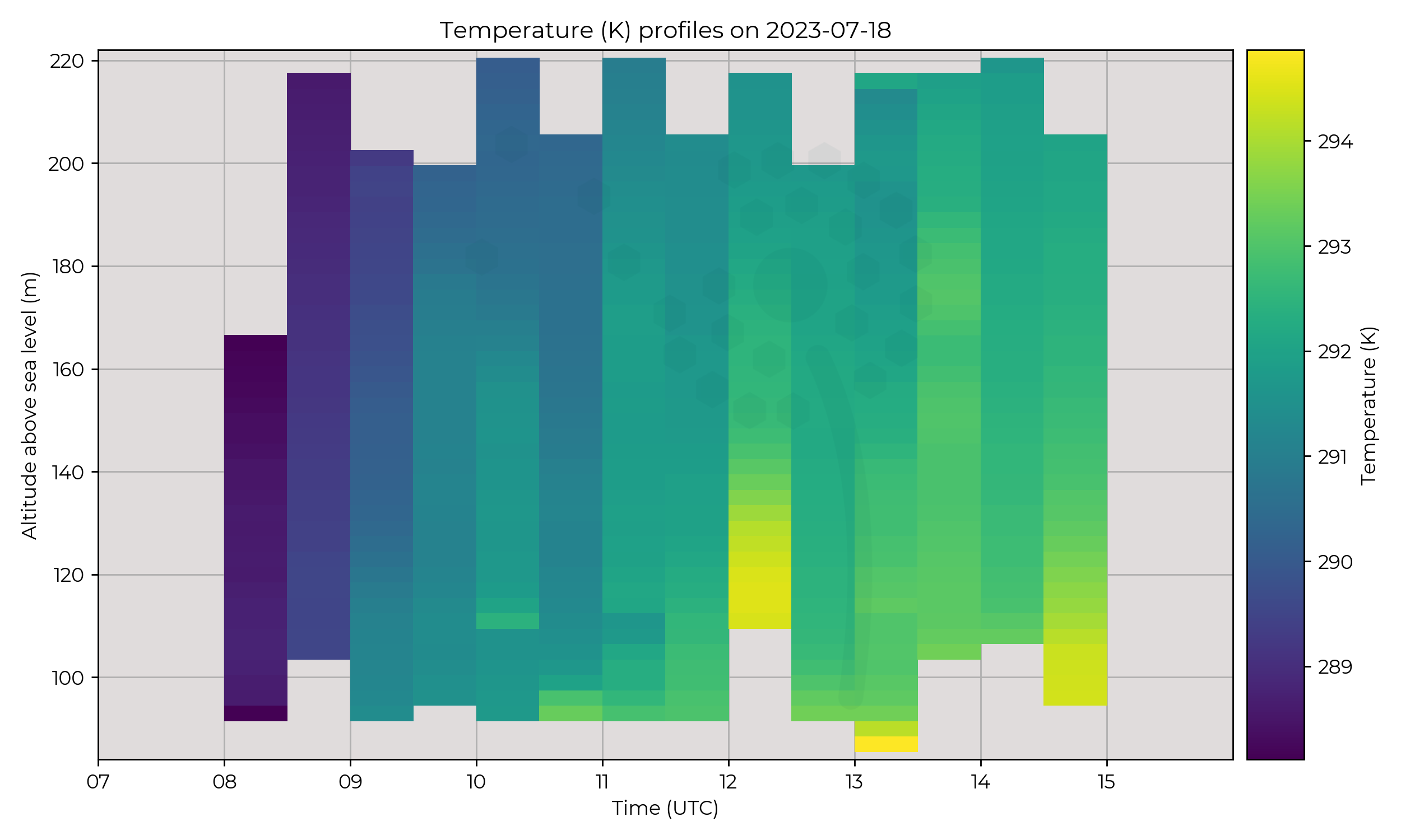
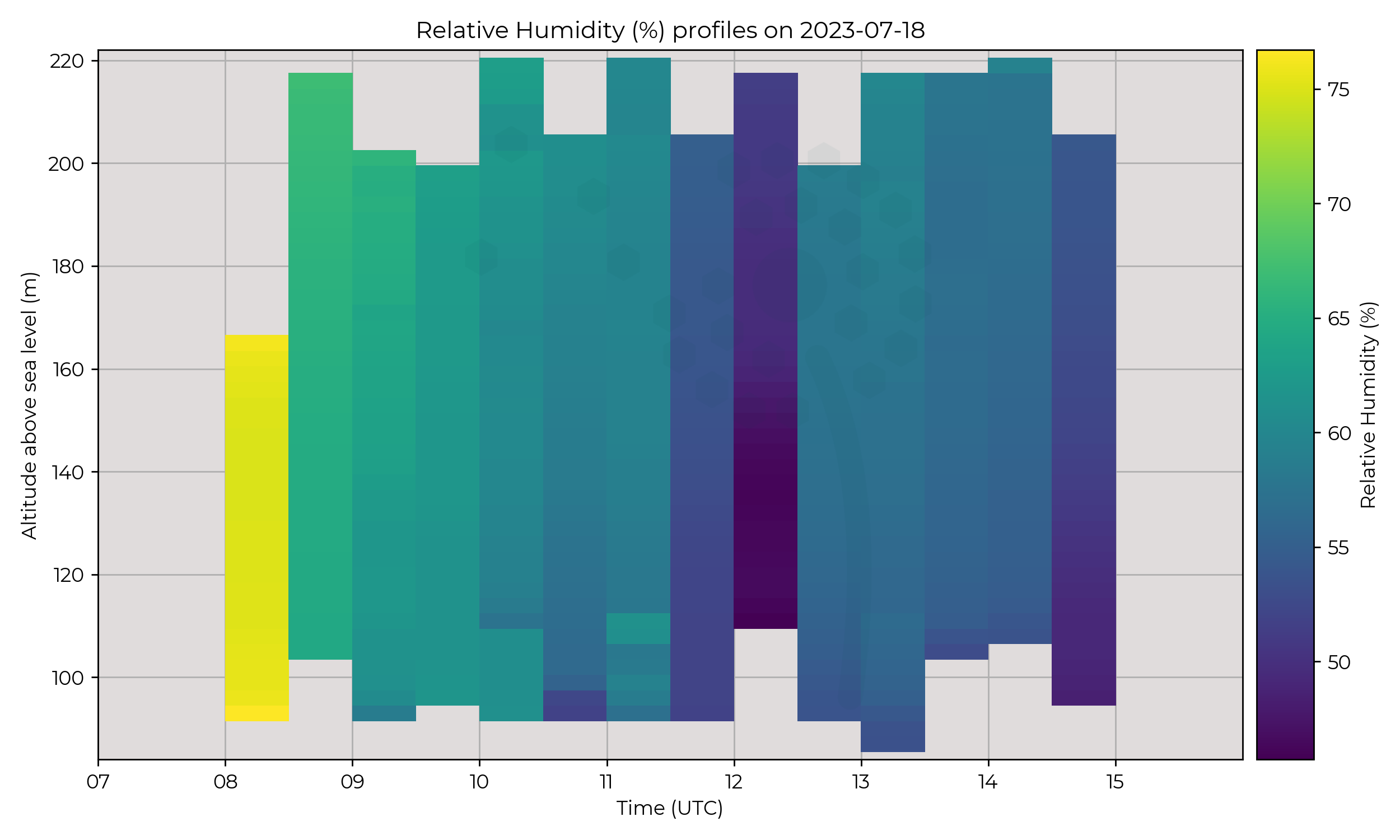
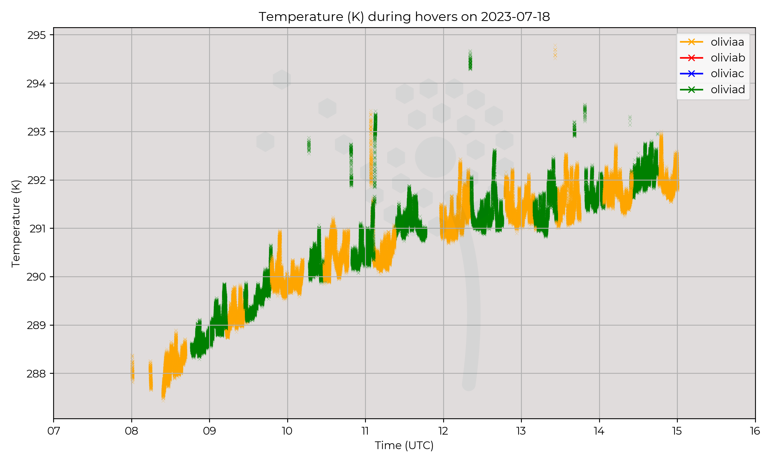
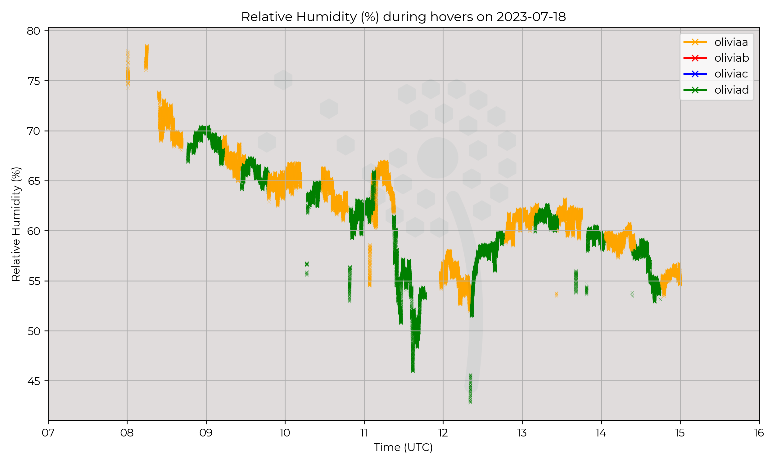
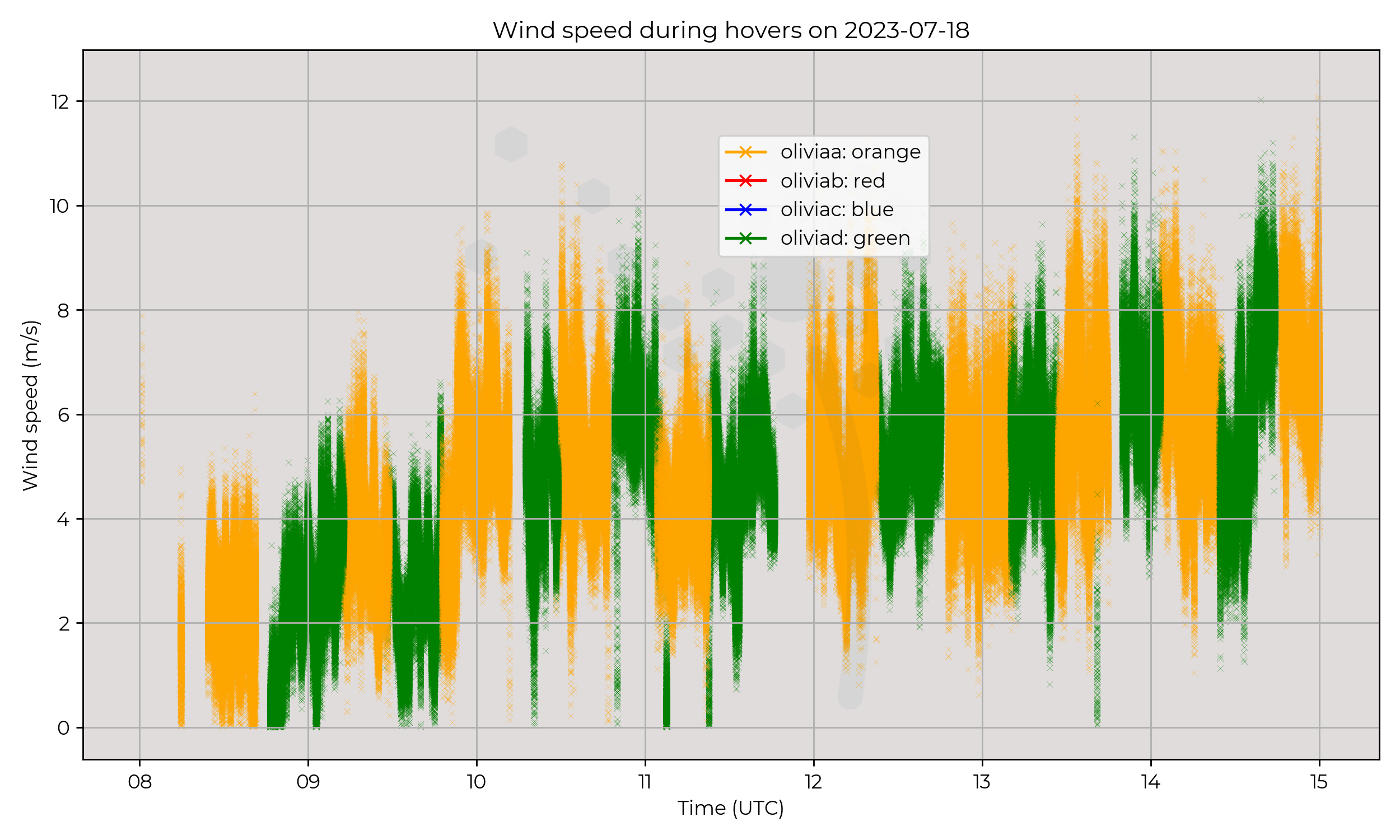
Almost constant presence at Chilbolton site, with Olivia A and Olivia D from 08:00 to 15:00 UTC. Hovers lasting approximately 30 minutes, with the two drones alternating each time.
Observations
Increase in temperature through day, as expected. High relative humidity and very low wind speed until around 10:00. Drop in humidity around 11:30, which may correspond to change in windspeed and approach of warm front.
Known Issues
None yet reported.2023-07-17
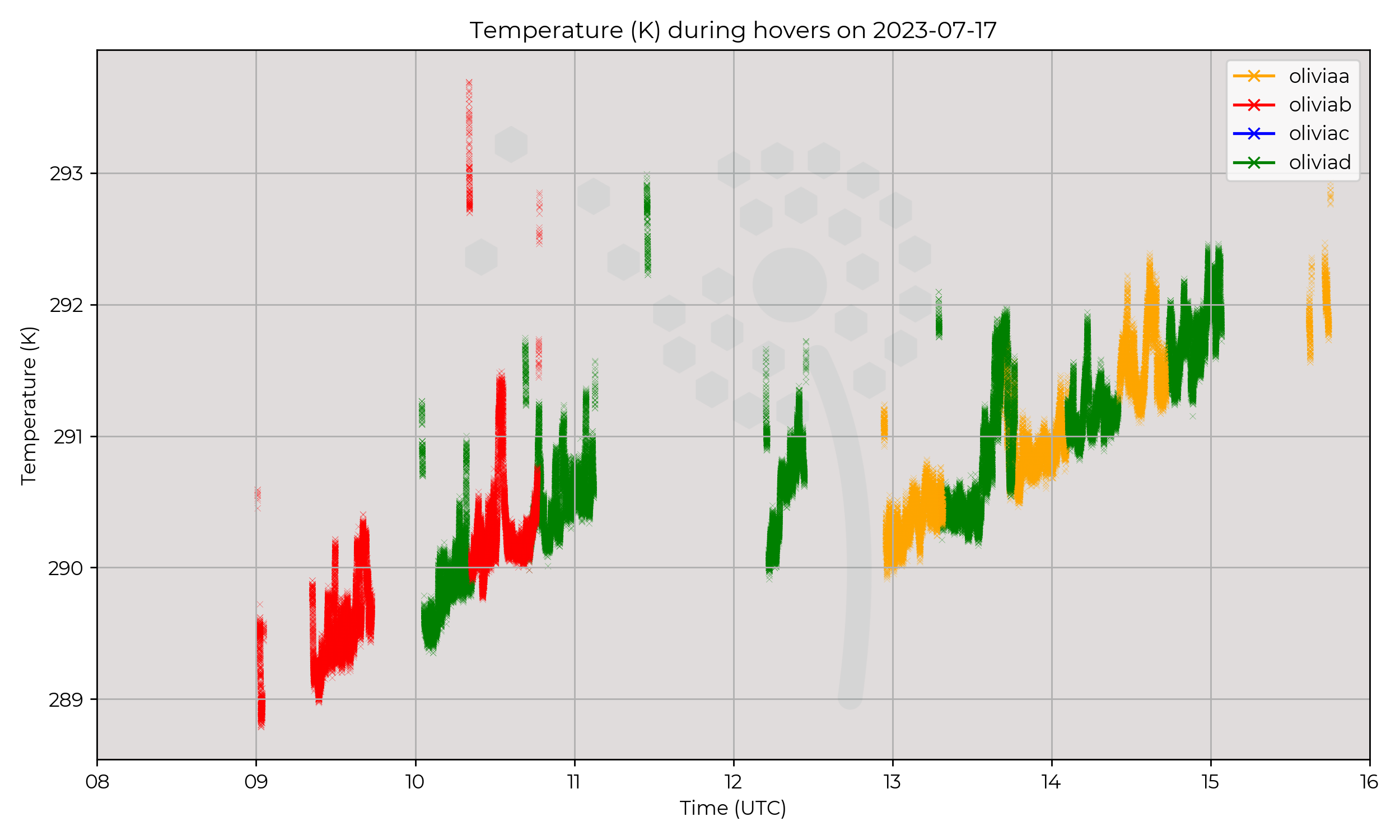
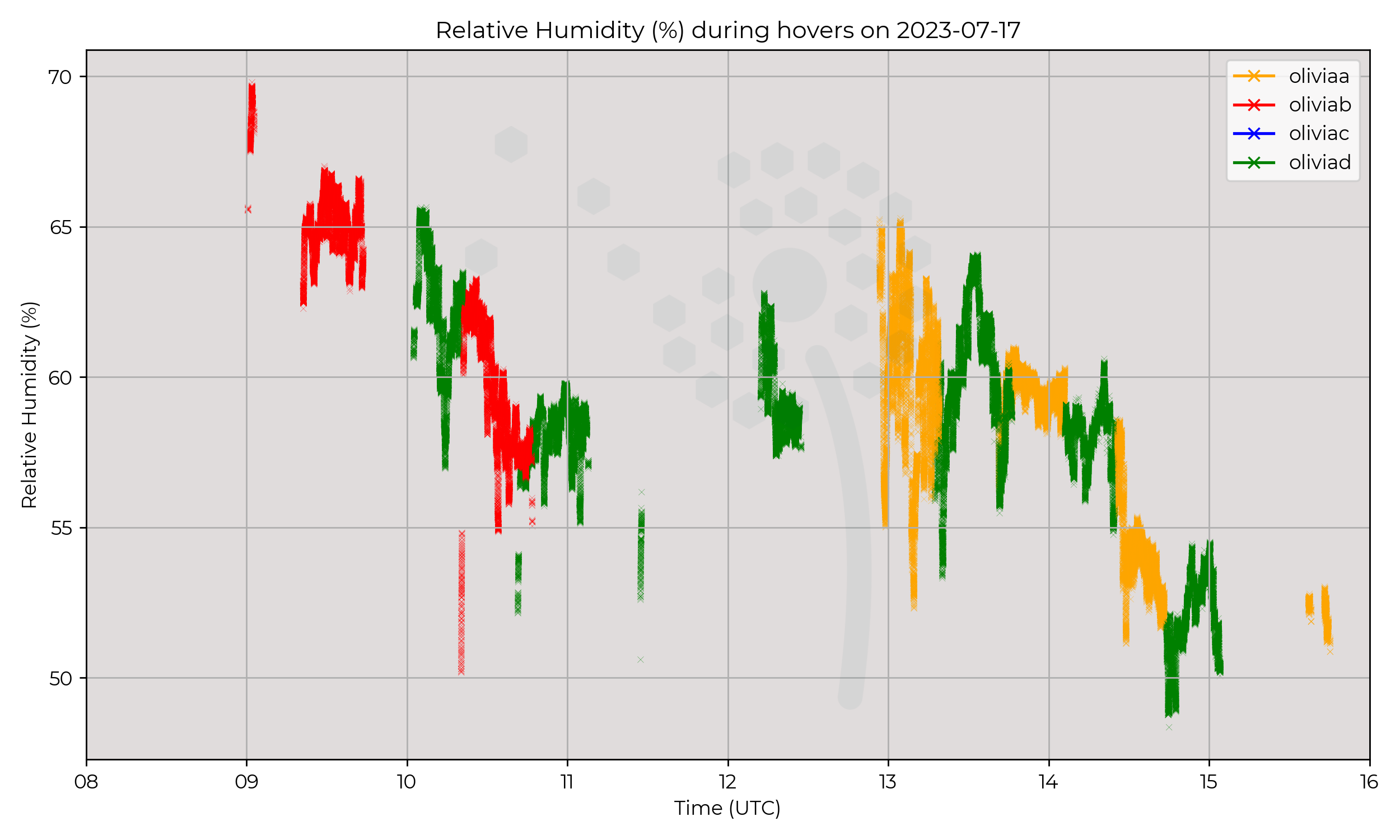
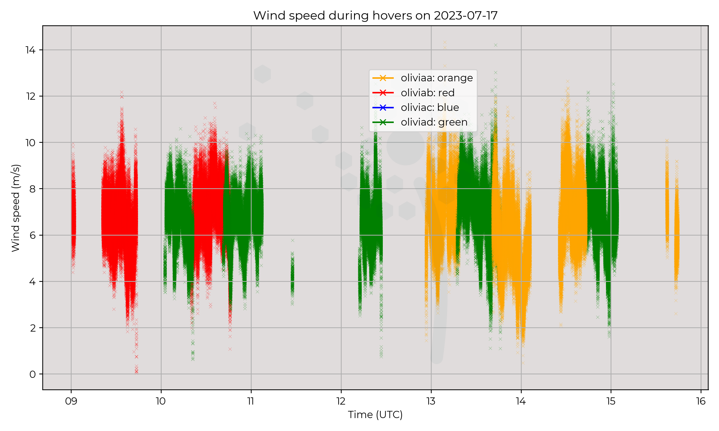
Synoptic Overview
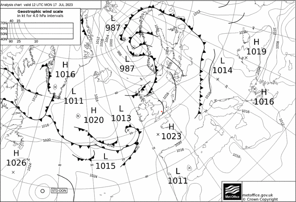
Few troughs present in early hours close to Cornwall, Ireland and the North of France. No major fronts in close proximity to Chilbolton.
Flight Patterns
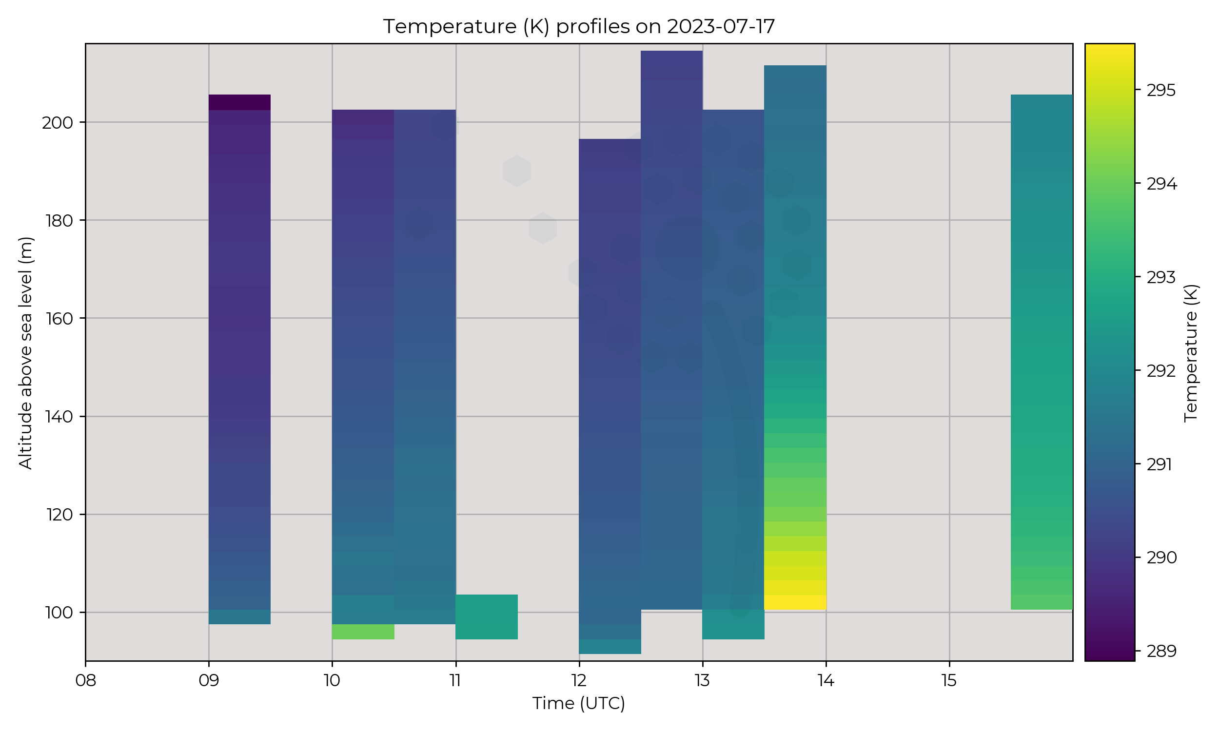
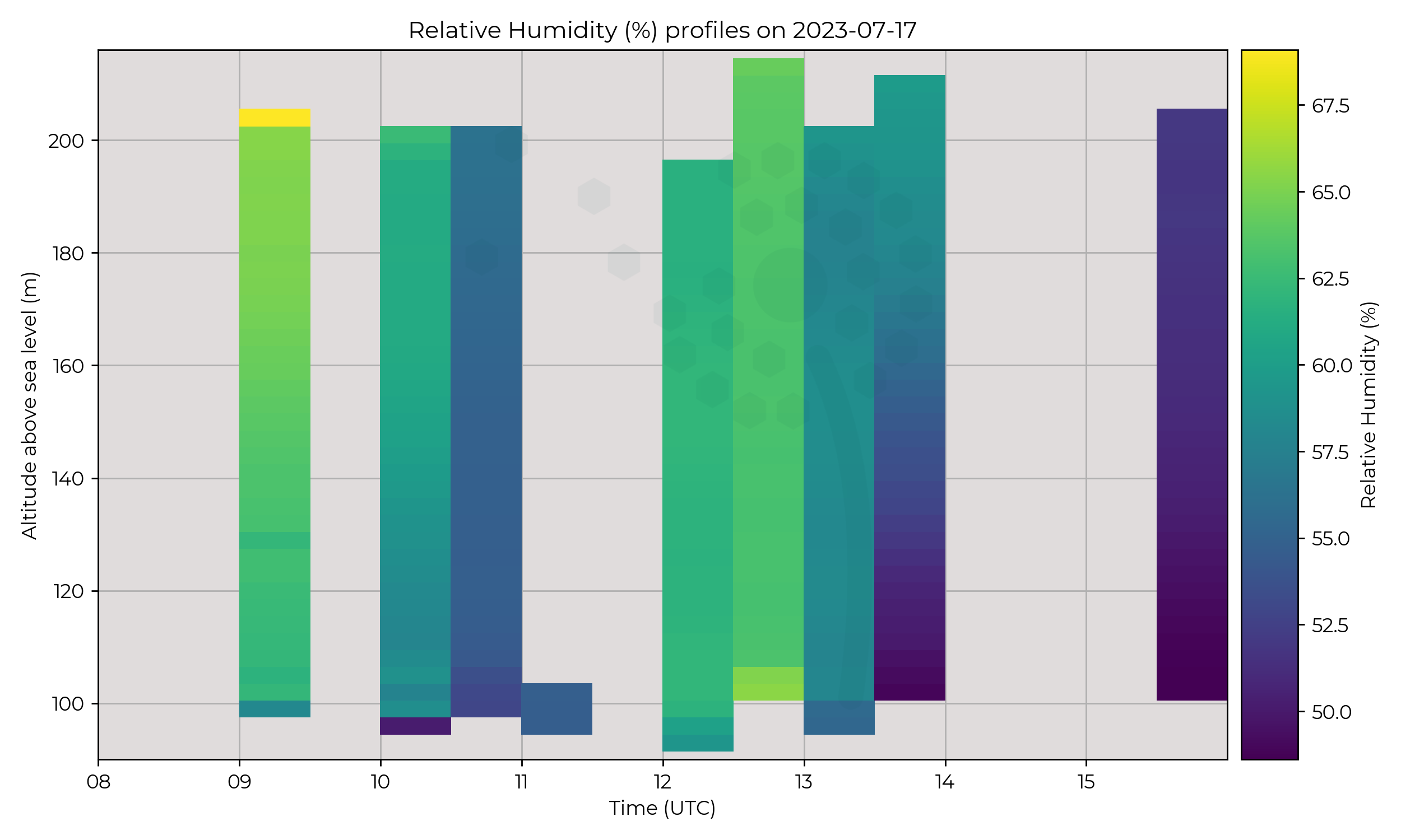
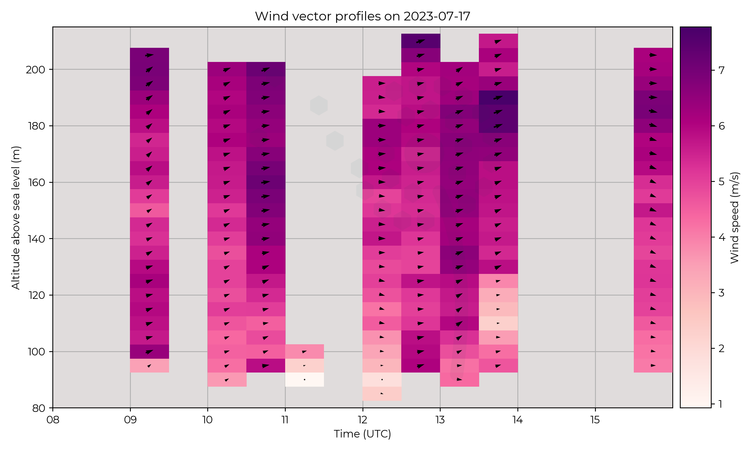
Attempted a constant presence at Chilbolton, hours of operation between 09:00 to 16:00 UTC. Hovers lasted approximately 30 minutes each. Ascent times are not syncronised to minutes past the hour.
Observations
Overall drying out and warming of environment through day, with some oscillations during hovers, which may correspond to passage of troughs.
Known Issues
None yet reported.Week 4
2023-07-14
2023-07-13
2023-07-12
2023-07-11
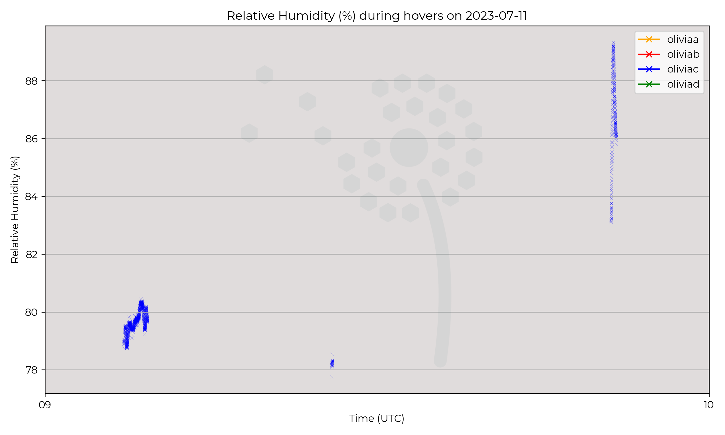
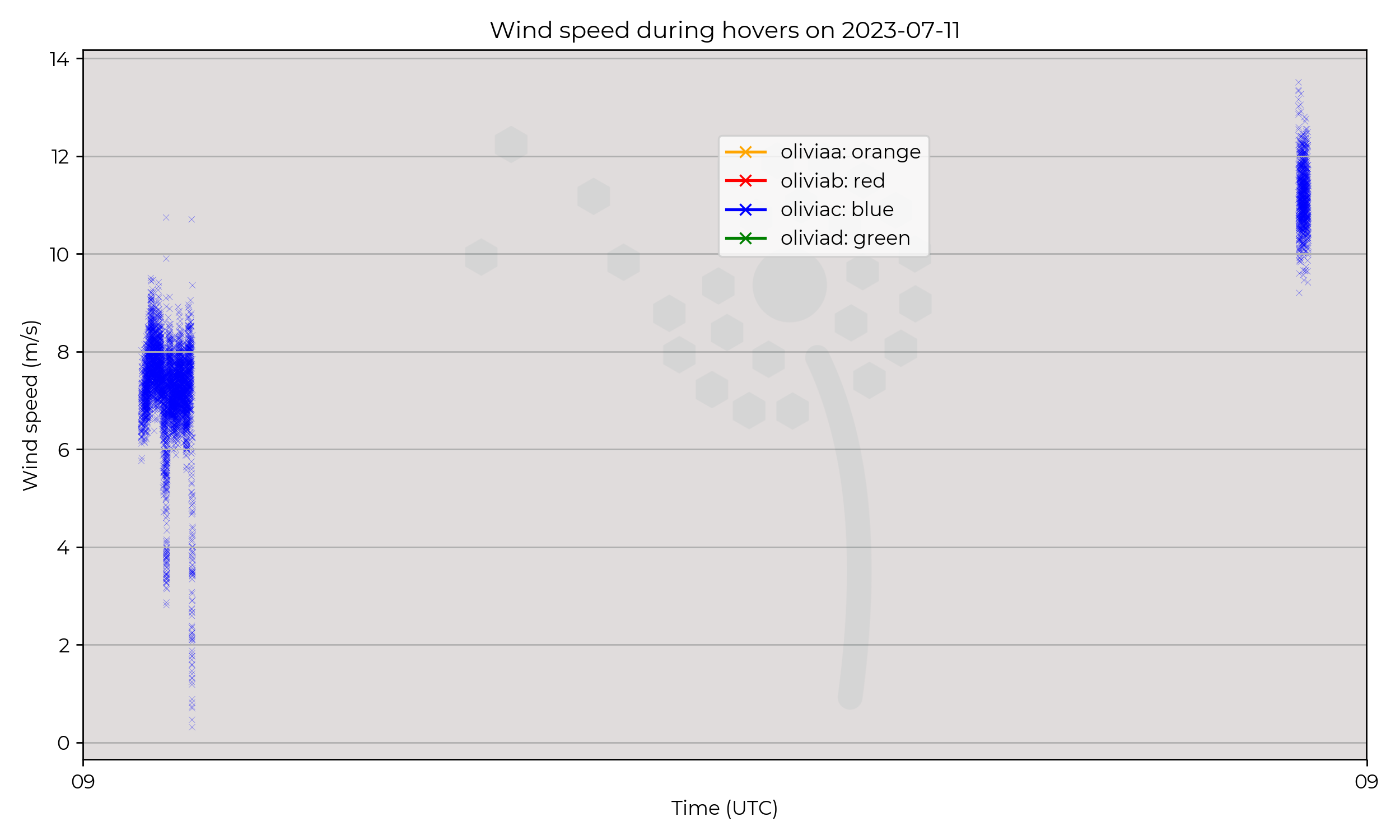
Synoptic Overview
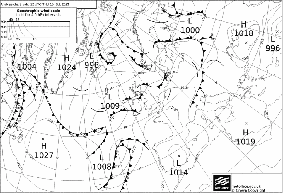
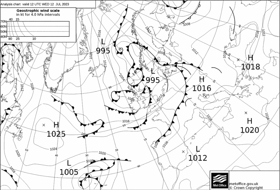
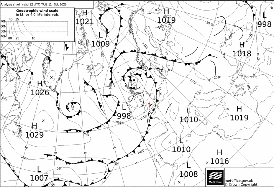
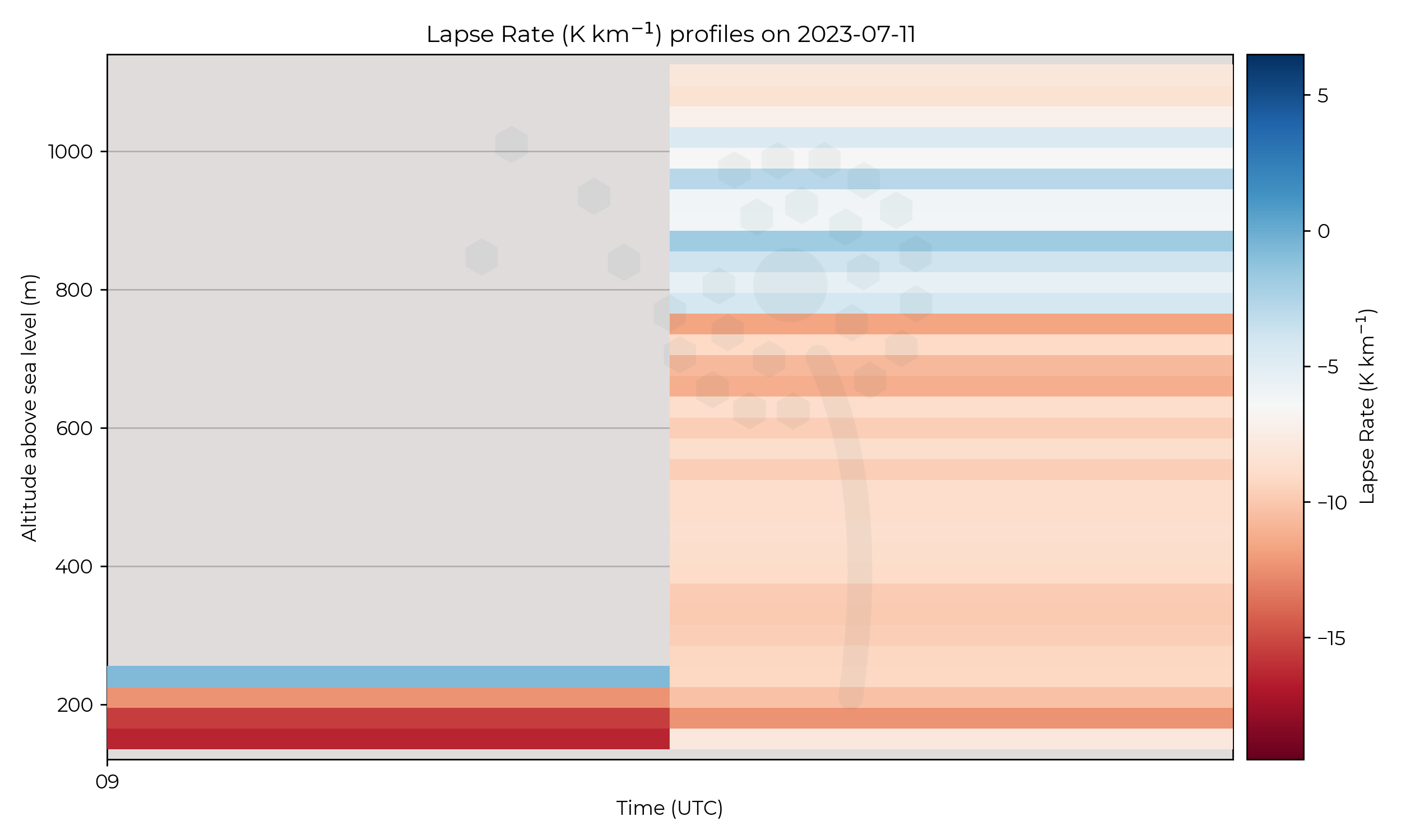
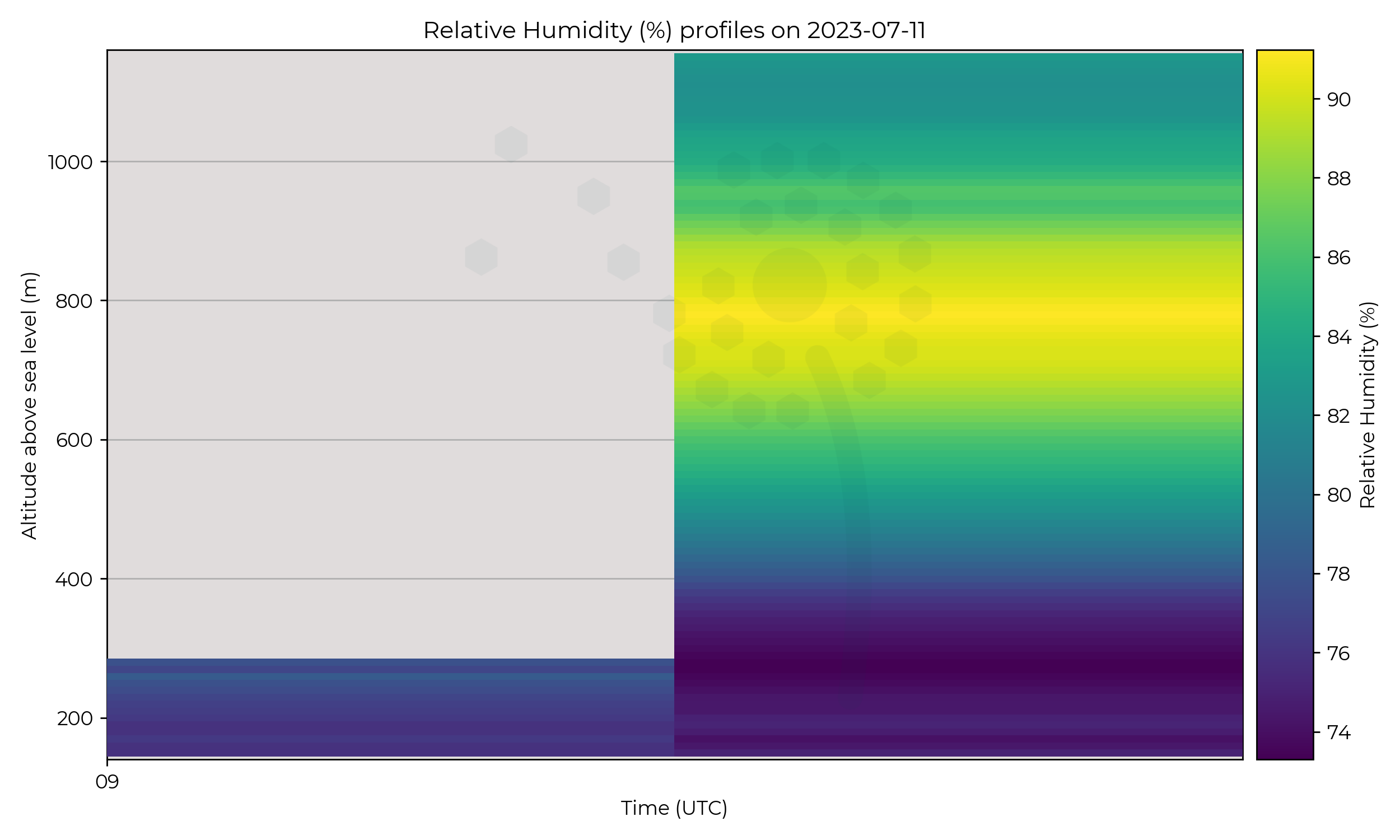
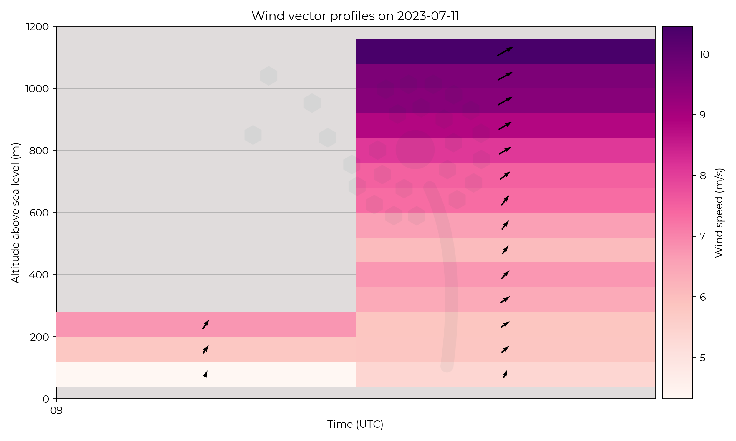
Stagnant area of low pressure over the north of Scotland.
Flight Patterns
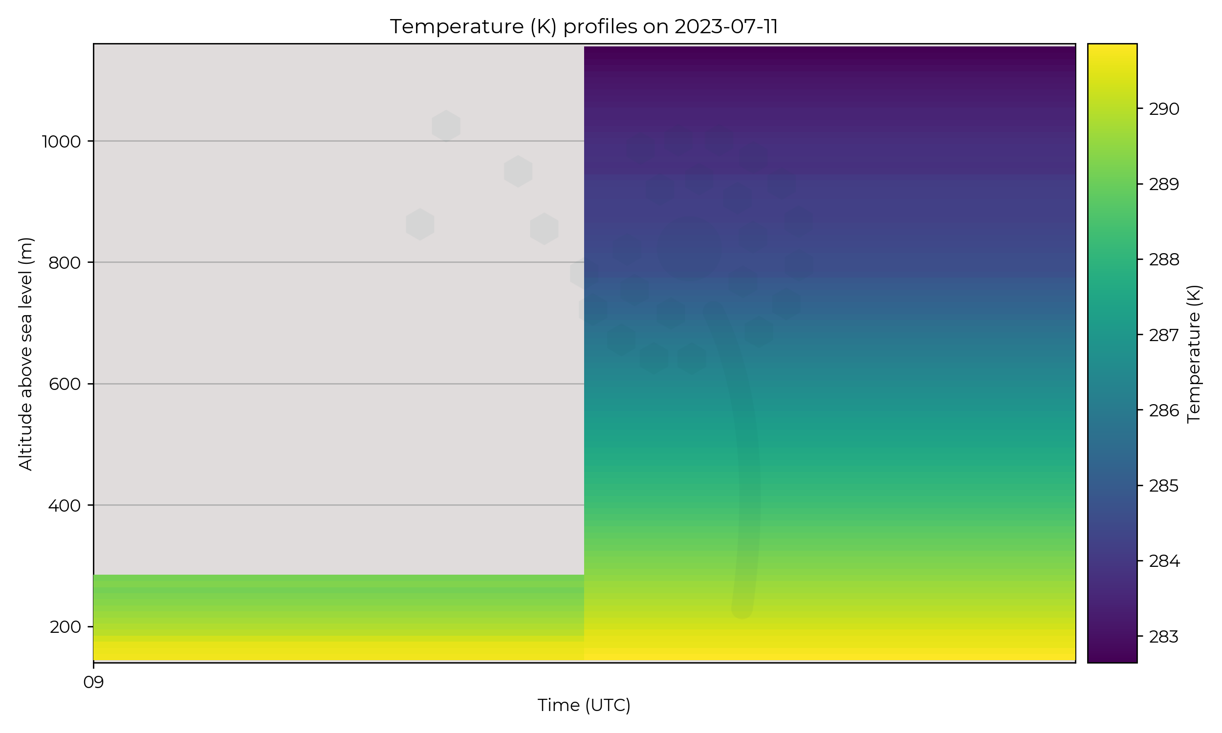
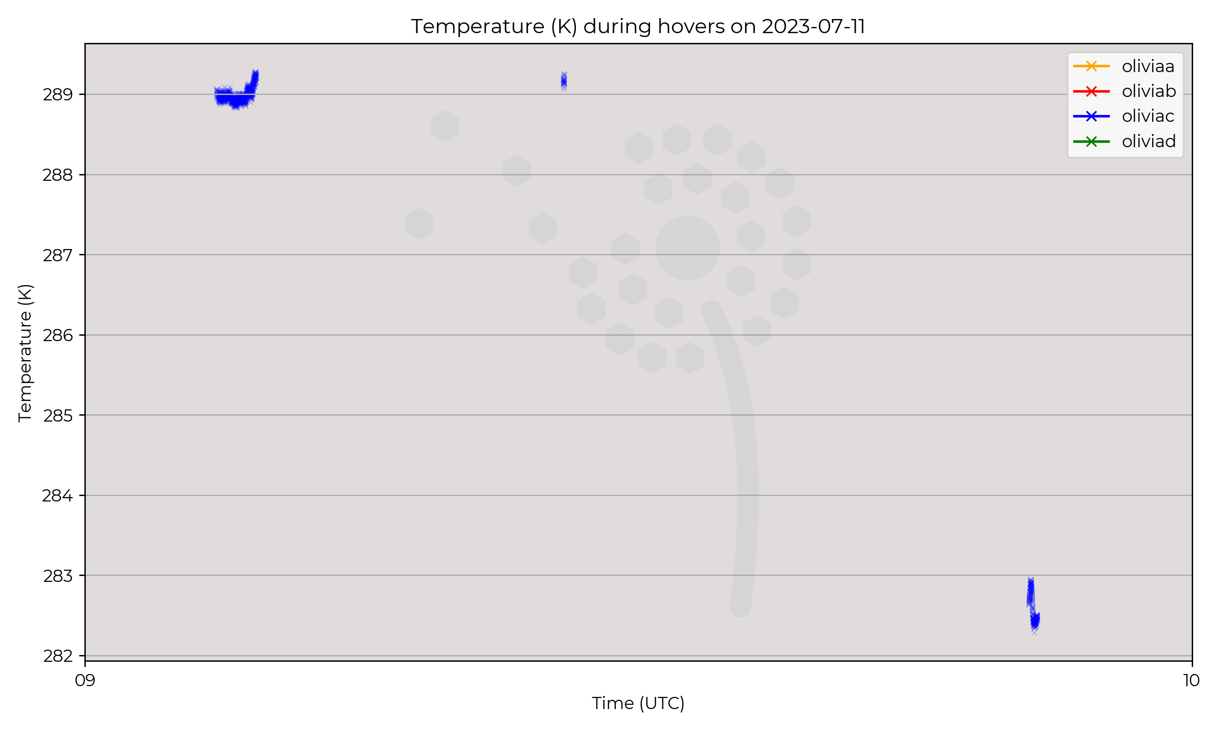
1km ascents at Breach Hill site. Unfortunate major crash of Olivia C halted operations.
Observations
Little data to discuss major trends of the day.
Known Issues
- UAS aborted with parachute on the 2nd flight, due to a component failure at 1.2 km AGL. The rest of the week was taken off to carefully analyse and resolve the issue across the UAS fleet.
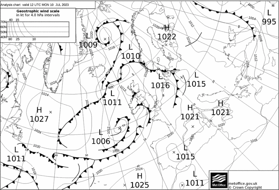
2023-07-10
Week 3
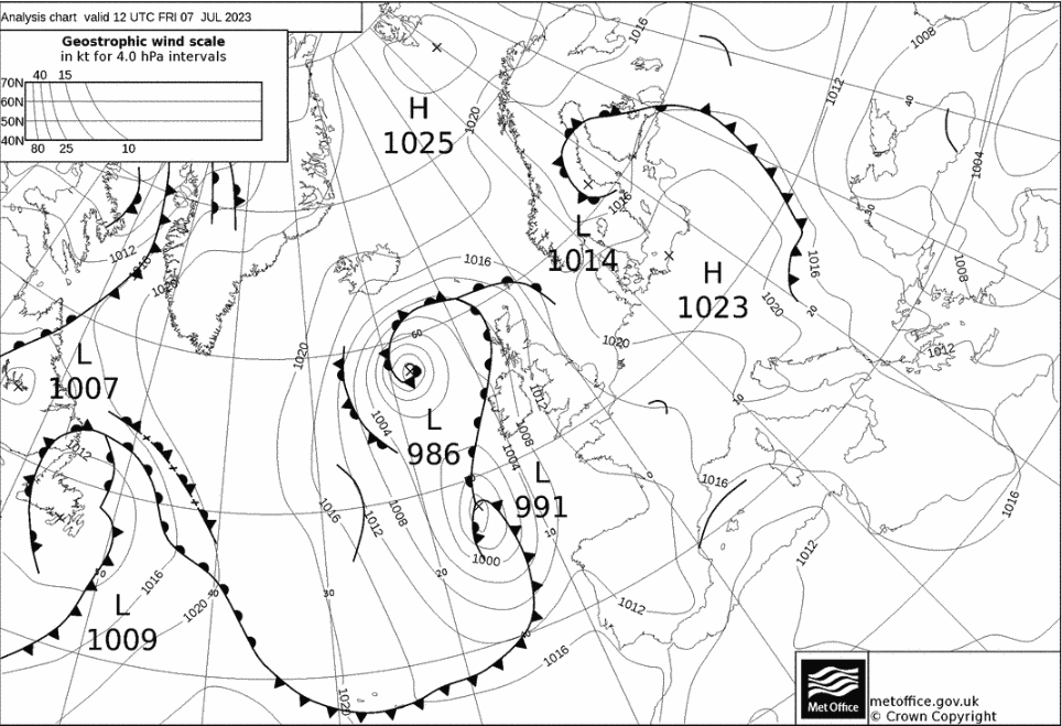
2023-07-07
2023-07-06
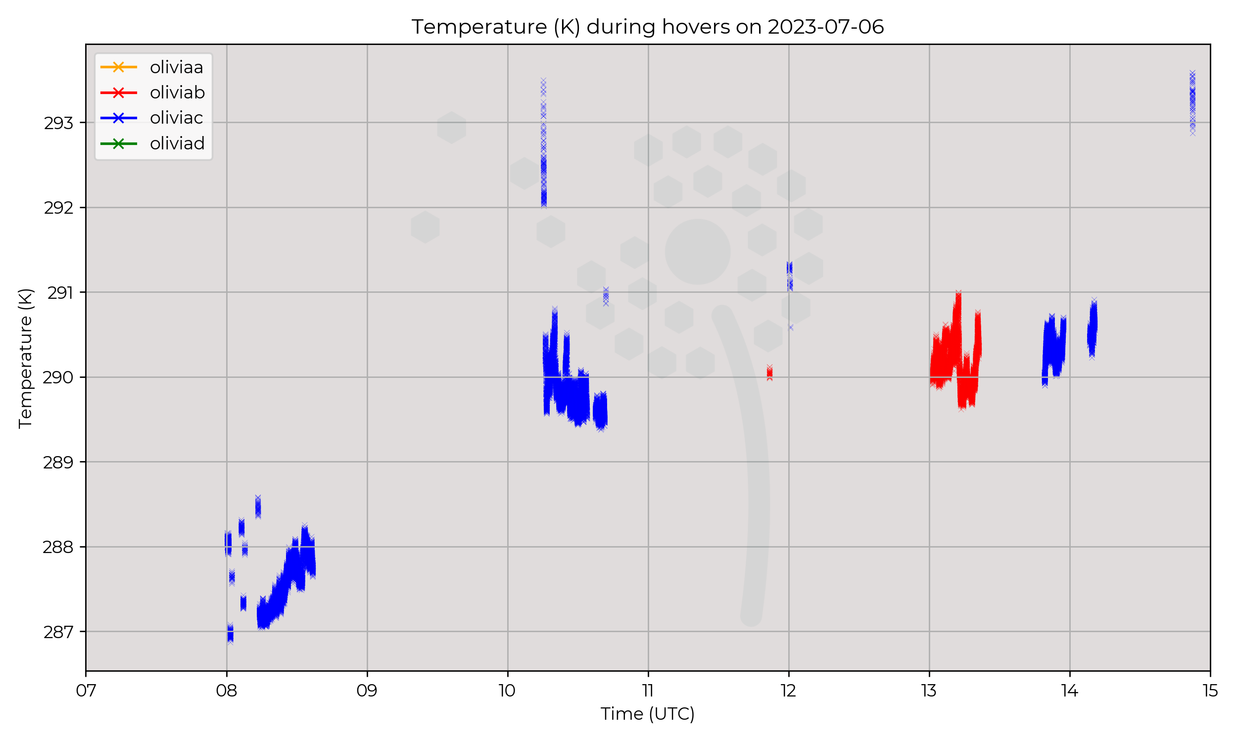
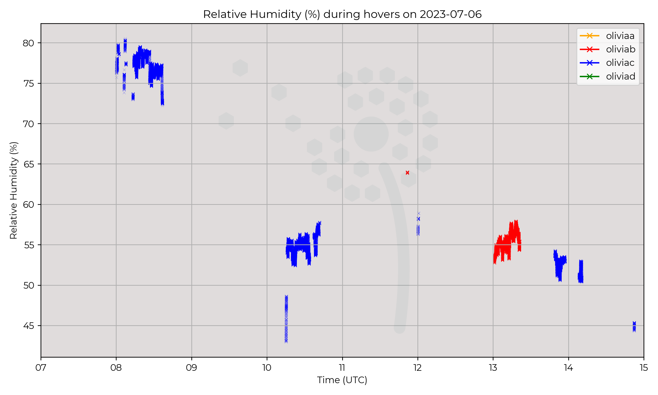
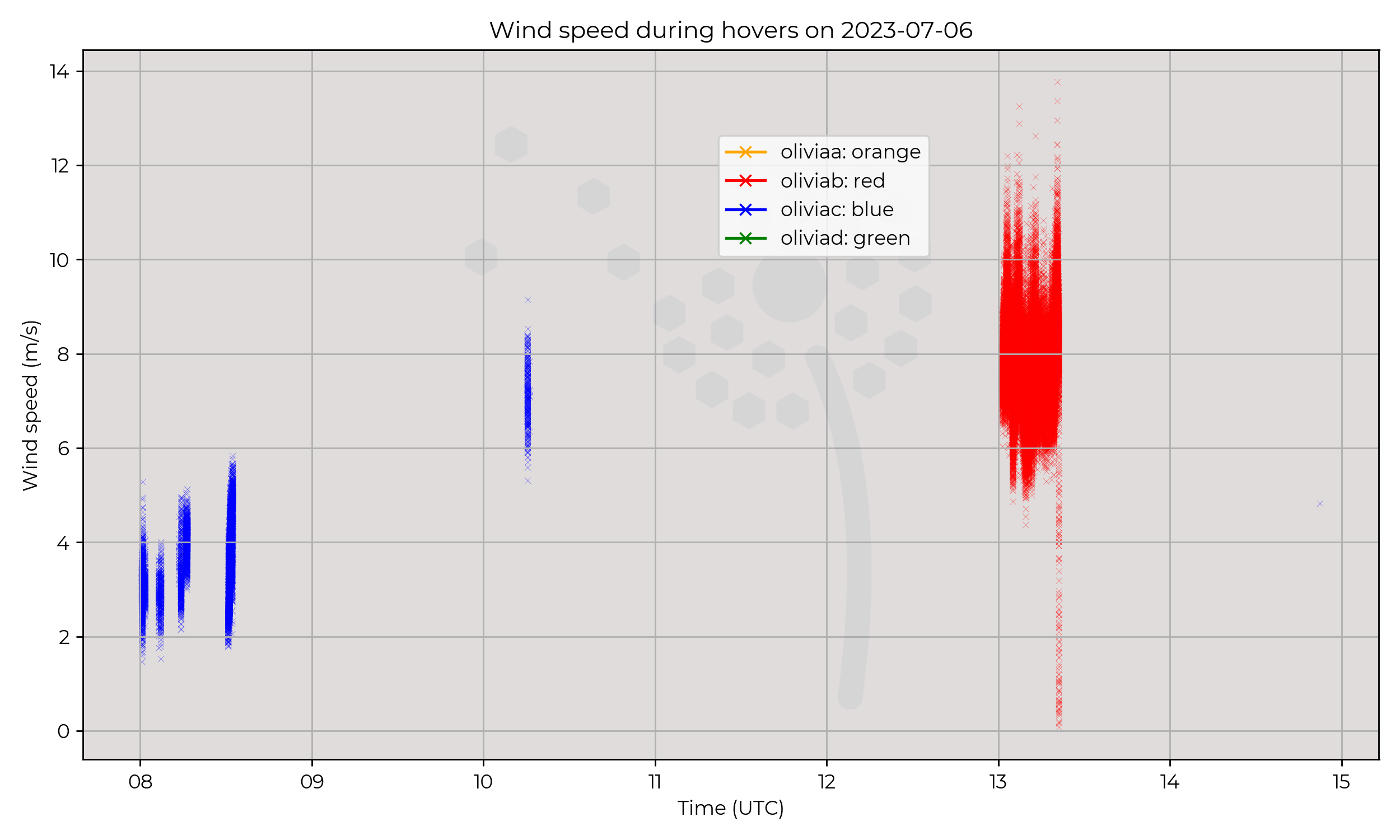
Synoptic Overview
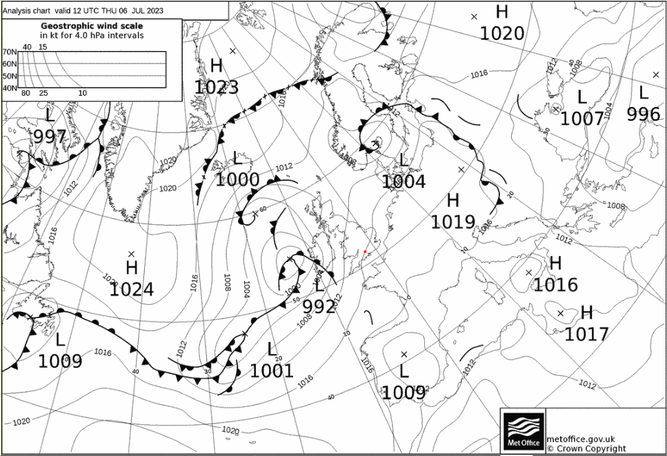
Many messy fronts in early hours with a developing area of low pressure to the west of the UK over the Atlantic. Low moves NE through the day.
Flight Patterns
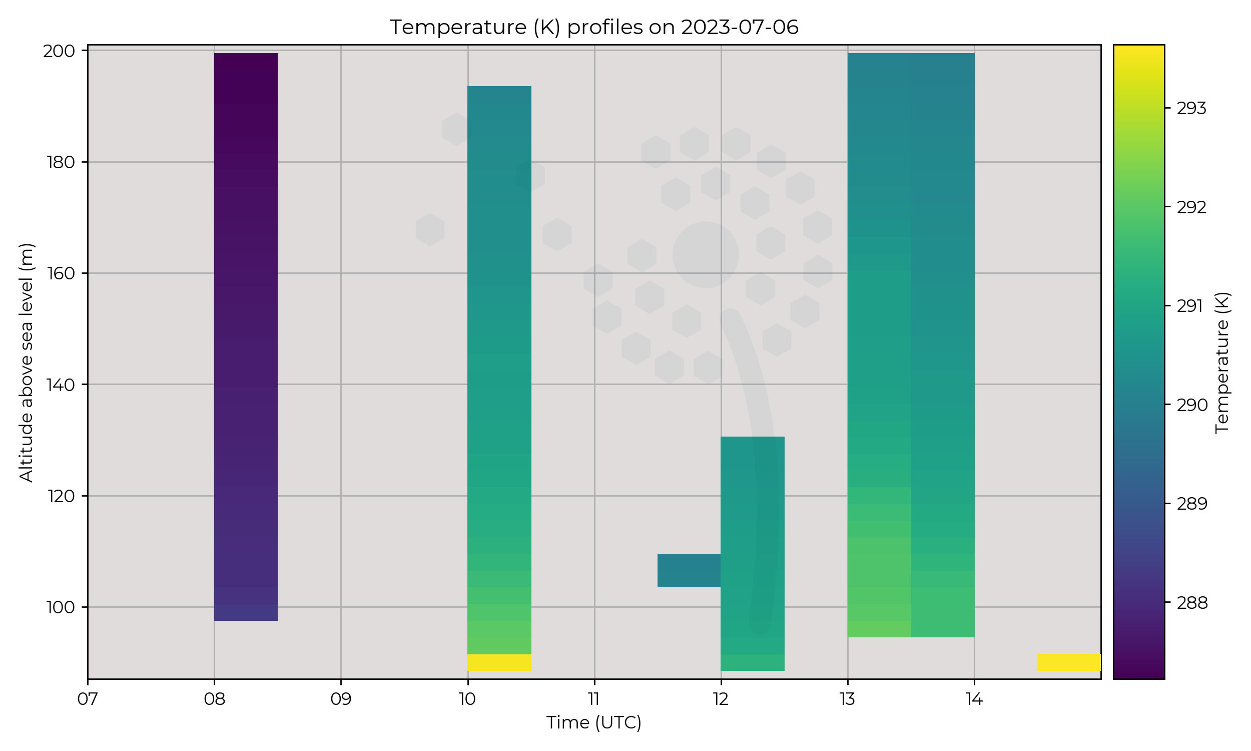
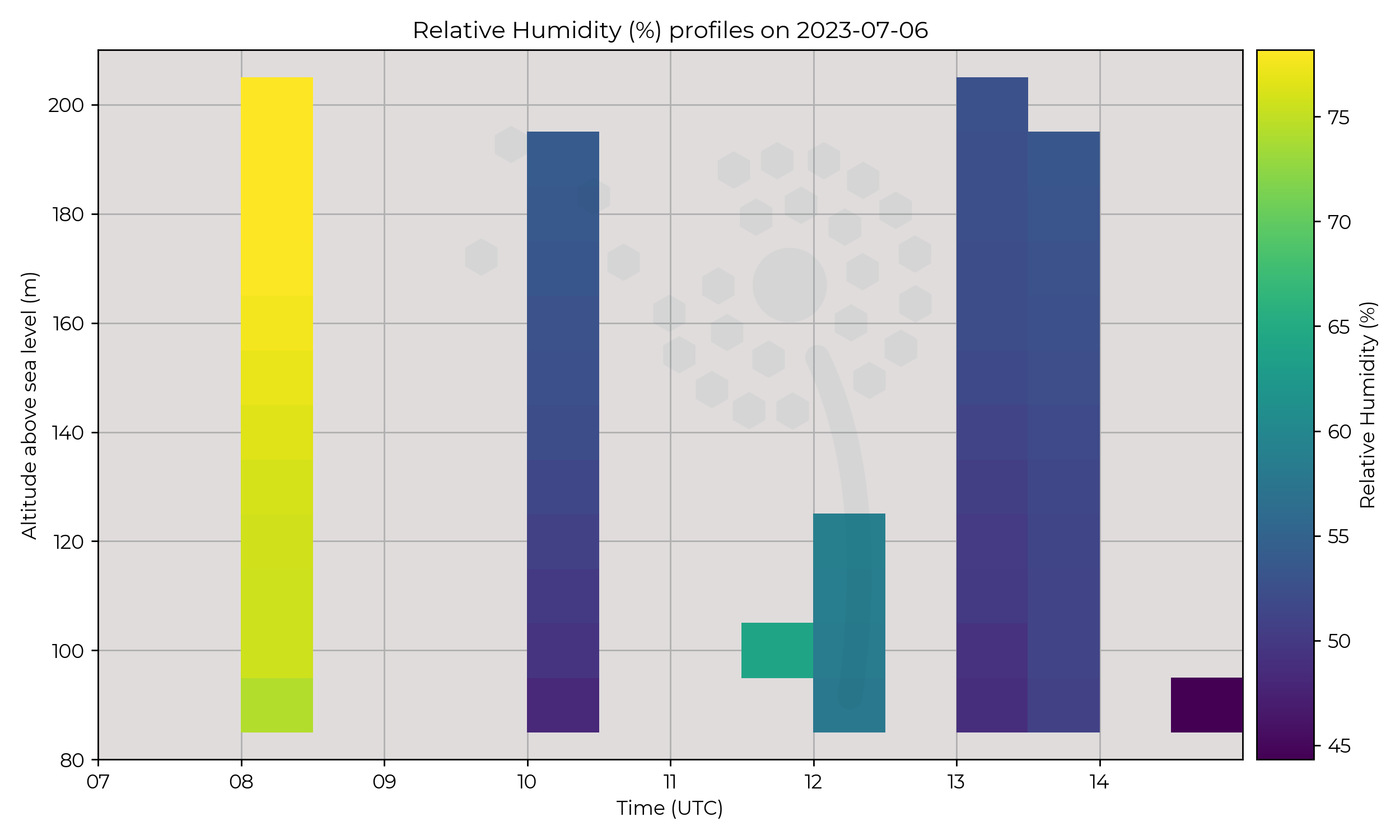
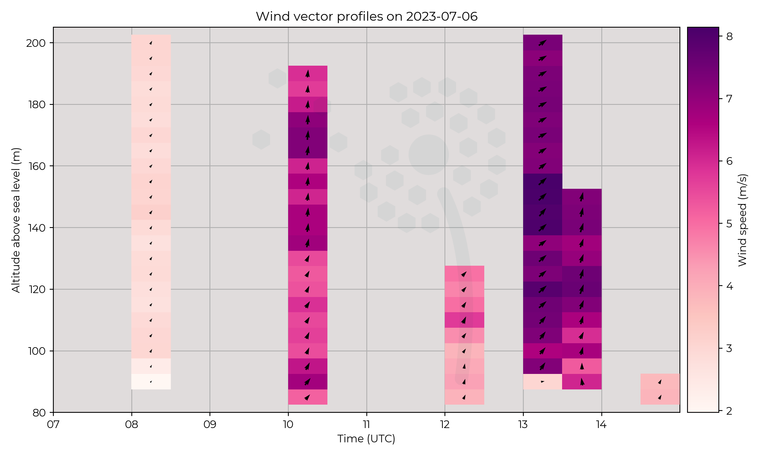
Hovers in Chilbolton, hours of operation between 08:00 to 15:00.
Observations
Increase of windspeed at 13:00 may relate to the proximity of the area of low pressure. Drying, warming and increase of wind speed of profile observed between 08:00 to 10:00 flight. 10:00 onwards, profiles remaining similar.
Known Issues
- Patchy wind data in hover measurements.
2023-07-05
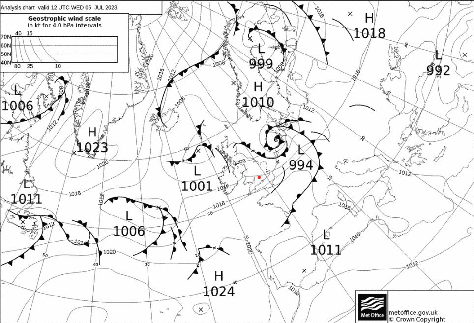
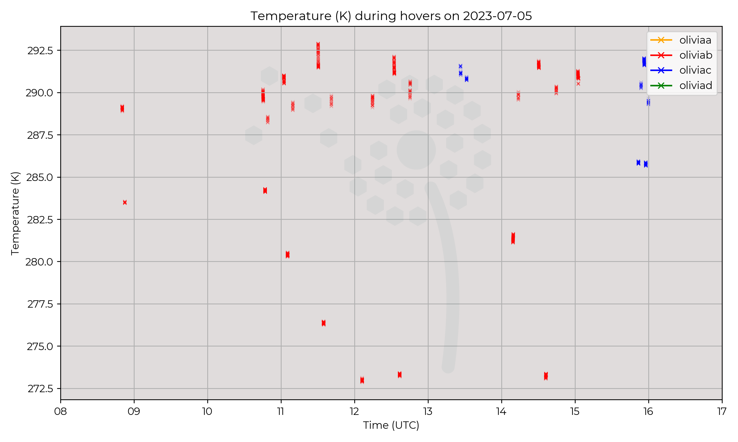
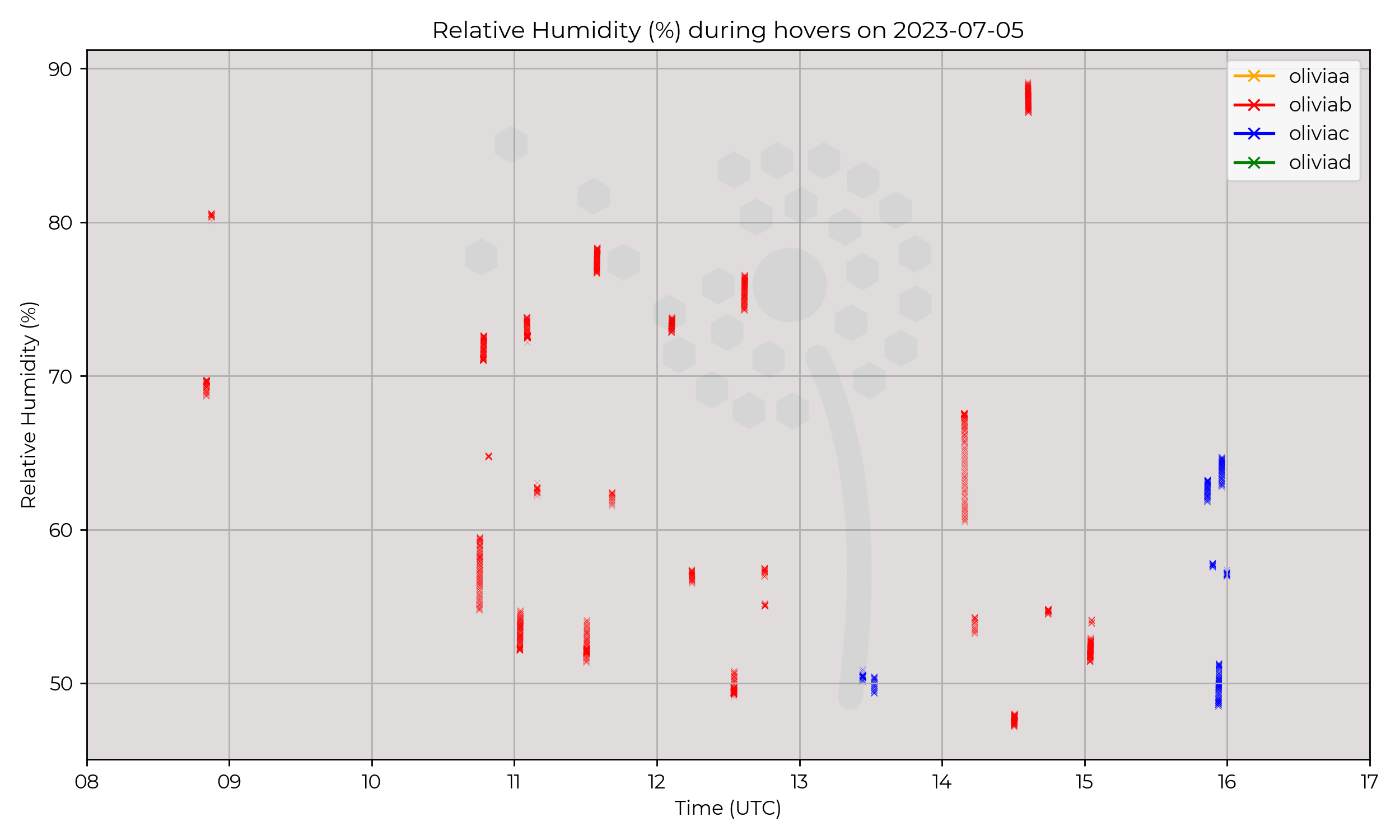
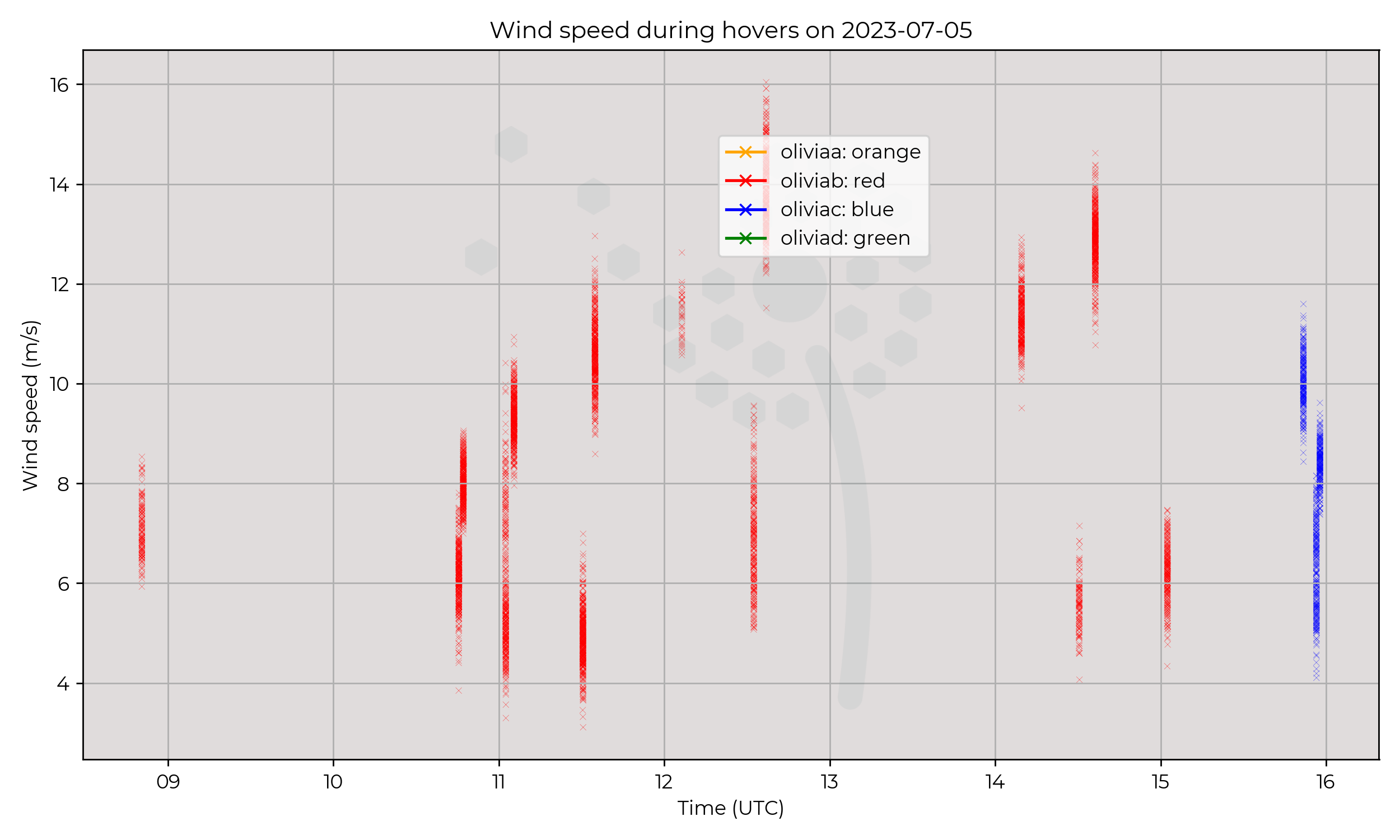
Synoptic Overview
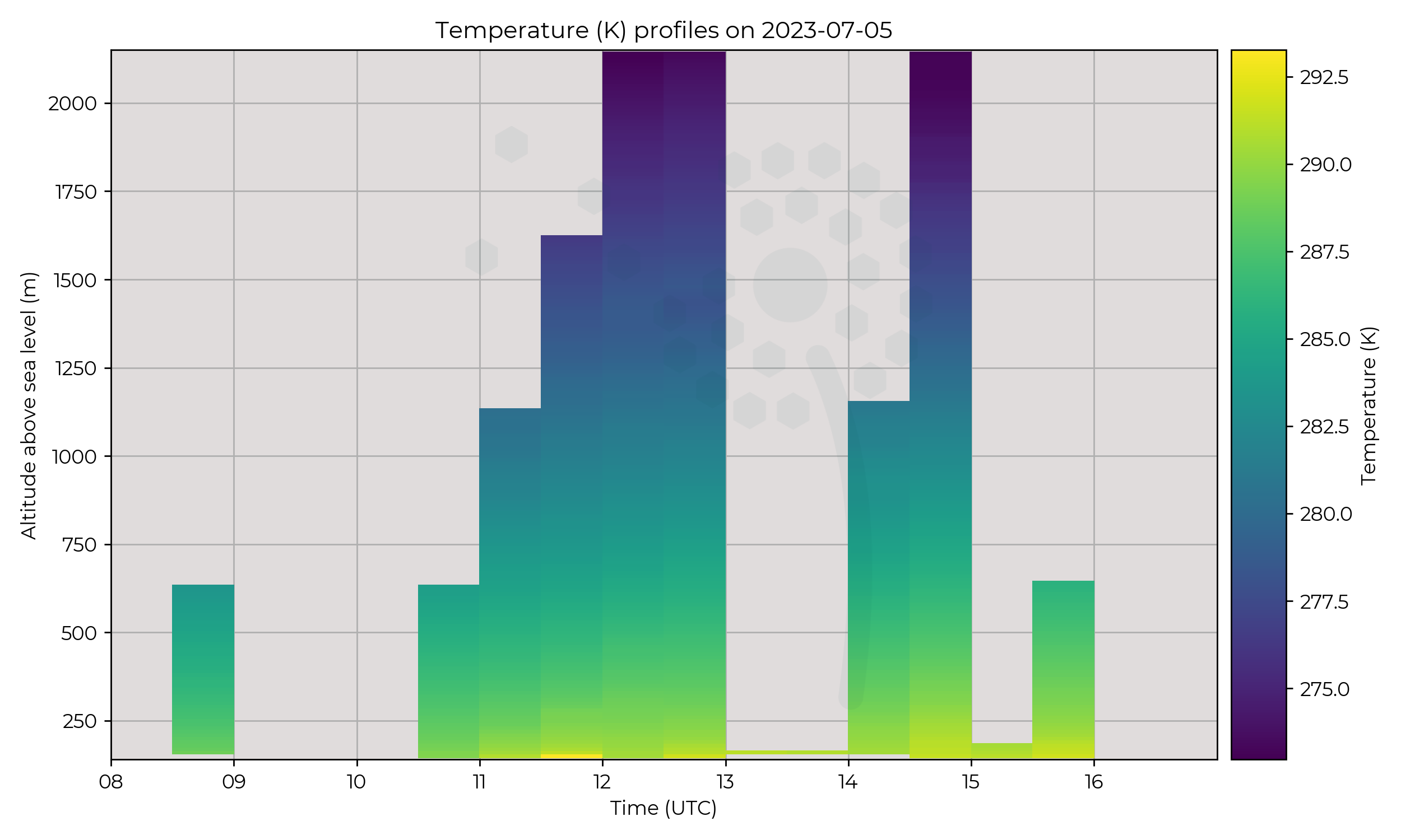
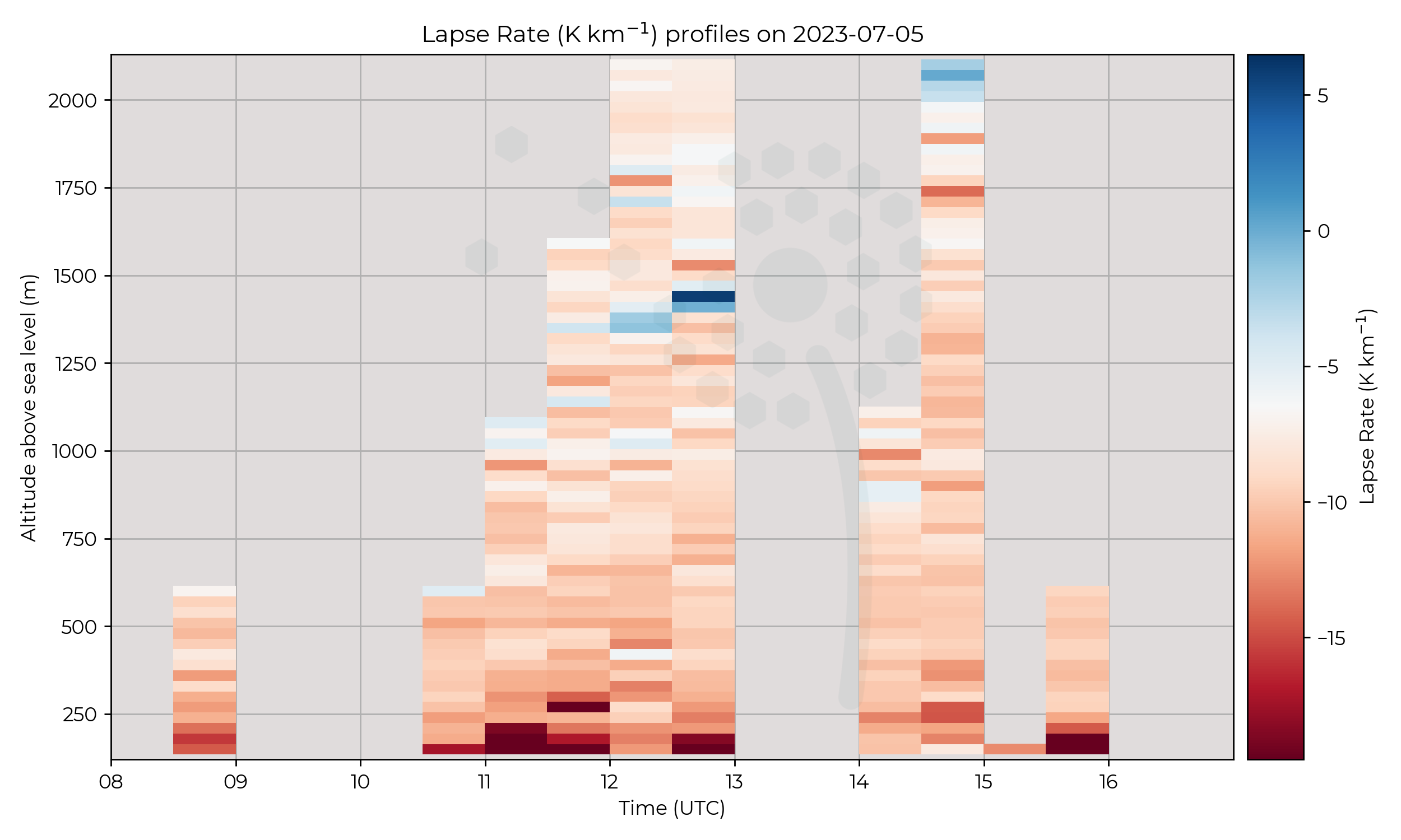
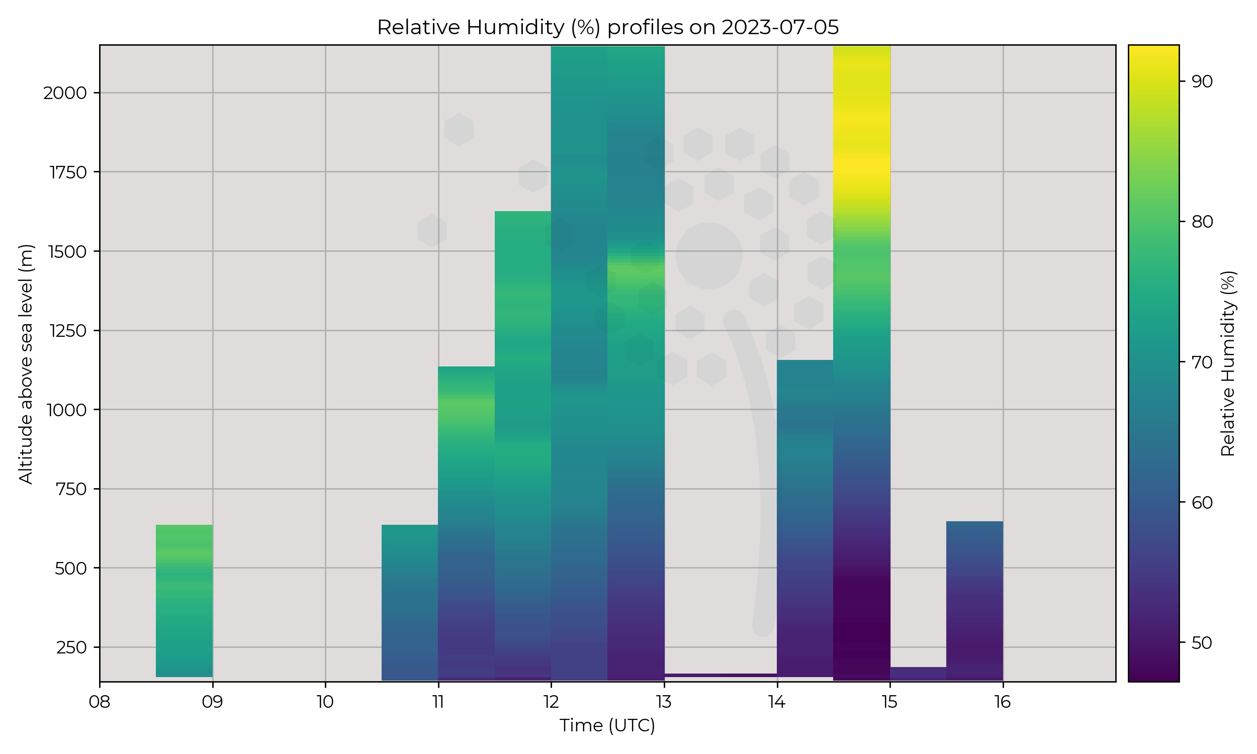
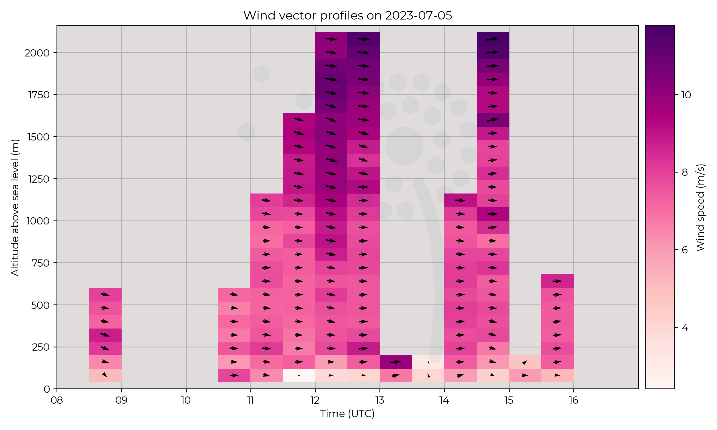
Passage of weakening occluded front over Breach Hill site in morning. Area of low pressure to NE of England and moving NE.
Flight Patterns
Vertical profiles to 2000 m asl at Breach Hill SPTA. Hours of operation between 08:30 to 16:00 UTC.
Observations
Stable day, no significant changes noted across measurements, temperature / wind remain approximately constant throughout the day. Some cloud development at around 14:30.
Known Issues
None yet reported.2023-07-04
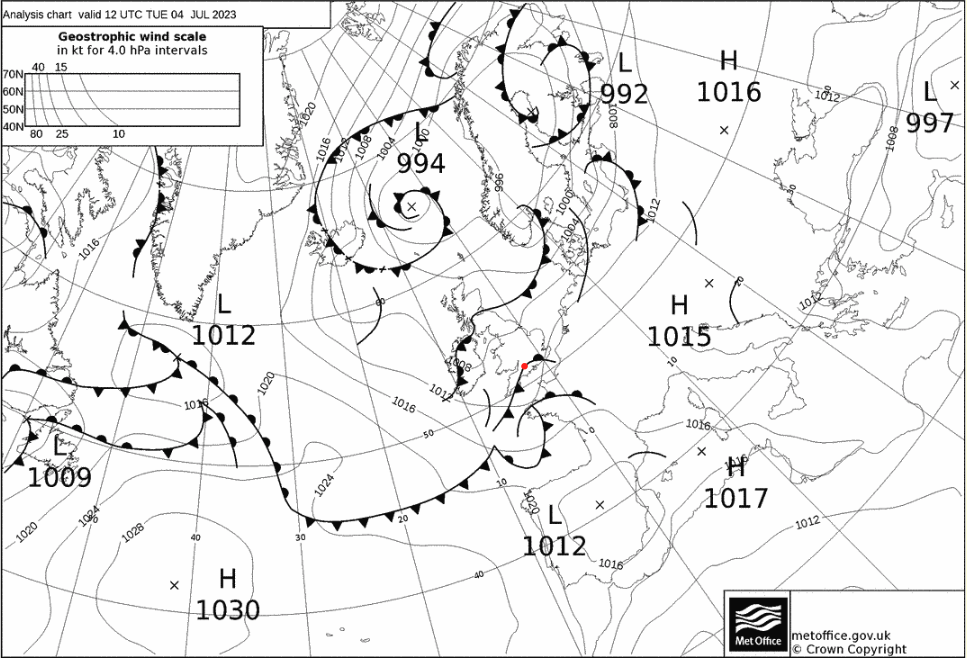
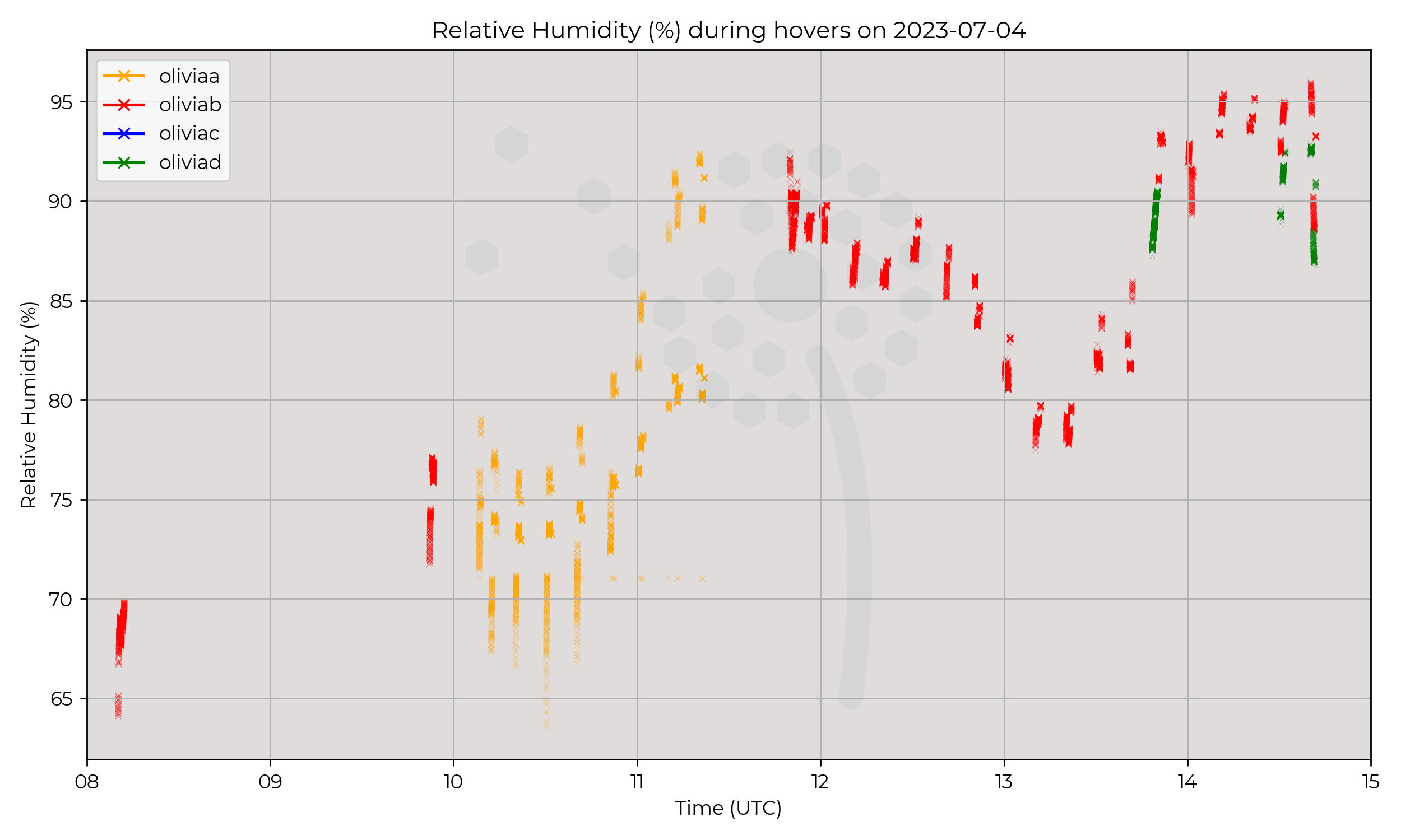
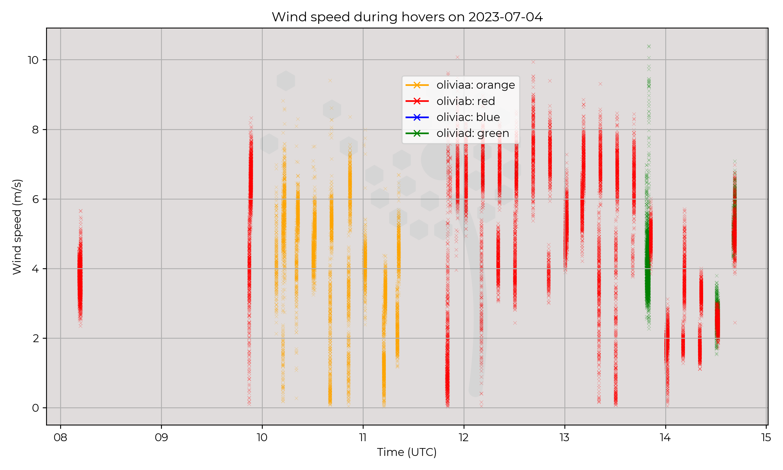
Synoptic Overview
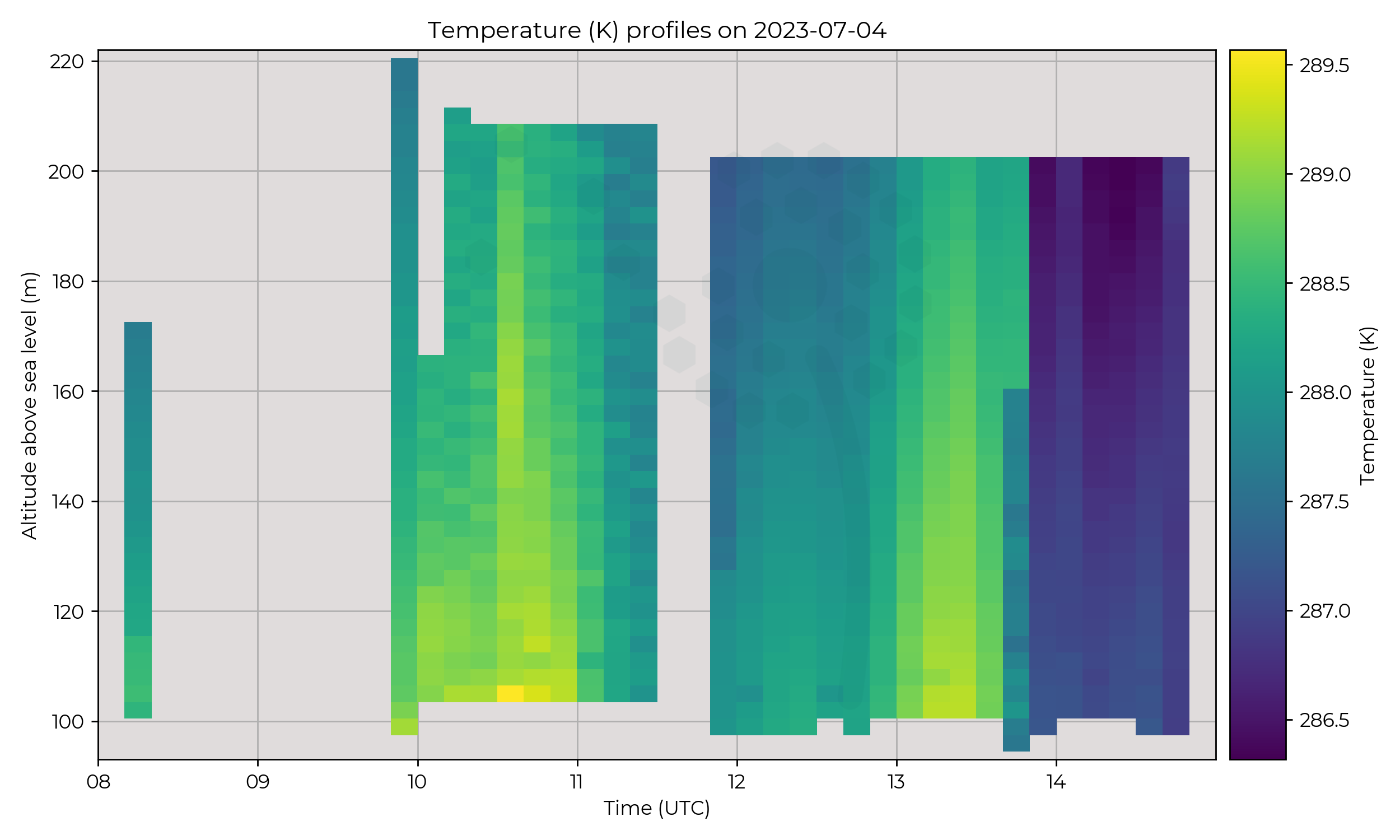
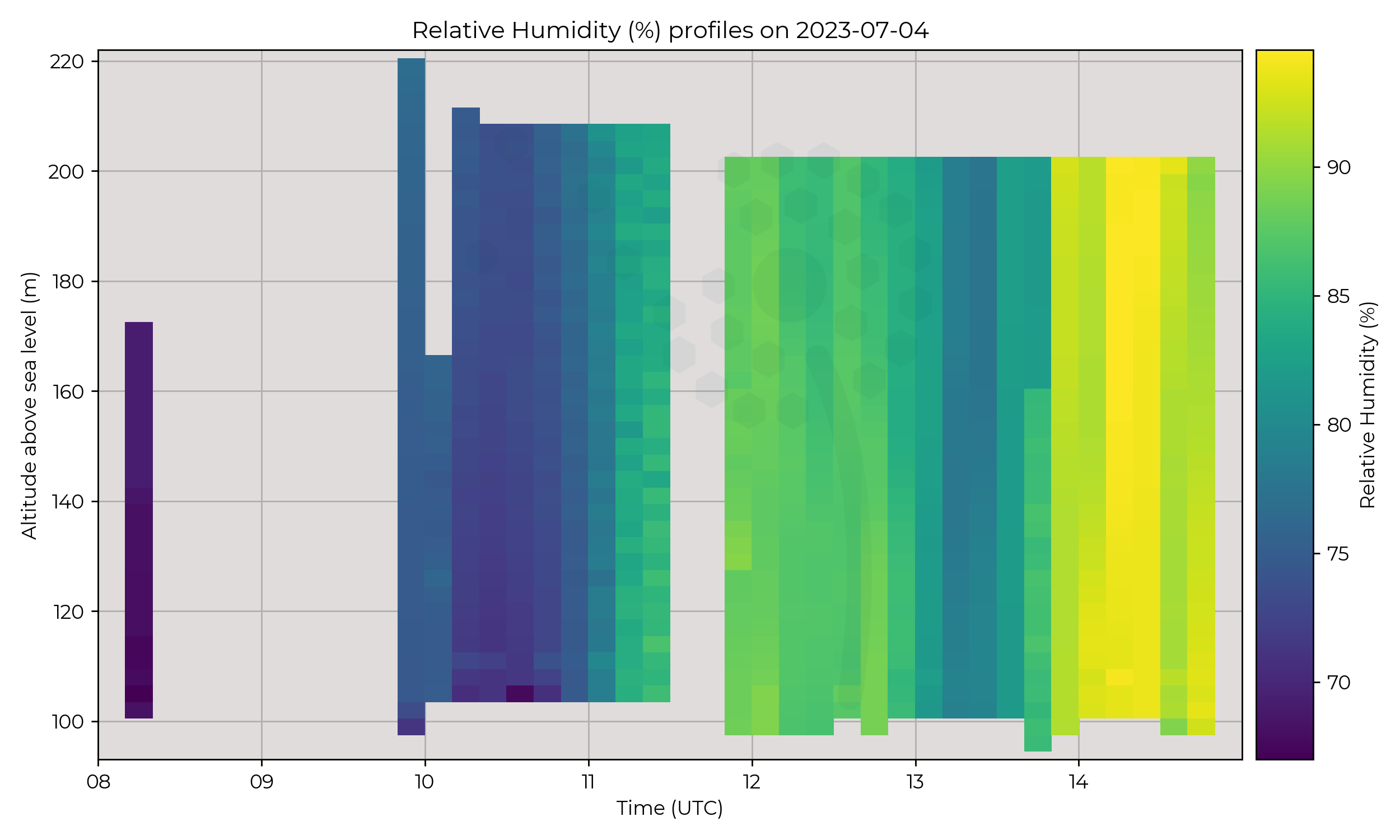
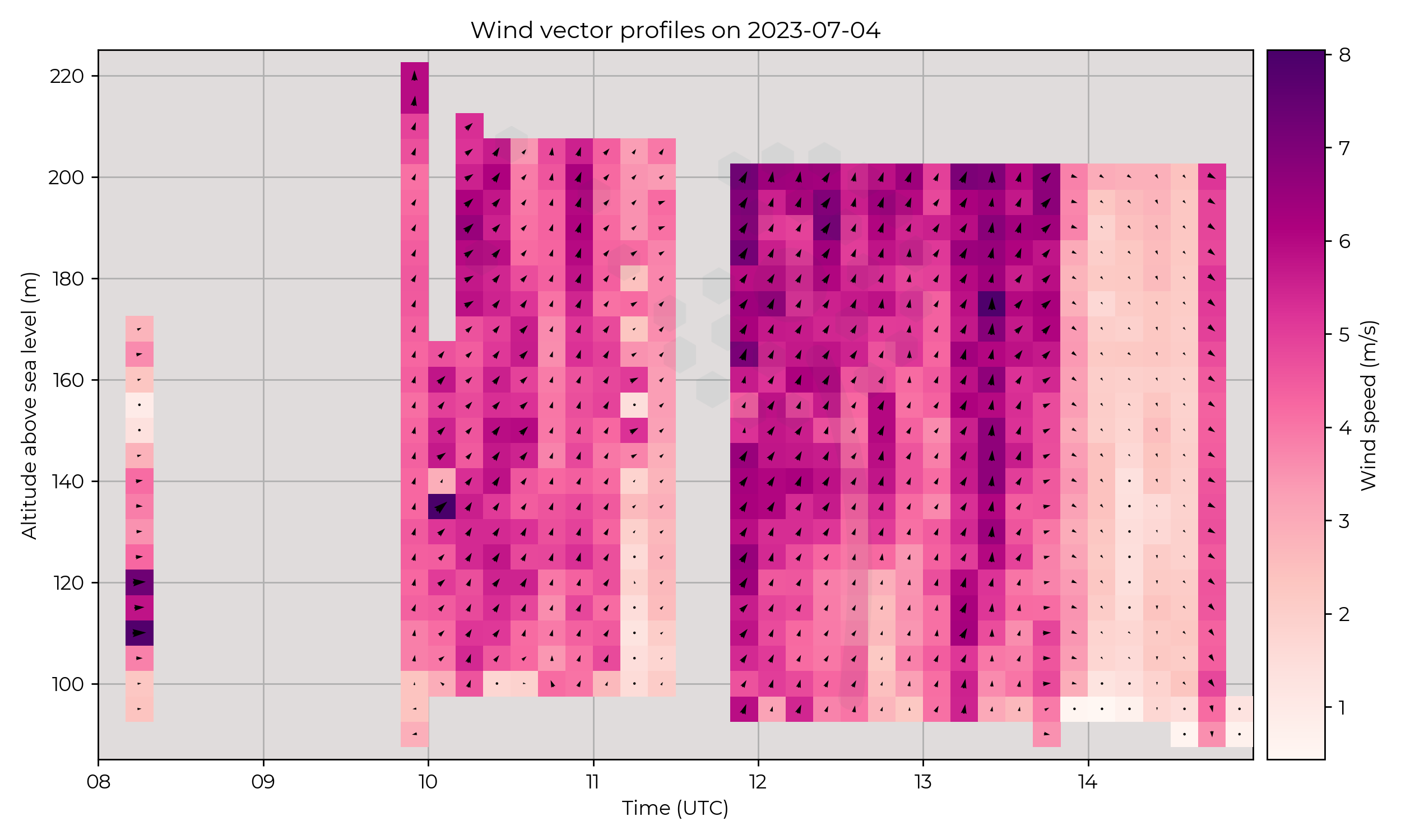
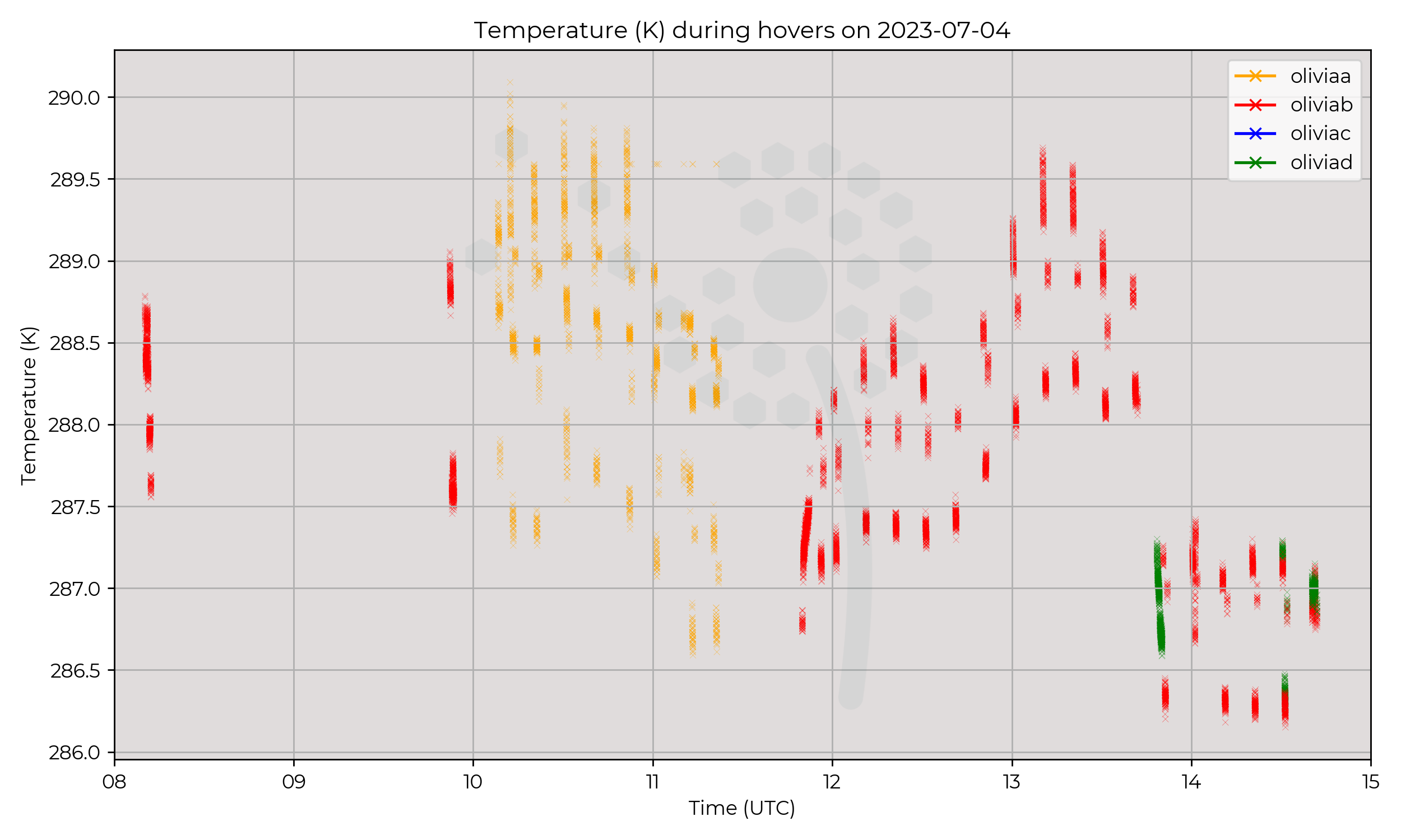
Developing cyclone between 12:00 and 18:00 to south / south east of Chilbolton.
Flight Patterns
Ascents in Chilbolton approximately every 10 minutes, hours of operation between 08:00 to 15:00.
Observations
Sharp change in profile around 14:00, decrease in temperature, increase RH and drop in wind.
Known Issues
None yet reported.2023-07-03
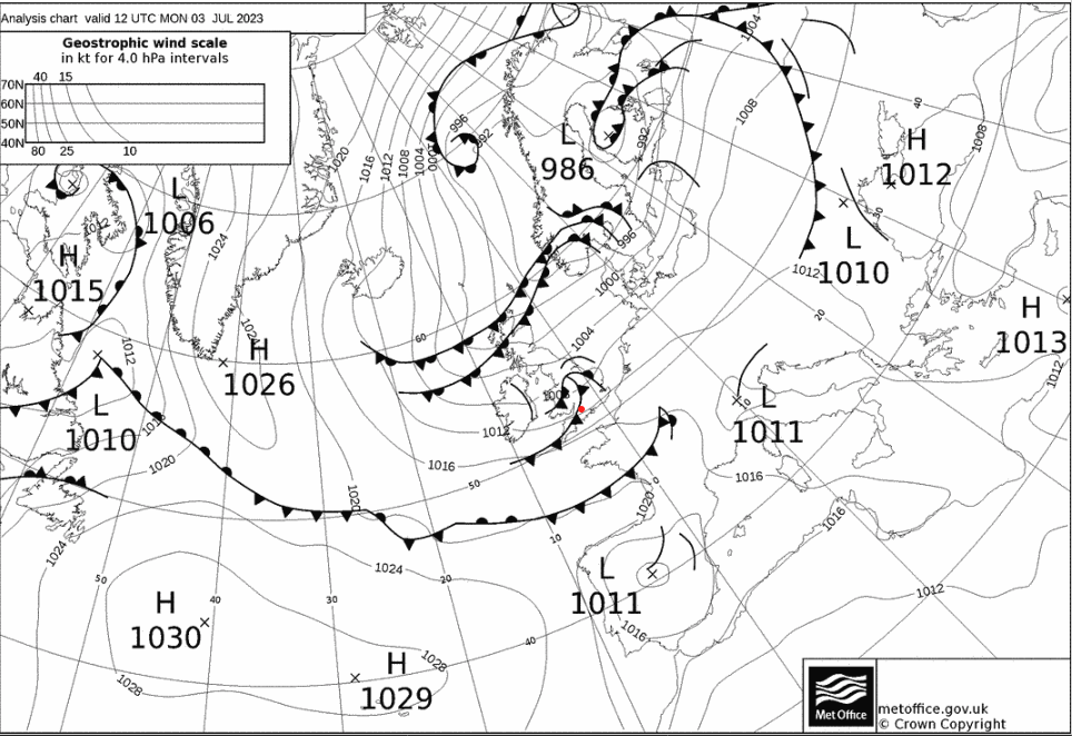
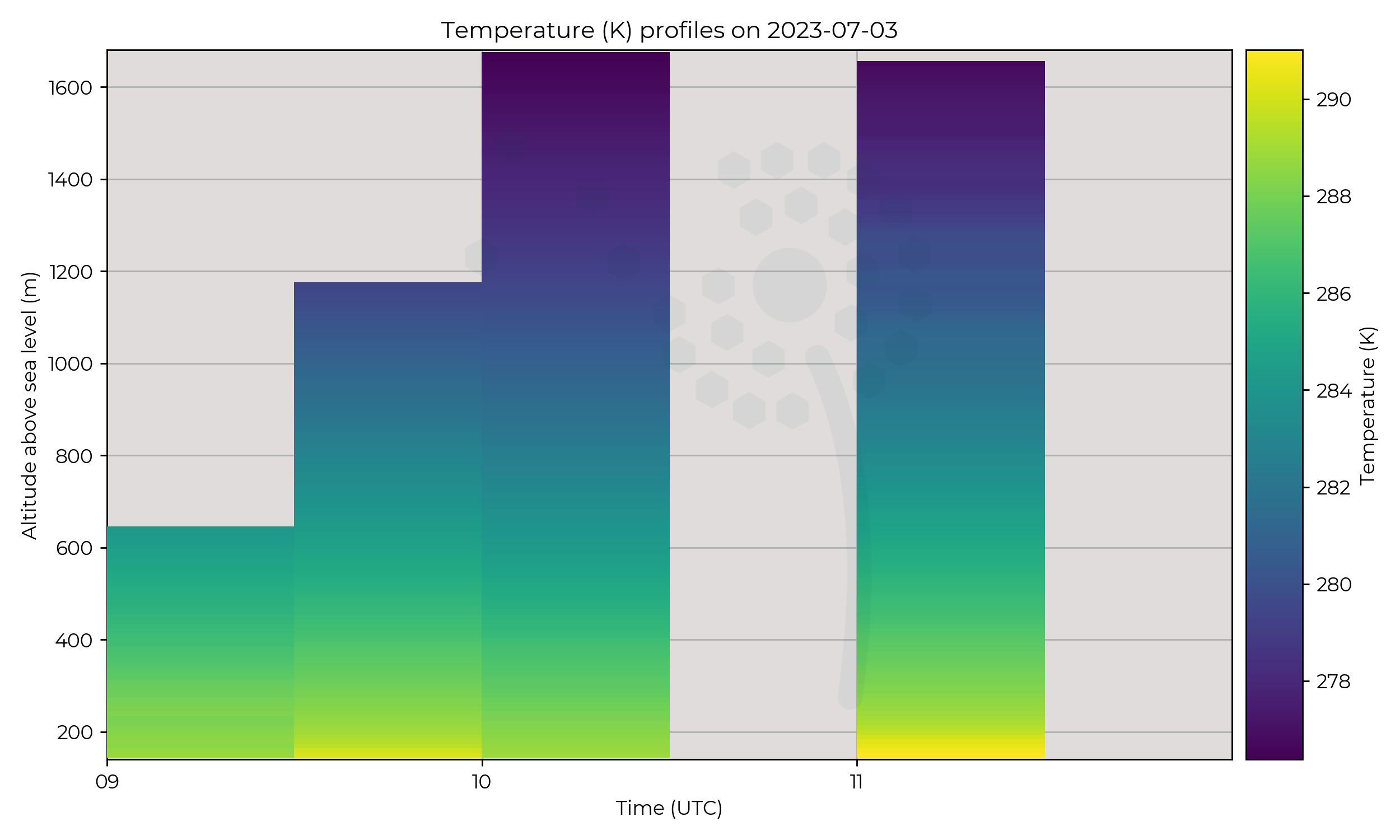
Synoptic Overview
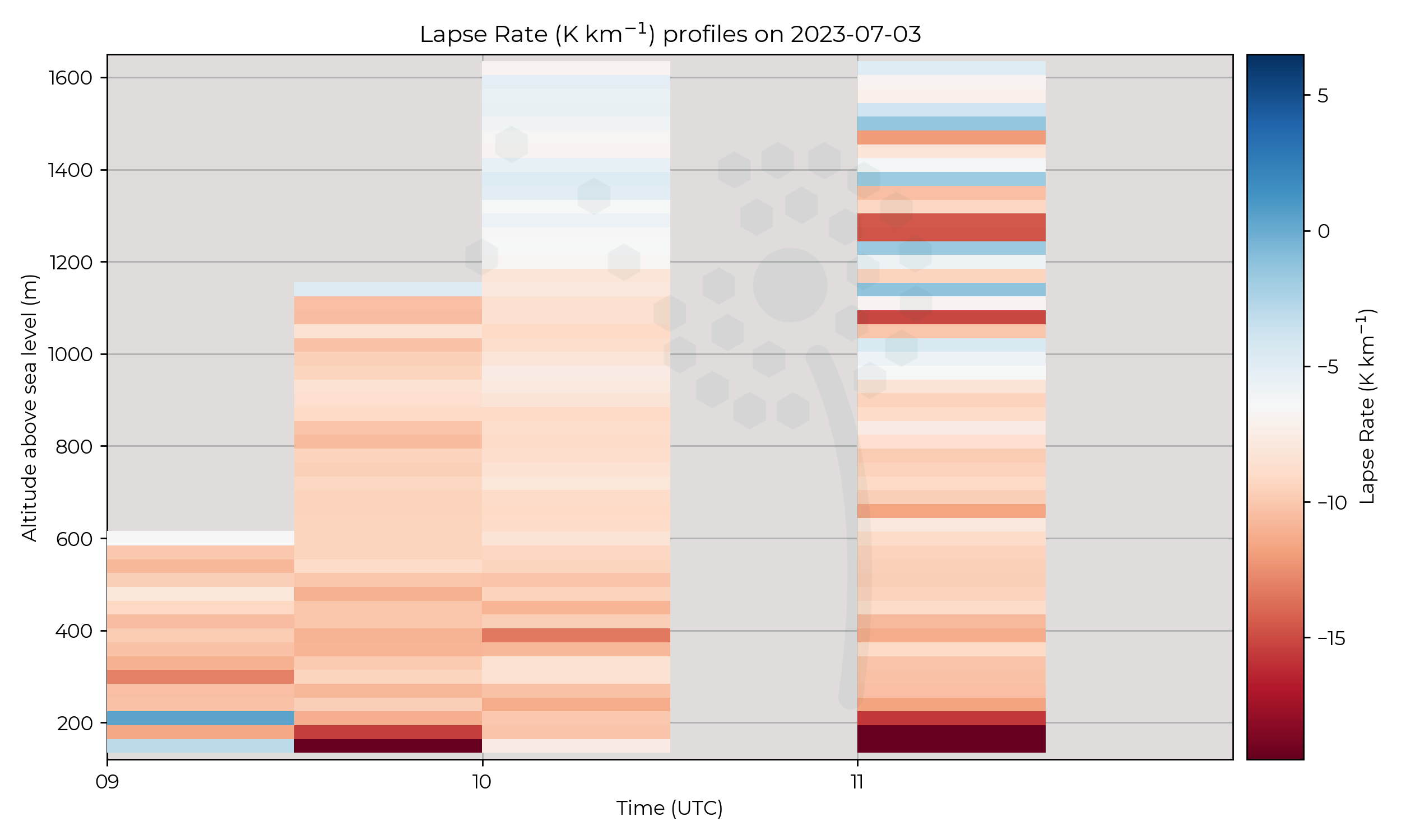
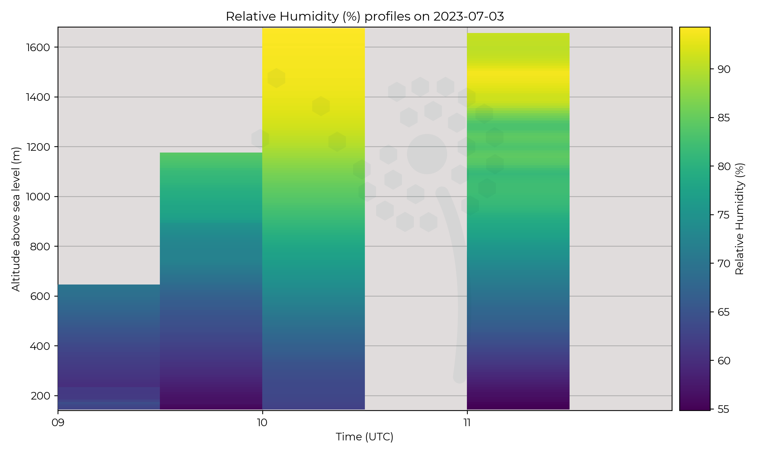
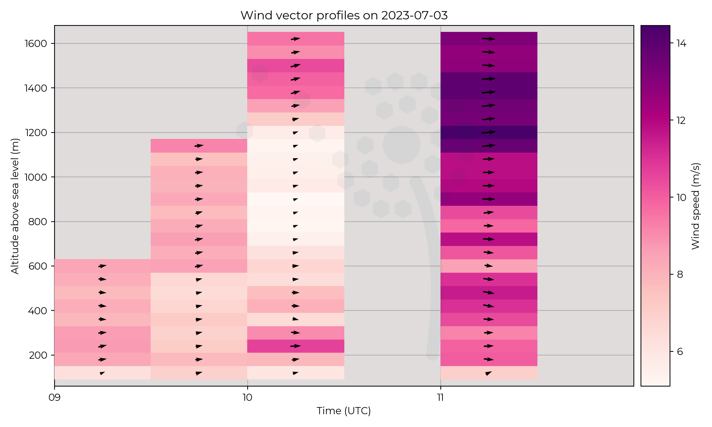
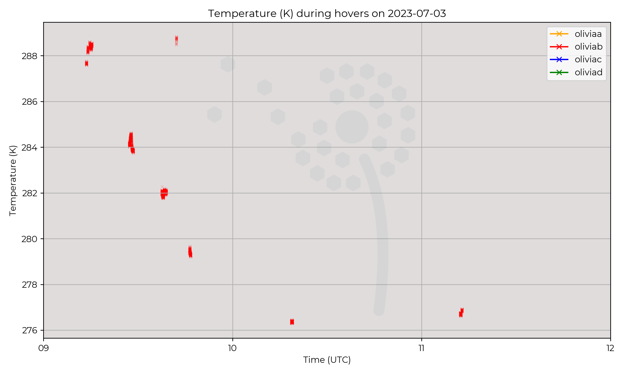
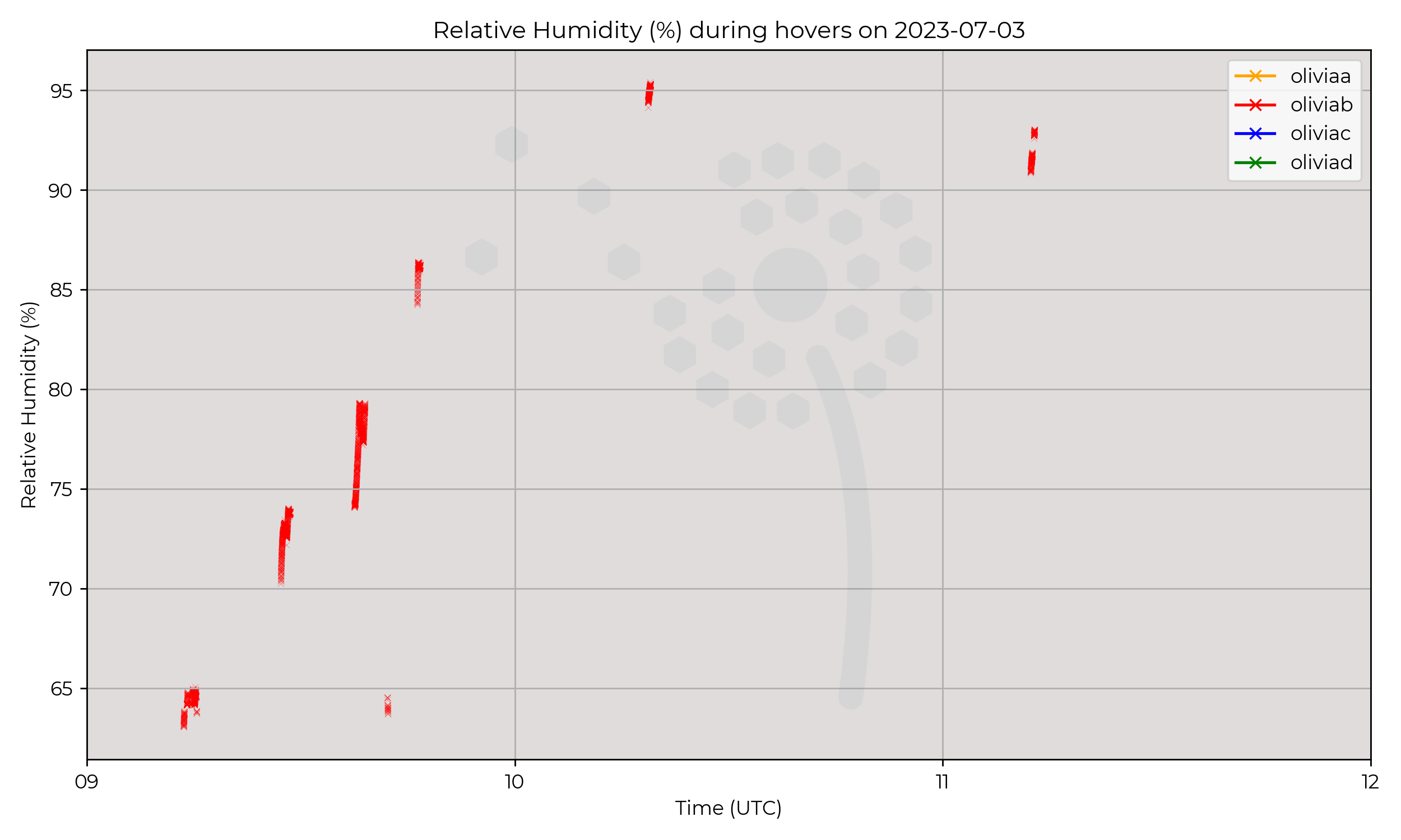
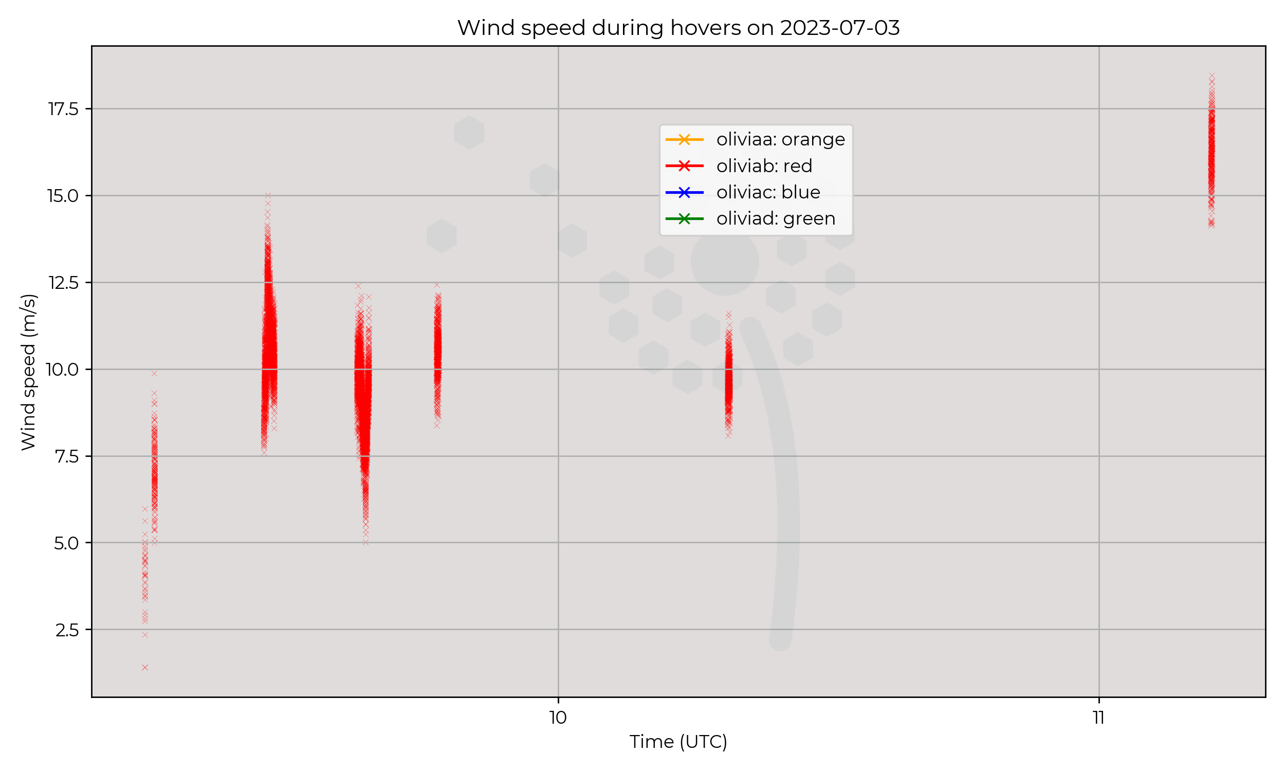
Cold front passage over SPTA, where front develops into occluded front.
Flight Patterns
UAVs undertaking higher ascents though day, reaching a maximum ~1600m AGL (highest altitude reached yet!)
Observations
Passage of front may align with high windspeed and high RH at altitude. (satellite image shows large cloud presence)
Known Issues
None yet reported.Week 2
2023-06-30
2023-06-29
Synoptic Overview
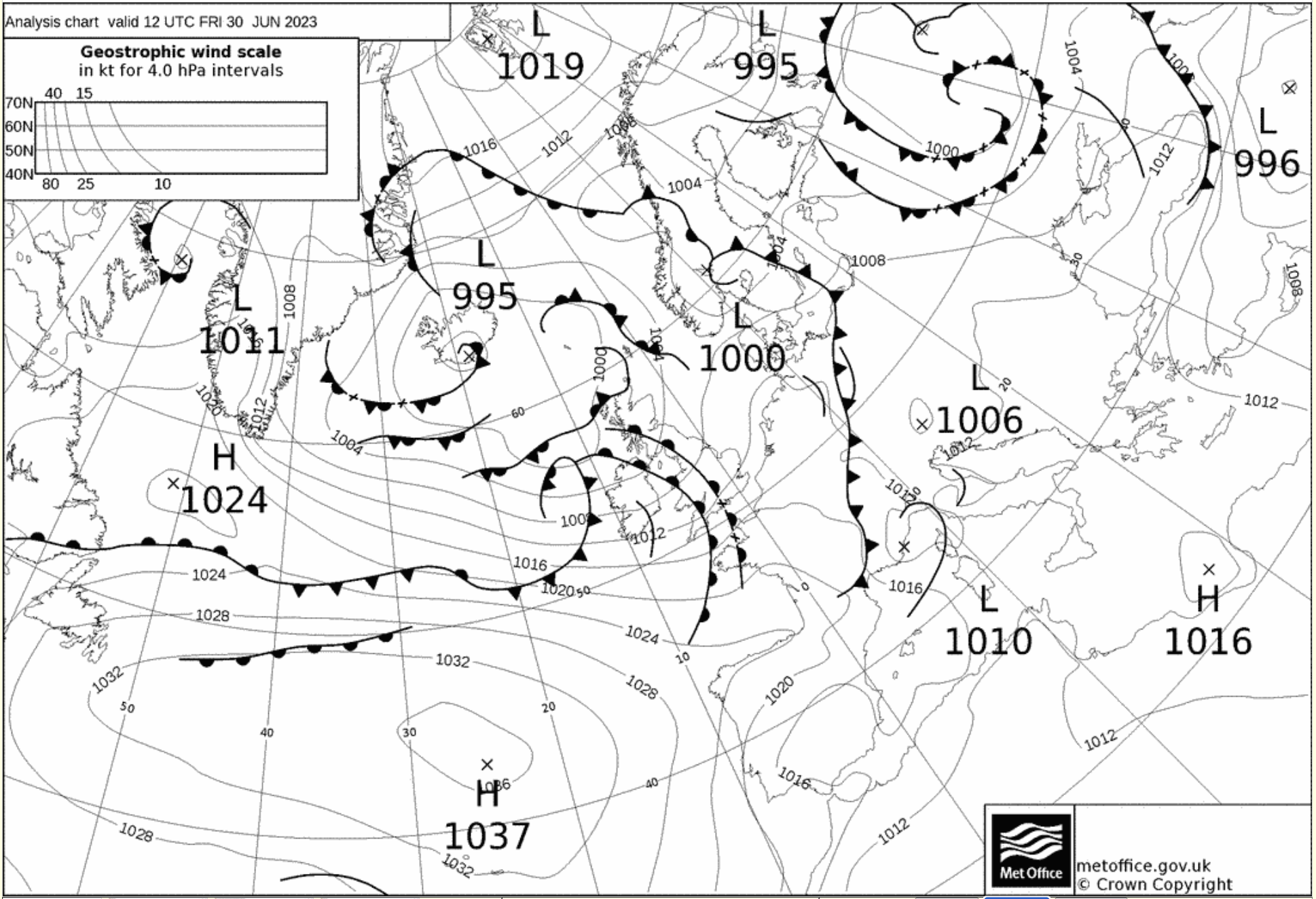
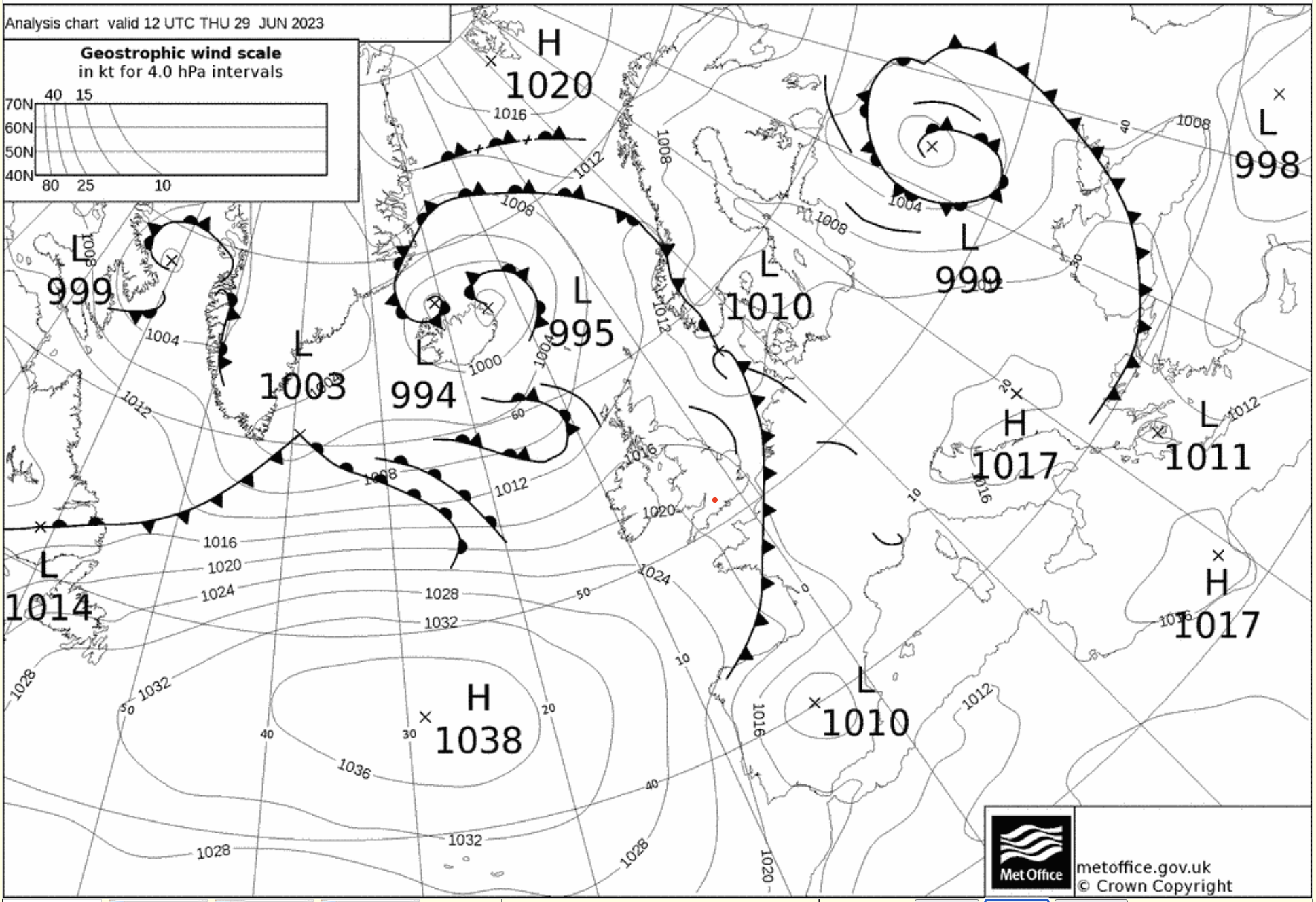
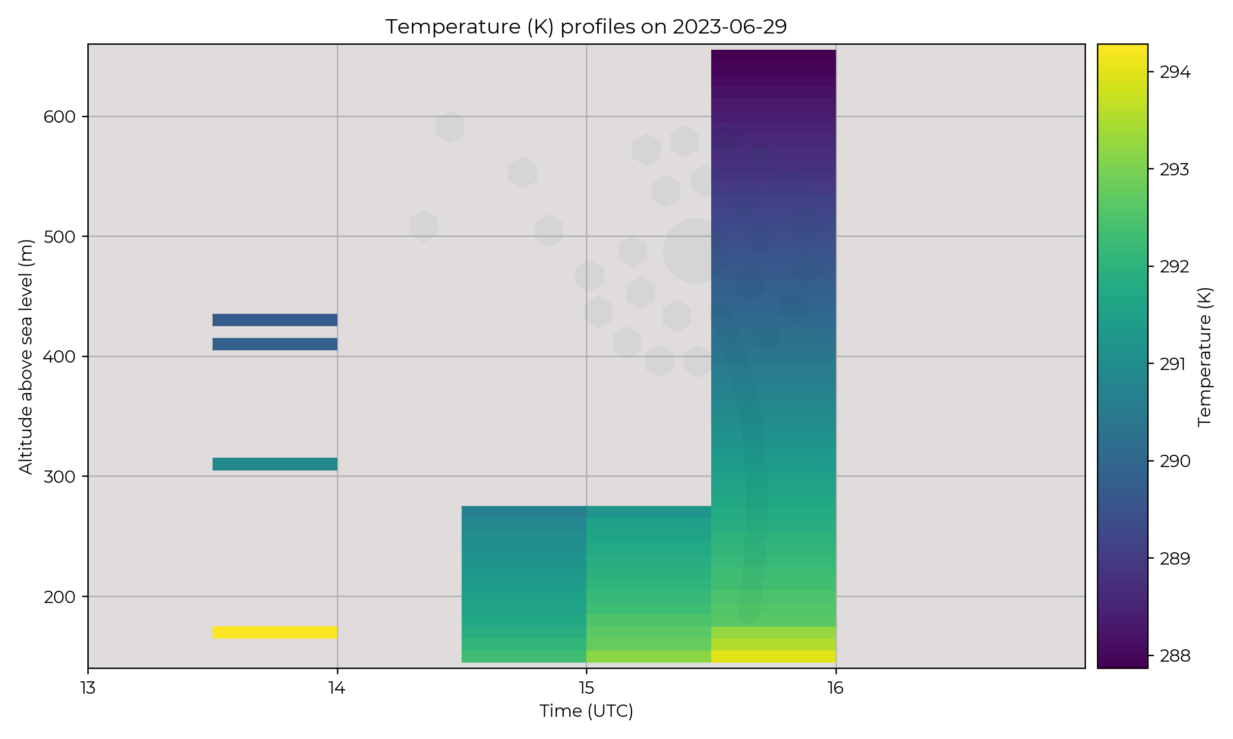
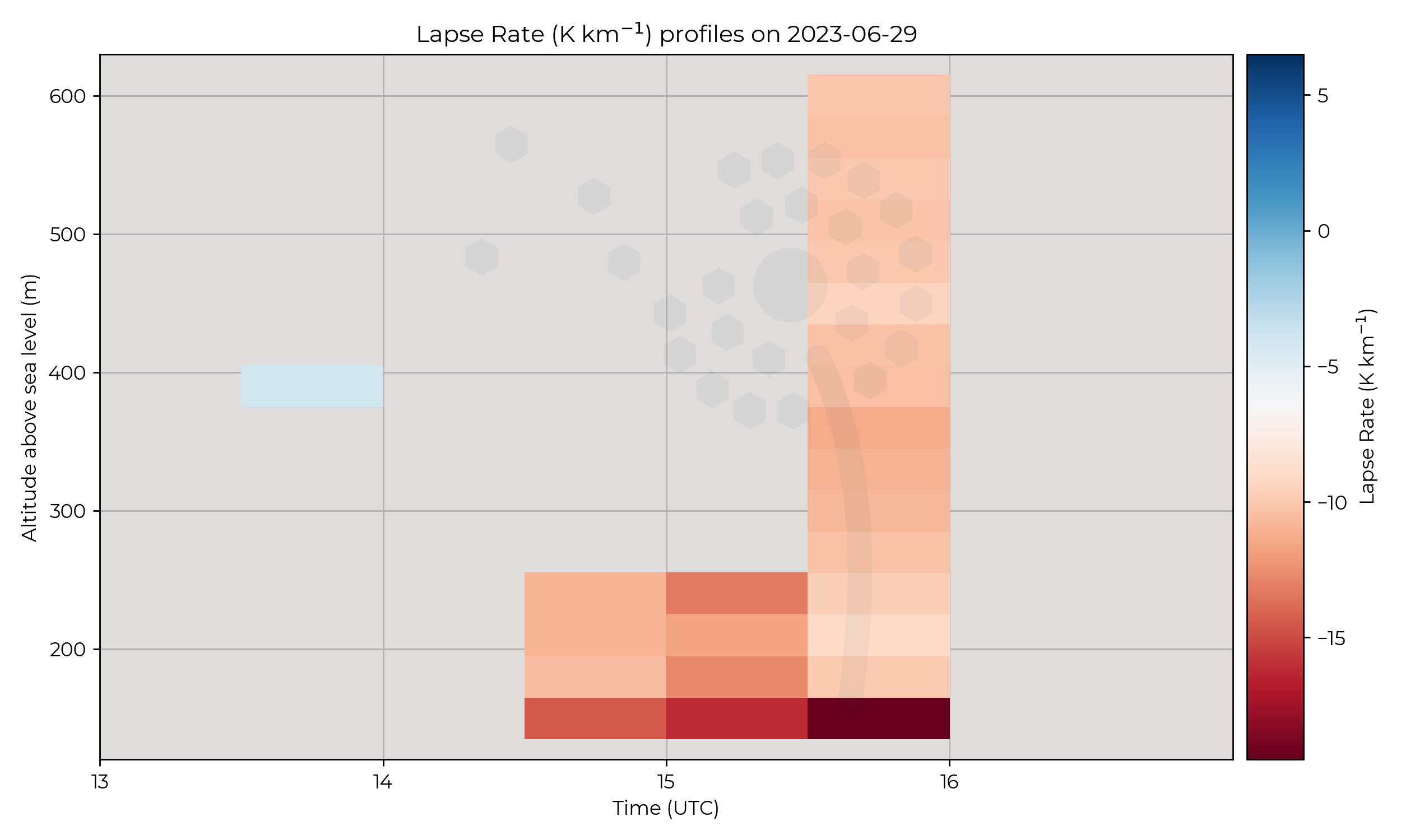
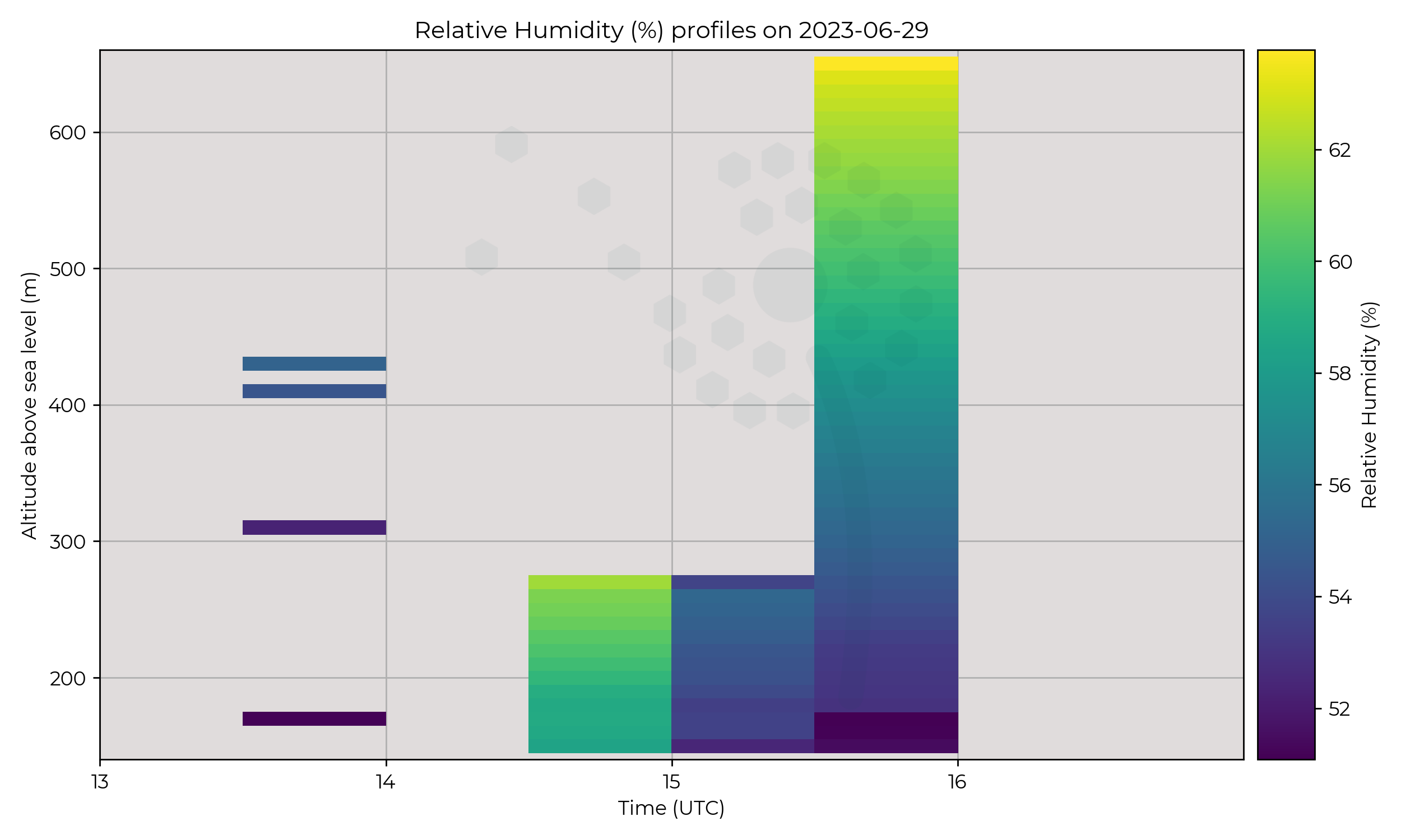
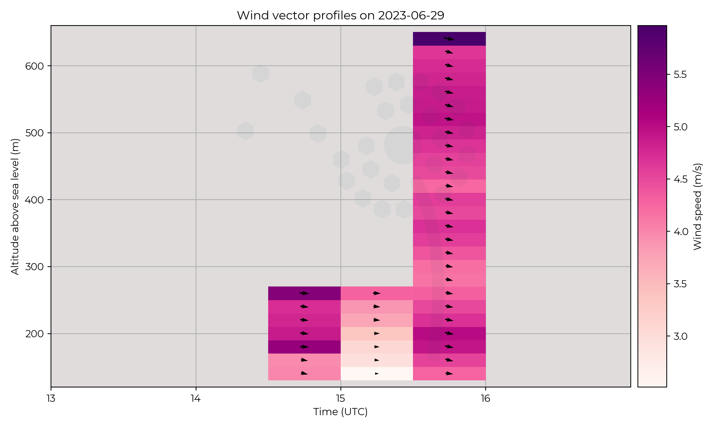
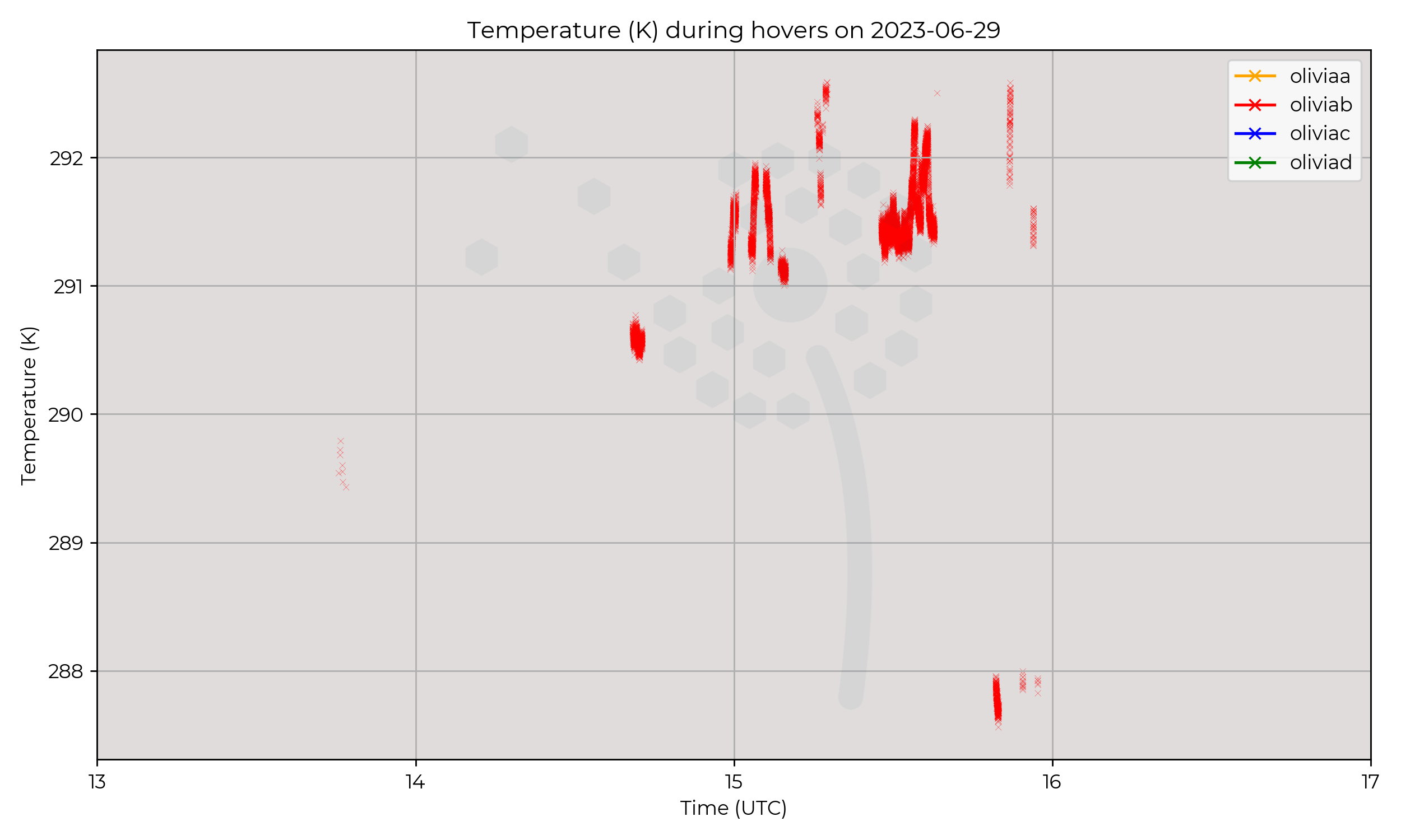
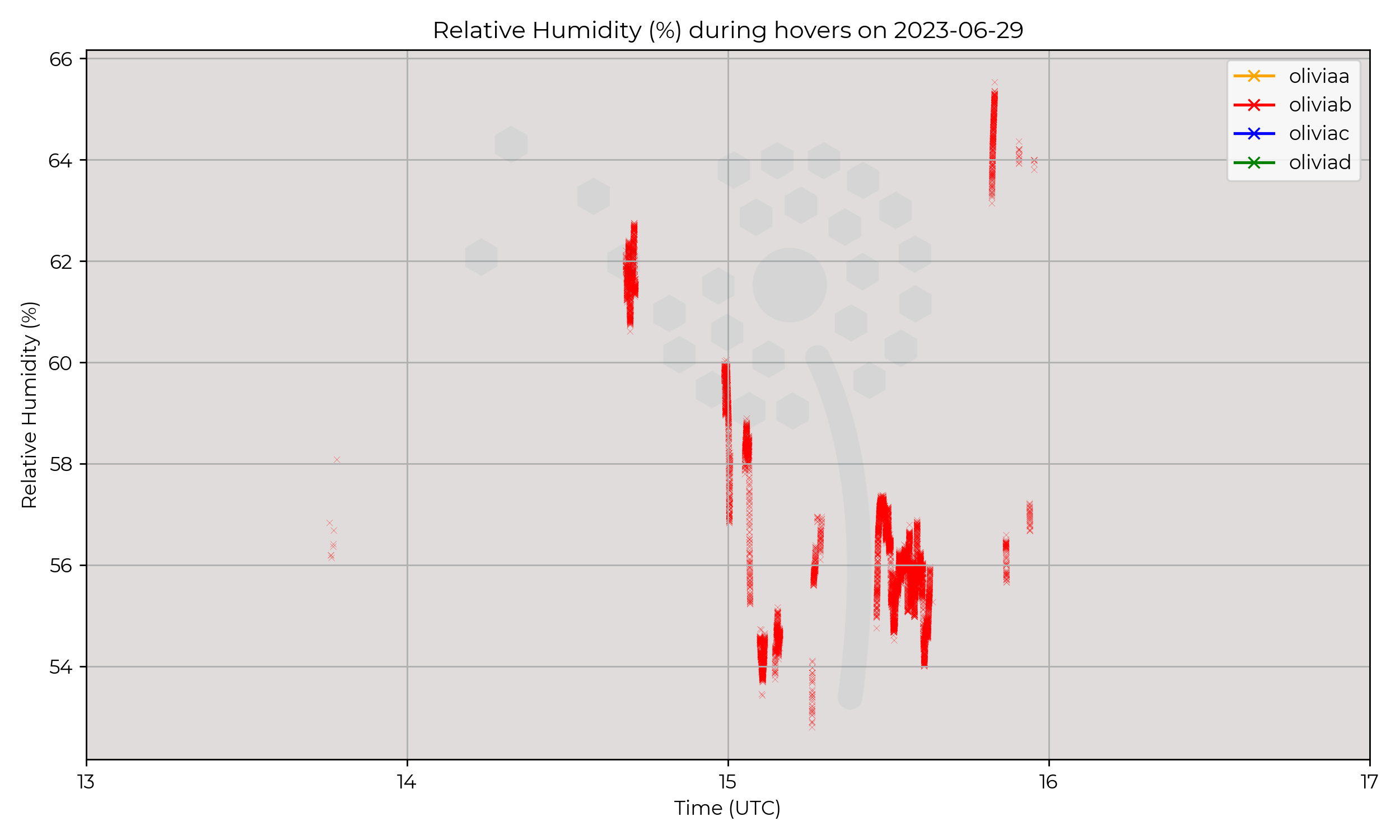
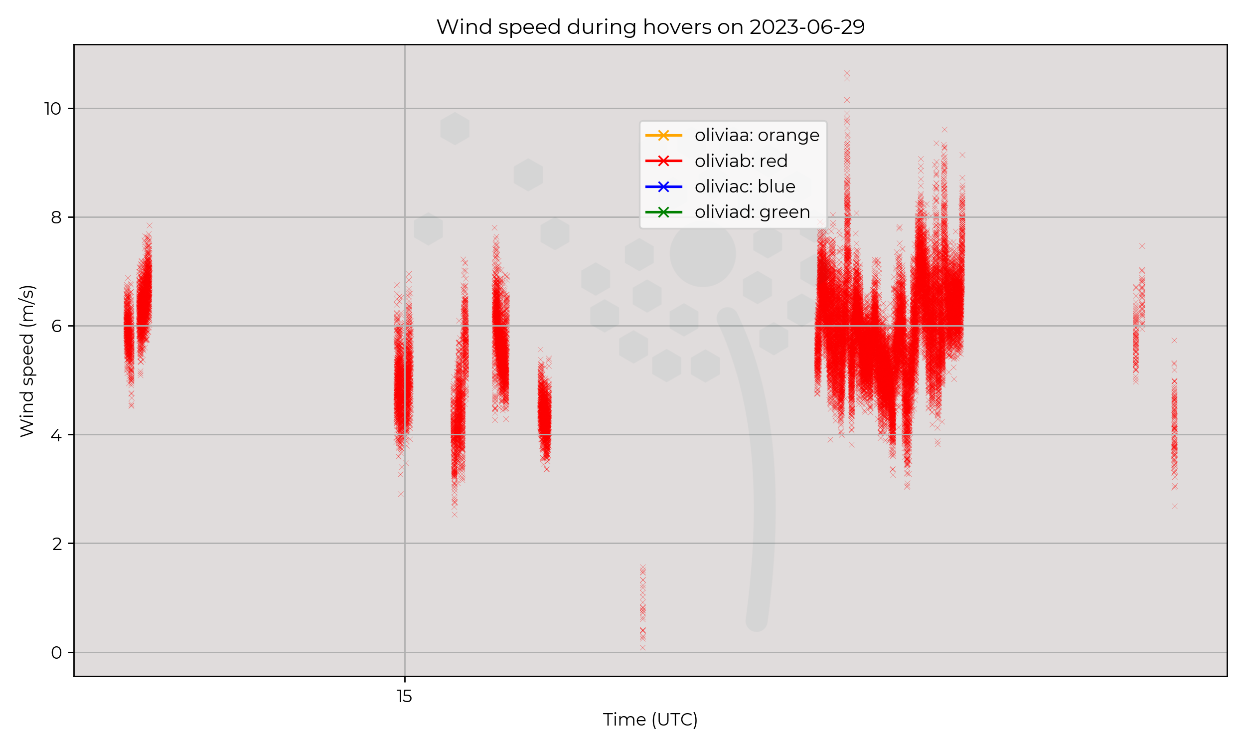
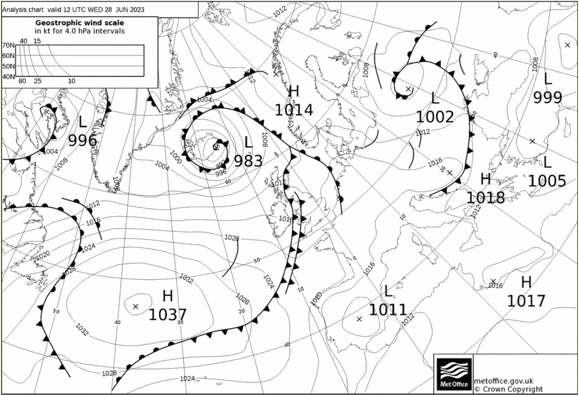
UK in the trail of a slow moving cold front moving SE.
Flight Patterns
Unusual flight pattern. Met Office scientists also present, simultaneous ascents with MetSprite and Met Office UAV at a range of ascent speeds.
Also the first flight to 500m AGL!
Observations
Data from this day for comparision with Met Office UAV.
Known Issues
None yet reported.2023-06-28
2023-06-27
2023-06-26
Synoptic Overview
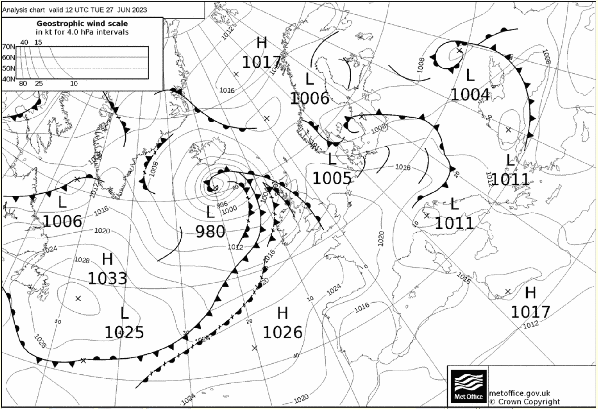
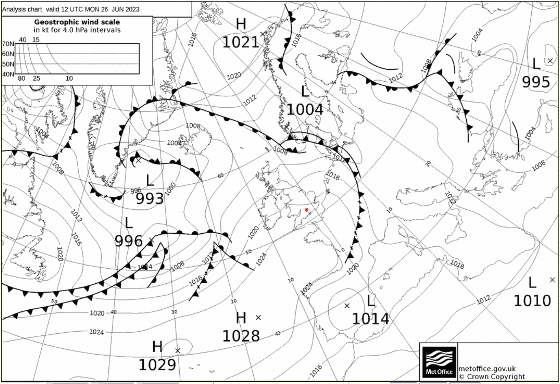
Passage of cold front in early hours, moving NE. Weakening occluded front dissipates before mid-day to NW of British Isles.
Flight Patterns
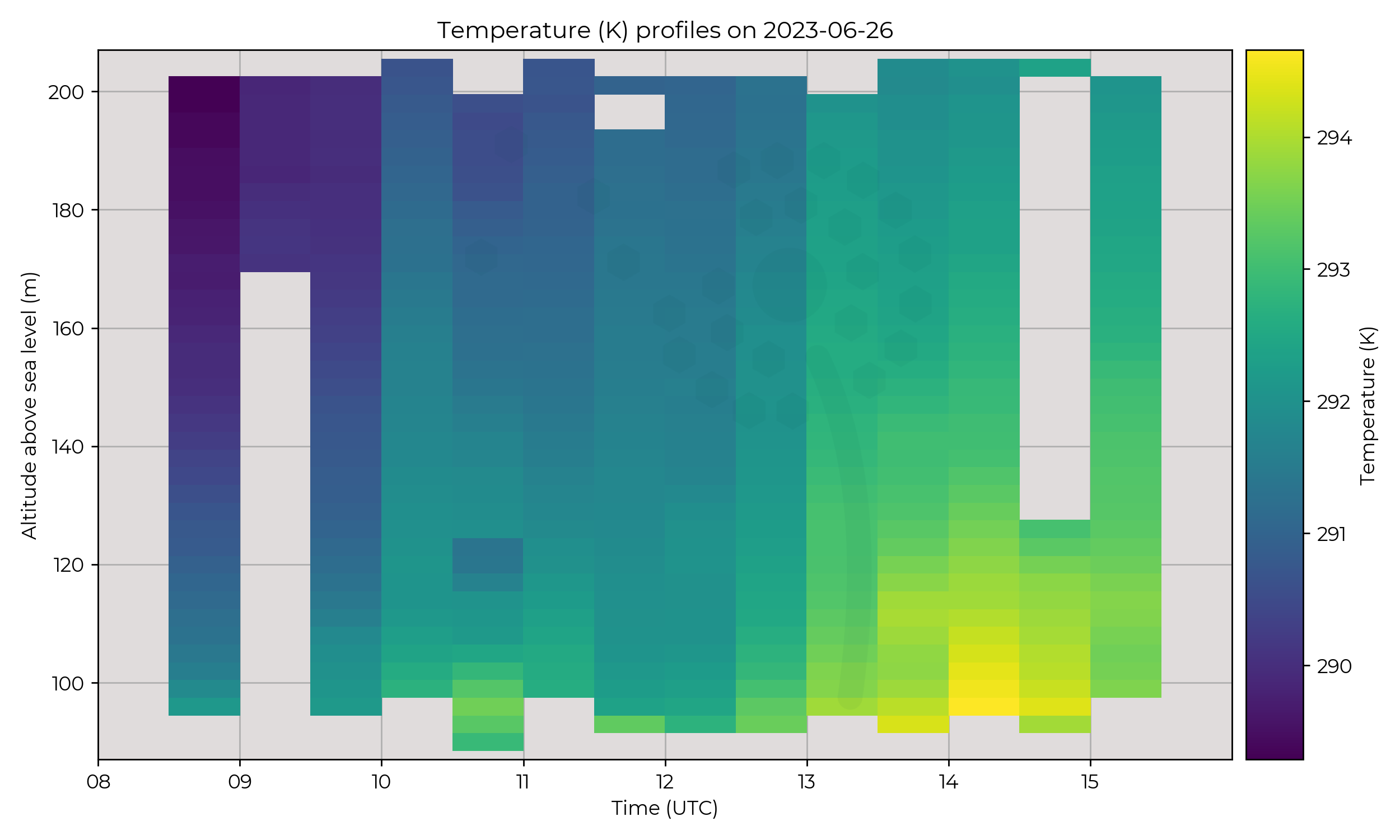
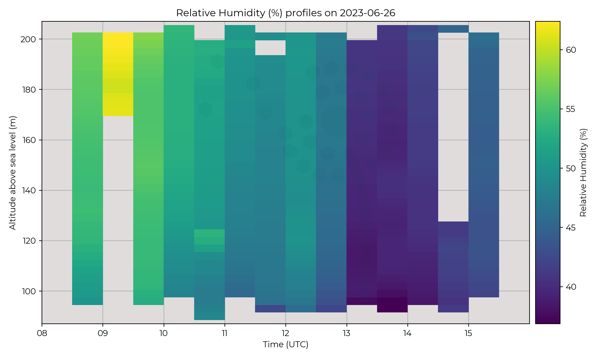
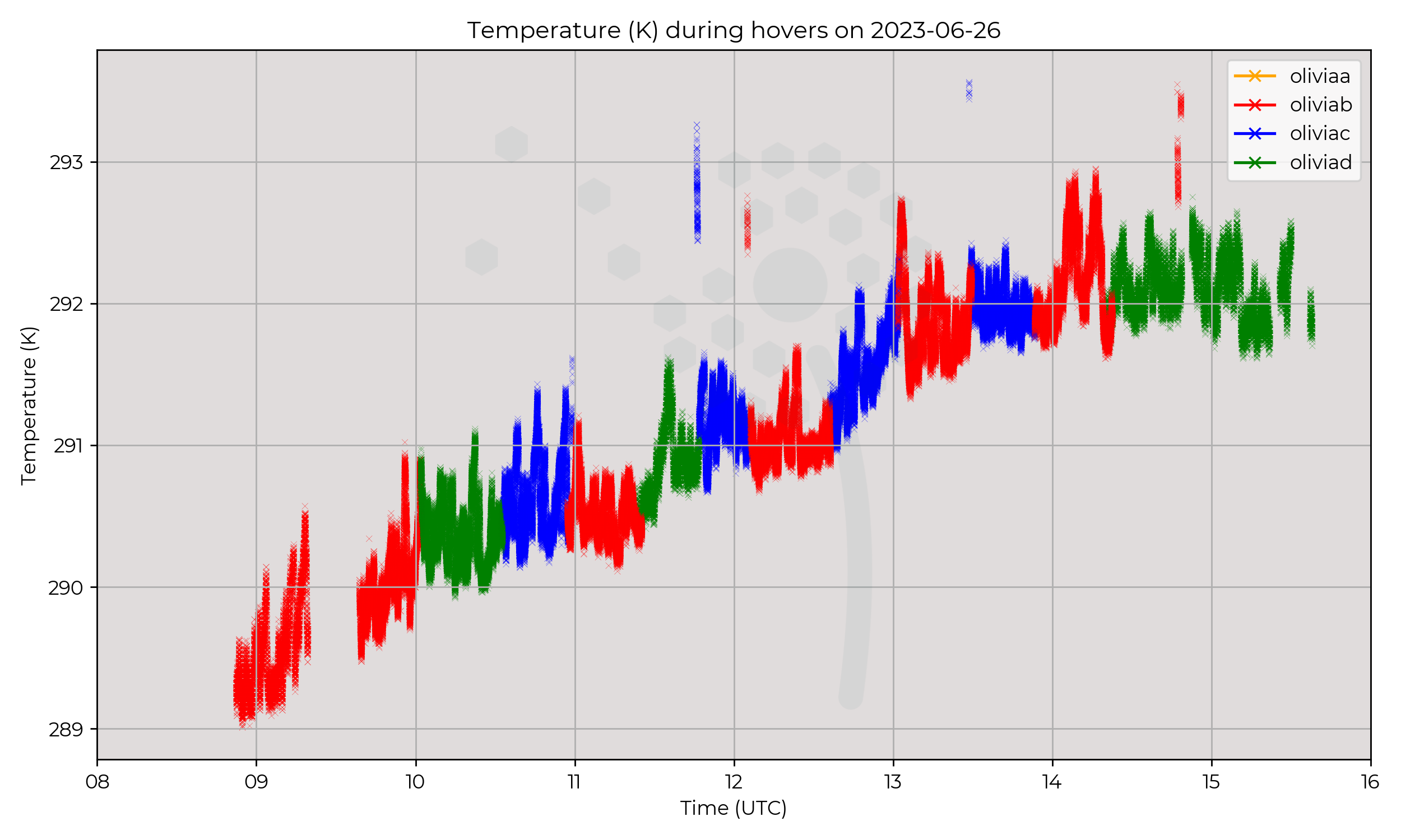
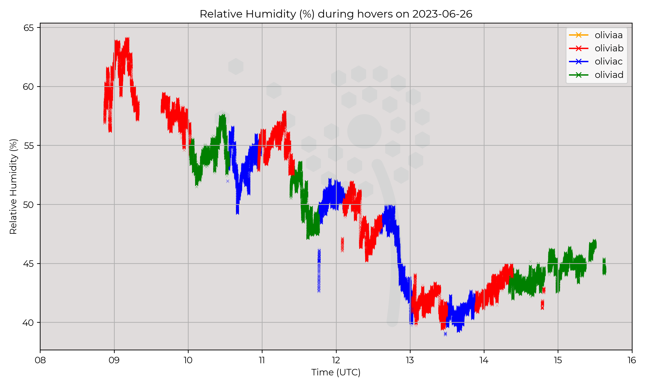
Hovers at Chilbolton, alternating ascents of Olivia-B, Olivia-C and Olivia-D approximately every 30 minutes.
Almost constant presence at 120m for the hours of operation.
Observations
Average day, warming and drying out of atmosphere, some oscillations in relative humidity during hovers.
Known Issues
- Wind data is not available for this day
- Drop out in measurements, led to gaps in profile data
Week 1
2023-06-23
2023-06-22
Synoptic Overview
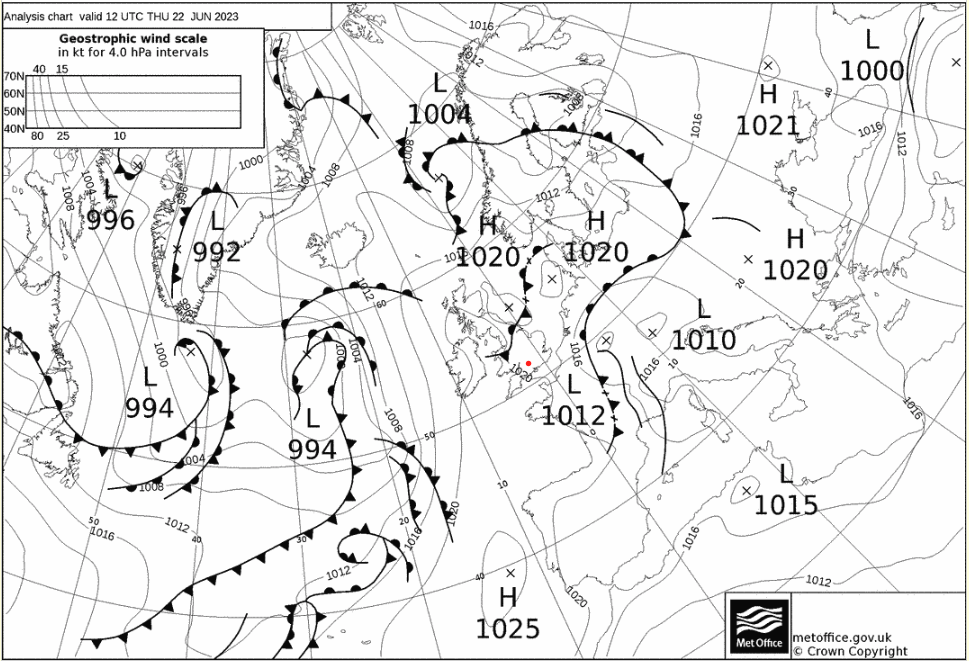
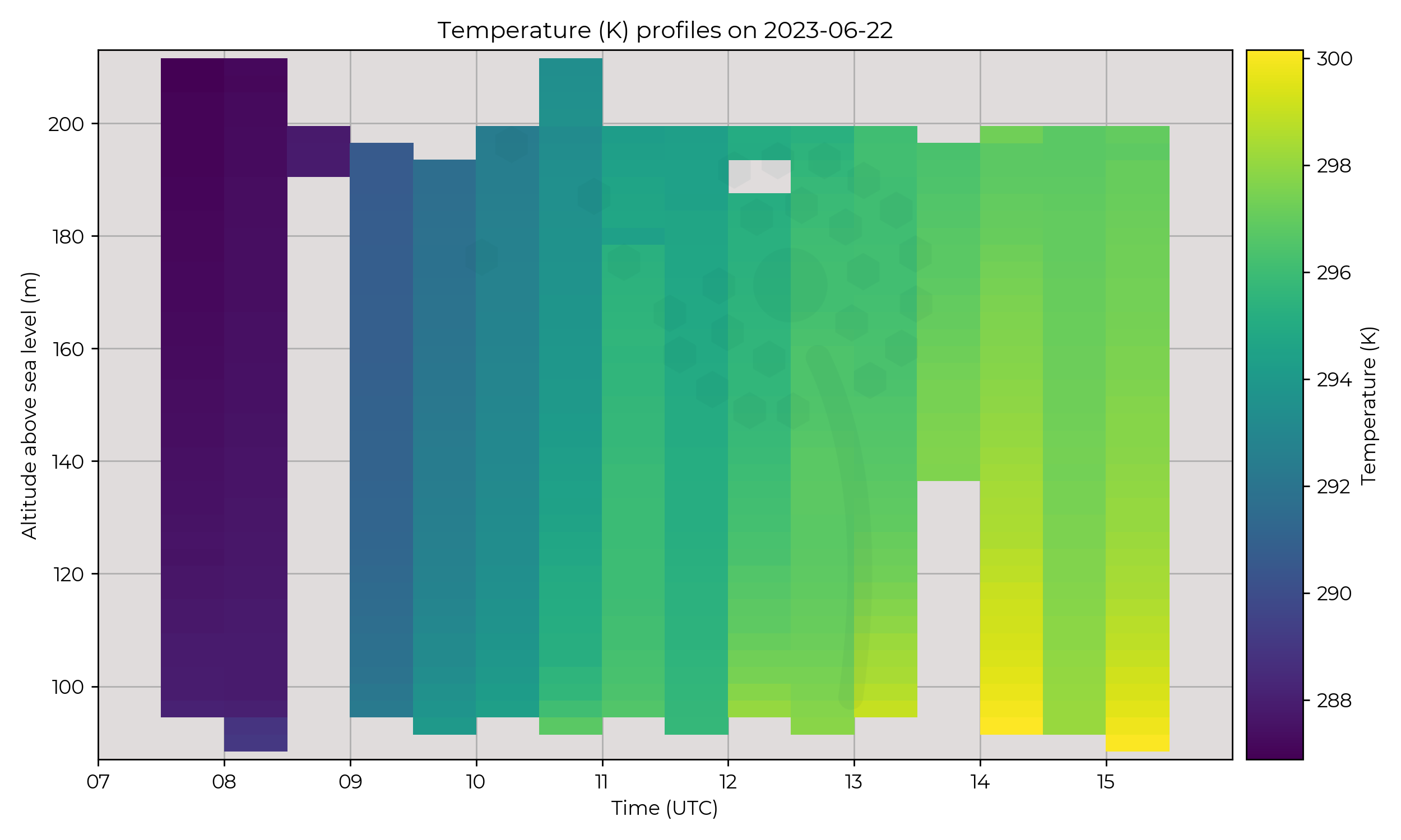
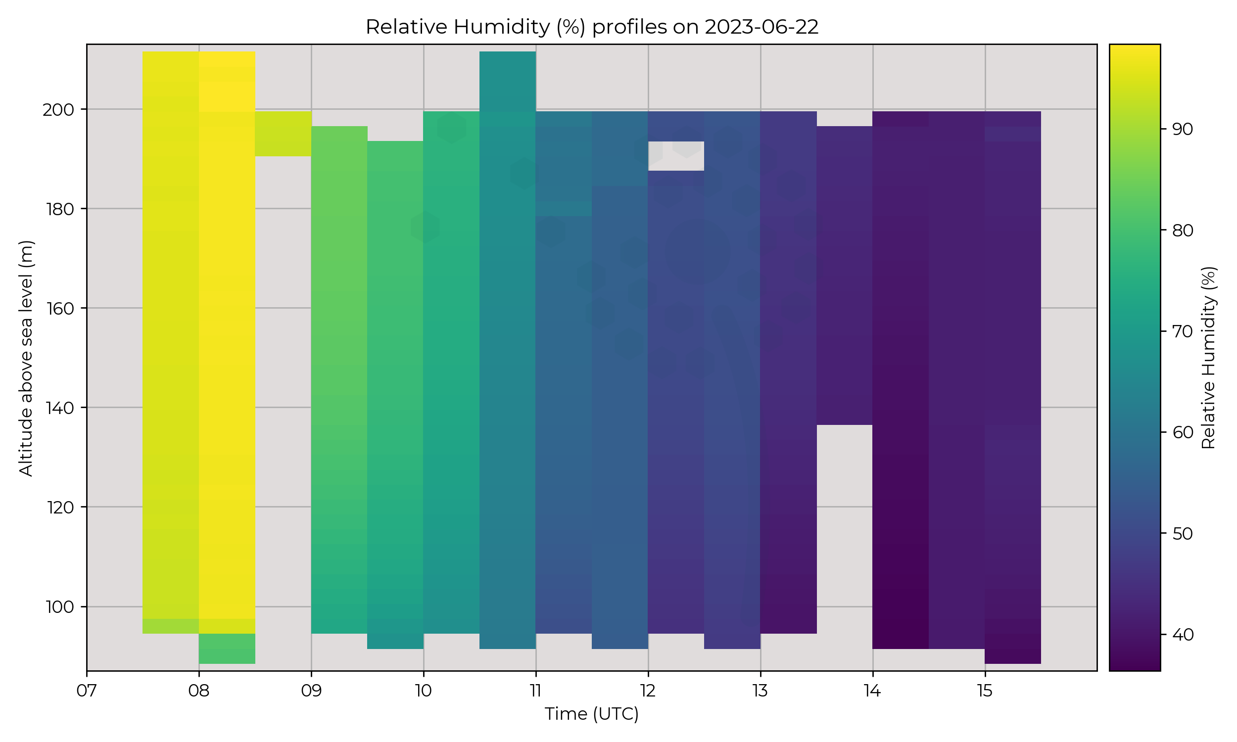
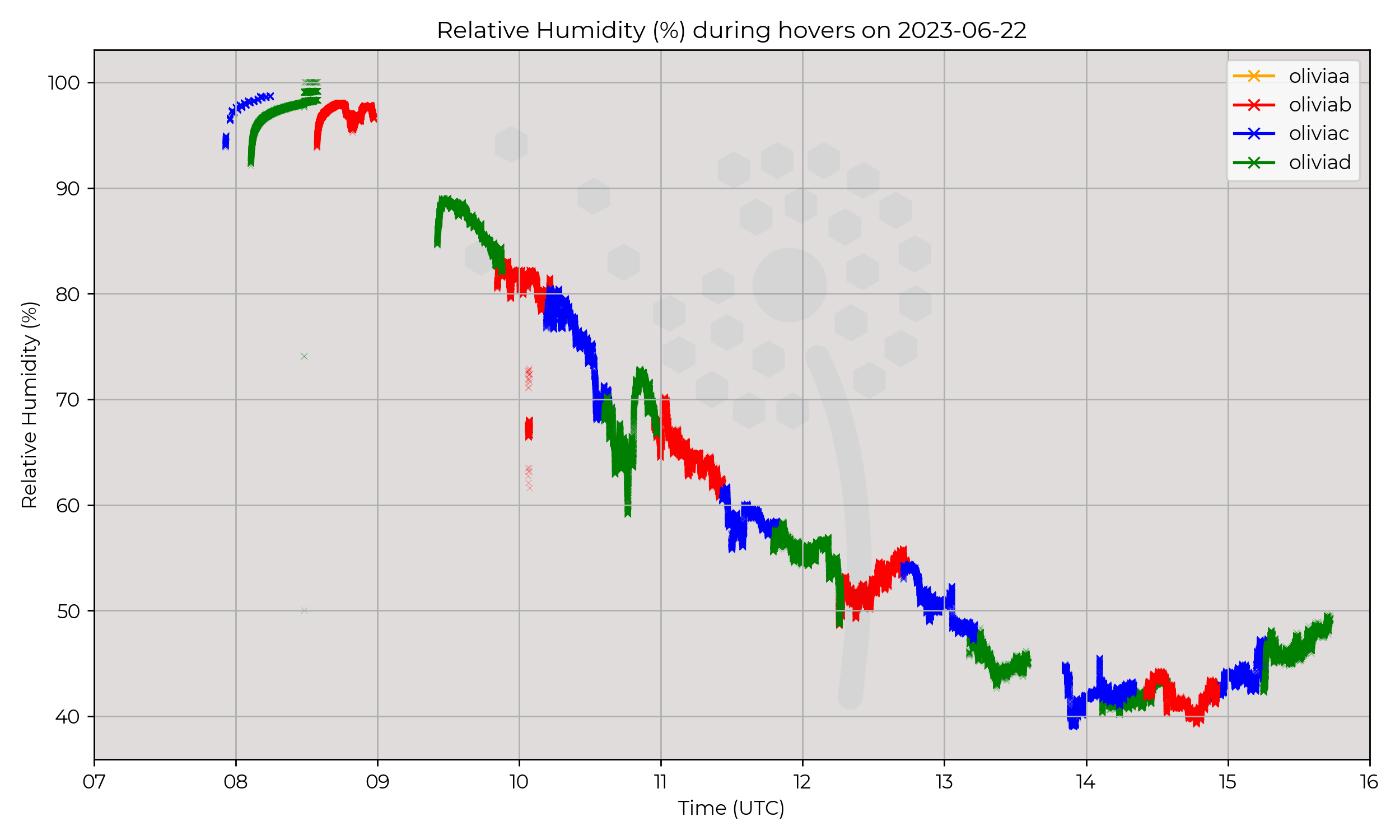
UK straddles a low to the south and high pressure region to the north. Weakening occluded front moves south, but not passing over Chilbolton.
Flight Patterns
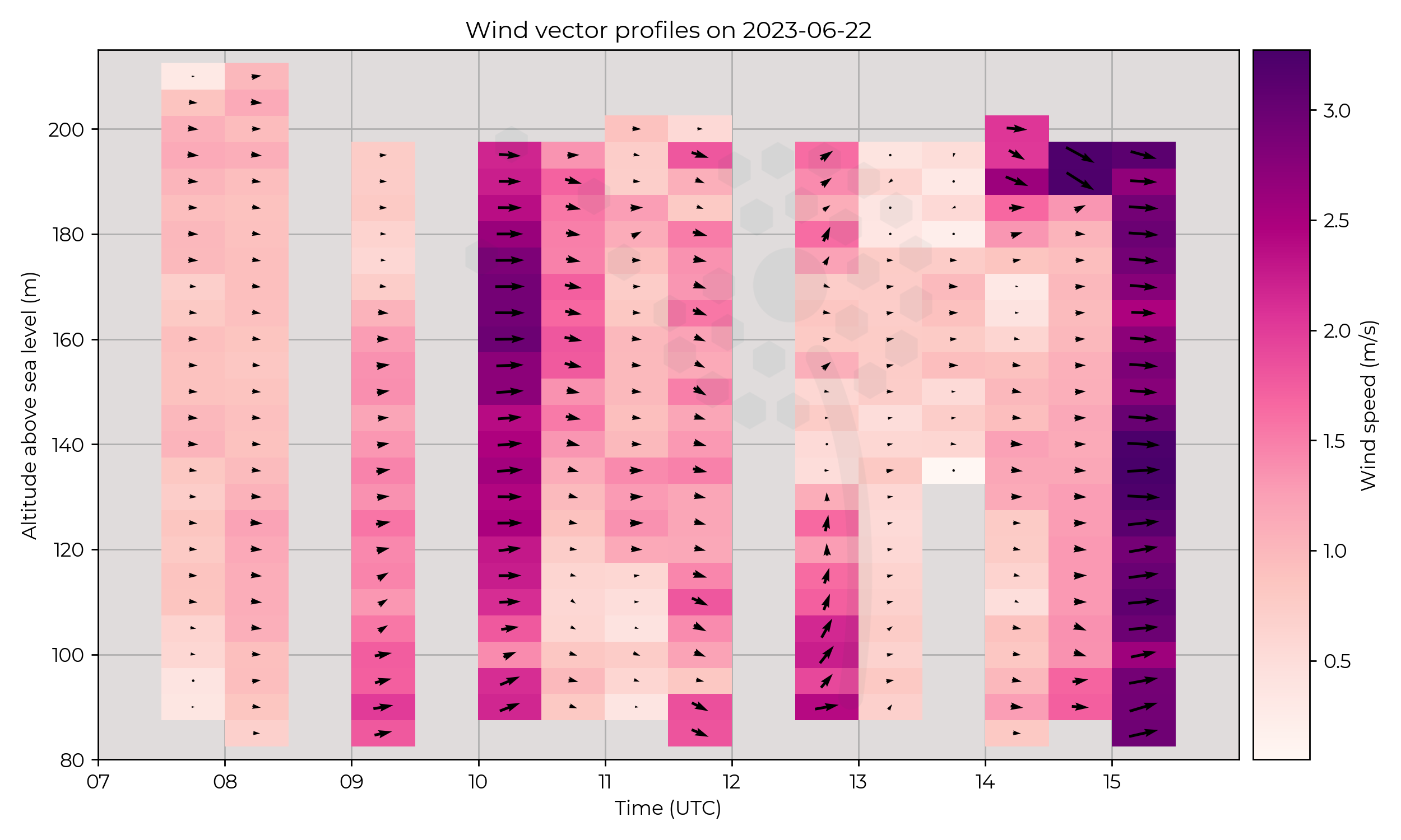
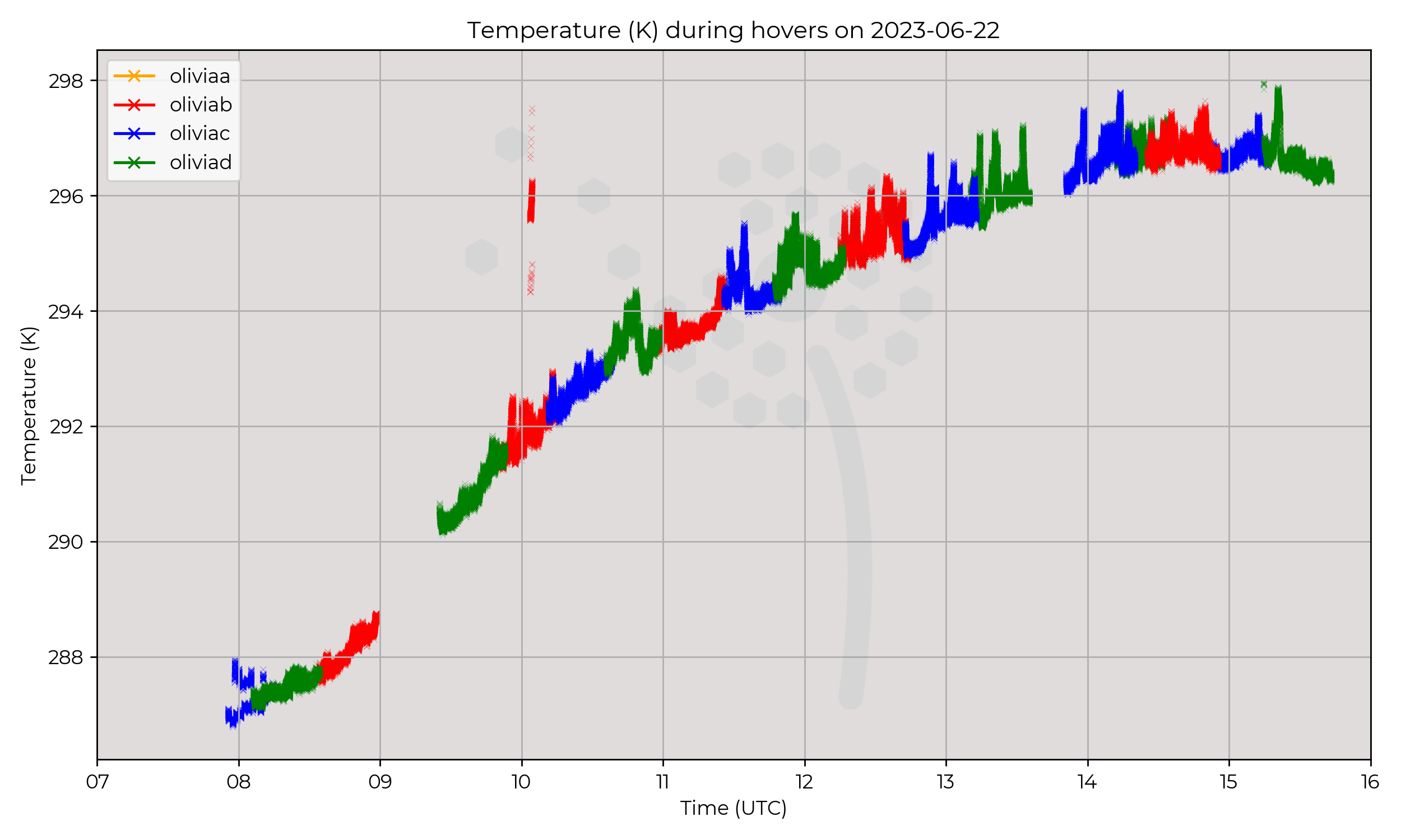
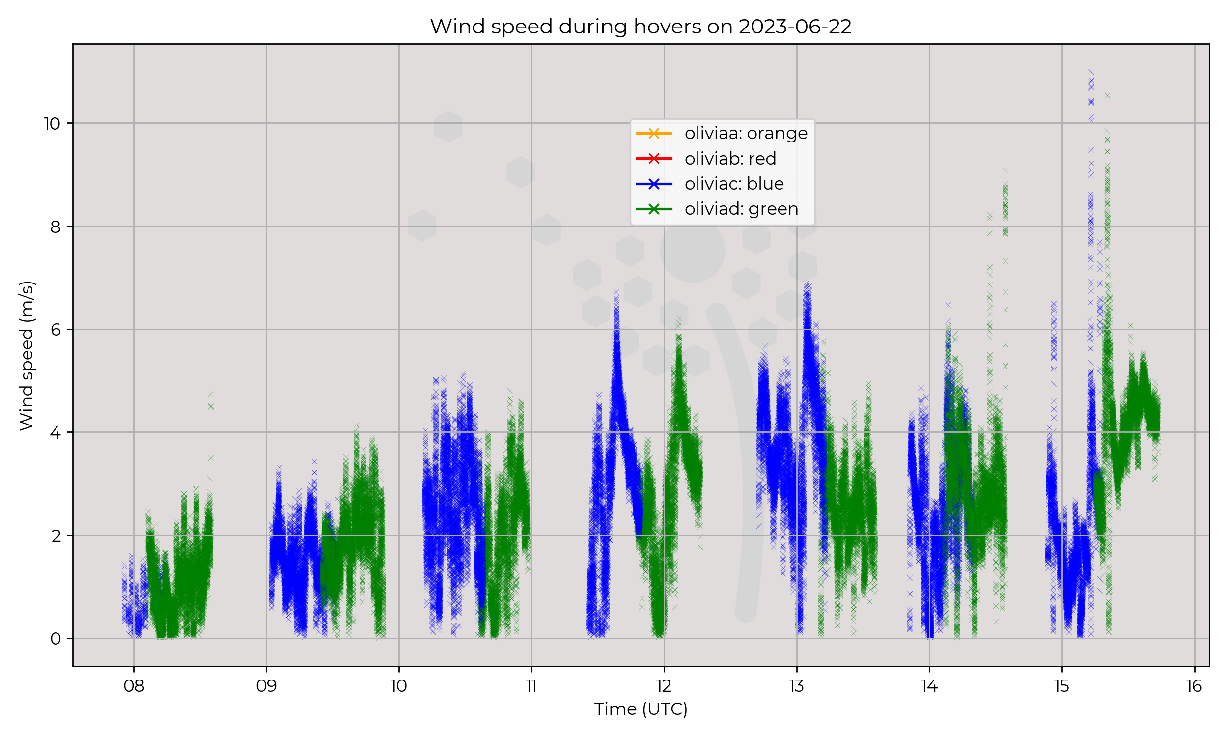
Consistent presence at 120m in Chilbolton, ascents approximately every 30 minutes.
Observations
Lovely day, convection in full force; low winds, with drying out and warming of the vertical profiles.
Known Issues
2023-06-21
Synoptic Overview
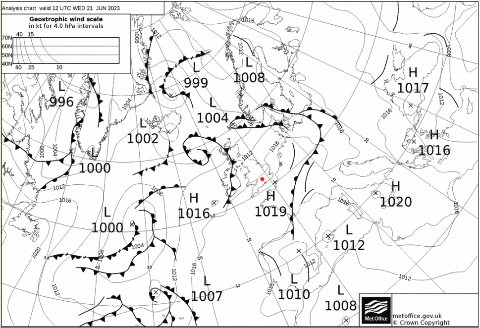
High pressure movement from SW (relative to Chilbolton) to NW of UK. No major frontal events around Chilbolton. Satellite data support presence of good convection, with horizontal convective rolls forming across southern UK.
Flight Patterns
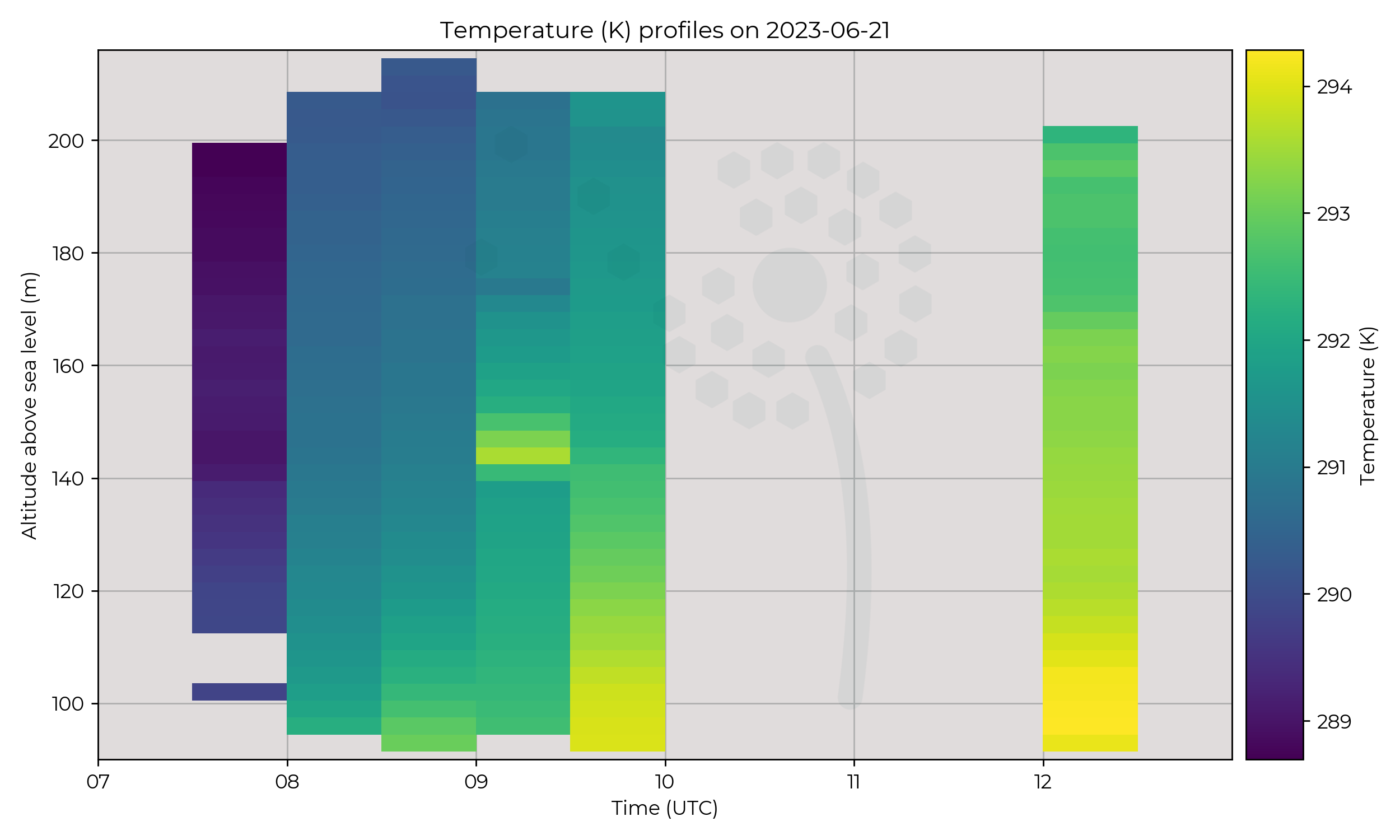
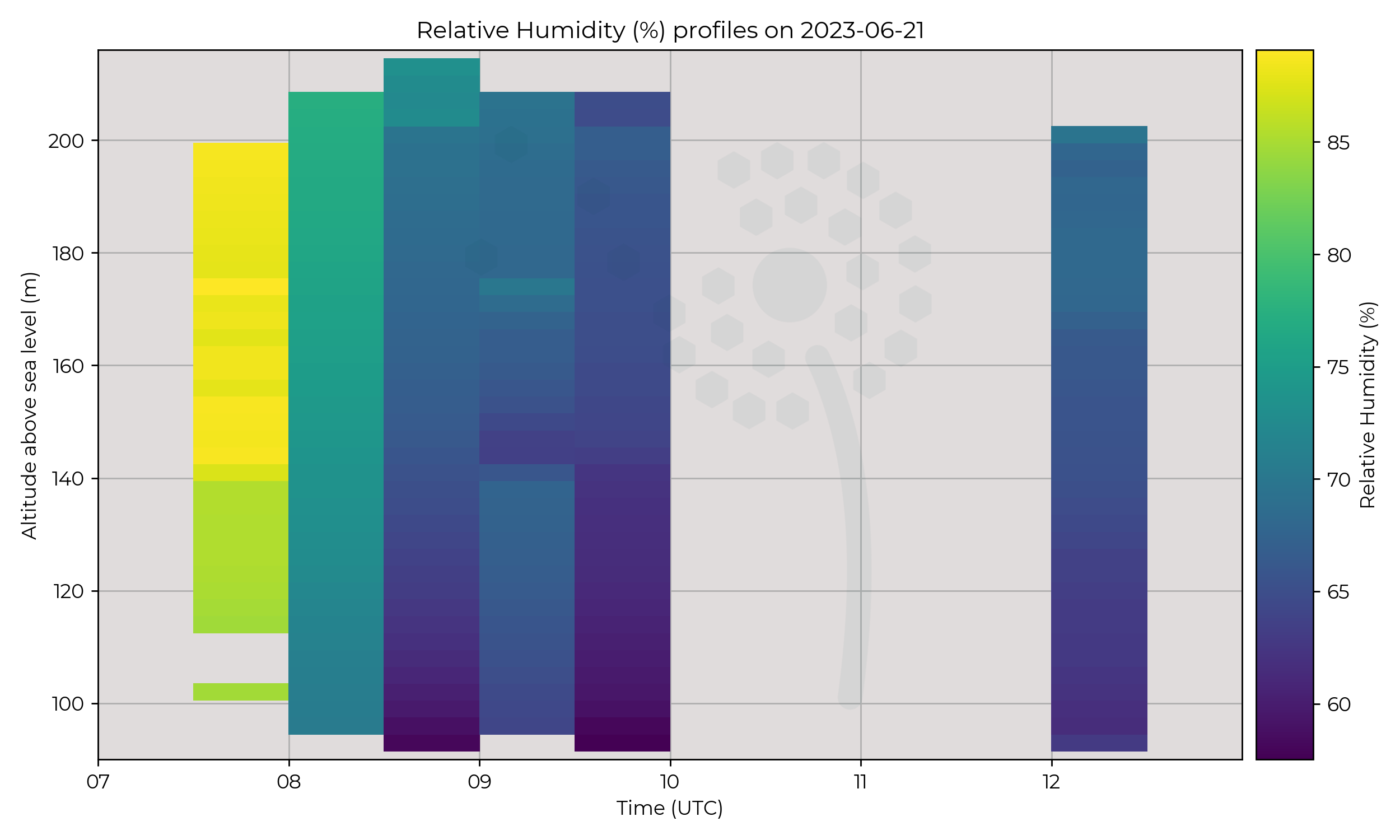
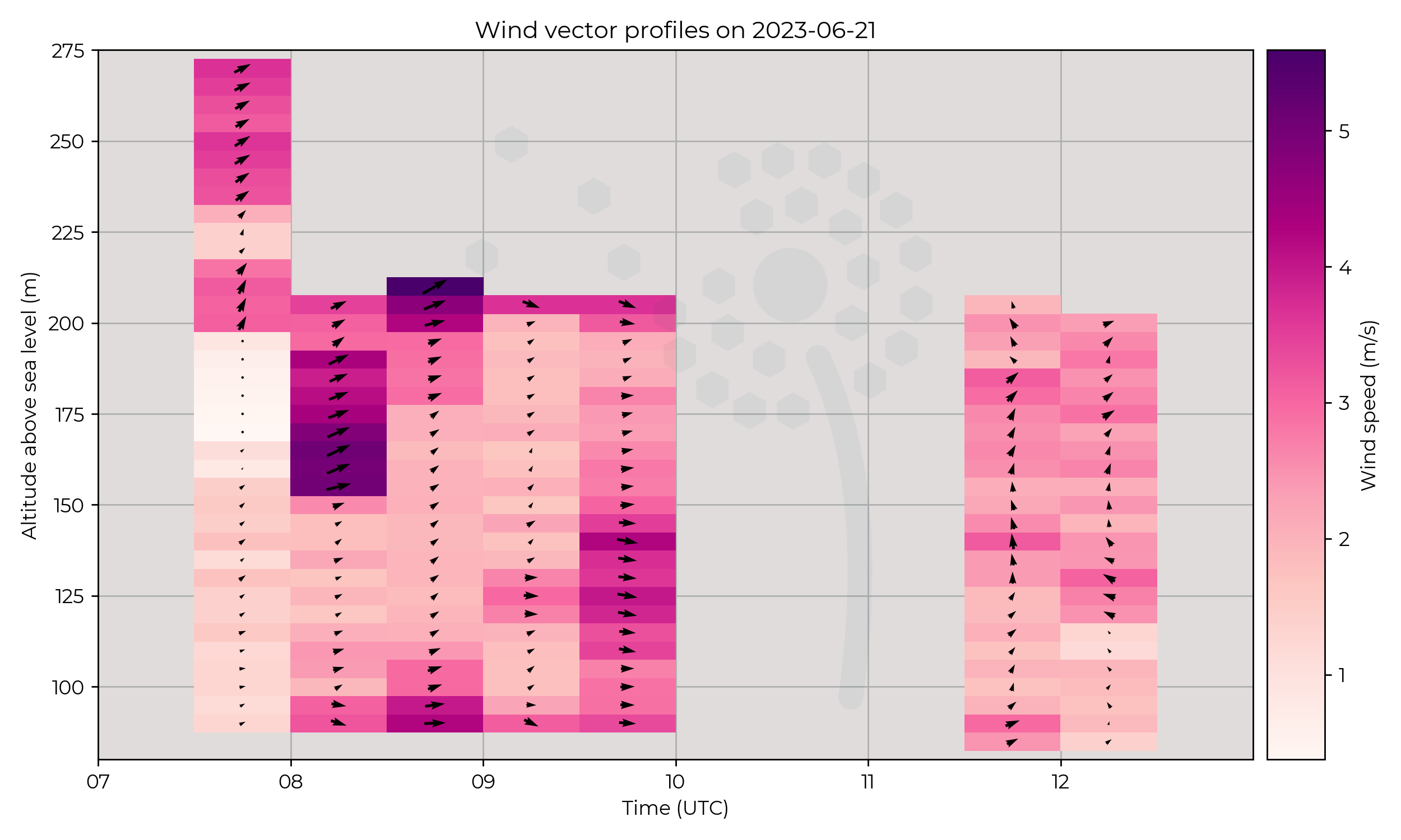
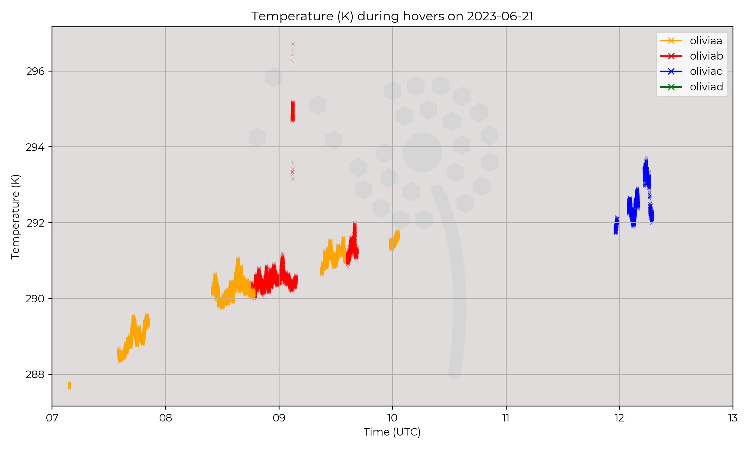
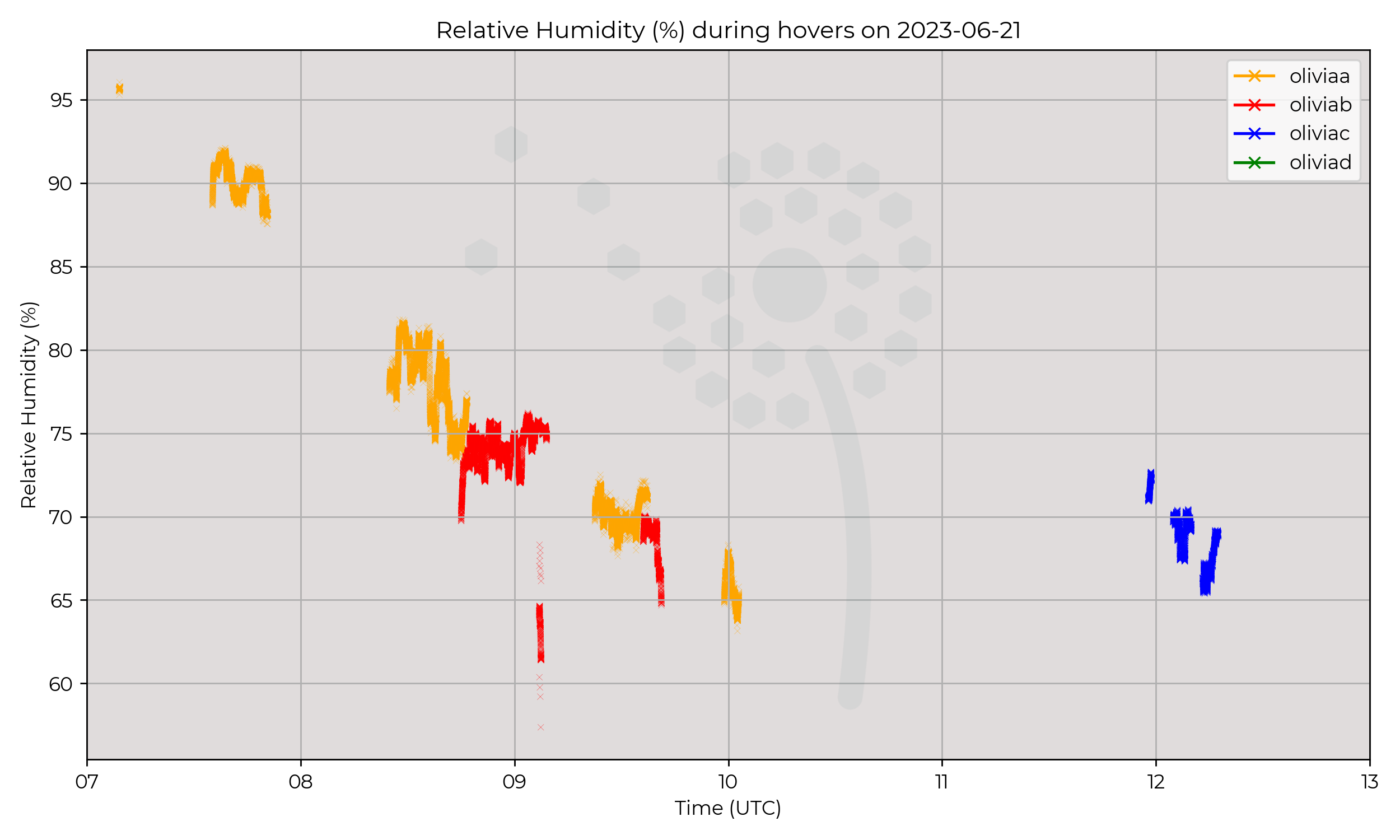
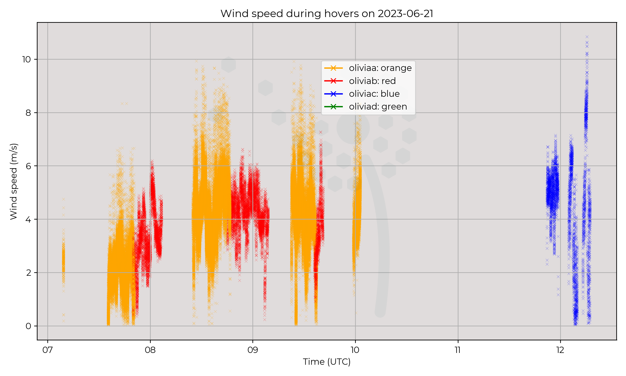
Consistent profiles between 7:30 and 10:00, roughly twice an hour and 1 stand alone flight at mid-day. Sporadic stints of constant presence at 120m.
Observations
Pretty average day. Cloudy morning, then drying / warming though day. Early finish to day due to technical problems. Also a temperature / humidity jump at 140 AGL during 09:00 profile.
Known Issues
2023-06-20
Synoptic Overview
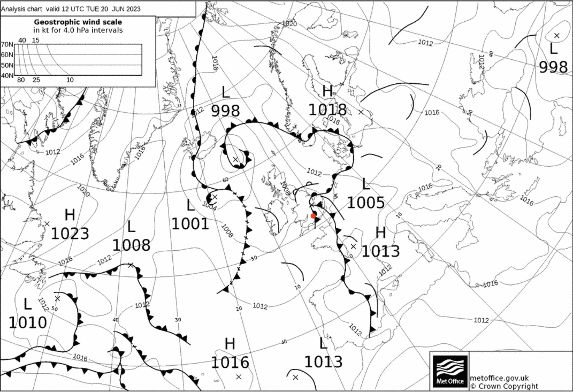
Messy frontal systems; warm front approaching in early hours, to develop into occluded front around mid day, with trough to west.
Flight Patterns
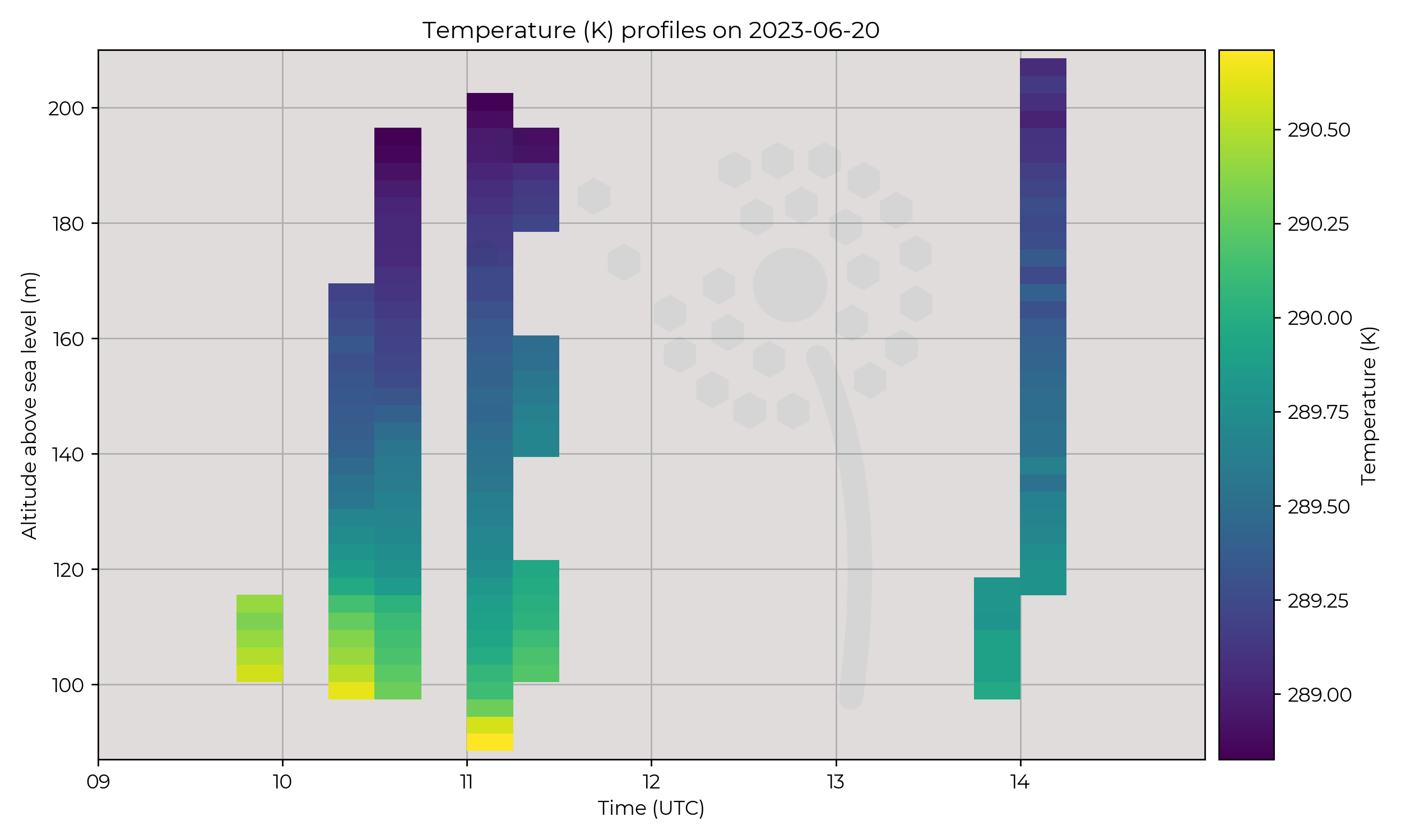
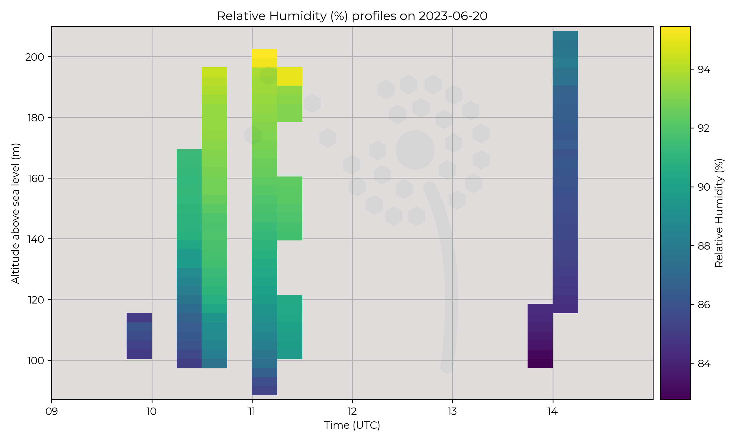
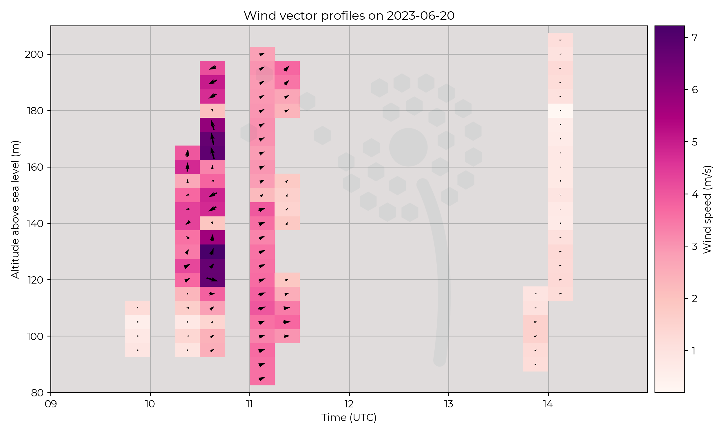
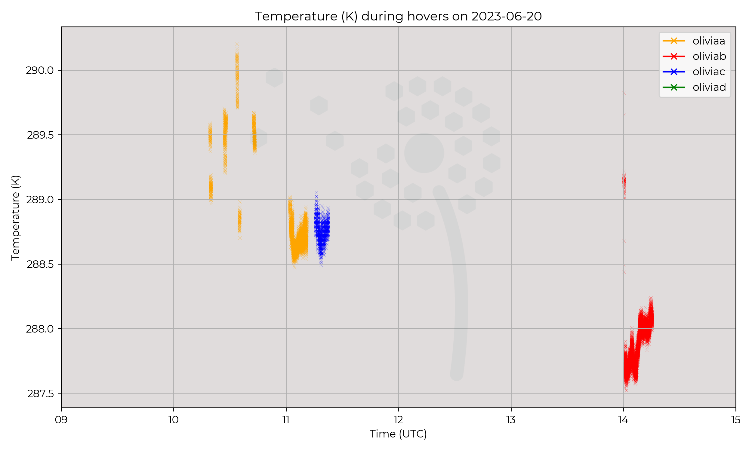
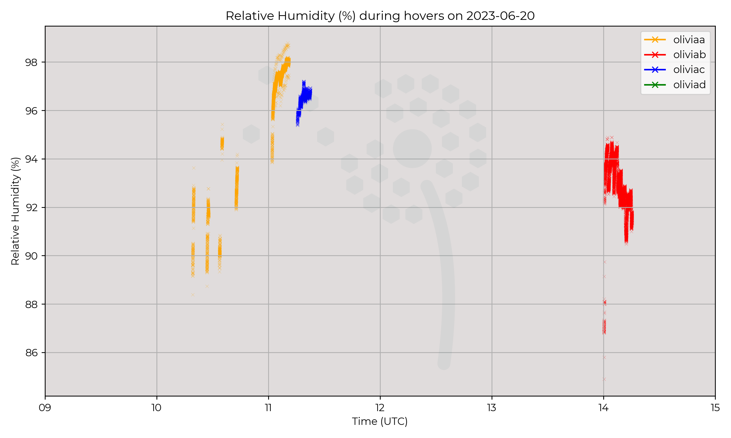
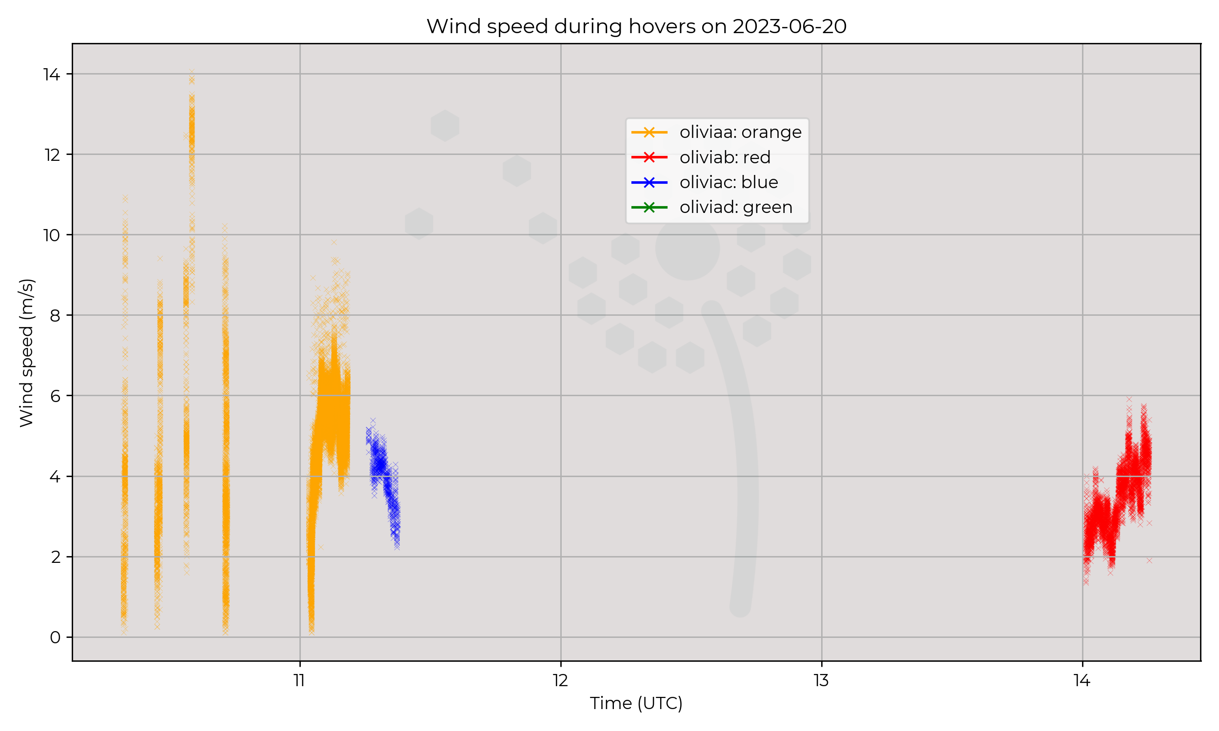
Struggled to get to 120m due to the wind gusts creating unsafe flying conditions. Altitudes of profiles increased through morning. Couple profiles between 10:00 and 11:30 UTC approximately every 15 minutes. Also a rogue profile at 14:00.
Observations
Frontal passage may explain wind changes, and drop in relative humidity. Cloud at the beginning of operations, transition to a dry afternoon.
Known Issues
2023-06-19
Synoptic Overview
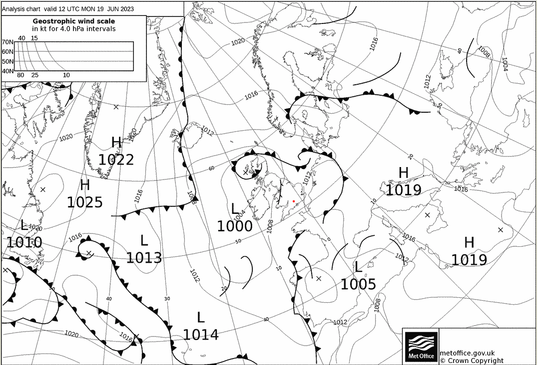
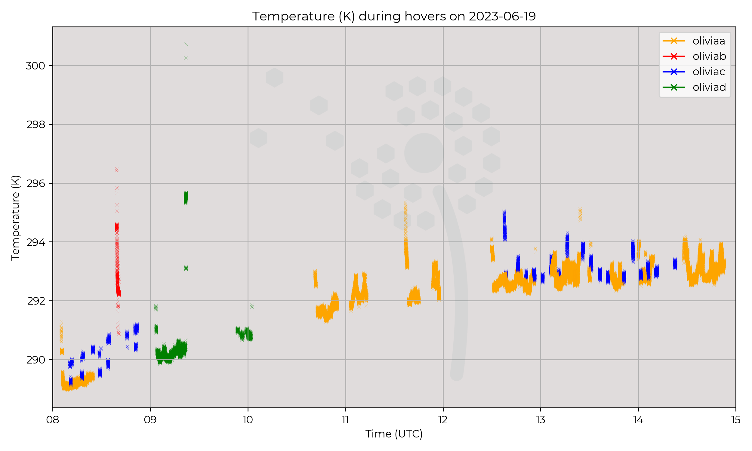
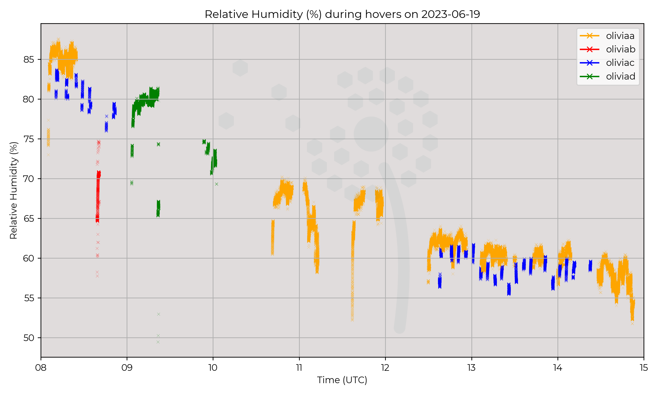
Trough / occluded front pass over during mid morning. Relatively stable day, overall low pressure centre dominates, moving from NW to N relative to Chilbolton through the day.
Flight Patterns
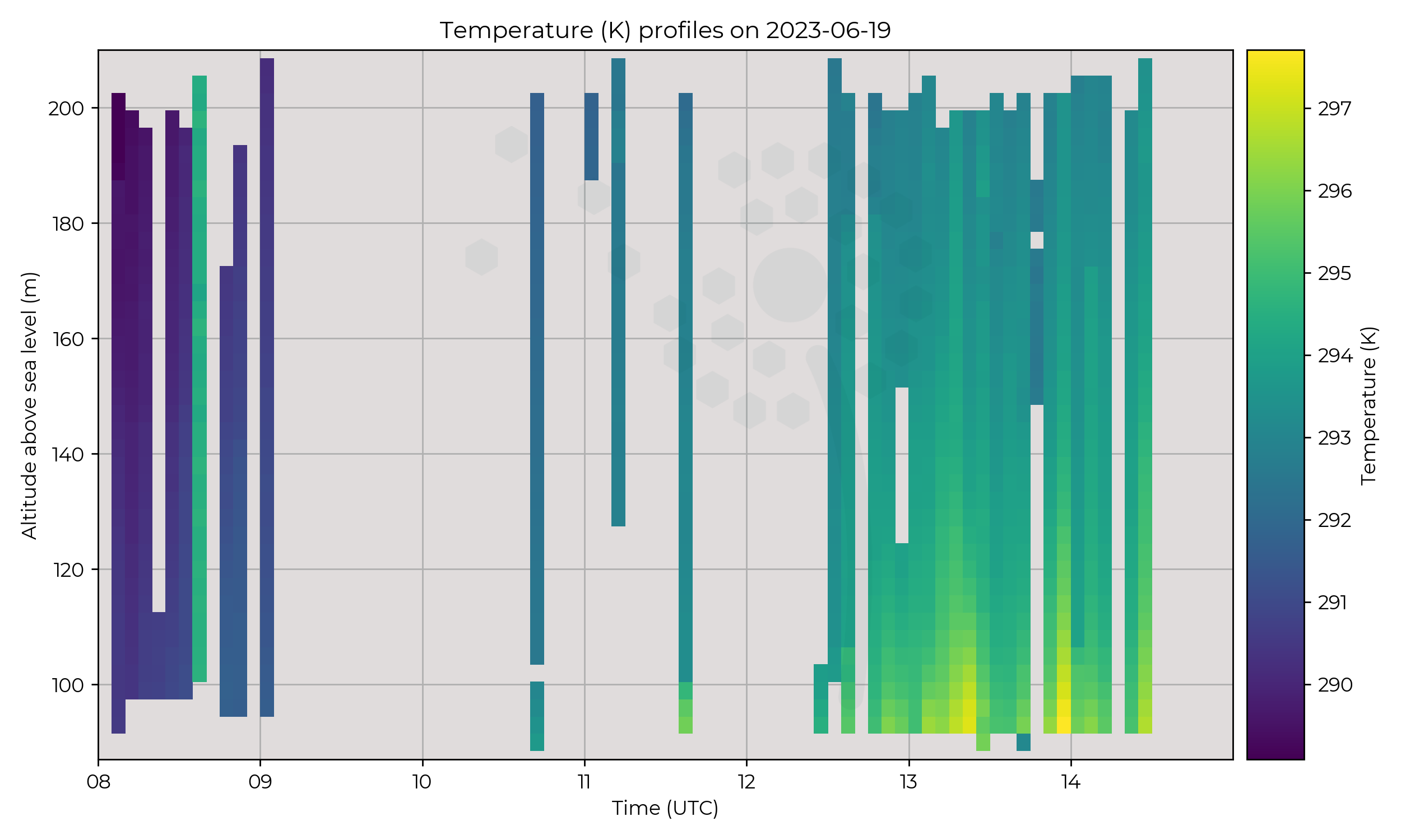
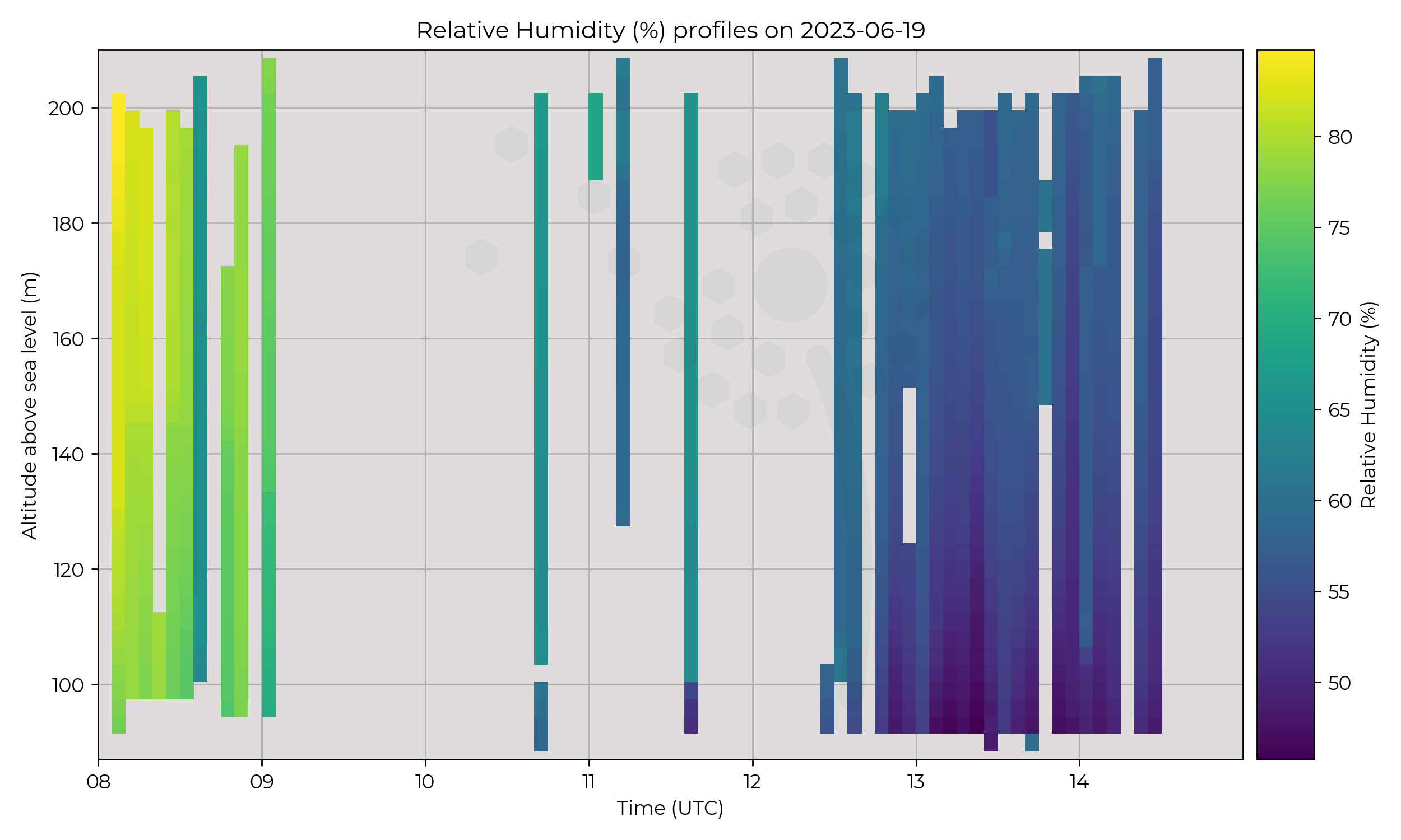
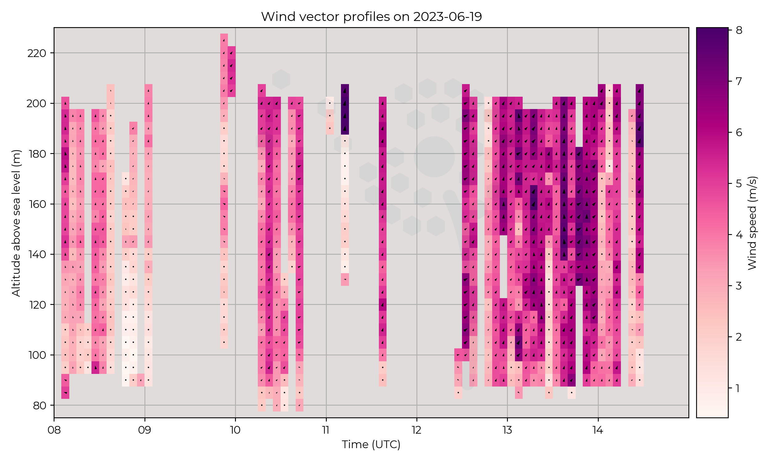
First flights of the campaign! Profiles at Chilbolton, aiming for every 5 minutes starting at 08:00 UTC.
Observations
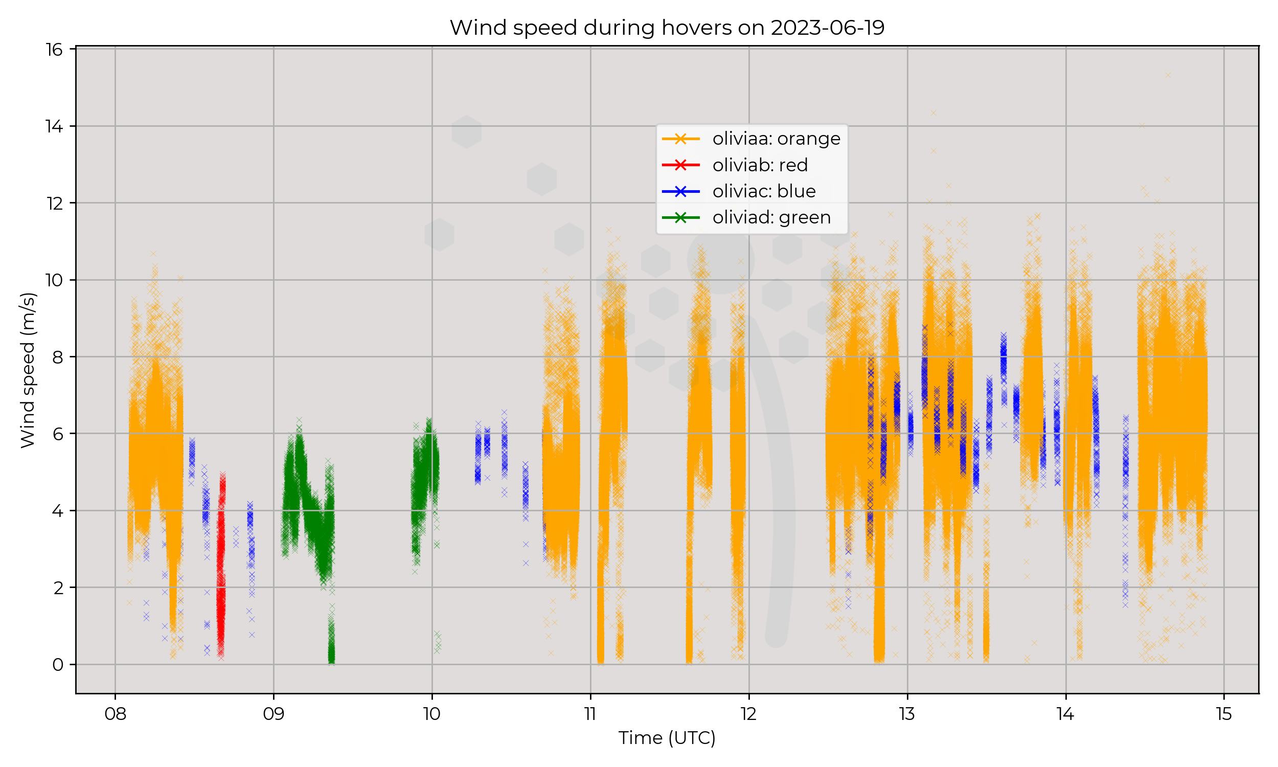
Drying out and slight warming of air through day, potentially matching to passing of front. Windspeed during hovers remains relatively stable throughout day, but increase of windspeed through profiles.
Known Issues